Guerneville (/ˈɡɜːrnvɪl, -nivɪl/) is an unincorporated community and census-designated place in the Russian River Valley of Sonoma County, California, United States. The town is historically known for the logging community, formed in the late 1800s. Guerneville is also known for its natural environment, liberal atmosphere, and proximity to wine-tasting and redwood forests. It was founded by the Guerne family in the 1850s.
| Name: | Guerneville CDP |
|---|---|
| LSAD Code: | 57 |
| LSAD Description: | CDP (suffix) |
| State: | California |
| County: | Sonoma County |
| Elevation: | 59 ft (18 m) |
| Total Area: | 9.879 sq mi (25.587 km²) |
| Land Area: | 9.709 sq mi (25.147 km²) |
| Water Area: | 0.170 sq mi (0.440 km²) 1.72% |
| Total Population: | 4,534 |
| Population Density: | 460/sq mi (180/km²) |
| ZIP code: | 95446 |
| Area code: | 707 |
| FIPS code: | 0631470 |
| GNISfeature ID: | 277527 |
Online Interactive Map
Click on ![]() to view map in "full screen" mode.
to view map in "full screen" mode.
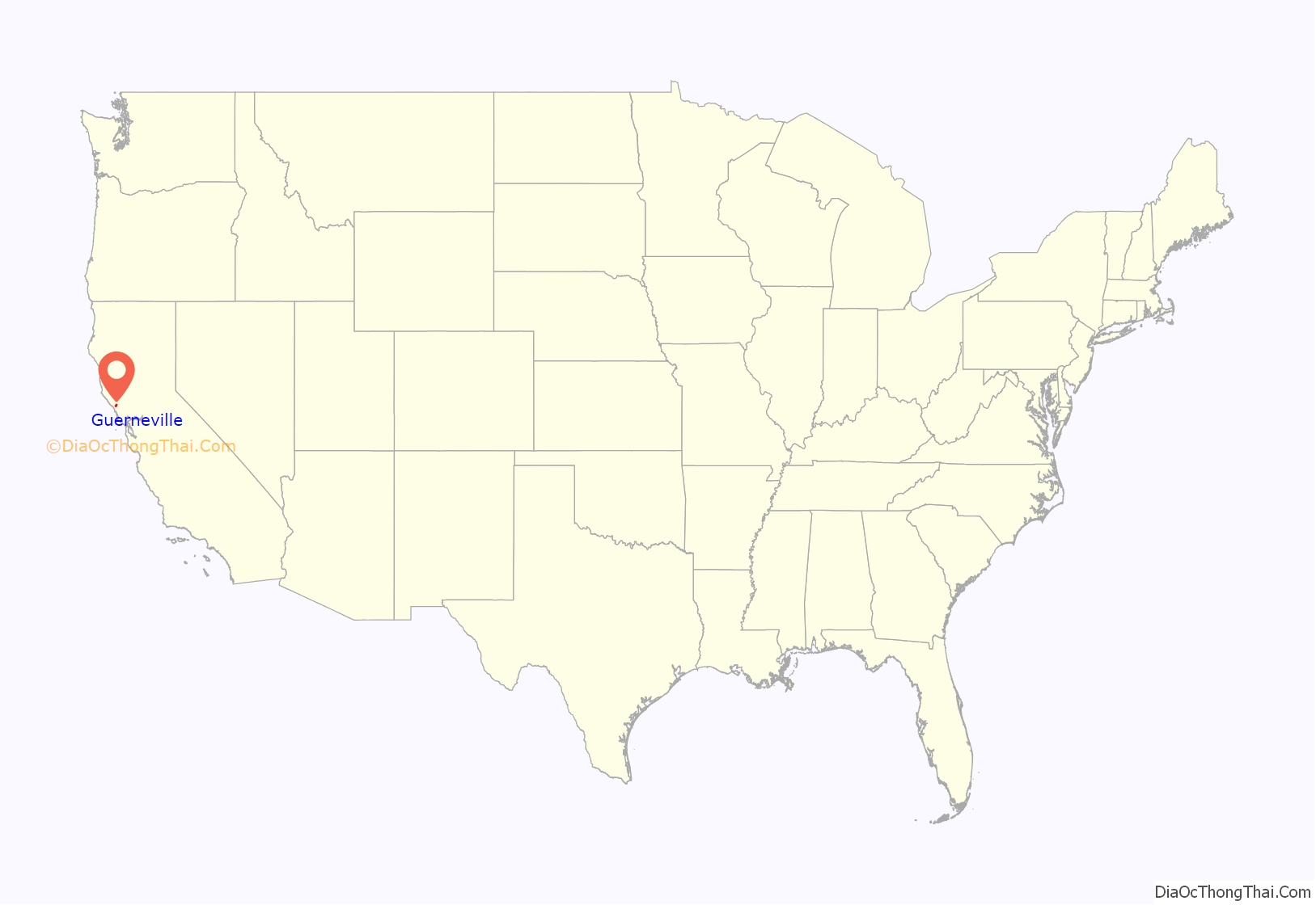
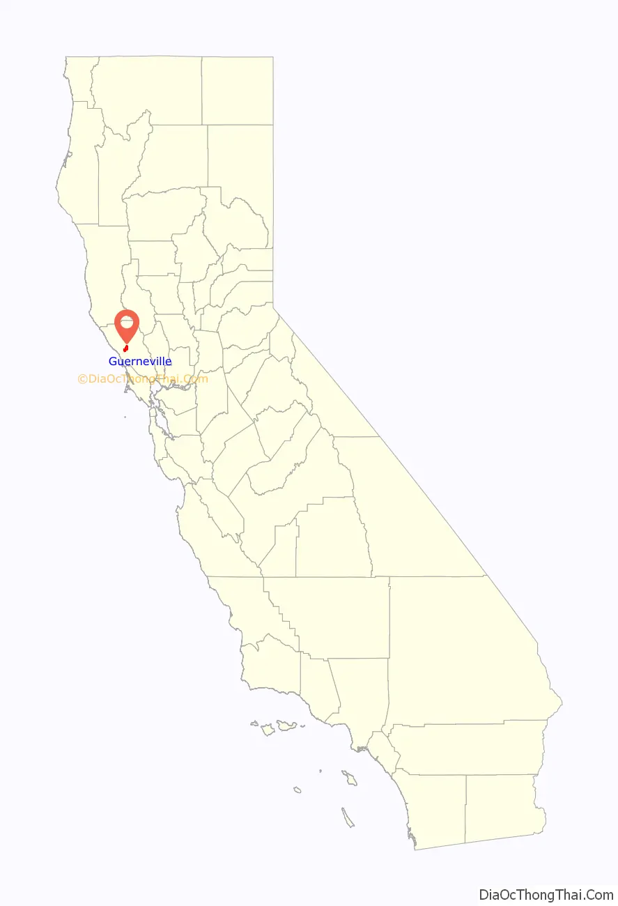
Guerneville location map. Where is Guerneville CDP?
History
Guerneville is built adjacent to the Russian River. Redwoods grew in the riverbed with such vigor that just a few centuries ago, the valley had the greatest biomass density on the planet, according to local lore. The local Pomo Indians used the area as a summer camp and called it “Ceola” (/ˈsiːoʊleɪ/ or cee-oh-lay) which meant “shady place.” Except for a large stand of ancient trees preserved in the Fife Creek watershed, now the centerpiece of Armstrong Woods Park, many of the trees were logged in the late 19th century and the early 20th century, giving rise to the first English name for the place – “Stumptown.” Logging in the area boomed after vast amounts of lumber were needed for rebuilding after the 1906 earthquake. The annual town parade still commemorates the old place name by calling itself “Stumptown Days.” The present name Guerneville was introduced to honor Swiss immigrant George Guerne, a local businessman of the 19th century who owned the town’s sawmill. By 1870, there was a U.S. Post Office in Guerneville; it was listed by the name “Guerneville”. Although locals may be found selling T-shirts that say “Don’t call it Guerneyville” (alluding to the “GURN-vil” pronunciation), many have called the town “Guerneyville” in spelling and pronunciation since the 1800s. The extensive redwood forests on the surrounding mountains are less than 200 years old, having been replacement plantings for much of the logging done in the 19th century.
The area became popular with wealthy vacationers from San Francisco and surrounding communities in the late 19th century. The San Francisco and North Pacific Railroad linked the town to the Ferries of San Francisco Bay in 1877. Even with the demise of train service in the late 1930s, the area’s resorts remained popular with vacationers who came by automobile through the 1950s. A local movie theater, the River, was built near the beach and showed double features throughout the 1950s and 1960s. The coming of jet airplane travel in the 1960s marked a period of decline for many of the older resorts. Winter floods in 1964 caused a further decline in business conditions. A renaissance took place in the late 1970s as large numbers of gay entrepreneurs from San Francisco identified the area as a prime recreational destination for weekends. Many older resorts benefited from increased tourism, and the town’s businesses began to thrive.
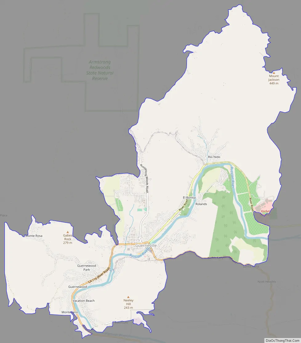
Guerneville Road Map
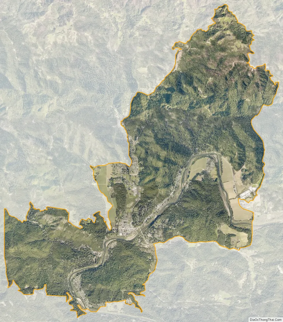
Guerneville city Satellite Map
Geography
Guerneville is located in western Sonoma County, along the Russian River on State Route 116, between Monte Rio to the west and Forestville to the east.
The CDP has a total area of 9.88 sq mi (25.6 km). Of that, 9.71 sq mi (25.1 km) is land and 0.17 sq mi (0.4 km) (1.72%) is water.
Climate
Guerneville has cool, wet winters and warm, dry summers, a climate typical of northern coastal California. Although rainfall is rare during the summer months, fog often comes up the river from the Pacific Ocean, producing enough condensation to create “fog drip,” which sustains the numerous redwood trees, ferns, and other vegetation.
The National Weather Service reports that Guerneville has an average annual rainfall of 49.15 inches (1,248 mm). Measurable precipitation occurs on an average of 73 days each year. The wettest year was 1970 with 70.2 inches (1,780 mm) and the driest year was 1949 with 31.34 inches (796 mm). The most rainfall in one month was 29.08 in January 1970. The most rainfall in 24 hours was 8.4 inches (210 mm) on February 8, 1960.
Although no official temperature records exist for Guerneville, the nearby town of Graton has average January temperatures ranging from 35.7 to 56.1 °F (2.1 to 13.4 °C), and July temperatures from 48.4 to 83.5 °F (9.1 to 28.6 °C). There are an average of 28.7 days annually with highs of 90 °F (32 °C) or higher and 44.7 days annually with lows of 32 °F (0 °C) or lower. The record high temperature was 113 °F (45 °C) on July 14, 1972, and the record low temperature was 14 °F (−10 °C) on December 22, 1990. Other nearby cooperative National Weather Service stations are in Occidental, Cazadero, and Fort Ross.
See also
Map of California State and its subdivision:- Alameda
- Alpine
- Amador
- Butte
- Calaveras
- Colusa
- Contra Costa
- Del Norte
- El Dorado
- Fresno
- Glenn
- Humboldt
- Imperial
- Inyo
- Kern
- Kings
- Lake
- Lassen
- Los Angeles
- Madera
- Marin
- Mariposa
- Mendocino
- Merced
- Modoc
- Mono
- Monterey
- Napa
- Nevada
- Orange
- Placer
- Plumas
- Riverside
- Sacramento
- San Benito
- San Bernardino
- San Diego
- San Francisco
- San Joaquin
- San Luis Obispo
- San Mateo
- Santa Barbara
- Santa Clara
- Santa Cruz
- Shasta
- Sierra
- Siskiyou
- Solano
- Sonoma
- Stanislaus
- Sutter
- Tehama
- Trinity
- Tulare
- Tuolumne
- Ventura
- Yolo
- Yuba
- Alabama
- Alaska
- Arizona
- Arkansas
- California
- Colorado
- Connecticut
- Delaware
- District of Columbia
- Florida
- Georgia
- Hawaii
- Idaho
- Illinois
- Indiana
- Iowa
- Kansas
- Kentucky
- Louisiana
- Maine
- Maryland
- Massachusetts
- Michigan
- Minnesota
- Mississippi
- Missouri
- Montana
- Nebraska
- Nevada
- New Hampshire
- New Jersey
- New Mexico
- New York
- North Carolina
- North Dakota
- Ohio
- Oklahoma
- Oregon
- Pennsylvania
- Rhode Island
- South Carolina
- South Dakota
- Tennessee
- Texas
- Utah
- Vermont
- Virginia
- Washington
- West Virginia
- Wisconsin
- Wyoming


