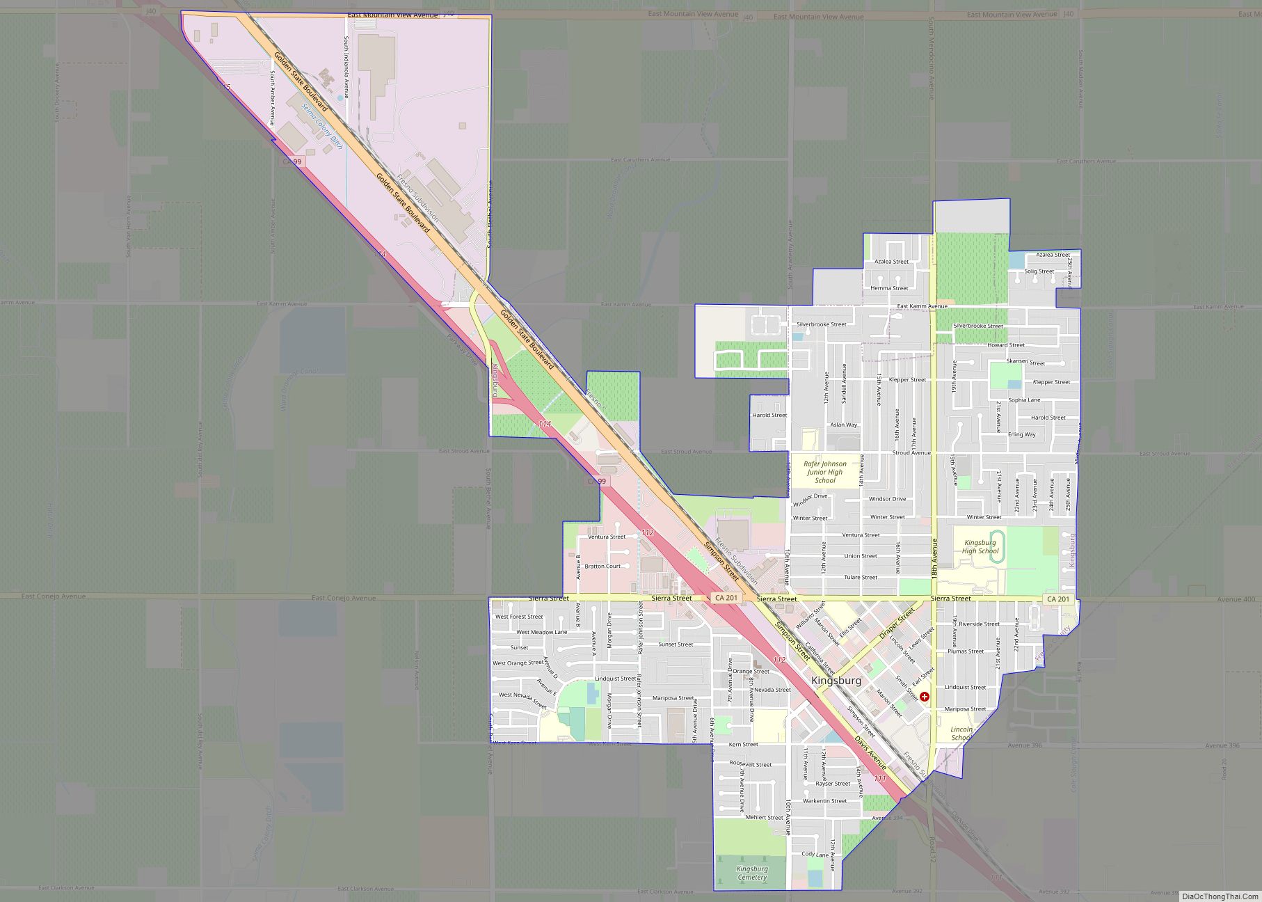
Map of Knightsen CDP

Map of Knightsen CDP

Knightsen is a census-designated place (CDP) in Contra Costa County, California, in the United States. As of the 2010 census, the CDP population was 1,568, up from 861 reported in the 2000 census. Knightsen CDP overview: Name: Knightsen CDP LSAD Code: 57 LSAD Description: CDP (suffix) State: California County: Contra Costa County Elevation: 30 ft (9 m) … Read more

Map of Knights Landing CDP

Map of Knights Landing CDP

Knights Landing (formerly, Baltimore and East Grafton) is a census-designated place in Yolo County, California, United States, founded by William Knight. It is located on the Sacramento River around 25 miles northwest of Sacramento in the northeastern portion of the county. Knights Landing’s ZIP Code is 95645 and its area code 530. It lies at … Read more

Map of Klamath CDP

Map of Klamath CDP

Klamath (Tolowa: Taa-chit) is an unincorporated, rural census-designated place (CDP) in Del Norte County, California, situated on US Route 101 inland from the mouth of the Klamath River. The current population of Klamath, California is 632 based on US Census estimates, down from 779 recorded in the 2010 US census. Klamath is at an elevation … Read more

Map of La Habra Heights city

Map of La Habra Heights city

La Habra Heights is a city in Los Angeles County, California, United States. The population was 5,325 at the 2010 census, down from 5,712 at the 2000 census. La Habra Heights is a suburban canyon community located on the border of Orange and Los Angeles counties. The zoning is 1-acre (4,000 m) lots with a variety … Read more

Map of La Crescenta-Montrose CDP

Map of La Crescenta-Montrose CDP

La Crescenta-Montrose (pronunciation) is an unincorporated area in Los Angeles County, California, United States. The community is bordered by Glendale to the south and west, La Cañada Flintridge to the east, and Angeles National Forest to the north. According to the United States Census Bureau, the La Crescenta-Montrose Census-Designated Place (CDP) measures about 3.4 square … Read more

Map of La Cañada Flintridge city

Map of La Cañada Flintridge city

La Cañada Flintridge, commonly known as “La Cañada” (Spanish for “The Canyon”), is a city in the foothills of the Verdugo Mountains in Los Angeles County, California. Located in the Crescenta Valley, in the western edge of Southern California’s San Gabriel Valley, it is the location of NASA’s Jet Propulsion Laboratory. Before the city’s incorporation … Read more

Map of La Mesa city

Map of La Mesa city, California

La Mesa (Spanish: La Mesa, lit. ’The Table’) is a city in San Diego County, located nine miles (14 kilometers) east of Downtown San Diego in Southern California. The population was 61,121 at the 2020 census, up from 57,065 at the 2010 census. Its civic motto is “the Jewel of the Hills.” La Mesa city overview: … Read more

Map of La Honda CDP

Map of La Honda CDP

La Honda (Spanish for “The Sling”) is a census-designated place (CDP) in southern San Mateo County, California, United States. The population was 979 at the 2020 census. It is located in the Santa Cruz Mountains between the Santa Clara Valley and the Pacific coast of California. La Honda is near the La Honda Creek Open … Read more

Map of La Habra city

Map of La Habra city

La Habra – archaic spelling of La Abra (Spanish for ‘The Opening’) – is a city in the northwestern corner of Orange County, California, United States. In the 2010 census, the city had a population of 60,239. A related city, La Habra Heights, is located to the north of La Habra, and is in Los … Read more

Map of La Porte CDP

Map of La Porte CDP, California

La Porte is a census-designated place (CDP) in Plumas County, California, United States. The population was 26 at the 2010 census, down from 43 at the 2000 census. La Porte CDP overview: Name: La Porte CDP LSAD Code: 57 LSAD Description: CDP (suffix) State: California County: Plumas County Elevation: 4,980 ft (1,518 m) Total Area: 4.457 sq mi (11.544 km²) … Read more

Map of La Palma city

Map of La Palma city

La Palma (Spanish for “The Palm”) is a city in Orange County, California, United States. The population was 15,568 at the 2010 Census, up from 15,408 at the 2000 census. La Palma city overview: Name: La Palma city LSAD Code: 25 LSAD Description: city (suffix) State: California County: Orange County Incorporated: October 26, 1955 Elevation: … Read more

Map of La Mirada city

Map of La Mirada city

La Mirada (Spanish for “The Look”) is a city in southeast Los Angeles County, California United States, and is one of the Gateway Cities. The population was 48,527 at the 2010 census, up from 46,783 at the 2000 census. The La Mirada Theatre for the Performing Arts and the Splash! La Mirada Regional Aquatics Center … Read more