La Palma (Spanish for “The Palm”) is a city in Orange County, California, United States. The population was 15,568 at the 2010 Census, up from 15,408 at the 2000 census.
| Name: | La Palma city |
|---|---|
| LSAD Code: | 25 |
| LSAD Description: | city (suffix) |
| State: | California |
| County: | Orange County |
| Incorporated: | October 26, 1955 |
| Elevation: | 46 ft (14 m) |
| Total Area: | 1.80 sq mi (4.67 km²) |
| Land Area: | 1.78 sq mi (4.61 km²) |
| Water Area: | 0.02 sq mi (0.06 km²) 1.32% |
| Total Population: | 15,568 |
| Population Density: | 8,667.42/sq mi (3,345.75/km²) |
| ZIP code: | 90623 |
| Area code: | 562/714/657 |
| FIPS code: | 0640256 |
| GNISfeature ID: | 1652737 |
| Website: | cityoflapalma.org |
Online Interactive Map
Click on ![]() to view map in "full screen" mode.
to view map in "full screen" mode.
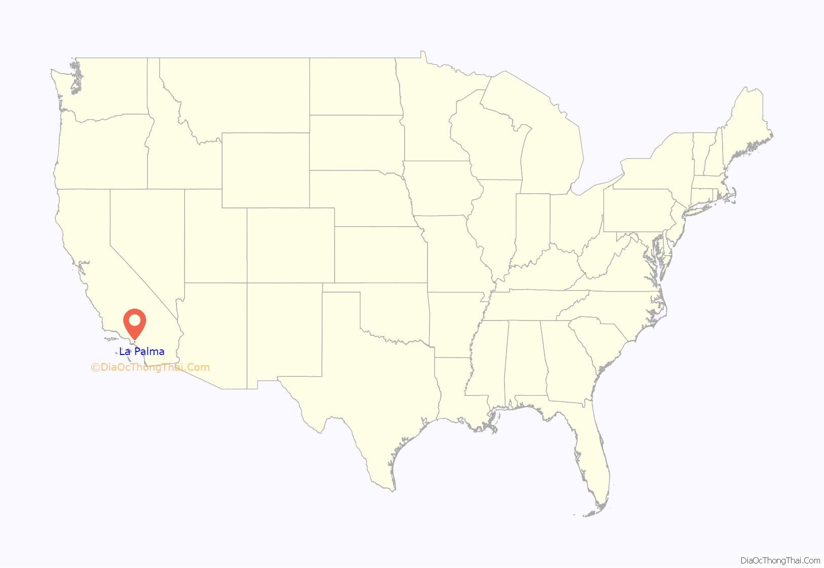
La Palma location map. Where is La Palma city?

History
La Palma was incorporated on October 26, 1955. It was originally incorporated as Dairyland, and was one of three dairy cities in the region (the other two being Dairy Valley, now Cerritos, and Dairy City, now Cypress) but when the dairies moved east in 1965, the name of the community was changed to La Palma, after the region’s Spanish heritage and its main thoroughfare, La Palma Avenue.
La Palma Road Map
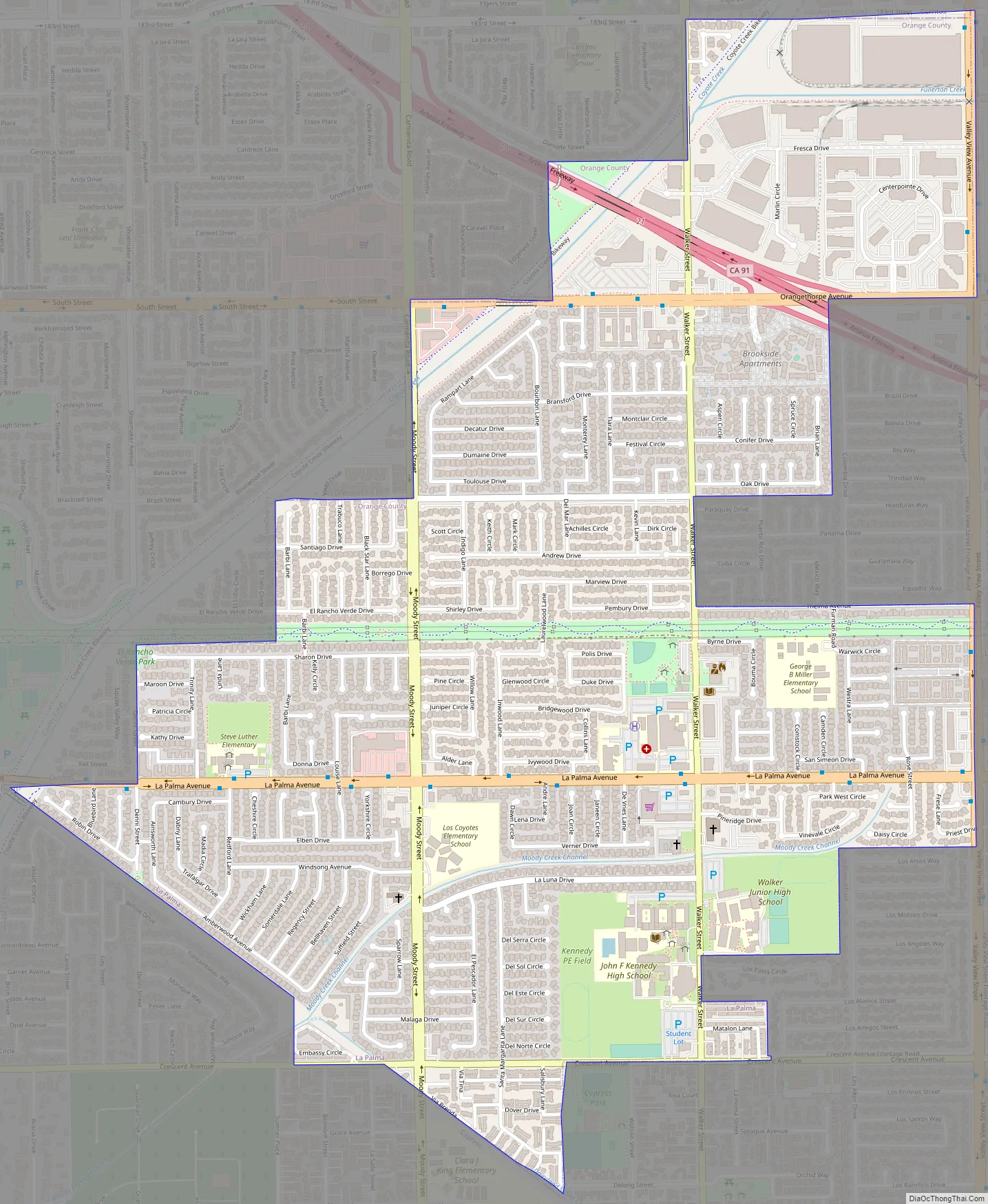
La Palma city Satellite Map

Geography
According to the United States Census Bureau, the city has a total area of 1.83 square miles (4.7 km). 1.8 square miles (4.7 km) of it is land and 0.02 square miles (0.052 km) of it (1.32%) is water. This makes it the smallest city in Orange County in terms of area.
See also
Map of California State and its subdivision:- Alameda
- Alpine
- Amador
- Butte
- Calaveras
- Colusa
- Contra Costa
- Del Norte
- El Dorado
- Fresno
- Glenn
- Humboldt
- Imperial
- Inyo
- Kern
- Kings
- Lake
- Lassen
- Los Angeles
- Madera
- Marin
- Mariposa
- Mendocino
- Merced
- Modoc
- Mono
- Monterey
- Napa
- Nevada
- Orange
- Placer
- Plumas
- Riverside
- Sacramento
- San Benito
- San Bernardino
- San Diego
- San Francisco
- San Joaquin
- San Luis Obispo
- San Mateo
- Santa Barbara
- Santa Clara
- Santa Cruz
- Shasta
- Sierra
- Siskiyou
- Solano
- Sonoma
- Stanislaus
- Sutter
- Tehama
- Trinity
- Tulare
- Tuolumne
- Ventura
- Yolo
- Yuba
- Alabama
- Alaska
- Arizona
- Arkansas
- California
- Colorado
- Connecticut
- Delaware
- District of Columbia
- Florida
- Georgia
- Hawaii
- Idaho
- Illinois
- Indiana
- Iowa
- Kansas
- Kentucky
- Louisiana
- Maine
- Maryland
- Massachusetts
- Michigan
- Minnesota
- Mississippi
- Missouri
- Montana
- Nebraska
- Nevada
- New Hampshire
- New Jersey
- New Mexico
- New York
- North Carolina
- North Dakota
- Ohio
- Oklahoma
- Oregon
- Pennsylvania
- Rhode Island
- South Carolina
- South Dakota
- Tennessee
- Texas
- Utah
- Vermont
- Virginia
- Washington
- West Virginia
- Wisconsin
- Wyoming


