La Habra – archaic spelling of La Abra (Spanish for ‘The Opening’) – is a city in the northwestern corner of Orange County, California, United States. In the 2010 census, the city had a population of 60,239. A related city, La Habra Heights, is located to the north of La Habra, and is in Los Angeles County.
| Name: | La Habra city |
|---|---|
| LSAD Code: | 25 |
| LSAD Description: | city (suffix) |
| State: | California |
| County: | Orange County |
| Incorporated: | January 20, 1925 |
| Elevation: | 299 ft (91 m) |
| Total Area: | 7.56 sq mi (19.58 km²) |
| Land Area: | 7.55 sq mi (19.57 km²) |
| Water Area: | 0.01 sq mi (0.02 km²) 0.08% |
| Total Population: | 60,239 |
| Population Density: | 8,010.72/sq mi (3,092.78/km²) |
| ZIP code: | 90631–90633 |
| Area code: | 562 |
| FIPS code: | 0639290 |
| Website: | www.lahabraca.gov |
Online Interactive Map
Click on ![]() to view map in "full screen" mode.
to view map in "full screen" mode.
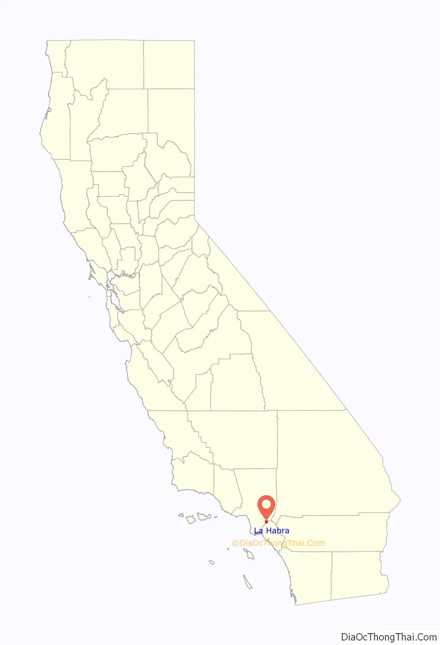
La Habra location map. Where is La Habra city?

History
Origin of name
The name referred to the “Pass Through the Hills,” the natural pass through the hills to the north first discovered and used by Spanish explorers of the Portola expedition on July 30, 1769.
In 1839, when the area was part of Alta California, vast herds of cattle and horses grazed over the hills and valleys of Southern California. Mariano Reyes Roldan was granted 6,698 acres (27 km) in that year and named his land Rancho Cañada de La Habra. In the 1860s, Abel Stearns purchased Rancho La Habra.
Historical information
La Habra was founded in 1896. The first post office in the town was established in 1898 in a corner of Coy’s Store at Central (now La Habra Boulevard) and Euclid Street.
The city was incorporated under general law on January 20, 1925, with a population of 3,000. The police force was organized in 1926 and employed a chief, traffic officer and patrolman. By 1928, the city was the largest avocado center in Southern California. In 1930, the first fire department building was constructed followed by the original City Hall in 1935. By 1950, the population reached nearly 5,000. The Civic Center took shape when the existing County Library was dedicated in 1966, followed by the present administration building in 1969.
For more than 70 years, La Habra was known as the city just south of La Habra Heights, where the ‘Hass’ avacado, of the ‘Hass’ avocado mother tree, was planted by Rudolph Hass in the 1920s. The fruit from this tree has since become one of the most popular avocado cultivars worldwide. The ‘Hass’ mother tree succumbed to root rot in 2002.
The La Habra Stakes, run since 1973 at the Santa Anita Park Thoroughbred race track, is named for La Habra. Although La Habra lies within Orange County, the city contracts with the Los Angeles County Fire Department for EMS and fire protection.
Law enforcement is provided by the La Habra Police Department, which in 2008 employed about 70 officers. From 2004 to 2008, they ranked third in the number of officer-involved shootings among twenty Orange County municipal police departments. One case among these, the 2007 death of Michael Cho, resulted in a wrongful death lawsuit against the city which was settled in September 2010 for $250,000.
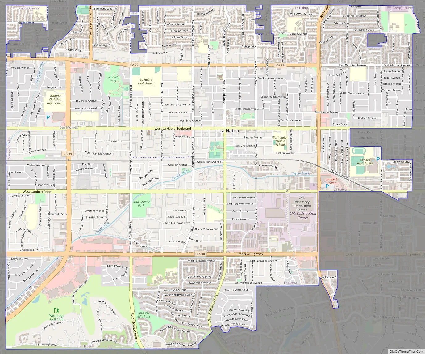
La Habra Road Map
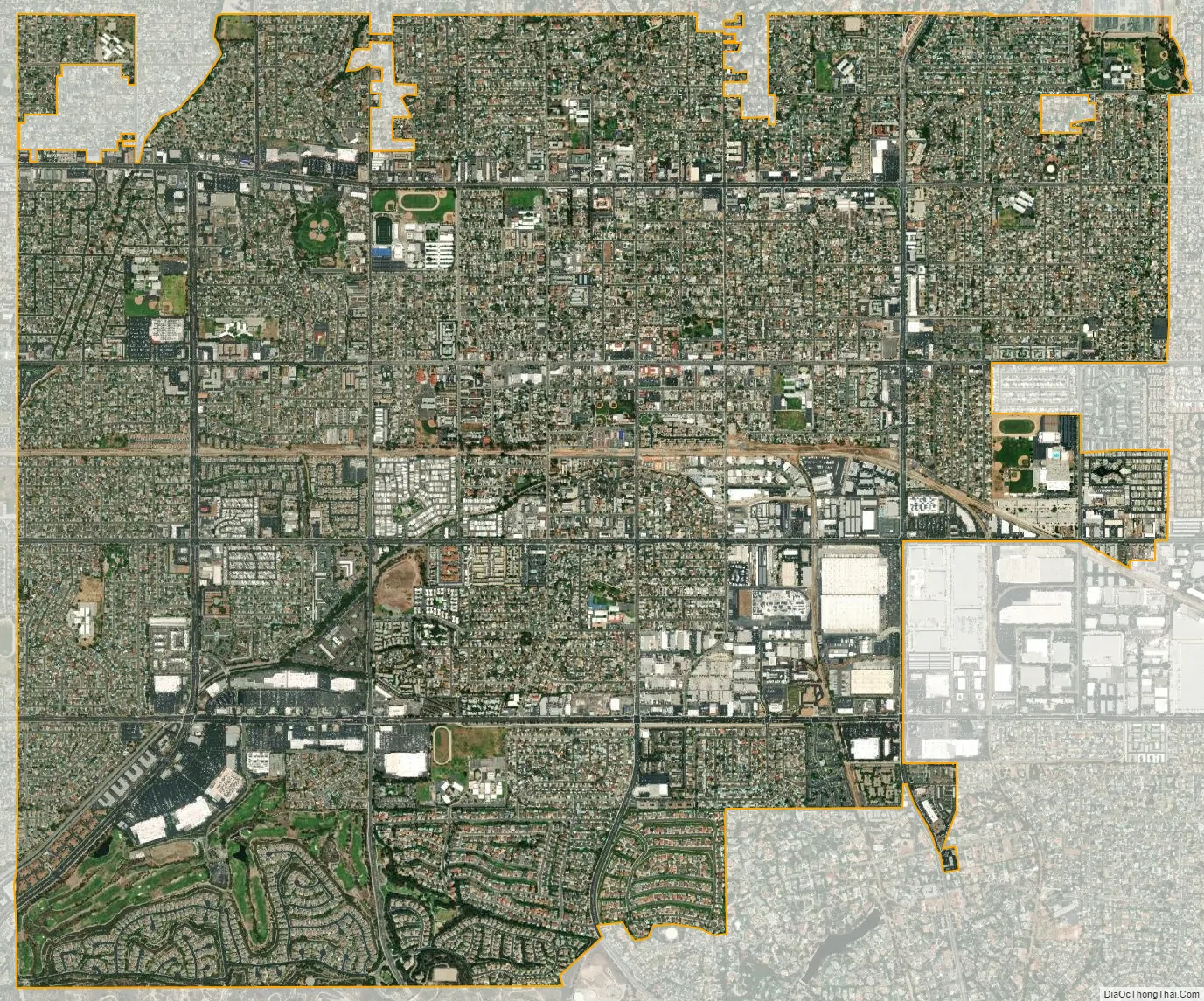
La Habra city Satellite Map
Geography
According to the United States Census Bureau, the city has a total area of 7.4 square miles (19 km), with 0.08% covered by water.
It is bordered by La Habra Heights on the north, Brea on the east, Fullerton on the south and southeast, La Mirada on the west and southwest, East Whittier on the west, Whittier on the northwest, and a small unnamed section of unincorporated Los Angeles County on the northeast.
Climate
According to the Köppen climate classification, La Habra has a hot-summer Mediterranean climate, Csa on climate maps.
See also
Map of California State and its subdivision:- Alameda
- Alpine
- Amador
- Butte
- Calaveras
- Colusa
- Contra Costa
- Del Norte
- El Dorado
- Fresno
- Glenn
- Humboldt
- Imperial
- Inyo
- Kern
- Kings
- Lake
- Lassen
- Los Angeles
- Madera
- Marin
- Mariposa
- Mendocino
- Merced
- Modoc
- Mono
- Monterey
- Napa
- Nevada
- Orange
- Placer
- Plumas
- Riverside
- Sacramento
- San Benito
- San Bernardino
- San Diego
- San Francisco
- San Joaquin
- San Luis Obispo
- San Mateo
- Santa Barbara
- Santa Clara
- Santa Cruz
- Shasta
- Sierra
- Siskiyou
- Solano
- Sonoma
- Stanislaus
- Sutter
- Tehama
- Trinity
- Tulare
- Tuolumne
- Ventura
- Yolo
- Yuba
- Alabama
- Alaska
- Arizona
- Arkansas
- California
- Colorado
- Connecticut
- Delaware
- District of Columbia
- Florida
- Georgia
- Hawaii
- Idaho
- Illinois
- Indiana
- Iowa
- Kansas
- Kentucky
- Louisiana
- Maine
- Maryland
- Massachusetts
- Michigan
- Minnesota
- Mississippi
- Missouri
- Montana
- Nebraska
- Nevada
- New Hampshire
- New Jersey
- New Mexico
- New York
- North Carolina
- North Dakota
- Ohio
- Oklahoma
- Oregon
- Pennsylvania
- Rhode Island
- South Carolina
- South Dakota
- Tennessee
- Texas
- Utah
- Vermont
- Virginia
- Washington
- West Virginia
- Wisconsin
- Wyoming


