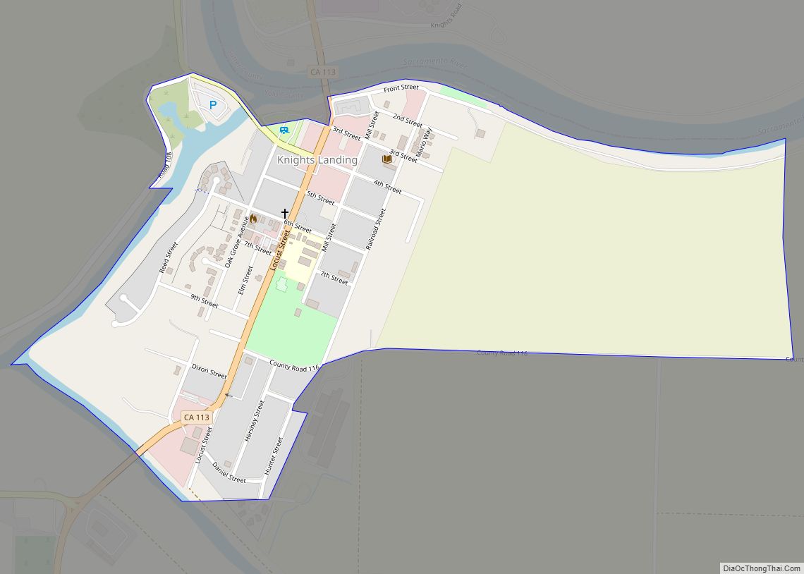
Knights Landing (formerly, Baltimore and East Grafton) is a census-designated place in Yolo County, California, United States, founded by William Knight. It is located on the Sacramento River around 25 miles northwest of Sacramento in the northeastern portion of the county. Knights Landing’s ZIP Code is 95645 and its area code 530. It lies at an elevation of 36 feet (11 m). The 2010 census reported that Knights Landing had a population of 995.
| Name: | Knights Landing CDP |
|---|---|
| LSAD Code: | 57 |
| LSAD Description: | CDP (suffix) |
| State: | California |
| County: | Yolo County |
| Elevation: | 11 m (36 ft) |
| Total Area: | 1.298 km² (0.501 sq mi) |
| Land Area: | 1.298 km² (0.501 sq mi) |
| Water Area: | 0 km² (0 sq mi) 0% |
| Total Population: | 995 |
| Population Density: | 770/km² (2,000/sq mi) |
| FIPS code: | 0638800 |
Online Interactive Map
Click on ![]() to view map in "full screen" mode.
to view map in "full screen" mode.
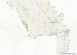
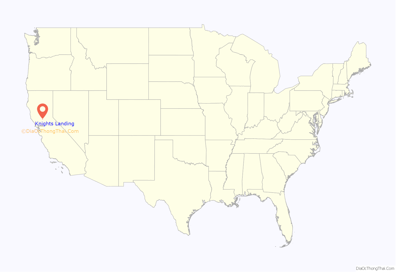
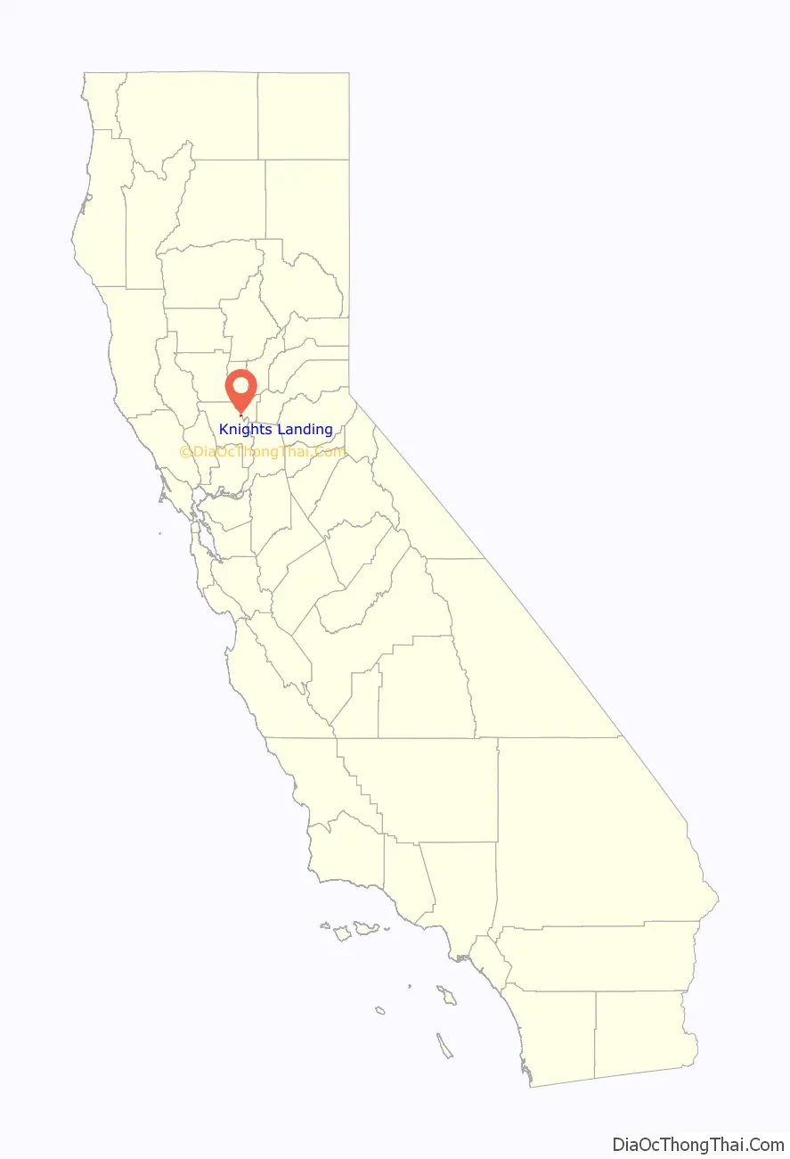
Knights Landing location map. Where is Knights Landing CDP?
History
Knights Landing was founded in 1843, by Dr. William Knight, a practicing physician from Baltimore, Maryland. William Knight built on a mound that marked the ancient meeting place of Native Americans inhabiting the regions about Cache Creek and the Sacramento River. The site early demonstrated its importance as a steamboat landing and point of communication between the people east and west of the big central river. When the town was laid out in 1849, it was originally called Baltimore, but an agreement over the sale of the new town lots could not be amicably arranged and the title Baltimore was lost. Knight established a ferry there, which afterwards passed to the ownership of J. W. Snowball. In those days the ferry tolls were $1 for a man and horse; a team and wagon cost $5. In 1850, S. R. Smith kept a hotel in the settlement and in 1853, Charles F. Reed surveyed and laid out a townsite and was officially given the name of Knight’s Landing. That year, J. W. Snowball and J. J. Perkins opened a large general merchandise store on the Native American mound. On January 1, 1854, Capt. J. H. Updegraff opened his hotel with $10 tickets to a grand New Years party. A steamer was run from Sacramento for the accommodation of guests. The establishment was called the “Yolo House.” In 1860 D. N. Hershey and George Glascock erected a brick hotel, which took the place of the Yolo House, that inn being retired to the status of a private residence
On March 25, 1890, the Knight’s Landing branch of the Southern Pacific Railroad was completed and ready for business, and later the completion of the bridge across the river added immensely to the prosperity of the town. The famous and now merged Southern Pacific Railroad Company once had a line from Davis, California, via Woodland, California, through Knights Landing, and the line continued to Marysville, California, via a junction in Yuba City, California. This 1879 map shows the railroad from Woodland almost to East Grafton (which contains Knights Landing): http://www.historicmapworks.com/Map/US/159571/West+Grafton+Township++East+Grafton+Township++Cacheville+Township/Yolo+County+1879/California/. The line now stops a few miles northeast of Woodland.
Grafton Elementary was the only public school in the community. It closed June 23, 2009. The area is served by Woodland Joint Unified School District. In 2010, the Science and Technology Academy of Knights Landing opened on the former Grafton Elementary campus as a charter school.
Knights Landing Cemetery (just south of town on County Road 102) is one of several purported final resting places of the stagecoach bandit Charles Bolles, a.k.a. Black Bart. If present, the grave is unmarked.
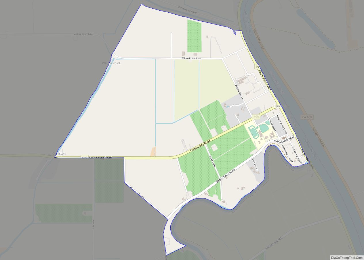
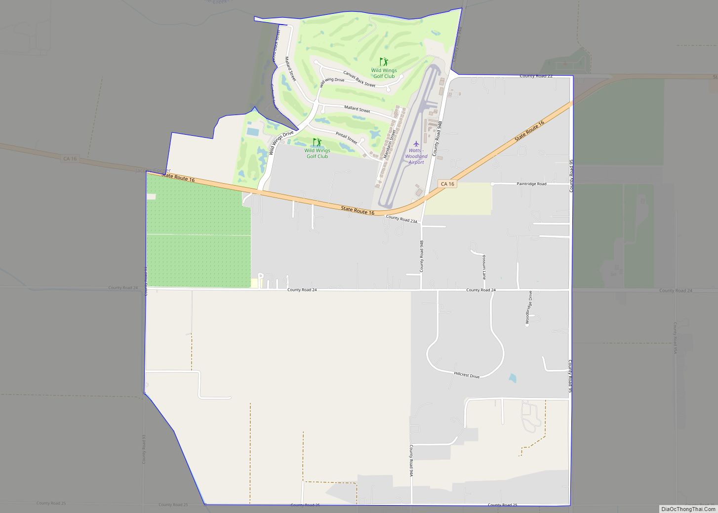
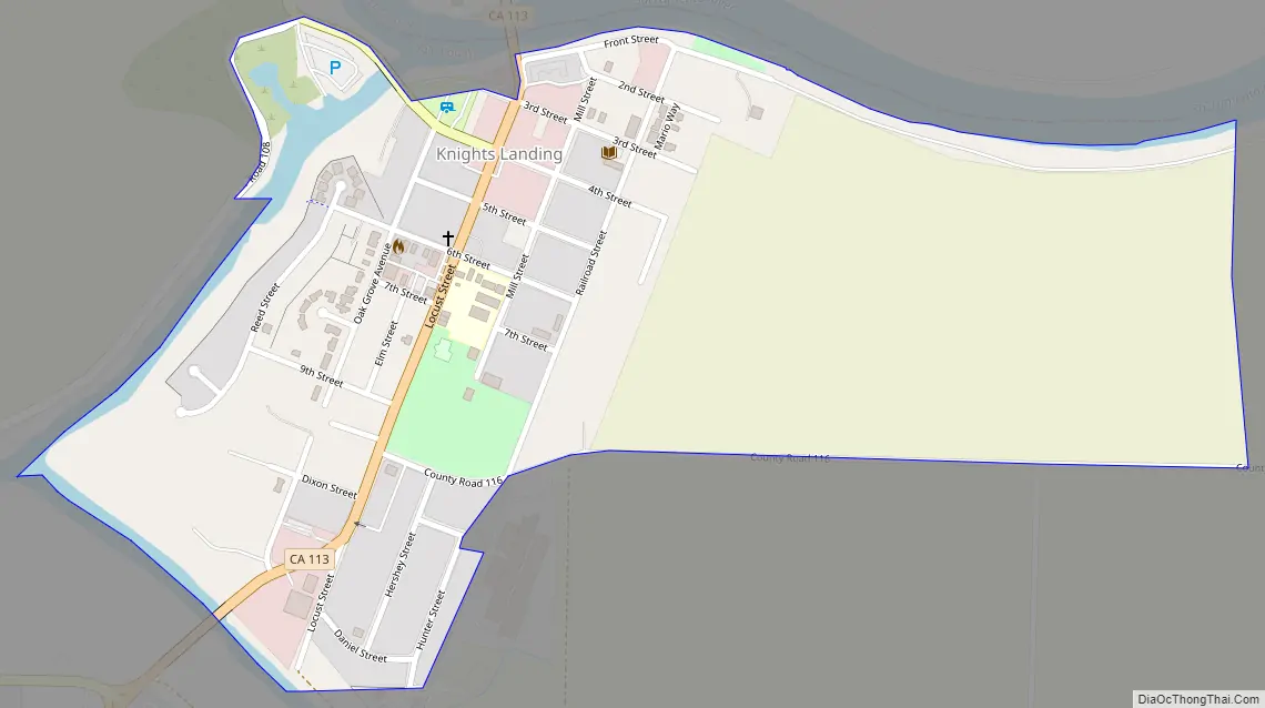
Knights Landing Road Map
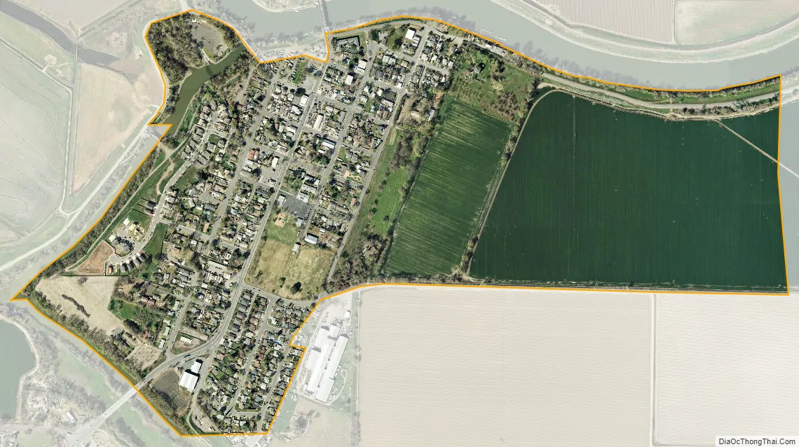
Knights Landing city Satellite Map
Geography
According to the United States Census Bureau, the CDP covers an area of 0.5 square miles (1.3 km), all of it land.
Climate
According to the Köppen Climate Classification system, Knights Landing has a warm-summer Mediterranean climate, abbreviated “Csa” on climate maps.
See also
Map of California State and its subdivision:- Alameda
- Alpine
- Amador
- Butte
- Calaveras
- Colusa
- Contra Costa
- Del Norte
- El Dorado
- Fresno
- Glenn
- Humboldt
- Imperial
- Inyo
- Kern
- Kings
- Lake
- Lassen
- Los Angeles
- Madera
- Marin
- Mariposa
- Mendocino
- Merced
- Modoc
- Mono
- Monterey
- Napa
- Nevada
- Orange
- Placer
- Plumas
- Riverside
- Sacramento
- San Benito
- San Bernardino
- San Diego
- San Francisco
- San Joaquin
- San Luis Obispo
- San Mateo
- Santa Barbara
- Santa Clara
- Santa Cruz
- Shasta
- Sierra
- Siskiyou
- Solano
- Sonoma
- Stanislaus
- Sutter
- Tehama
- Trinity
- Tulare
- Tuolumne
- Ventura
- Yolo
- Yuba
- Alabama
- Alaska
- Arizona
- Arkansas
- California
- Colorado
- Connecticut
- Delaware
- District of Columbia
- Florida
- Georgia
- Hawaii
- Idaho
- Illinois
- Indiana
- Iowa
- Kansas
- Kentucky
- Louisiana
- Maine
- Maryland
- Massachusetts
- Michigan
- Minnesota
- Mississippi
- Missouri
- Montana
- Nebraska
- Nevada
- New Hampshire
- New Jersey
- New Mexico
- New York
- North Carolina
- North Dakota
- Ohio
- Oklahoma
- Oregon
- Pennsylvania
- Rhode Island
- South Carolina
- South Dakota
- Tennessee
- Texas
- Utah
- Vermont
- Virginia
- Washington
- West Virginia
- Wisconsin
- Wyoming