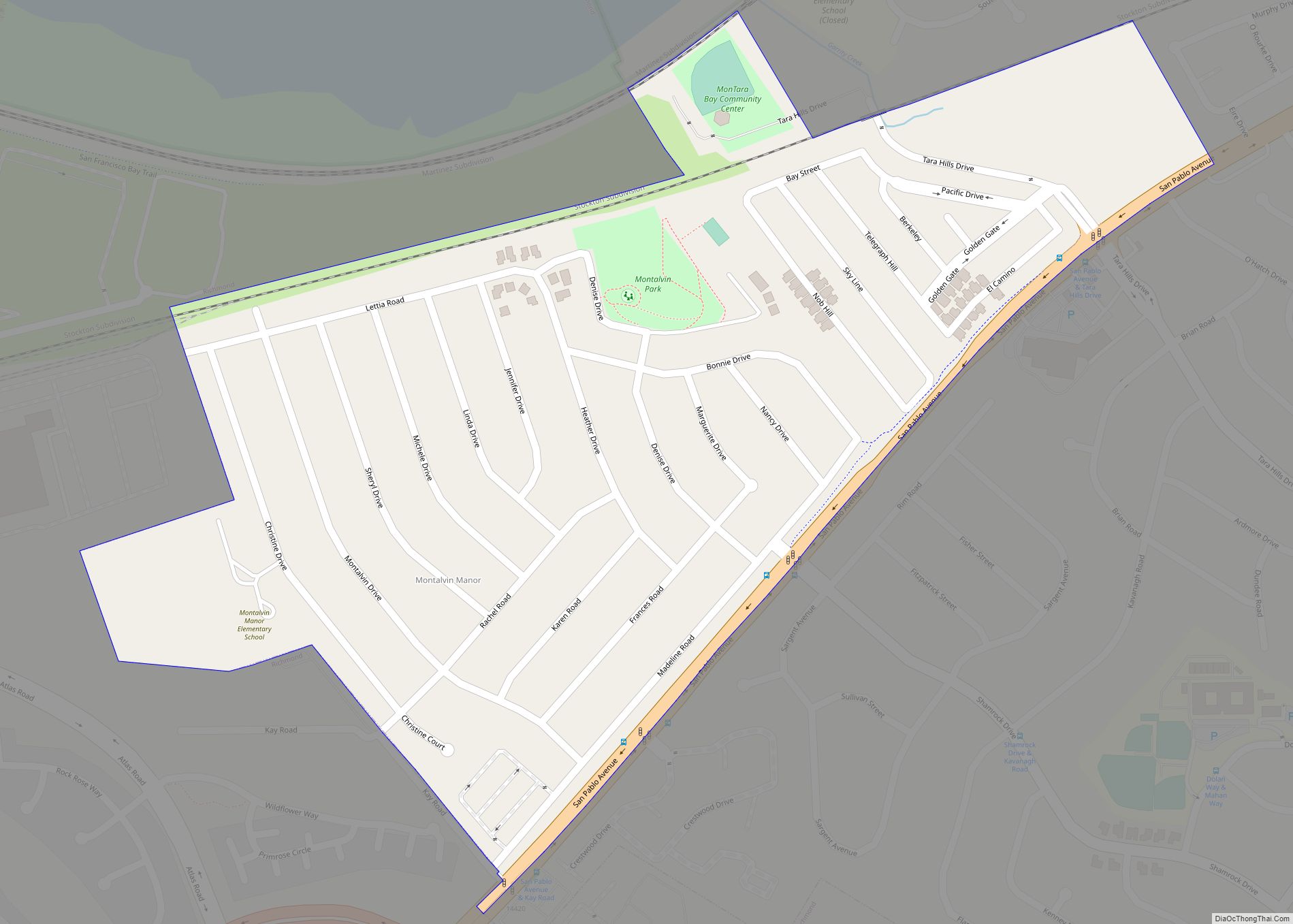
Map of Montebello city

Map of Montebello city, California

Montebello (Italian for “Beautiful Mountain”) is a city in Los Angeles County, California, United States, located just east of East Los Angeles and southwest of San Gabriel Valley. It is an independent city. 8 mi (13 km) east of downtown Los Angeles. It is considered part of the Gateway Cities, and is a member of the Gateway … Read more

Map of Monte Sereno city

Map of Monte Sereno city

Monte Sereno (Spanish for “Serene Mountain”) is a city in Santa Clara County, California, United States. The population was 3,479 at the 2020 census. The city is located in the foothills of the Santa Cruz Mountains, about 10 miles (16 km) southwest of San Jose, and is bordered by the town of Los Gatos to the … Read more

Map of Monte Rio CDP

Map of Monte Rio CDP

Monte Rio (Spanish: Monte Río, meaning “River Mountain”) is a census-designated place (CDP) in Sonoma County, California along the Russian River near the Pacific Ocean. The town of Guerneville lies northeast of Monte Rio, and Jenner is to the west. The population was 1,152 at the 2010 census, up from 1,104 at the 2000 census. … Read more

Map of Monterey Park city

Map of Monterey Park city, California

Monterey Park is a city in the western San Gabriel Valley region of Los Angeles County, California, United States, approximately seven miles (11 km) east of the Downtown Los Angeles civic center. It is bordered by Alhambra, Los Angeles, Montebello and Rosemead. The city’s motto is “Pride in the past, Faith in the future”. Monterey Park … Read more

Map of Monterey Park Tract CDP

Map of Monterey Park Tract CDP

Monterey Park Tract is a census-designated place (CDP) in Stanislaus County, California. Monterey Park Tract sits at an elevation of 62 feet (19 m). The 2010 United States census reported Monterey Park Tract’s population was 133. Monterey Park Tract CDP overview: Name: Monterey Park Tract CDP LSAD Code: 57 LSAD Description: CDP (suffix) State: California County: … Read more

Map of Montecito CDP

Map of Montecito CDP

Montecito (Spanish for “Little mountain”) is an unincorporated town and census-designated place in Santa Barbara County, California, United States. Located on the Central Coast of California, Montecito sits between the Santa Ynez Mountains and the Pacific Ocean and had a population of 8,638 in 2020. Montecito is best known as a “celebrity enclave”, owing to … Read more

Map of Moorpark city

Map of Moorpark city

Moorpark is a city in Ventura County in Southern California. Moorpark was founded in 1900. The town grew from just over 4,000 citizens in 1980 to over 25,000 by 1990. As of 2006, Moorpark was one of the fastest-growing cities in Ventura County. The population was 34,421 at the 2010 census, up from 31,415 at … Read more

Map of Monument Hills CDP

Map of Monument Hills CDP

Monument Hills is a census-designated place in Yolo County, California. Monument Hills sits at an elevation of 135 feet (41 m). The 2010 United States census reported Monument Hills’s population was 1,542. Monument Hills CDP overview: Name: Monument Hills CDP LSAD Code: 57 LSAD Description: CDP (suffix) State: California County: Yolo County Elevation: 135 ft (41 m) … Read more

Map of Montgomery Creek CDP

Map of Montgomery Creek CDP

Montgomery Creek is a census-designated place in Shasta County, California, United States. Its population is 176 as of the 2020 census, up from 163 from the 2010 census. The town and associated creek were named after Zachariah Montgomery. Montgomery Creek CDP overview: Name: Montgomery Creek CDP LSAD Code: 57 LSAD Description: CDP (suffix) State: California … Read more

Map of Morgan Hill city

Map of Morgan Hill city

Morgan Hill is a city in Santa Clara County, California, at the southern tip of Silicon Valley, in the San Francisco Bay Area. Morgan Hill is an affluent residential community, the seat of several high-tech companies, and a dining, entertainment, and recreational destination, owing to its luxury hospitality, wineries, and nature parks. Morgan Hill city … Read more

Map of Moraga town

Map of Moraga town

Moraga is a town in Contra Costa County, California, in the San Francisco Bay Area. The town is named in honor of Joaquín Moraga, member of the famed Californio family. As of 2020, Moraga had a total population of 16,870 people. Moraga is the home of Saint Mary’s College of California. Moraga town overview: Name: Moraga … Read more

Map of Morada CDP

Map of Morada CDP

Morada (Spanish for “Residence”) is a census-designated place (CDP) in San Joaquin County, California, United States. The population was 3,166 at the 2020 census, down from 3,828 at the 2010 census. Morada CDP overview: Name: Morada CDP LSAD Code: 57 LSAD Description: CDP (suffix) State: California County: San Joaquin County Elevation: 43 ft (13 m) Total Area: … Read more