Montecito (Spanish for “Little mountain”) is an unincorporated town and census-designated place in Santa Barbara County, California, United States. Located on the Central Coast of California, Montecito sits between the Santa Ynez Mountains and the Pacific Ocean and had a population of 8,638 in 2020. Montecito is best known as a “celebrity enclave”, owing to its concentration of prominent residents.
| Name: | Montecito CDP |
|---|---|
| LSAD Code: | 57 |
| LSAD Description: | CDP (suffix) |
| State: | California |
| County: | Santa Barbara County |
| Elevation: | 180 ft (55 m) |
| Total Area: | 9.265 sq mi (23.994 km²) |
| Land Area: | 9.259 sq mi (23.979 km²) |
| Water Area: | 0.006 sq mi (0.014 km²) 0.06% |
| Total Population: | 8,638 |
| Population Density: | 930/sq mi (360/km²) |
| Area code: | 805 and 820 |
| FIPS code: | 0648844 |
Online Interactive Map
Click on ![]() to view map in "full screen" mode.
to view map in "full screen" mode.
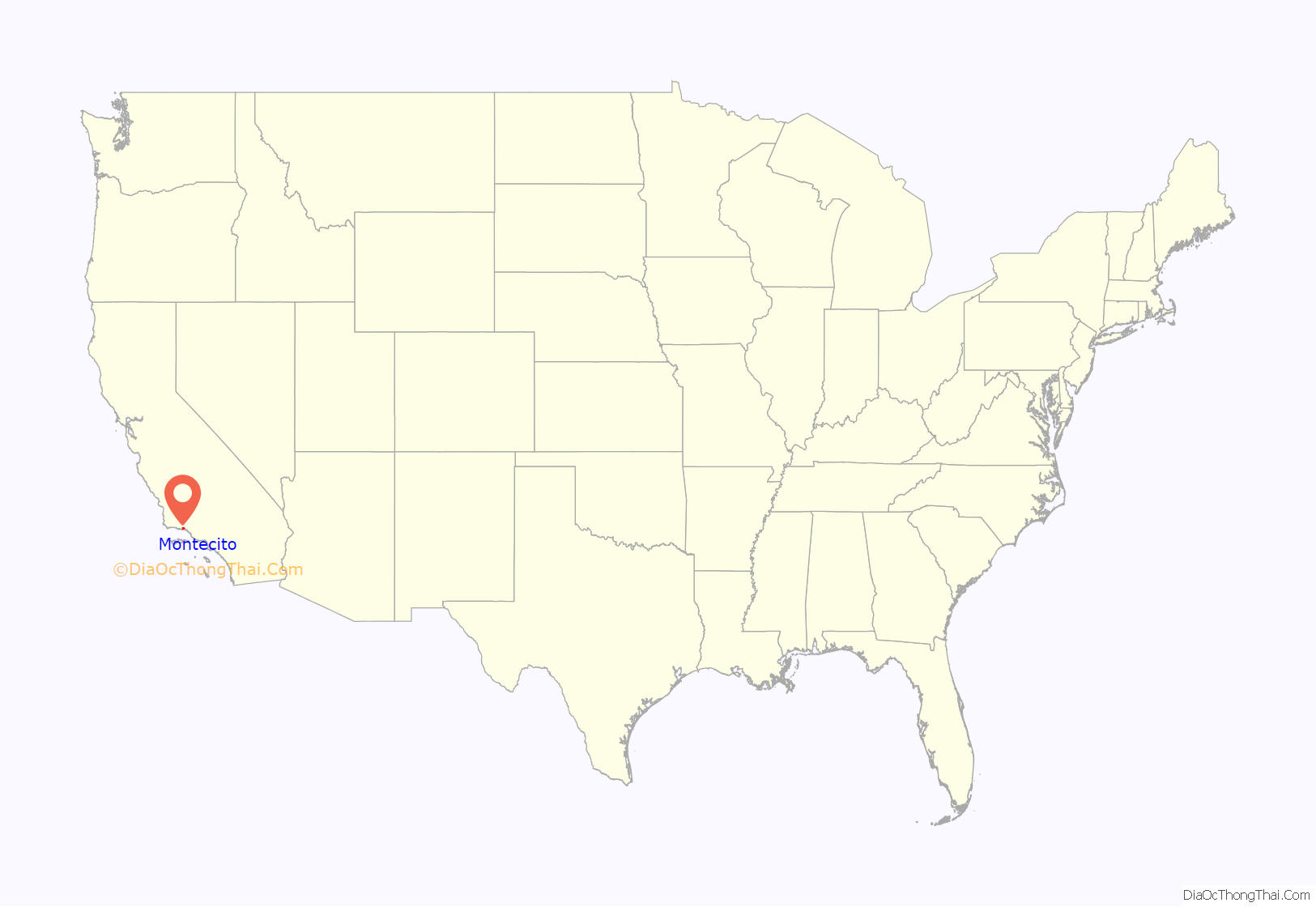
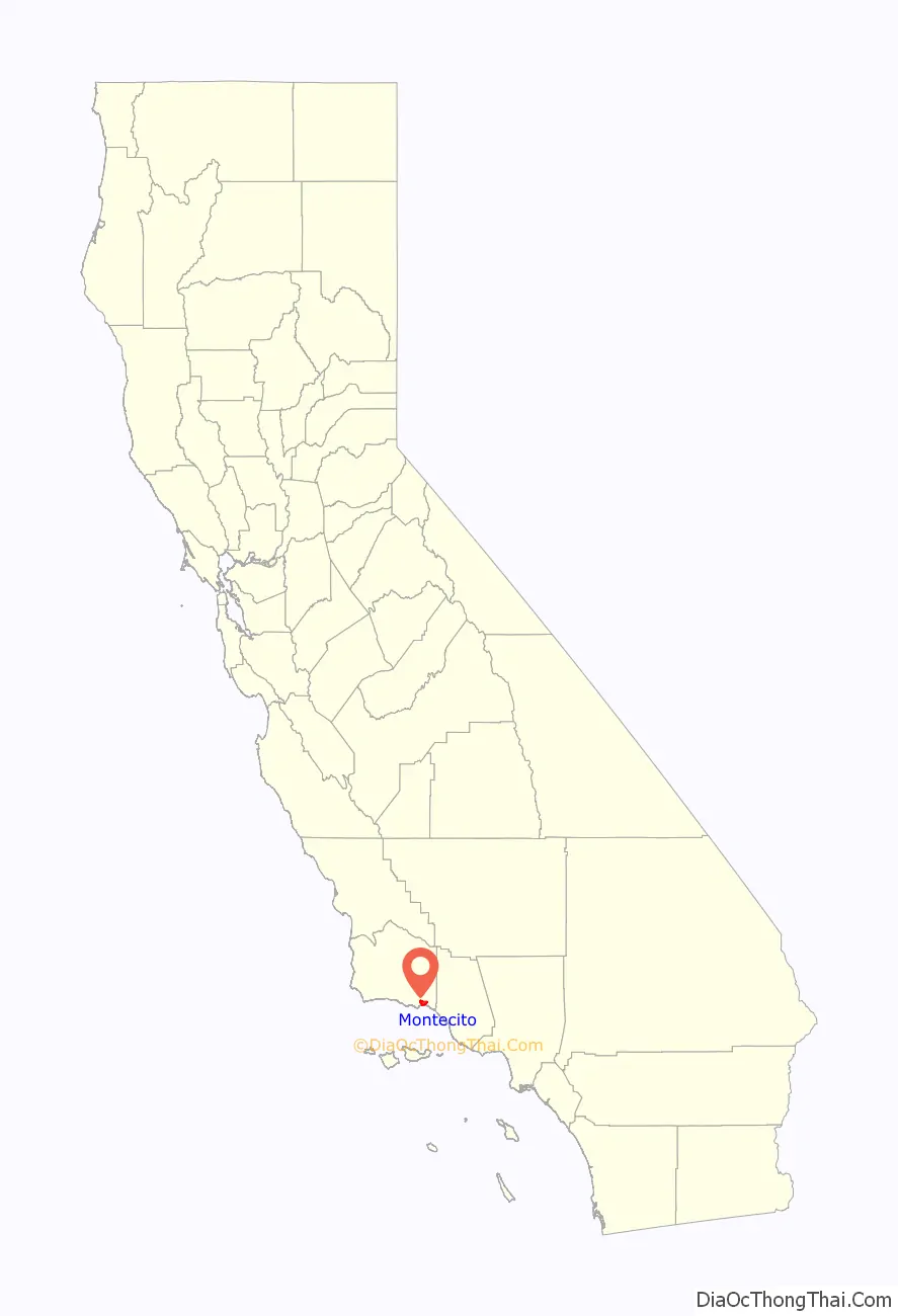
Montecito location map. Where is Montecito CDP?
History
The site of present-day Montecito, along with the entire south coast of Santa Barbara County, was inhabited for over 10,000 years by the Chumash Indians. The Spanish arrived in the 18th century but left the region largely unsettled while they built the Presidio and Mission Santa Barbara farther west.
In the middle of the 19th century, the area was known as a haven for bandits and highway robbers, who hid in the oak groves and canyons, preying on traffic on the coastal route between the towns that developed around the missions. By the end of the 1860s, the bandit gangs were gone, and Italian settlers arrived. Finding an area reminiscent of Italy, they built farms and gardens similar to those they had left behind.
Around the end of the 19th century, wealthy tourists from the eastern and midwestern United States began to buy land in the area. It was near enough to Santa Barbara for essential services while still being secluded. Desirable weather and several nearby hot springs offered the promise of comfortable, healthy living, in addition to the availability of affordable land.
The Montecito Hot Springs Hotel was built near the largest of the springs, in a canyon north of the town center and directly south of Montecito Peak, in Hot Springs Canyon. The hotel burned down in 1920; it was replaced a few years later by the smaller Hot Springs Club.
The architect George Washington Smith is noted particularly for his residences around Montecito, and for popularizing the Spanish Colonial Revival style in early 20th century America, as is Lutah Maria Riggs, who started as a draftsman in Smith’s firm, rose to partner, and later started her own firm.
Montecito was evacuated five times in four months between December 2017 and March 2018 because of weather-related events, which included the Thomas Fire, the 2018 Southern California mudflows, and flooding related to the Pineapple Express. The mudflows resulted in 20 reported deaths; 28 others were injured, and at least four people were reported missing. FEMA gave the Santa Barbara County Flood Control District $13.5 million in 2020. The funds will be used to buy land in Montecito to construct an $18 million project that will help control debris flows from San Ysidro Creek with a larger debris basin.
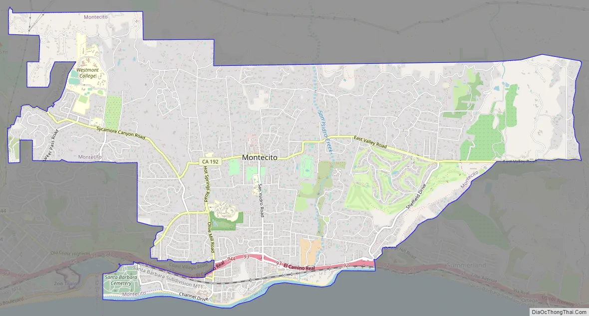
Montecito Road Map
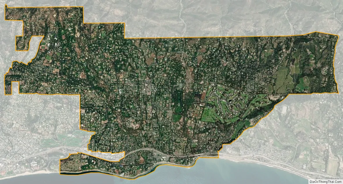
Montecito city Satellite Map
Geography
According to the United States Census Bureau, the CDP (census-designated place) has a total area of 9.3 square miles (24 km), 99.94% of it land and 0.06% of it water.
March and April are the months to watch gray whales migrate north from Mexico through the Santa Barbara Channel. The community provides access to backcountry hiking trails.
Climate
Montecito experiences a warm Mediterranean climate (Köppen climate classification: Csb) characteristic of coastal Southern California. Because of Montecito’s proximity to the ocean, onshore breezes significantly moderate temperatures, resulting in warmer winters and cooler summers compared with places further inland. With its gentle Mediterranean climate, Montecito has long been a desirable location for horticulturists.
See also
Map of California State and its subdivision:- Alameda
- Alpine
- Amador
- Butte
- Calaveras
- Colusa
- Contra Costa
- Del Norte
- El Dorado
- Fresno
- Glenn
- Humboldt
- Imperial
- Inyo
- Kern
- Kings
- Lake
- Lassen
- Los Angeles
- Madera
- Marin
- Mariposa
- Mendocino
- Merced
- Modoc
- Mono
- Monterey
- Napa
- Nevada
- Orange
- Placer
- Plumas
- Riverside
- Sacramento
- San Benito
- San Bernardino
- San Diego
- San Francisco
- San Joaquin
- San Luis Obispo
- San Mateo
- Santa Barbara
- Santa Clara
- Santa Cruz
- Shasta
- Sierra
- Siskiyou
- Solano
- Sonoma
- Stanislaus
- Sutter
- Tehama
- Trinity
- Tulare
- Tuolumne
- Ventura
- Yolo
- Yuba
- Alabama
- Alaska
- Arizona
- Arkansas
- California
- Colorado
- Connecticut
- Delaware
- District of Columbia
- Florida
- Georgia
- Hawaii
- Idaho
- Illinois
- Indiana
- Iowa
- Kansas
- Kentucky
- Louisiana
- Maine
- Maryland
- Massachusetts
- Michigan
- Minnesota
- Mississippi
- Missouri
- Montana
- Nebraska
- Nevada
- New Hampshire
- New Jersey
- New Mexico
- New York
- North Carolina
- North Dakota
- Ohio
- Oklahoma
- Oregon
- Pennsylvania
- Rhode Island
- South Carolina
- South Dakota
- Tennessee
- Texas
- Utah
- Vermont
- Virginia
- Washington
- West Virginia
- Wisconsin
- Wyoming


