Moorpark is a city in Ventura County in Southern California. Moorpark was founded in 1900. The town grew from just over 4,000 citizens in 1980 to over 25,000 by 1990. As of 2006, Moorpark was one of the fastest-growing cities in Ventura County. The population was 34,421 at the 2010 census, up from 31,415 at the 2000 census.
| Name: | Moorpark city |
|---|---|
| LSAD Code: | 25 |
| LSAD Description: | city (suffix) |
| State: | California |
| County: | Ventura County |
| Founded: | 1887 |
| Incorporated: | 1983-07-01 |
| Elevation: | 515 ft (157 m) |
| Total Area: | 12.47 sq mi (32.28 km²) |
| Land Area: | 12.28 sq mi (31.80 km²) |
| Water Area: | 0.19 sq mi (0.49 km²) 1.72% |
| Total Population: | 34,421 |
| Population Density: | 2,962.86/sq mi (1,144.01/km²) |
| Area code: | 805 |
| FIPS code: | 0649138 |
| GNISfeature ID: | 1652754 |
| Website: | www.moorparkca.gov |
Online Interactive Map
Click on ![]() to view map in "full screen" mode.
to view map in "full screen" mode.
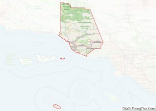
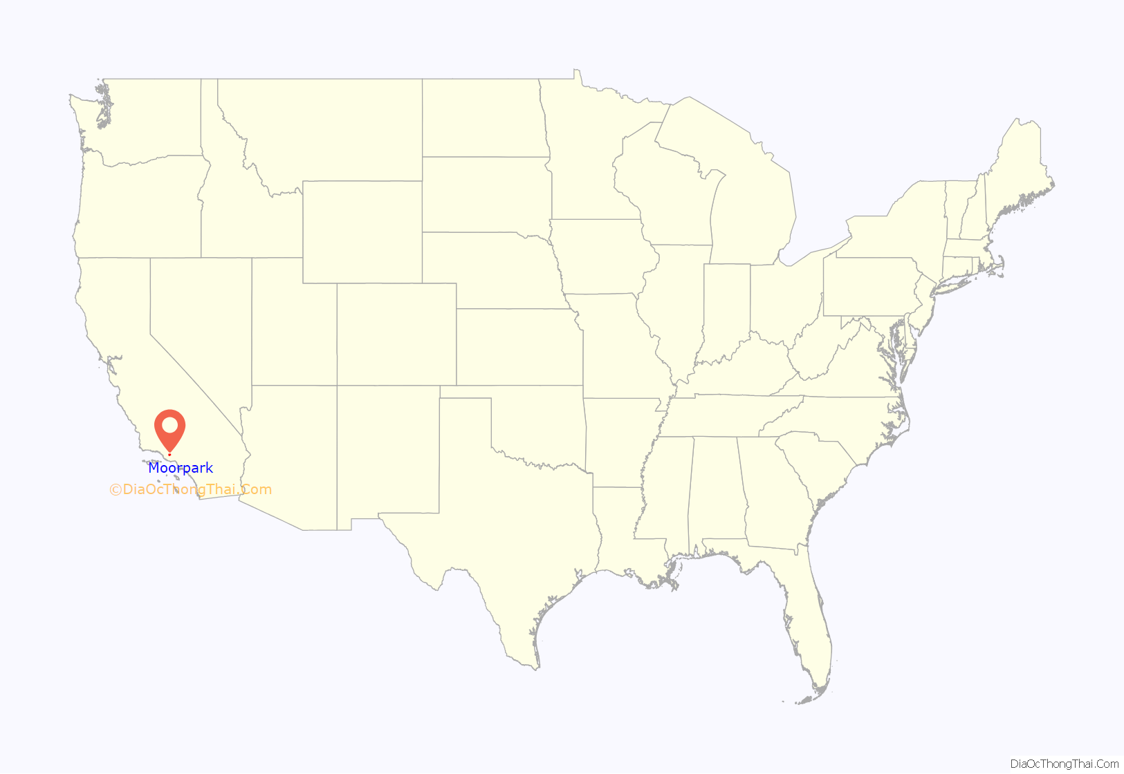
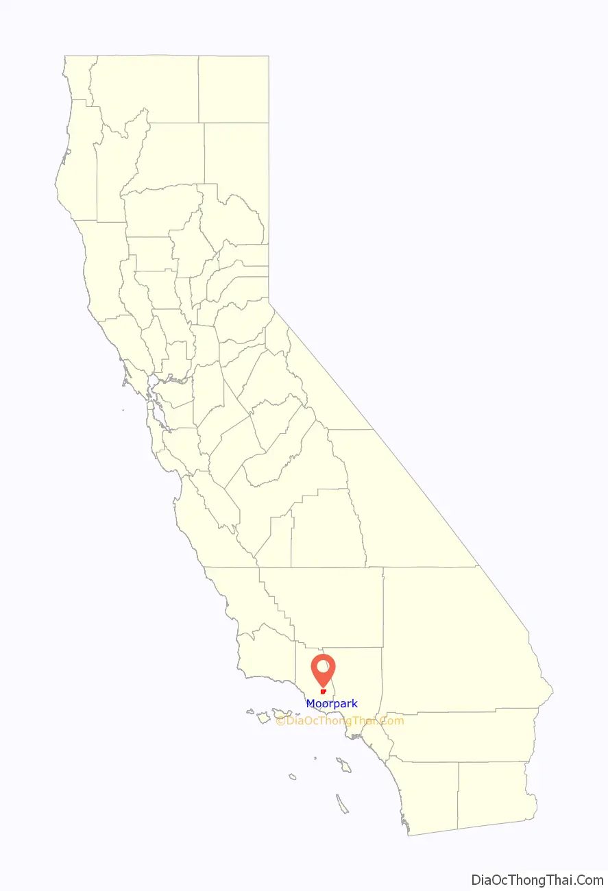
Moorpark location map. Where is Moorpark city?
History
Chumash people were the first to inhabit what is now known as Moorpark. A Chumash village, known as Quimisac (Kimishax), was located in today’s Happy Camp Canyon Regional Park. They were hunters and gatherers who often traveled between villages to trade. The village of Quimisac once controlled the local trade of fused shale in the region. The area was later part of the large Rancho Simi land grant given in 1795 to the Pico brothers by Governor Diego de Borica of Alta California.
Robert W. Poindexter, the secretary of the Simi Land and Water Company, received the land when the association was disbanded. A map showing the townsite was prepared in November 1900. It was a resubdivision of the large lot subdivision known as Fremont, or Fremontville. An application for a post office was submitted on June 1, 1900, and approved by August of that year. The application noted that the town had a railroad depot. The town grew after the 1904 completion of a 7,369-foot (2,246 m) tunnel through the Santa Susana Mountains. Moorpark was then on the main route of the Southern Pacific Railroad’s Coast Line between Los Angeles and San Francisco. The depot remained in operation until it was closed in 1958. It was eventually torn down around 1965.
Moorpark was one of the first cities to run off commercial nuclear power in the entire world, and the second in the United States, after Arco, Idaho, on July 17, 1955, which is the first city in the world to be lit by atomic power. For one hour on November 12, 1957, this fact was featured on Edward R. Murrow’s See It Now television show. The reactor, called the Sodium Reactor Experiment was built by the Atomics International division of North American Aviation at the nearby Santa Susana Field Laboratory. The Sodium Reactor Experiment operated from 1957 to 1964 and produced 7.5 megawatts of electrical power at a Southern California Edison-supplied generating station.
Moorpark College opened on September 11, 1967. Moorpark College is one of the few colleges that features an exotic animal training and management program. Moorpark was incorporated as a city on July 1, 1983.
In 1996, Moorpark’s Little League All-Star team represented the West Region in the Little League World Series in Williamsport, PA.
In February 2005, a Siberian tiger named Tuffy that escaped from a local residence was shot and killed in one of Moorpark’s parks. This created a great deal of uproar, because the animal control officers used a gun instead of a tranquilizer to kill the tiger, primarily because the tiger could not be shot from the proper angle for a tranquilizer to prove effective. Candlelight vigils were held for the late Tuffy. The couple who owned the tiger had moved from a licensed facility in Temecula, California, to an unlicensed facility in the Moorpark area of Ventura County. They lost their U.S. Department of Agriculture exhibitor license because they failed to notify the department of the move within 10 days. The wife pleaded guilty to a federal misdemeanor count of failing to maintain records of exotic felines. The husband pleaded guilty to obstruction of justice, making false statements and failing to maintain proper records. Each was sentenced to home detention, three years probation, and fined $900.
Just a month later, in March 2005, the fairly complete remains (about 75%) of an unusually old mammoth, possibly the rare southern mammoth (Mammuthus meridionalis), were discovered in the foothills of Moorpark at the site of a housing development. The fossilized skeleton is believed to be from a 800,000 to 1.4 million years old mammoth, which is estimated to have had a weight of ten tons.
In 2006, the Moorpark city council transferred governance of their library from the Ventura County library system to their own newly created city library system. The library, which opened in 1912, celebrated its centennial in 2012.
On February 28, 2006, a housing proposal, North Park Village, which would have added 1,680 houses on 3,586 acres (15 km) in the north-east area of the city, was defeated by a landslide in a city election.
Egg City
In 1961, Julius Goldman founded Egg City, the largest chicken ranch in the United States at the time located just north of Moorpark, California. Many chicken coops were spread over acres of concrete, with millions of chickens in them. Local residents were somewhat irked by the farm, when the smell of it wafted to Moorpark on windy days. The odors also commonly flowed to the nearby town of Fillmore. The business suffered a setback in 1972, when millions of chickens were slaughtered because of the threat of Newcastle disease. Egg gathering was done from 36 houses by hand, with workers placing eggs onto plastic flats while riding electric carts. Liquid, dry and shell eggs were processed at the 8,000 sq ft hatchery facility warehouse with yolk and albumen available in individually. The farm finally closed in 1996. In early December 2006, a wildfire destroyed the dilapidated remains of Egg City.
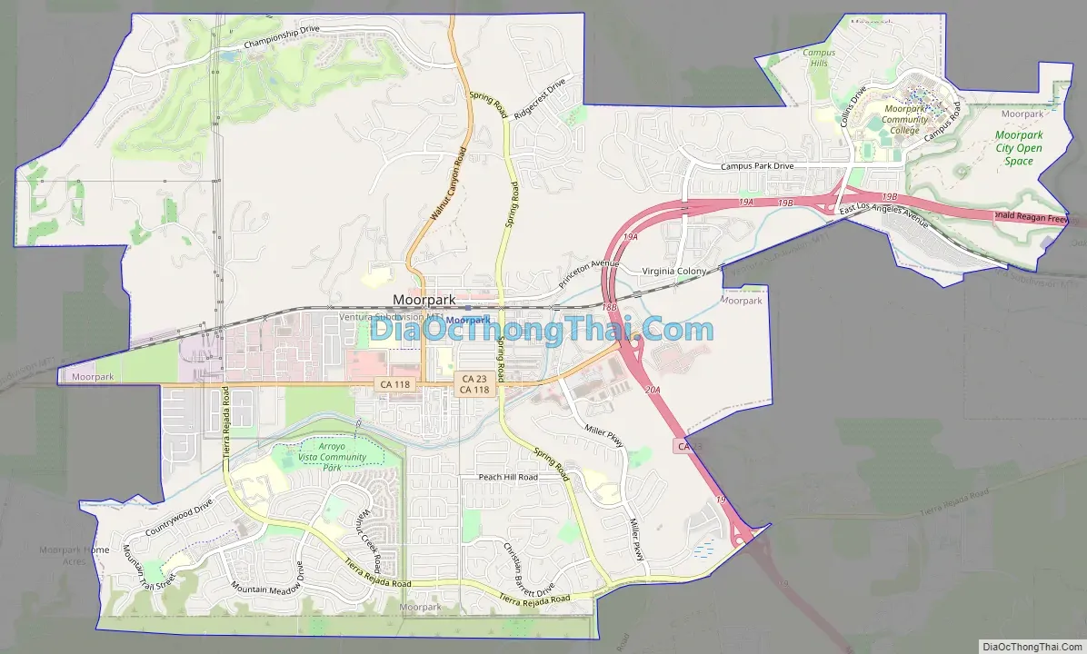
Moorpark Road Map
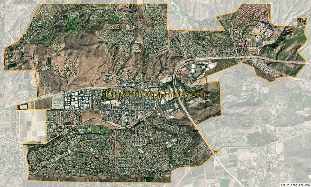
Moorpark city Satellite Map
Geography
Central Moorpark lies in a valley created by the Arroyo Simi river. It is situated on flatlands and mesas at the base of numerous hills. It is located immediately west of Simi Valley, California.
The city is divided by Highway 118, locally known as Los Angeles Avenue. Old Town Moorpark (Downtown) is located north of Route 118. Many newer residential communities can be found south of Route 118.
Neighborhoods
- Downtown is on High Street at the historic center of the city. The pepper trees that line High Street were planted by Robert Poindexter who was responsible for the plotting and mapping of the town. This area also features the High Street Arts Center (a Performing Arts center operated by the City of Moorpark), and various restaurants and businesses.
- The Peach Hill and Mountain Meadows neighborhoods are south of the Arroyo Simi. Moorpark High School is in this area, as well as many parks, including the Arroyo Vista Park and Recreation Center, the city’s largest park. This area contains a large part of the city’s population as over 75 percent of homes in Moorpark were constructed after 1980 here and in other new projects.
- Campus Park is named for Moorpark College. An additional substantial development is occurring to the north of the existing city, in the area of the Moorpark Country Club.
Climate
With its close proximity to Los Angeles, Moorpark too has a Subtropical-Mediterranean climate (Köppen climate classification Csb on the coast, Csb inland), and receives just enough annual precipitation to avoid either Köppen’s BSh or BSk (semi-arid climate) classification.
See also
Map of California State and its subdivision:- Alameda
- Alpine
- Amador
- Butte
- Calaveras
- Colusa
- Contra Costa
- Del Norte
- El Dorado
- Fresno
- Glenn
- Humboldt
- Imperial
- Inyo
- Kern
- Kings
- Lake
- Lassen
- Los Angeles
- Madera
- Marin
- Mariposa
- Mendocino
- Merced
- Modoc
- Mono
- Monterey
- Napa
- Nevada
- Orange
- Placer
- Plumas
- Riverside
- Sacramento
- San Benito
- San Bernardino
- San Diego
- San Francisco
- San Joaquin
- San Luis Obispo
- San Mateo
- Santa Barbara
- Santa Clara
- Santa Cruz
- Shasta
- Sierra
- Siskiyou
- Solano
- Sonoma
- Stanislaus
- Sutter
- Tehama
- Trinity
- Tulare
- Tuolumne
- Ventura
- Yolo
- Yuba
- Alabama
- Alaska
- Arizona
- Arkansas
- California
- Colorado
- Connecticut
- Delaware
- District of Columbia
- Florida
- Georgia
- Hawaii
- Idaho
- Illinois
- Indiana
- Iowa
- Kansas
- Kentucky
- Louisiana
- Maine
- Maryland
- Massachusetts
- Michigan
- Minnesota
- Mississippi
- Missouri
- Montana
- Nebraska
- Nevada
- New Hampshire
- New Jersey
- New Mexico
- New York
- North Carolina
- North Dakota
- Ohio
- Oklahoma
- Oregon
- Pennsylvania
- Rhode Island
- South Carolina
- South Dakota
- Tennessee
- Texas
- Utah
- Vermont
- Virginia
- Washington
- West Virginia
- Wisconsin
- Wyoming