Monterey Park is a city in the western San Gabriel Valley region of Los Angeles County, California, United States, approximately seven miles (11 km) east of the Downtown Los Angeles civic center. It is bordered by Alhambra, Los Angeles, Montebello and Rosemead. The city’s motto is “Pride in the past, Faith in the future”.
Monterey Park is part of a cluster of cities (Alhambra, Arcadia, Temple City, Rosemead, San Marino, and San Gabriel in the west San Gabriel Valley) with a growing Asian American population. According to the 2010 Census, the city had a total population of 60,269. Monterey Park has consistently ranked as one of the country’s best places to live due to its good schools, growing economy, and central location.
| Name: | Monterey Park city |
|---|---|
| LSAD Code: | 25 |
| LSAD Description: | city (suffix) |
| State: | California |
| County: | Los Angeles County |
| Incorporated: | May 29, 1916 |
| Elevation: | 384 ft (117 m) |
| Total Area: | 7.73 sq mi (20.03 km²) |
| Land Area: | 7.67 sq mi (19.87 km²) |
| Water Area: | 0.06 sq mi (0.16 km²) 0.79% |
| Total Population: | 61,259 |
| Population Density: | 7,776.49/sq mi (3,002.41/km²) |
| ZIP code: | 91754-91756 |
| Area code: | 323, 626 |
| FIPS code: | 0648914 |
| Website: | montereypark.ca.gov |
Online Interactive Map
Click on ![]() to view map in "full screen" mode.
to view map in "full screen" mode.
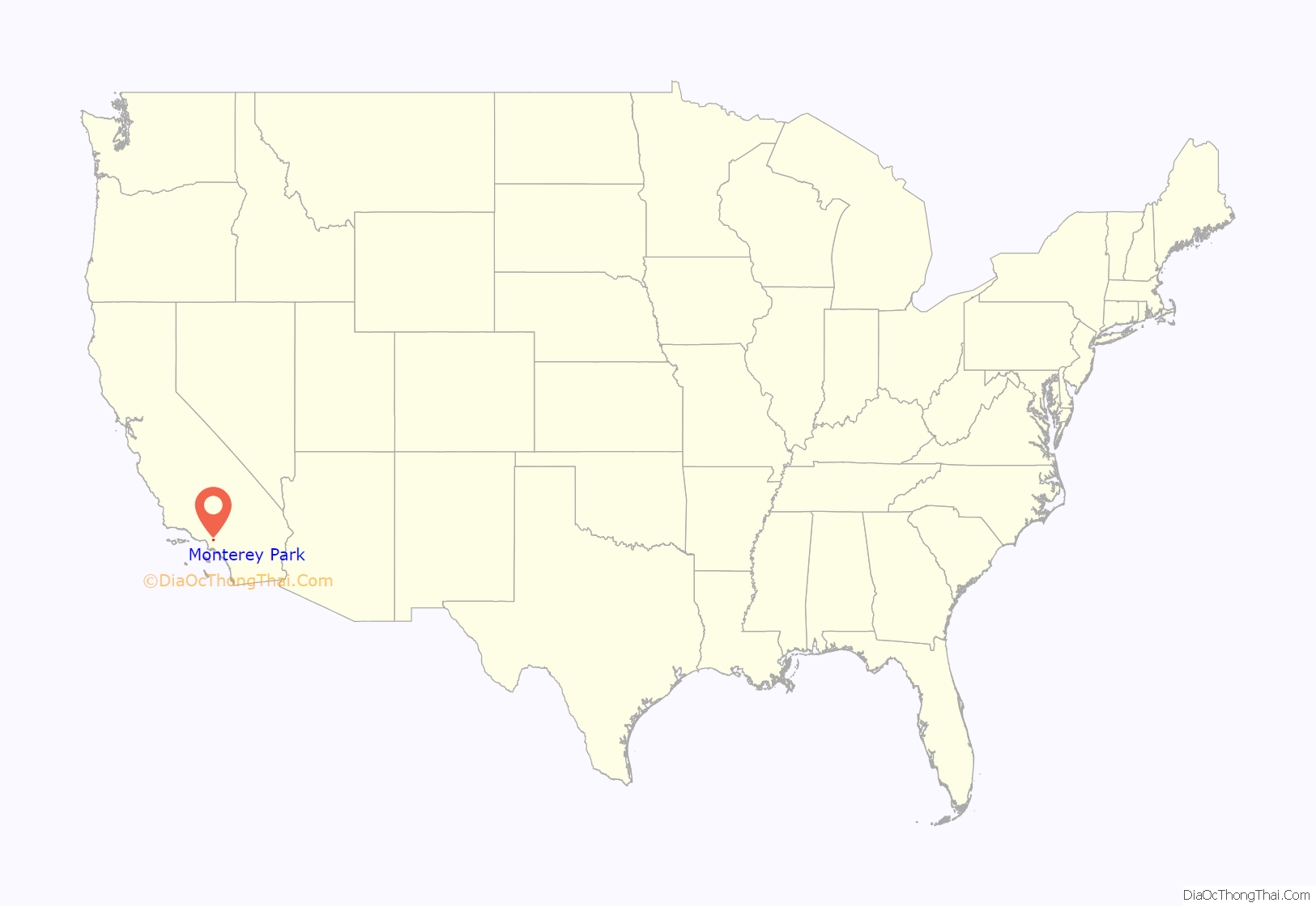
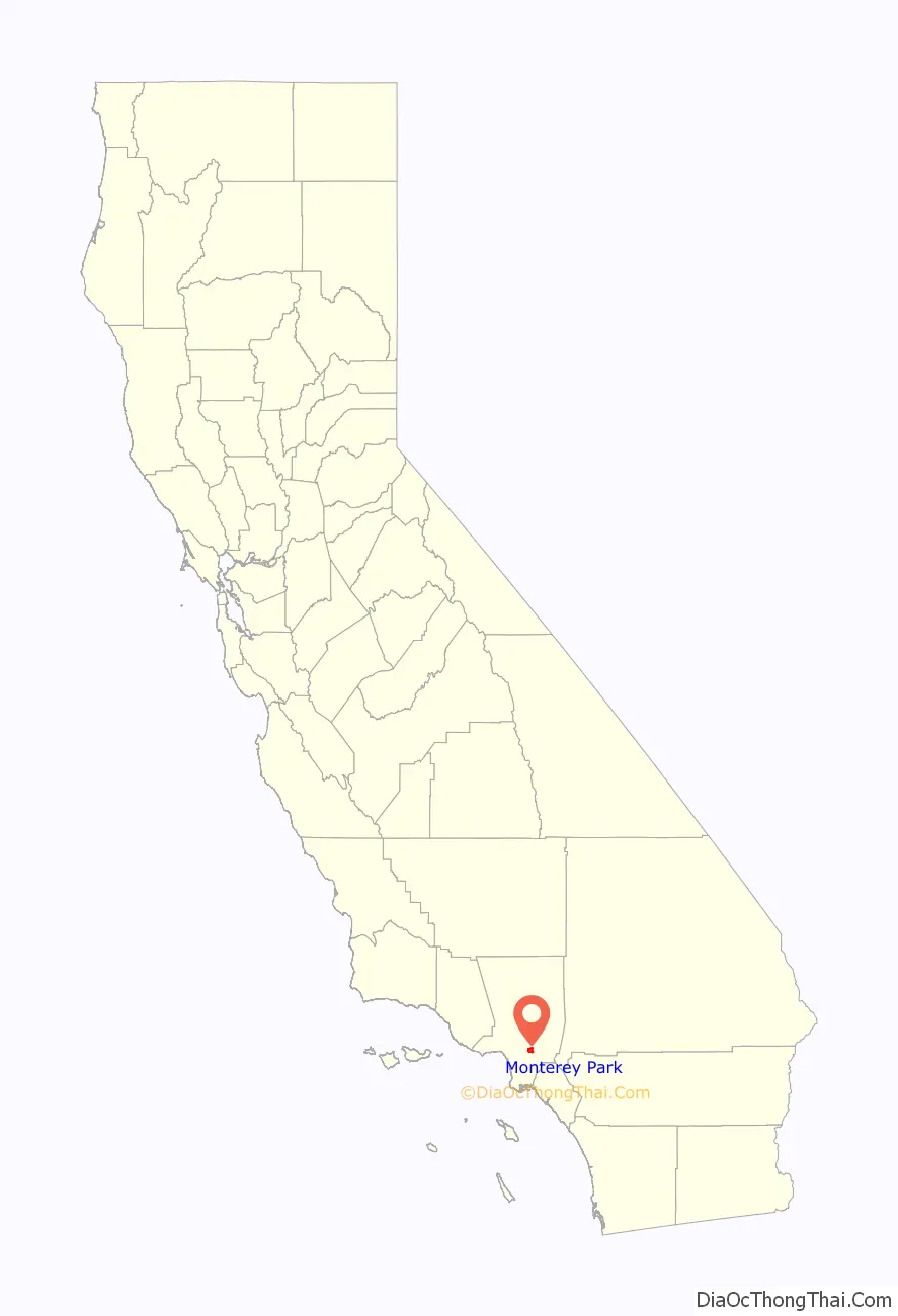
Monterey Park location map. Where is Monterey Park city?
History
Early history
For at least seven thousand years the land was populated by the Tongva (Gabrielino) Native Americans. The Tongva lived in dome like structures with thatched exteriors, with an open smoke hole for ventilation and light at the top. Both sexes wore long hair styles and tattooed their bodies. During warm weather the men wore few clothes, and the women wore minimal skirts made of animal hides. During the cold weather they would wear animal skin capes and occasionally wore sandals made from hide or yucca fiber. With the arrival of the Spaniards, Old World diseases killed off many of the Tongva, and by 1870 very few Native-Americans had survived. In the early 19th century the area was part of the Mission San Gabriel Arcángel mission system and later the Rancho San Antonio.
1860s–1960s
Following the Civil War, an Italian, Alessandro Repetto, purchased 5,000 acres (20 km) of the rancho and built his ranch house on the hill overlooking his land, about a half-mile north of where Garfield Avenue crosses the Pomona Freeway, not far from where the Edison substation is now located on Garfield Avenue.
It was at this time, Richard Garvey, a mail rider for the U.S. Army whose route took him through Monterey Pass, a trail that is now Garvey Avenue, settled down in the King’s Hills. Garvey began developing the land by bringing in spring water from near the Hondo River and by constructing a 54-foot-high (16 m) dam to form Garvey Lake located where Garvey Ranch Park is now. To pay for his development and past debts, Garvey began selling portions of his property. In 1906, the first subdivision in the area, Ramona Acres (named after the developer’s daughter, who would also later inspire the title of the novel Ramona), was developed north of Garvey and east of Garfield Avenues.
In 1916, the new residents of the area initiated action to become a city when the cities of Pasadena, South Pasadena, and Alhambra proposed to put a large sewage treatment facility in the area. The community voted itself into cityhood on May 29, 1916, by a vote of 455 to 33. The City’s new board of directors immediately outlawed sewage plants within city boundaries and named the new city Monterey Park. The name was taken from an old government map showing the oak-covered hills of the area as Monterey Hills. In 1920, a large area on the south edge of the city broke away and the separate city of Montebello was established.
By 1920, the white and Spanish-surname settlers were joined by Asian residents who began farming potatoes and flowers and developing nurseries in the Monterey Highlands area. They improved the Monterey Pass Trail with a road to aid in shipping their produce to Los Angeles. The nameless pass, which had been used as a location for western movies, was called Coyote Pass by Pioneer Masami Abe.
In 1926, near the corner of Atlantic and Garvey Avenue, Laura Scudder invented the first sealed bag of potato chips. In an effort to maintain quality and freshness, Laura’s team would iron sheets of wax paper together to form a bag. They would fill these bags with potato chips; iron the top closed, and then deliver them to various retailers.
Real estate became a thriving industry during the late 1920s with investors attracted to the many subdivisions under development and increasing commercial opportunities. The Midwick View Estates by Peter N. Snyder, a proposed garden community that was designed to rival Bel Air and Beverly Hills. Known as the “Father of the East Side”, Mr. Snyder was a key player in the vast undertaking in the 1920s of developing the East Side as part of the industrial base of Los Angeles. His efforts to build Atlantic Boulevard, his work with the East Side organization to bring industry to the East Side, and his residential and commercial development projects along Atlantic Boulevard (Gardens Square, Golden Gate Square, and the Midwick View Estates) were a major influence to the surrounding communities. The focal point of the Midwick View Estates was “Jardin del Encanto”, otherwise known as “El Encanto,” a Spanish style building that was to serve as the administration building and community center for Midwick View Estates. The development also included an observation terrace above Jardin del Encanto and the fountain with cascading water going down the hillside in stepped pools to De La Fuente. Now known as Heritage Falls Park or “the Cascades.” The Great Depression brought an abrupt end to the real estate boom, as well as the Midwick proposal. From the late 1920s, the City had little development for nearly two decades.
The end of World War II resulted in a revived growth trend with explosive population gains during the late 1940s and 1950s. Until this time, the population was concentrated in the northern and southern portions of the city, with the Garvey and Monterey Hills forming a natural barrier. With the renewed growth, many new subdivisions were developed, utilizing even the previously undeveloped central area to allow for maximum growth potential. A series of annexations of surrounding land also occurred. Many veterans settled in Monterey Park and continued through the 1950s. Around this time, Japanese Americans from the West Side, Chinese Americans from Chinatown, and Latinos from East Los Angeles also began settling in the area and largely assimilated into the small-town suburban culture.
1970s–1990s
Beginning in the 1970s, middle-class ethnic Asian Americans and Asian immigrants began settling in the west San Gabriel Valley, primarily to Monterey Park. The City Council of Monterey Park subsequently tried and failed to pass English-only ordinances. In 1985 the Council approved drafting of a proposal that would require all businesses in Monterey Park to display English language identification on business signs.
In the 1980s, Monterey Park was referred to as “Little Taipei” or “The Chinese Beverly Hills”. Frederic Hsieh, a local realtor who bought land in Monterey Park and sold it to newly arrived immigrants, is credited with engendering Monterey Park’s Chinese American community. Many businesses from the Chinatown in downtown LA began to open up stores in Monterey Park. In the 1970s and 1980s, many affluent waisheng ren Taiwanese immigrants moved abroad from Taiwan and began settling into Monterey Park. Mandarin Chinese became the most widely spoken language in many Chinese businesses of the city during that time, displacing Cantonese that had been common previously. Cantonese has dominated the Chinatowns of North America for decades, but Mandarin is the most common language of Chinese immigrants in the past few decades. In 1983, Lily Lee Chen became the first Chinese American woman to be elected mayor of a U.S. city. By the late 1980s, immigrants from mainland China and Vietnam began moving into Monterey Park. By the 1990 census, Monterey Park became the first city with an Asian descent majority population in the continental United States. Timothy P. Fong, a professor and director of Asian American studies at California State University, Sacramento, describes Monterey Park as the “First Suburban Chinatown”.
In the 1980s, the second generation Chinese Americans generally moved out of the old Chinatown and into the San Gabriel Valley suburbs, joining the new immigrants from Taiwan and mainland China. From that time, with a combined influx of Vietnamese, Taiwanese and Hong Kong immigrant students at the time, Mark Keppel High School, constructed during the New Deal era and located in Alhambra, but also serving most of Monterey Park and portions of Rosemead, felt the impact of this new immigration as the student population increased dramatically, leading to overcrowding. Today, many students are second or third-generation Asian Americans.
In 1988, the City of Monterey Park passed an ordinance declaring a moratorium on new building, in an attempt to regulate the rapid growth the city experienced as a result of the influx of Asian immigrants. This moratorium was challenged and defeated in 1989. This controversial move caused many Asian residents and businesses to shift focus, establishing themselves in the neighboring city of Alhambra. When the potential loss of business revenue was recognized, “Monterey Park went through a lot of upheaval that a lot of people regret,” and relocation back to Monterey Park was highly encouraged in the Asian American community.
Since the early 1990s, Taiwanese people are no longer the majority in the city. The construction boom of shopping centers had declined, but plans for redevelopment sought to change that. High property values and overcrowding in Monterey Park have contributed to a secondary migration away from Monterey Park.
2000s–present
Redevelopment produced several projects included the massive Atlantic Times Square development that opened in 2010 with ground-floor shops and restaurants. The Atlantic Times Square, which has 215,000 square feet (20,000 m), is anchored by AMC Theatres and 24 Hour Fitness, in addition to eating establishments and other stores. The development includes 210 condos on the third through sixth floors.
Monterey Park Village is a 40,000 sq. ft. shopping center on South Atlantic Boulevard commercial corridor. Tenants include: Staples, Walgreens and Togo’s eatery. The CVS Center on South Garfield Avenue is a redevelopment of infill site into a 17,000 square feet (1,600 m) neighborhood convenience center. Anchor tenant CVS Pharmacy brings a full-service drug store back to the downtown project, and the center includes a Subway sandwich shop. The 507,000-square-foot (47,100 m) Cascades Market Place will be the largest shopping center in the city. Located along the Pomona (60) Freeway west of Paramount Boulevard, this center proposes to be a major regional shopping center for the San Gabriel Valley. The new shopping center contains a Home Depot, a Costco, Chick-fil-A, and a Guitar Center. This 45 plus acre project has great grade level visibility from the freeway.
In 2017, Monterey Park was recognized as “America’s Best Places to Live 2017” ranked at #3 by Money magazine and three local news TV stations. It also ranked at #2 in Money Magazine’s “The 10 Best Places in America to Raise a Family”.
On January 21, 2023, a mass shooting occurred in Monterey Park at a dance studio in the city, after a Chinese New Year celebration where twenty people were shot, killing eleven of them, and injuring nine others. The gunman, identified as 72-year-old Huu Can Tran, fled and was later found dead from a self-inflicted gunshot wound in nearby Torrance the next day.
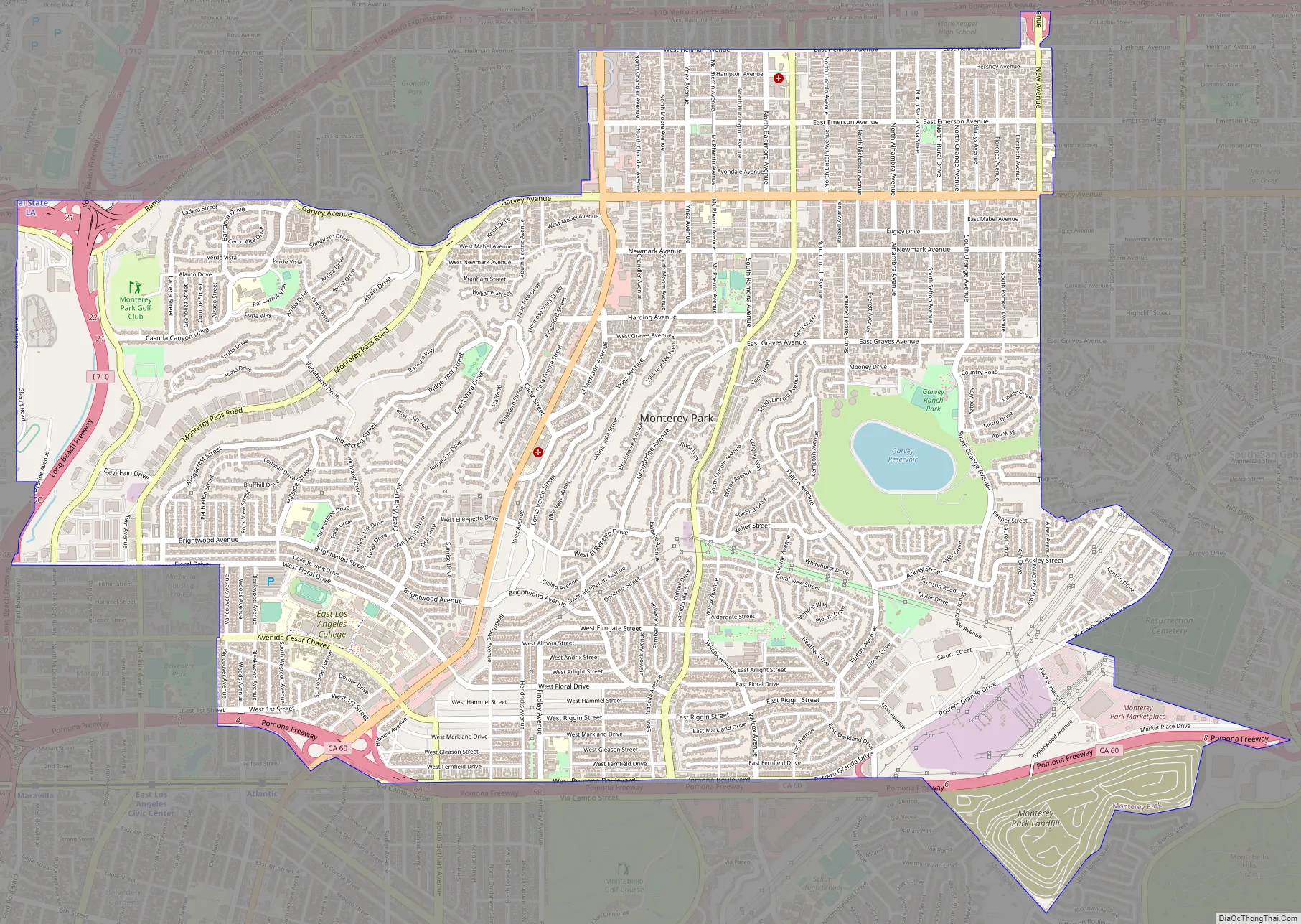
Monterey Park Road Map
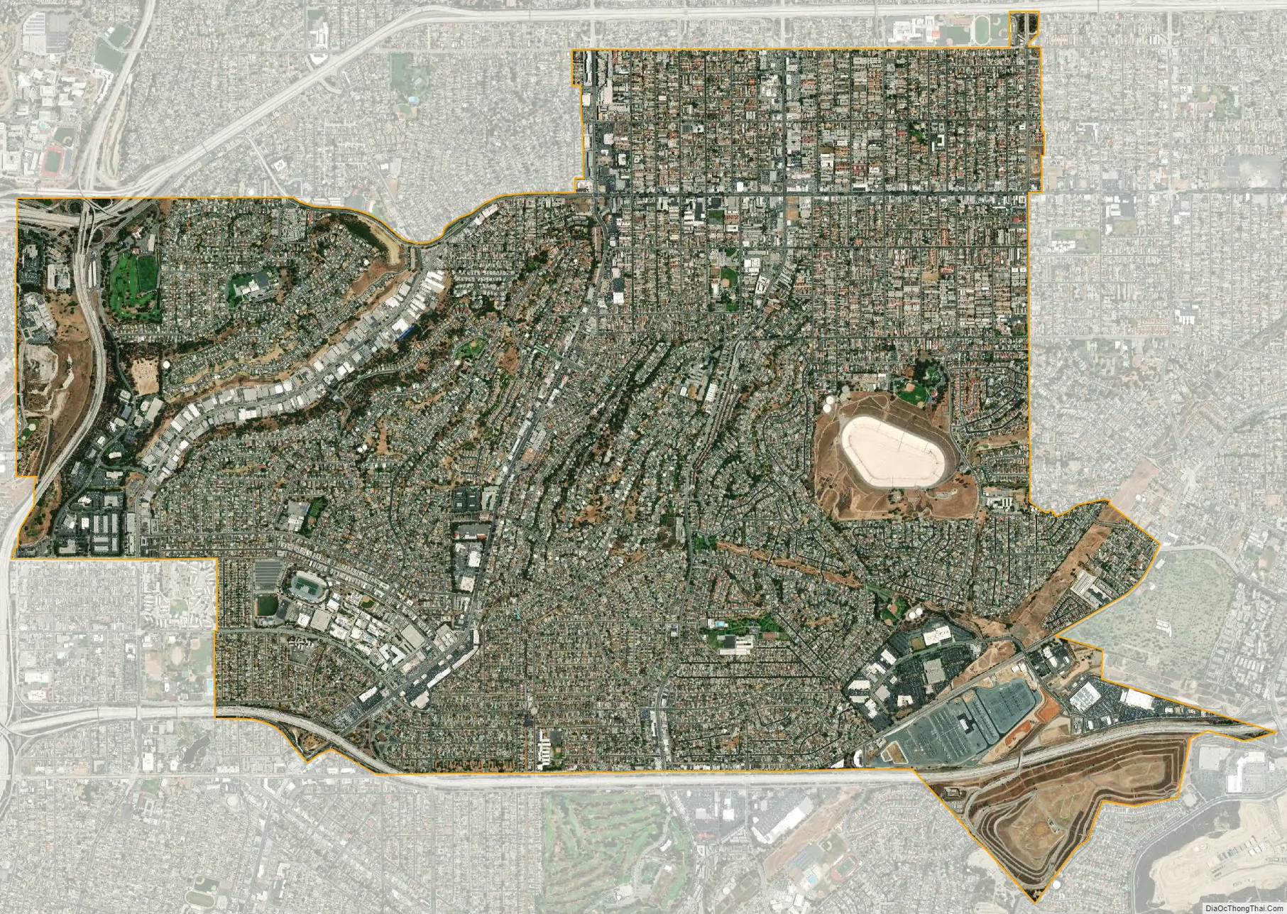
Monterey Park city Satellite Map
Geography
According to the United States Census Bureau, the city has a total area of 7.7 square miles (20 km), of which, 7.6 square miles (20 km) is land, and 0.04 square miles (0.10 km) (0.39%) is water.
The city boundaries include Los Angeles to the west, unincorporated East Los Angeles to the south and west, Alhambra to the north, Rosemead to the northeast, Montebello to the south, and unincorporated South San Gabriel to the southeast.
See also
Map of California State and its subdivision:- Alameda
- Alpine
- Amador
- Butte
- Calaveras
- Colusa
- Contra Costa
- Del Norte
- El Dorado
- Fresno
- Glenn
- Humboldt
- Imperial
- Inyo
- Kern
- Kings
- Lake
- Lassen
- Los Angeles
- Madera
- Marin
- Mariposa
- Mendocino
- Merced
- Modoc
- Mono
- Monterey
- Napa
- Nevada
- Orange
- Placer
- Plumas
- Riverside
- Sacramento
- San Benito
- San Bernardino
- San Diego
- San Francisco
- San Joaquin
- San Luis Obispo
- San Mateo
- Santa Barbara
- Santa Clara
- Santa Cruz
- Shasta
- Sierra
- Siskiyou
- Solano
- Sonoma
- Stanislaus
- Sutter
- Tehama
- Trinity
- Tulare
- Tuolumne
- Ventura
- Yolo
- Yuba
- Alabama
- Alaska
- Arizona
- Arkansas
- California
- Colorado
- Connecticut
- Delaware
- District of Columbia
- Florida
- Georgia
- Hawaii
- Idaho
- Illinois
- Indiana
- Iowa
- Kansas
- Kentucky
- Louisiana
- Maine
- Maryland
- Massachusetts
- Michigan
- Minnesota
- Mississippi
- Missouri
- Montana
- Nebraska
- Nevada
- New Hampshire
- New Jersey
- New Mexico
- New York
- North Carolina
- North Dakota
- Ohio
- Oklahoma
- Oregon
- Pennsylvania
- Rhode Island
- South Carolina
- South Dakota
- Tennessee
- Texas
- Utah
- Vermont
- Virginia
- Washington
- West Virginia
- Wisconsin
- Wyoming


