Moraga is a town in Contra Costa County, California, in the San Francisco Bay Area. The town is named in honor of Joaquín Moraga, member of the famed Californio family. As of 2020, Moraga had a total population of 16,870 people. Moraga is the home of Saint Mary’s College of California.
| Name: | Moraga town |
|---|---|
| LSAD Code: | 43 |
| LSAD Description: | town (suffix) |
| State: | California |
| County: | Contra Costa County |
| Incorporated: | November 13, 1974 |
| Elevation: | 499 ft (152 m) |
| Total Area: | 9.45 sq mi (24.49 km²) |
| Land Area: | 9.45 sq mi (24.46 km²) |
| Water Area: | 0.01 sq mi (0.02 km²) 0.09% |
| Total Population: | 16,870 |
| Population Density: | 1,800/sq mi (690/km²) |
| ZIP code: | 94556, 94570, 94575 |
| Area code: | 925 |
| FIPS code: | 0649187 |
| Website: | www.moraga.ca.us |
Online Interactive Map
Click on ![]() to view map in "full screen" mode.
to view map in "full screen" mode.
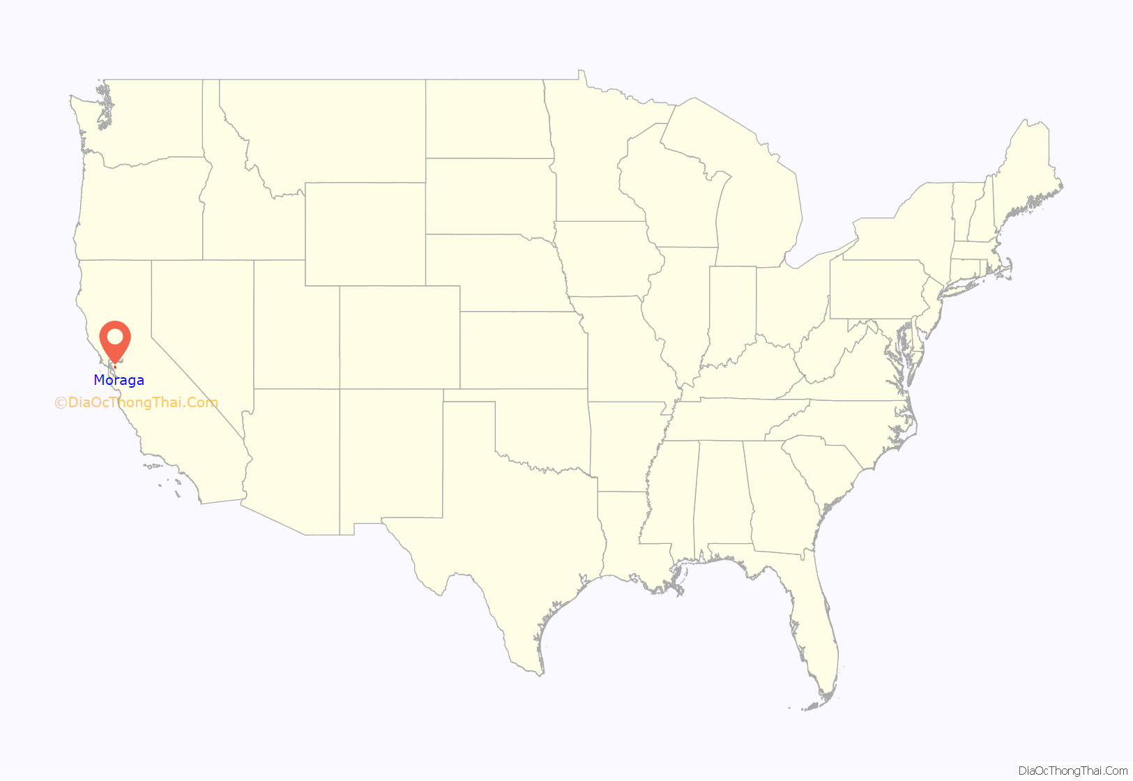
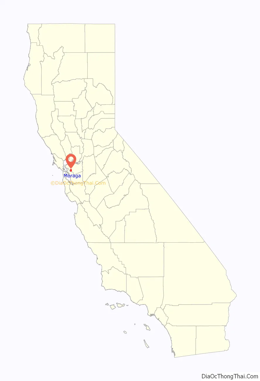
Moraga location map. Where is Moraga town?
History
The land now called Moraga was first inhabited by the Saklan Native Americans who belonged to the Bay Miwok language group.
Joaquin Moraga was the grandson of José Joaquín Moraga, builder of the Presidio of San Francisco and founder of the pueblo that grew into the city of San Jose. Joaquin’s father Gabriel Moraga was also a soldier, and an early explorer who named many of the state’s rivers, including the Sacramento and San Joaquin.
Moraga is located on the 1835 Mexican Land Grant Rancho Laguna de Los Palos Colorados given to Joaquin Moraga and his cousin, Juan Bernal. Part of that grant was the property today known as Moraga Ranch. The Moraga Adobe has been preserved and is located in neighboring Orinda. Joaquin Moraga Intermediate School, a middle school in Moraga, bears his name.
In the first half of the 20th century, the line of the Sacramento Northern Railroad ran through Moraga; much of the old right-of-way is now part of the Lafayette-Moraga Regional Trail.
Moraga’s first post office opened in 1886, and was closed in 1887; it reopened in 1915. In 1955, Moraga built a new post office. Saint Mary’s College of California moved to Moraga in 1928. Moraga incorporated in 1974, when the communities of Moraga Town, Rheem, and Rheem Valley, united into one town.
In June 2017, Moraga declared a fiscal emergency, because a sinkhole in the downtown area and a failed bridge on Canyon Road were expected to cost $5 million to repair.
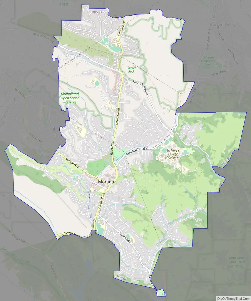
Moraga Road Map
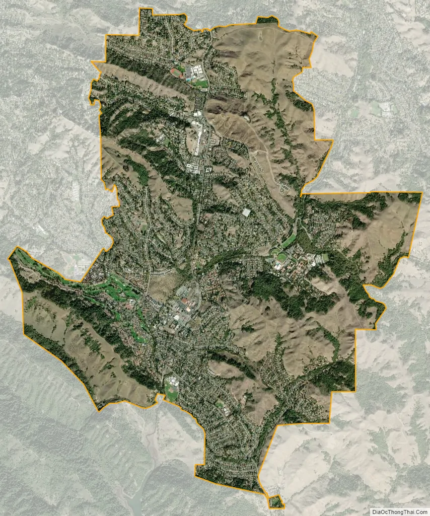
Moraga city Satellite Map
Geography
Moraga is located at 37°50’06” North, 122°07’47” West, at an elevation of 499 feet (152 m). It is located adjacent to the cities of Lafayette and Orinda, as well as the unincorporated community of Canyon. Other nearby cities include Walnut Creek, Oakland, San Francisco, Concord and Berkeley.
According to the United States Census Bureau, the town has a total area of 9.4 square miles (24 km), of which 9.4 square miles (24 km) is land and 0.09% is water. Moraga is in a valley, surrounded by rolling hills. Large sections of the Lafayette-Moraga Regional Trail pass through the town.
See also
Map of California State and its subdivision:- Alameda
- Alpine
- Amador
- Butte
- Calaveras
- Colusa
- Contra Costa
- Del Norte
- El Dorado
- Fresno
- Glenn
- Humboldt
- Imperial
- Inyo
- Kern
- Kings
- Lake
- Lassen
- Los Angeles
- Madera
- Marin
- Mariposa
- Mendocino
- Merced
- Modoc
- Mono
- Monterey
- Napa
- Nevada
- Orange
- Placer
- Plumas
- Riverside
- Sacramento
- San Benito
- San Bernardino
- San Diego
- San Francisco
- San Joaquin
- San Luis Obispo
- San Mateo
- Santa Barbara
- Santa Clara
- Santa Cruz
- Shasta
- Sierra
- Siskiyou
- Solano
- Sonoma
- Stanislaus
- Sutter
- Tehama
- Trinity
- Tulare
- Tuolumne
- Ventura
- Yolo
- Yuba
- Alabama
- Alaska
- Arizona
- Arkansas
- California
- Colorado
- Connecticut
- Delaware
- District of Columbia
- Florida
- Georgia
- Hawaii
- Idaho
- Illinois
- Indiana
- Iowa
- Kansas
- Kentucky
- Louisiana
- Maine
- Maryland
- Massachusetts
- Michigan
- Minnesota
- Mississippi
- Missouri
- Montana
- Nebraska
- Nevada
- New Hampshire
- New Jersey
- New Mexico
- New York
- North Carolina
- North Dakota
- Ohio
- Oklahoma
- Oregon
- Pennsylvania
- Rhode Island
- South Carolina
- South Dakota
- Tennessee
- Texas
- Utah
- Vermont
- Virginia
- Washington
- West Virginia
- Wisconsin
- Wyoming


