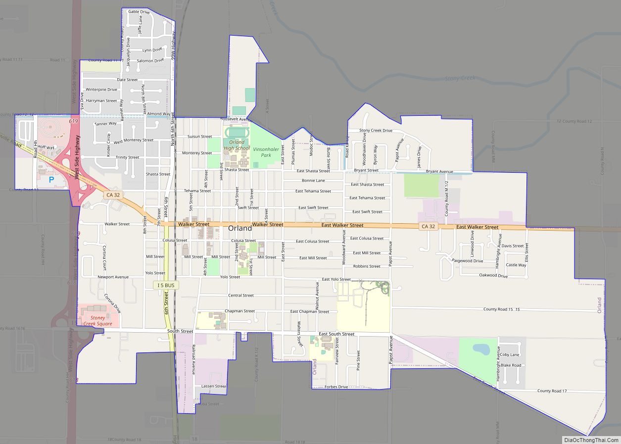
Map of Pacific Grove city

Map of Pacific Grove city

Pacific Grove is a coastal city in Monterey County, California, in the United States. The population at the 2020 census was 15,090. Pacific Grove is located between Point Pinos and Monterey. Pacific Grove has numerous Victorian-era houses, some of which have been turned into bed-and-breakfast inns. The city is the location of the Point Pinos … Read more

Map of Pacheco CDP

Map of Pacheco CDP

Pacheco is a census-designated place (CDP) in Contra Costa County, California. The population was 3,685 at the 2010 census. It is bounded by Martinez to the north and west, Concord to the east, and Pleasant Hill to the south. Pacheco CDP overview: Name: Pacheco CDP LSAD Code: 57 LSAD Description: CDP (suffix) State: California County: … Read more

Map of Oroville city

Map of Oroville city, California

Oroville (Oro, Spanish for “Gold” and Ville, French for “town”) is the county seat of Butte County, California, United States. The population of the city was 15,506 at the 2010 census, up from 13,004 in the 2000 census. Following the 2018 Camp Fire that destroyed much of the town of Paradise, the population of Oroville … Read more

Map of Pajaro CDP

Map of Pajaro CDP

Pajaro (Spanish Pájaro ‘bird’) is an unincorporated community and census-designated place (CDP) in Monterey County, California. It is located on the south bank of the Pajaro River 5 miles (8 km) northeast of its mouth, at an elevation of 26 feet (7.9 m). The population was 2,882 at the 2020 census, down from 3,070 in 2010. The … Read more

Map of Pajaro Dunes CDP

Map of Pajaro Dunes CDP

Pajaro Dunes is a census-designated place (CDP) in Santa Cruz County, California. Pajaro Dunes is situated at an elevation of 13 feet (4.0 m) above sea level. The 2020 United States census reported Pajaro Dunes’ population was 122. Pajaro Dunes CDP overview: Name: Pajaro Dunes CDP LSAD Code: 57 LSAD Description: CDP (suffix) State: California … Read more

Map of Pacifica city

Map of Pacifica city

Pacifica (Spanish: Pacífica, meaning “Peaceful”) is a city in San Mateo County, California, on the coast of the Pacific Ocean between San Francisco and Half Moon Bay. Pacifica city overview: Name: Pacifica city LSAD Code: 25 LSAD Description: city (suffix) State: California County: San Mateo County Incorporated: November 22, 1957 Elevation: 82 ft (25 m) Total Area: … Read more

Map of Palm Desert city

Map of Palm Desert city

Palm Desert is a city in Riverside County, California, United States, in the Coachella Valley, approximately 14 miles (23 km) east of Palm Springs, 121 miles (195 km) northeast of San Diego and 122 miles (196 km) east of Los Angeles. The population was 48,445 at the 2010 census. The city has been one of the state’s fastest … Read more

Map of Palermo CDP

Map of Palermo CDP, California

Palermo is a census-designated place (CDP) in Butte County, California, United States. The population was 5,382 at the 2010 census, down from 5,720 at the 2000 census. Palermo CDP overview: Name: Palermo CDP LSAD Code: 57 LSAD Description: CDP (suffix) State: California County: Butte County Elevation: 194 ft (59 m) Total Area: 29.176 sq mi (75.566 km²) Land Area: 29.162 sq mi … Read more

Map of Pala CDP

Map of Pala CDP

Pala is a small, mostly Native American, community and CDP located in the Pala Indian Reservation, located within San Diego County, California. For centuries a traditional gathering place of native peoples, it was selected in the early 19th century by Spanish Franciscan missionaries as the site of a mission to indoctrinate the Native Americans. The … Read more

Map of Palo Verde CDP

Map of Palo Verde CDP

Palo Verde (Spanish for “Green Stick”; Mojave: Hanyomalivah) is a census-designated place (CDP) in Imperial County, California. Its name comes from the native desert tree, Palo Verde (Parkinsonia florida), which in turn takes its name from the Spanish for stick (palo) and green (verde), sharing its name with the Palo Verde Valley, the valley it … Read more

Map of Palo Cedro CDP

Map of Palo Cedro CDP

Palo Cedro (Spanish for “Cedar Wood”) is a census-designated place (CDP) in Shasta County, California, United States. It is 8 miles (13 km) east of Redding. Its population is 2,931 as of the 2020 census, up from 1,269 from the 2010 census. Originally, indigenous Native Americans lived in Northern California, including what is now Shasta County, … Read more

Map of Palo Alto city

Map of Palo Alto city, California

Palo Alto (/ˌpæloʊ ˈæltoʊ/; Spanish for “tall stick”) is a charter city in the northwestern corner of Santa Clara County, California, United States, in the San Francisco Bay Area, named after a coastal redwood tree known as El Palo Alto. Originally formed as the township of Mayfield in 1855, the city was established in 1894 … Read more