Orland is a city in Glenn County, California. The population was 7,291 at the 2010 census, up from 6,281 at the 2000 census, making Orland the most populous and fastest growing city in Glenn County. Orland is located 16 miles (26 km) north of Willows, at an elevation of 259 feet (79 m). Interstate 5, (north–south) passes west of the downtown area while State Route 32 (east–west) passes through downtown.
A member of Bee City USA, Orland is the “Queen Bee Capital of North America” owing to its robust local and regional queen bee production as part of the county’s agricultural products. It is home of the Honeybee Discovery Center museum. Annual events include the Queen Bee Festival in June and OktoBEEfest in October.
| Name: | Orland city |
|---|---|
| LSAD Code: | 25 |
| LSAD Description: | city (suffix) |
| State: | California |
| County: | Glenn County |
| Incorporated: | November 11, 1909 |
| Elevation: | 259 ft (79 m) |
| Total Area: | 2.98 sq mi (7.72 km²) |
| Land Area: | 2.98 sq mi (7.72 km²) |
| Water Area: | 0.00 sq mi (0.00 km²) 0% |
| Total Population: | 7,622 |
| Population Density: | 2,600/sq mi (990/km²) |
| ZIP code: | 95963 |
| Area code: | 530 |
| FIPS code: | 0654274 |
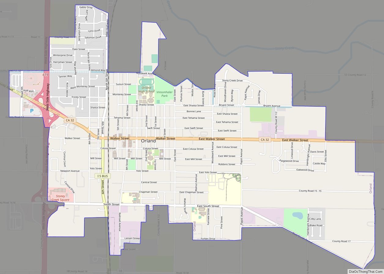
Online Interactive Map
Click on ![]() to view map in "full screen" mode.
to view map in "full screen" mode.
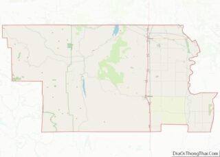
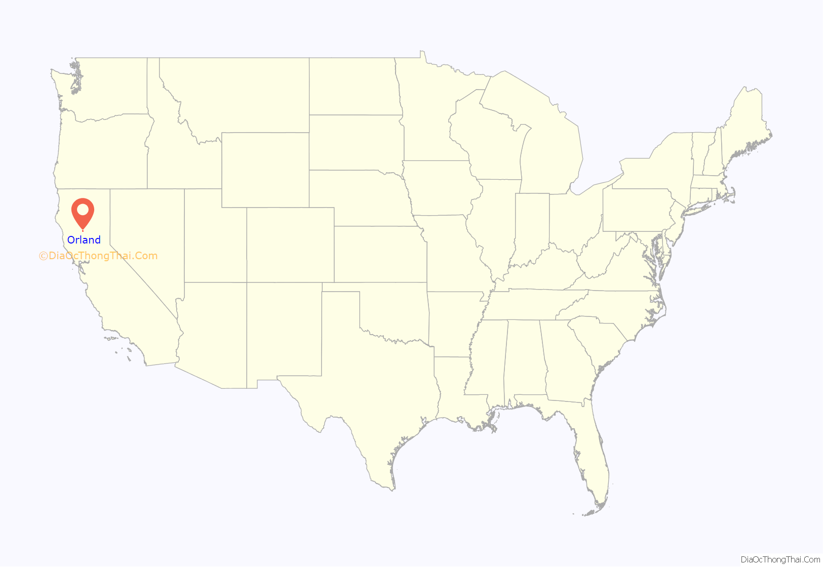
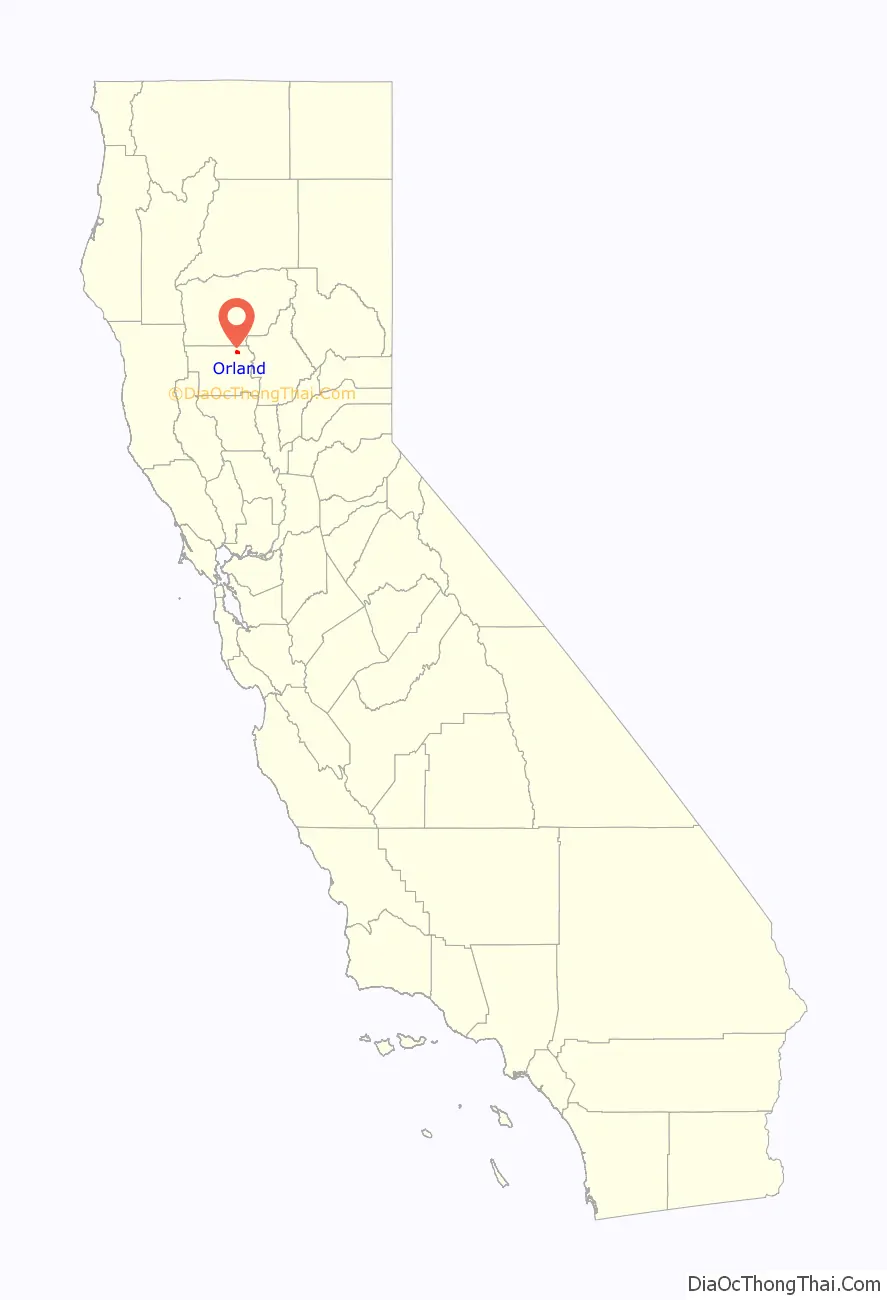
Orland location map. Where is Orland city?
History
Orland incorporated in 1909. The first post office in Orland opened in 1916.
In 1908 Orland was the namesake of one of the first irrigation projects of the newly formed United States Bureau of Reclamation, the Orland Project, authorized by the Newlands Reclamation Act. The 1910 East Park Dam and other area dams still provide agricultural irrigation water.
During World War II, Orland was selected by the United States Army as the location for an airfield that was used for training pilots. Aircraft used at Orland included the Boeing B-17 Flying Fortress. Scenes for several films used for training pilots and aircrew members were produced at Orland. Constructed of a large square of thick, reinforced concrete, most of the airfield is now a civil airport operated by Glenn County.
Orland station was a stop along the Southern Pacific railroad’s West Valley Line, now known as the California Northern Railroad. The Amtrak Coast Starlight route, running daily from Los Angeles to Seattle, served the town from 1974 to 1982.
In 2017 the City Council affiliated the city with Bee City USA and declared itself “Queen Bee Capital of North America” due to the unmatched production of queen bees by locally owned commercial apiaries.
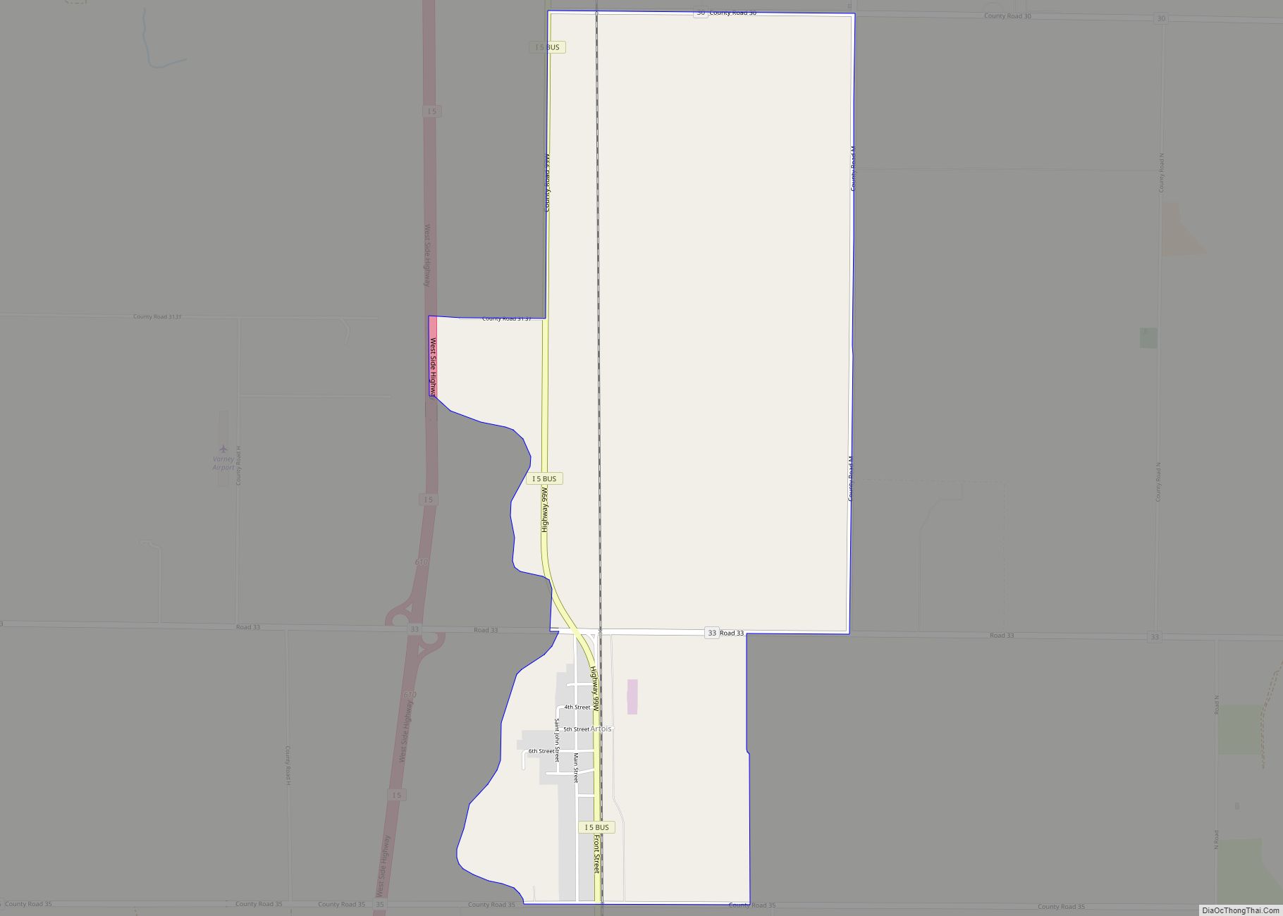
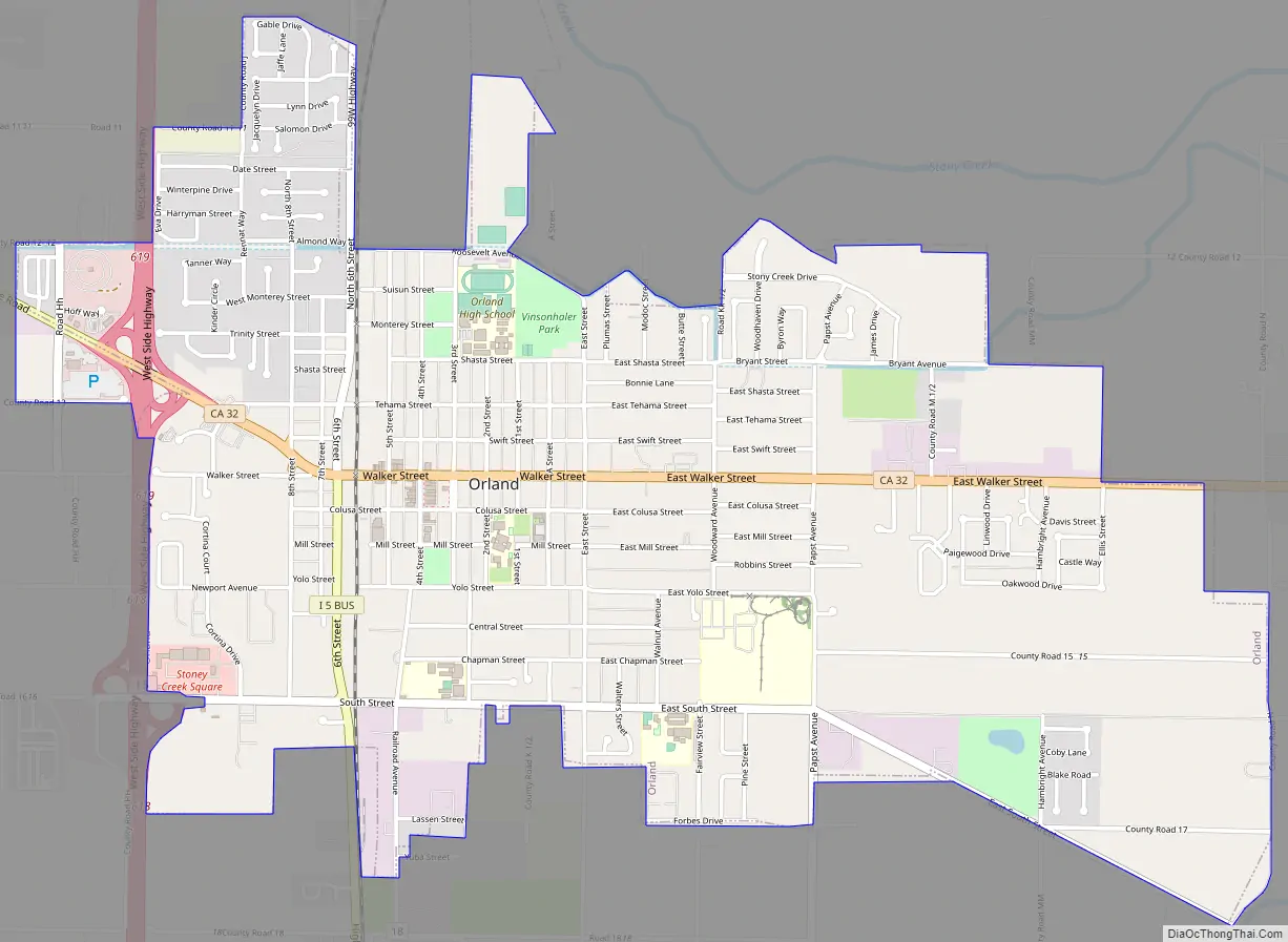
Orland Road Map
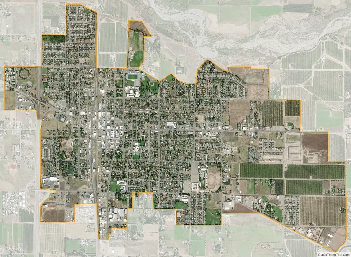
Orland city Satellite Map
Geography
According to the United States Census Bureau, the city has a total area of 3.0 square miles (7.8 km), all of it land.
Orland is a rural agricultural town that sits in the northern Sacramento Valley. Interstate 5 is just west of the town.
The Sacramento River runs 10 miles (16 km) East of Orland and Black Butte Lake sits 8 miles (13 km) West. The Black Butte Lake dam drains into Stony Creek, which flows about a half-mile north of the Orland Arch.
Climate
According to the Köppen Climate Classification system, Orland has a warm-summer Mediterranean climate, abbreviated “Csa” on climate maps.
See also
Map of California State and its subdivision:- Alameda
- Alpine
- Amador
- Butte
- Calaveras
- Colusa
- Contra Costa
- Del Norte
- El Dorado
- Fresno
- Glenn
- Humboldt
- Imperial
- Inyo
- Kern
- Kings
- Lake
- Lassen
- Los Angeles
- Madera
- Marin
- Mariposa
- Mendocino
- Merced
- Modoc
- Mono
- Monterey
- Napa
- Nevada
- Orange
- Placer
- Plumas
- Riverside
- Sacramento
- San Benito
- San Bernardino
- San Diego
- San Francisco
- San Joaquin
- San Luis Obispo
- San Mateo
- Santa Barbara
- Santa Clara
- Santa Cruz
- Shasta
- Sierra
- Siskiyou
- Solano
- Sonoma
- Stanislaus
- Sutter
- Tehama
- Trinity
- Tulare
- Tuolumne
- Ventura
- Yolo
- Yuba
- Alabama
- Alaska
- Arizona
- Arkansas
- California
- Colorado
- Connecticut
- Delaware
- District of Columbia
- Florida
- Georgia
- Hawaii
- Idaho
- Illinois
- Indiana
- Iowa
- Kansas
- Kentucky
- Louisiana
- Maine
- Maryland
- Massachusetts
- Michigan
- Minnesota
- Mississippi
- Missouri
- Montana
- Nebraska
- Nevada
- New Hampshire
- New Jersey
- New Mexico
- New York
- North Carolina
- North Dakota
- Ohio
- Oklahoma
- Oregon
- Pennsylvania
- Rhode Island
- South Carolina
- South Dakota
- Tennessee
- Texas
- Utah
- Vermont
- Virginia
- Washington
- West Virginia
- Wisconsin
- Wyoming