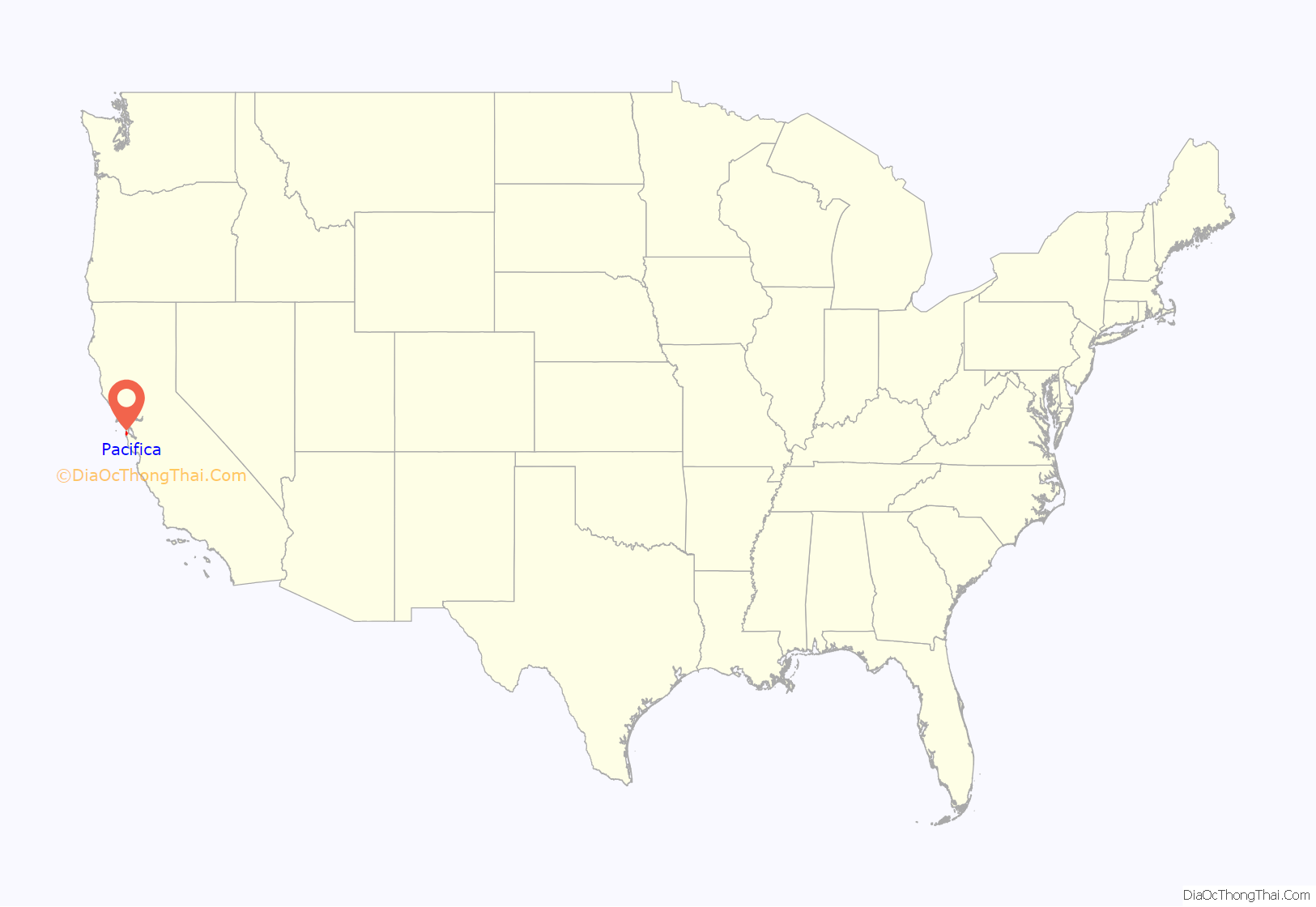
Pacifica (Spanish: Pacífica, meaning “Peaceful”) is a city in San Mateo County, California, on the coast of the Pacific Ocean between San Francisco and Half Moon Bay.
| Name: | Pacifica city |
|---|---|
| LSAD Code: | 25 |
| LSAD Description: | city (suffix) |
| State: | California |
| County: | San Mateo County |
| Incorporated: | November 22, 1957 |
| Elevation: | 82 ft (25 m) |
| Total Area: | 12.59 sq mi (32.61 km²) |
| Land Area: | 12.58 sq mi (32.59 km²) |
| Water Area: | 0.01 sq mi (0.02 km²) 0.01% |
| Total Population: | 38,640 |
| Population Density: | 3,100/sq mi (1,200/km²) |
| ZIP code: | 94044, 94045 |
| Area code: | 650 |
| FIPS code: | 0654806 |
| Website: | www.cityofpacifica.org |
Online Interactive Map
Click on ![]() to view map in "full screen" mode.
to view map in "full screen" mode.
Pacifica location map. Where is Pacifica city?

History
Before European settlers arrived, Pacifica was home to two significant Ohlone Indian villages: Pruristac located at San Pedro Creek near present-day Adobe Drive, and Timigtac on Calera Creek in the Rockaway Beach neighborhood.
Pacifica is the location of the oldest European encounter with the San Francisco Bay. An expedition led by Gaspar de Portolà sighted the bay by climbing the hills of Sweeney Ridge in Pacifica on November 4, 1769. Before then, earlier Spanish maritime explorers of the California coast Juan Cabrillo and Sebastian Vizcaino had missed the San Francisco Bay because heavy fog so frequently shrouded its entrance from the Pacific Ocean (the Golden Gate). Sighting the San Francisco Bay accelerated the Spanish colonization of Alta California because it was the only large, safe, centrally located harbor on the Alta California coast. The Spanish had known about Monterey Bay since the sixteenth century, but, unlike San Francisco Bay, it was too exposed to rough currents and winds to be used as major harbor for their trade between Asia and Mexico. In the Spanish era, Pacifica was the site of the San Pedro Valley Mission Outpost (1786–1793) of Mission Dolores. That was dissolved when a newly independent Mexico secularized the mission system. Pacifica is also the site of the still-extant Mexican-era Sánchez Adobe, built in 1846. The city is located on a part of the Mexican land grant Rancho San Pedro given to Francisco Sanchez in 1839.
During World War II, the area around the present-day Sharp Park recreational area held the Sharp Park Detention Center, an INS processing facility for Japanese Americans, Japanese nationals, and other “foreign enemies” during Japanese internment. The Stanford professor Yamato Ichihashi spent six weeks in Sharp Park. He described the facility, writing, “The ground is limited by tall iron net-fences and small in area; barracks 20′ x 120′ are well-built and painted outside and inside and are regularly arranged; there are 10 of these for inmates, each accommodating about 40, divided into 5 rooms for 8 persons each; if double-decked (beds), 80 can be put in.”
On February 20, 1956, an LGBT-friendly bar, Hazel’s Inn in Sharp Park, was raided by police. Sheriff Earl Whitmore told the San Mateo County Times at the time, “The purpose of the raid was to let it be known that we are not going to tolerate gatherings of homosexuals in this county.” Ninety people were arrested that night, and the majority were San Francisco residents.
Pacifica was incorporated in 1957, relatively recently in the history of San Mateo County. Its first elected mayor was Jean Fassler, one of the first women mayors in California. It was the union of nine previously separate, unincorporated communities–Fairmont, Westview, Pacific Manor (or just Manor), Sharp Park, Fairway Park, Vallemar, Rockaway Beach, Linda Mar and Pedro Point–some of which were stops on the short-lived Ocean Shore Railroad. The name “Pacifica” was chosen from Thomas Barca, by vote; “Coastside” was a close runner-up. In 1960, the city seal was designed by resident Ralph Barkey, who was inspired by Ralph Stackpole’s towering “Pacifica” statue produced for the 1939–1940 Golden Gate International Exposition on Treasure Island in the San Francisco Bay.
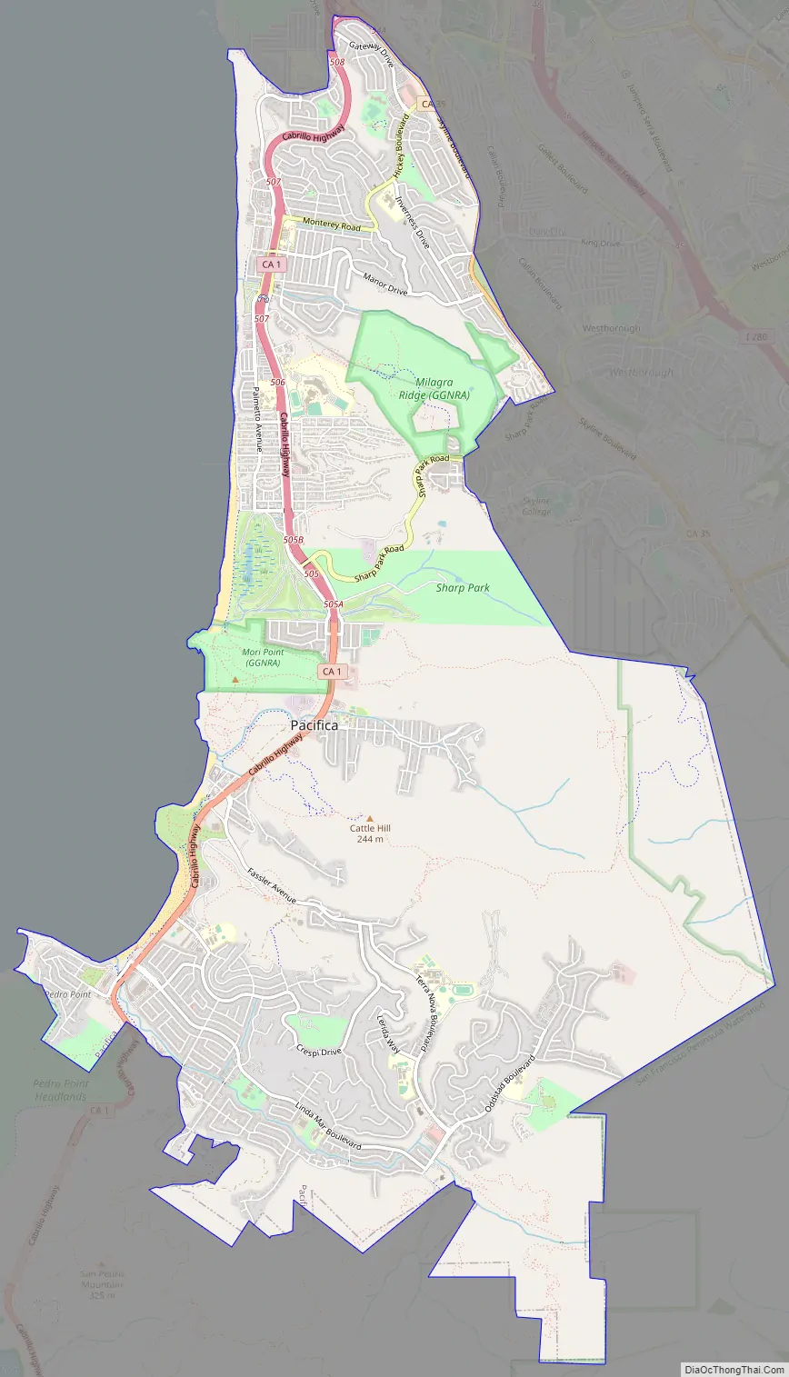
Pacifica Road Map
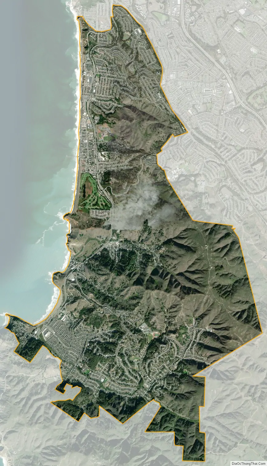
Pacifica city Satellite Map
Geography
Topography
Pacifica straddles San Pedro Creek which flows from the western slope of Sweeney Ridge. The far eastern portion of Pacifica includes San Andreas Creek which flows down the eastern slope of Sweeney Ridge. The Portola expedition followed these two creeks in the discovery of San Francisco Bay. Calera Creek runs through Pacifica Quarry and is protected as ESHA Environmentally Sensitive Habitat.
Climate
Pacifica has a warm summer Mediterranean climate (Köppen climate classification Csb) typical of coastal areas of California. The National Weather Service has maintained a cooperative weather station in Pacifica since November 1, 1983. Based on those records, average January temperatures range from 45.8 °F (7.7 °C) to 56.7 °F (13.7 °C) and average September temperatures range from 53.9 °F (12.2 °C) to 71.8 °F (22.1 °C). There are an average of 3.0 days with highs of 90 °F (32 °C) or higher and an average of 0.2 day with lows of 32 °F (0 °C) or lower. The highest temperature on record was 102 °F (39 °C) on October 5, 1987, and the lowest temperature was 23 °F (−5 °C) on December 22, 1990. Annual precipitation averages 30.29 inches (769 mm) and has ranged from 15.88 inches (403 mm) in 1990 to 43.17 inches (1,097 mm) in 1996. The most rainfall in one month was 18.05 inches (458 mm) in February 1998 and the most rainfall in 24 hours was 5.00 inches (127 mm) on December 27, 2004. There are an average of 66 days annually with measurable precipitation, most of which falls from October through May. Summer fogs often produce light drizzle in the night and morning hours. Condensation from the fogs also produces fog drip from trees overnight. No measurable snowfall has been recorded since records began. The southeastern portions of the municipality, such as Park Pacifica, are known to be much sunnier than the rest of the city.
See also
Map of California State and its subdivision:- Alameda
- Alpine
- Amador
- Butte
- Calaveras
- Colusa
- Contra Costa
- Del Norte
- El Dorado
- Fresno
- Glenn
- Humboldt
- Imperial
- Inyo
- Kern
- Kings
- Lake
- Lassen
- Los Angeles
- Madera
- Marin
- Mariposa
- Mendocino
- Merced
- Modoc
- Mono
- Monterey
- Napa
- Nevada
- Orange
- Placer
- Plumas
- Riverside
- Sacramento
- San Benito
- San Bernardino
- San Diego
- San Francisco
- San Joaquin
- San Luis Obispo
- San Mateo
- Santa Barbara
- Santa Clara
- Santa Cruz
- Shasta
- Sierra
- Siskiyou
- Solano
- Sonoma
- Stanislaus
- Sutter
- Tehama
- Trinity
- Tulare
- Tuolumne
- Ventura
- Yolo
- Yuba
- Alabama
- Alaska
- Arizona
- Arkansas
- California
- Colorado
- Connecticut
- Delaware
- District of Columbia
- Florida
- Georgia
- Hawaii
- Idaho
- Illinois
- Indiana
- Iowa
- Kansas
- Kentucky
- Louisiana
- Maine
- Maryland
- Massachusetts
- Michigan
- Minnesota
- Mississippi
- Missouri
- Montana
- Nebraska
- Nevada
- New Hampshire
- New Jersey
- New Mexico
- New York
- North Carolina
- North Dakota
- Ohio
- Oklahoma
- Oregon
- Pennsylvania
- Rhode Island
- South Carolina
- South Dakota
- Tennessee
- Texas
- Utah
- Vermont
- Virginia
- Washington
- West Virginia
- Wisconsin
- Wyoming


