Oroville (Oro, Spanish for “Gold” and Ville, French for “town”) is the county seat of Butte County, California, United States. The population of the city was 15,506 at the 2010 census, up from 13,004 in the 2000 census. Following the 2018 Camp Fire that destroyed much of the town of Paradise, the population of Oroville increased as many people who lost their homes relocated to nearby Oroville. In 2020, the 2020 census recorded the population of Oroville at 20,042.
Oroville is considered the gateway to Lake Oroville and Feather River recreational areas. The Berry Creek Rancheria of Maidu Indians of California is headquartered in Oroville.
Oroville is located adjacent to State Route 70, and is in close proximity to State Route 99, which connects Butte County with Interstate 5. The city of Chico is located about 23 miles (38 kilometers) northwest of the city, and the state capital of Sacramento lies around 70 miles (112 kilometers) to the south.
Oroville’s nickname is the “City of Gold”, basically just the Spanish name of the city in English. Oroville has also been declared a Tree City USA for 41 years by the National Arbor Day Foundation.
| Name: | Oroville city |
|---|---|
| LSAD Code: | 25 |
| LSAD Description: | city (suffix) |
| State: | California |
| County: | Butte County |
| Incorporated: | January 3, 1906 |
| Elevation: | 167 ft (51 m) |
| Land Area: | 13.83 sq mi (35.83 km²) |
| Water Area: | 0.02 sq mi (0.05 km²) 0.14% |
| Population Density: | 1,449.17/sq mi (559.36/km²) |
| ZIP code: | 95940, 95965, 95966 |
| Area code: | 530 |
| FIPS code: | 0654386 |
| Website: | cityoforoville.org |
Online Interactive Map
Click on ![]() to view map in "full screen" mode.
to view map in "full screen" mode.
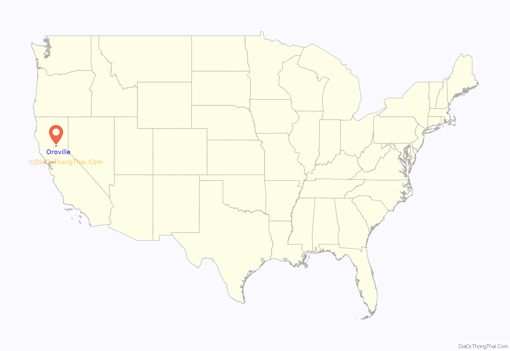
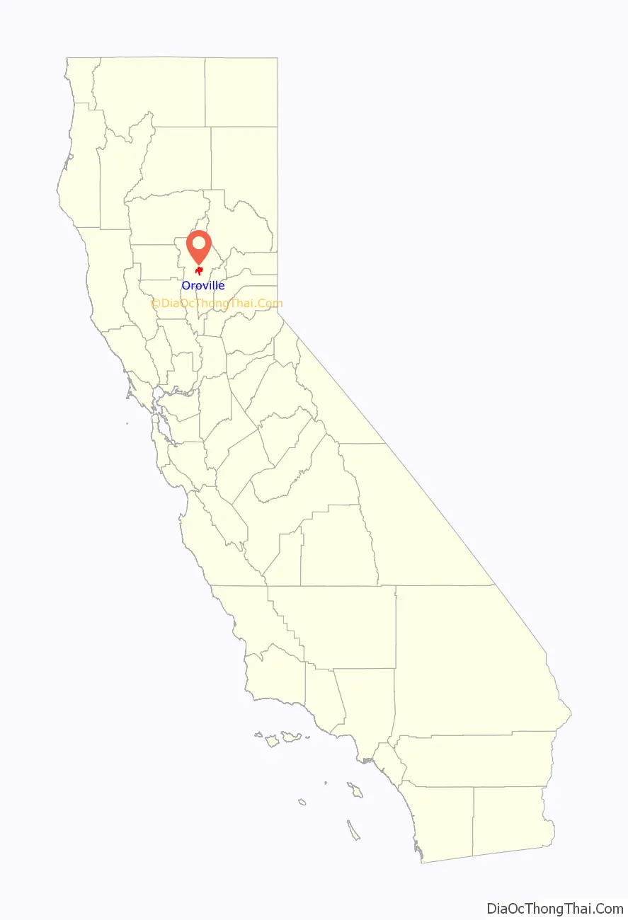
Oroville location map. Where is Oroville city?
History
Oroville is situated at the base of the foothills on the banks of the Feather River where it flows out of the Sierra Nevada onto the flat floor of the Sacramento Valley. It was established as the home base of navigation on the Feather River to supply gold miners during the California Gold Rush.
The town was originally named “Ophir City”, but was later changed to Oroville when the first post office opened in 1854 (oro is the Spanish word for ‘gold’). The City of Oroville was incorporated on January 3, 1906.
Gold was found at Bidwell Bar, one of the first gold mining sites in California, bringing thousands of prospectors to the Oroville area seeking riches. Now inundated by the waters of enormous Lake Oroville, which was filled in 1968, Bidwell Bar is memorialized by the Bidwell Bar Bridge, an original remnant from the area and the first suspension bridge in California (California Historical Landmark #314). In the early 20th century, the Western Pacific Railroad completed construction of the all-weather Feather River Canyon route through the Sierra Nevada giving it the nickname of “The Feather River Route”. Oroville station would serve as an important stop for the California Zephyr during its 20-year run. In 1983, this became a part of the Union Pacific Railroad as their Feather River Canyon Subdivision. A major highway, State Route 70, roughly parallels the railroad line winding through the canyon.
The Chinese Temple (CHL No. 770 and listed on the National Register of Historic Places) is another monument to Oroville’s storied past. Chinese laborers from the pioneer era established the Temple as a place of worship for followers of Chinese Popular Religion and the three major Chinese religions: Taoism, Buddhism, and Confucianism. The Chinese Temple and Garden, as it is now called, has an extensive collection of artifacts and a serene garden to enjoy.
The olive-canning industry was founded in Oroville by Freda Ehmann, the “mother of ripe olives”. She built a large cannery in Oroville, and by 1900 was the president of the world’s largest canned olive factory. Ehmann was a believer in women’s suffrage and a friend of Susan B. Anthony
Ishi, Oroville’s most famous resident, was the last of the Yahi people and is considered the last “Stone Age” Indian to come out of the wilderness and into Western civilization. When he appeared out of the hills in East Oroville in 1911, he was immediately thrust into the national spotlight. The Visitor’s Center at Lake Oroville has a thorough exhibit and documentary film on Ishi and his life in society.
Archaeological finds place the northwestern border for the prehistoric Martis people in the Oroville area.
1881 lynching
On August 7, 1881, pioneer Jack Crum was allegedly stomped to death by local bully Tom Noacks in Chico, California. The young Noacks was feared by the locals of Butte County, not only because of his size and strength, but allegedly because he was mentally unbalanced and enjoyed punching oxen in the head.
Noacks was arrested and jailed in the Chico jail. Once word got out that the old pioneer had been murdered, the authorities moved Noacks to the Butte County county jail in Oroville for his safety. Crum’s friends, knowing that Noacks was in the county jail, made their way to Oroville with rope in hand. Knocking on the jail door, the men told the jailer that they had a prisoner from the town of Biggs, California. Once inside the jail, they overpowered the jailer and dragged Noacks from his cell. They took Noacks to Crum’s former farm and hanged him from an old cottonwood tree. Nobody was ever prosecuted for the lynching.
Hate groups
Hate groups began appearing in Oroville media stories beginning in 1976 with a neo-Nazi husband and wife couple killed in a shootout. In 1980, members of the American Nazi Party moved to Oroville from Tracy, California, to re-organize as Chico Area National Socialists. In September 1982, 17-year-old Joseph Hoover was murdered by his Nazi colleagues after he told police he helped spread anti-Black hate literature at Oroville High School. One thousand people marched in Oroville in protest of Nazi and Ku Klux Klan activity on December 11, 1982. Local Nazi leader Perry “Red” Wartham was convicted of Hoover’s murder and sentenced to 27 years, and two more male high school–age Nazi recruits were convicted as accessories to murder. In 2016, an Oroville man was found spreading Nazi hate messages in Sacramento. In January 2004, a white power publication was distributed in the Kelly Ridge area south of Oroville.
Oroville Dam crisis
On February 7, 2017, after heavy rains, a defect formed in a spillway of Oroville Dam. For the first time since its construction, the secondary spillway was overtopped on February 11. Shortly after being put into service, this structure began to show signs of being undermined, raising fears of catastrophic failure. Owing to their inability to predict the continued safety of this spillway, the Butte County Sheriff ordered evacuations of downstream residents from Butte, Sutter, and Yuba counties.
Camp Fire
In November 2018, Oroville was threatened by the Camp Fire.
COVID-19
In November 2021, citing alleged federal and state overreach during the COVID-19 pandemic, the Oroville city council passed a resolution declaring the city as its own “Constitutional Republic” and refused to enforce federal orders that it said violated its citizens’ rights.
The resolution to declare the town a constitutional republic was an attempt to limit state and federal restrictions related to the COVID-19 pandemic in California. One rural law expert stated that the designation was unclear and would not operate to shield the city from following state and federal laws.
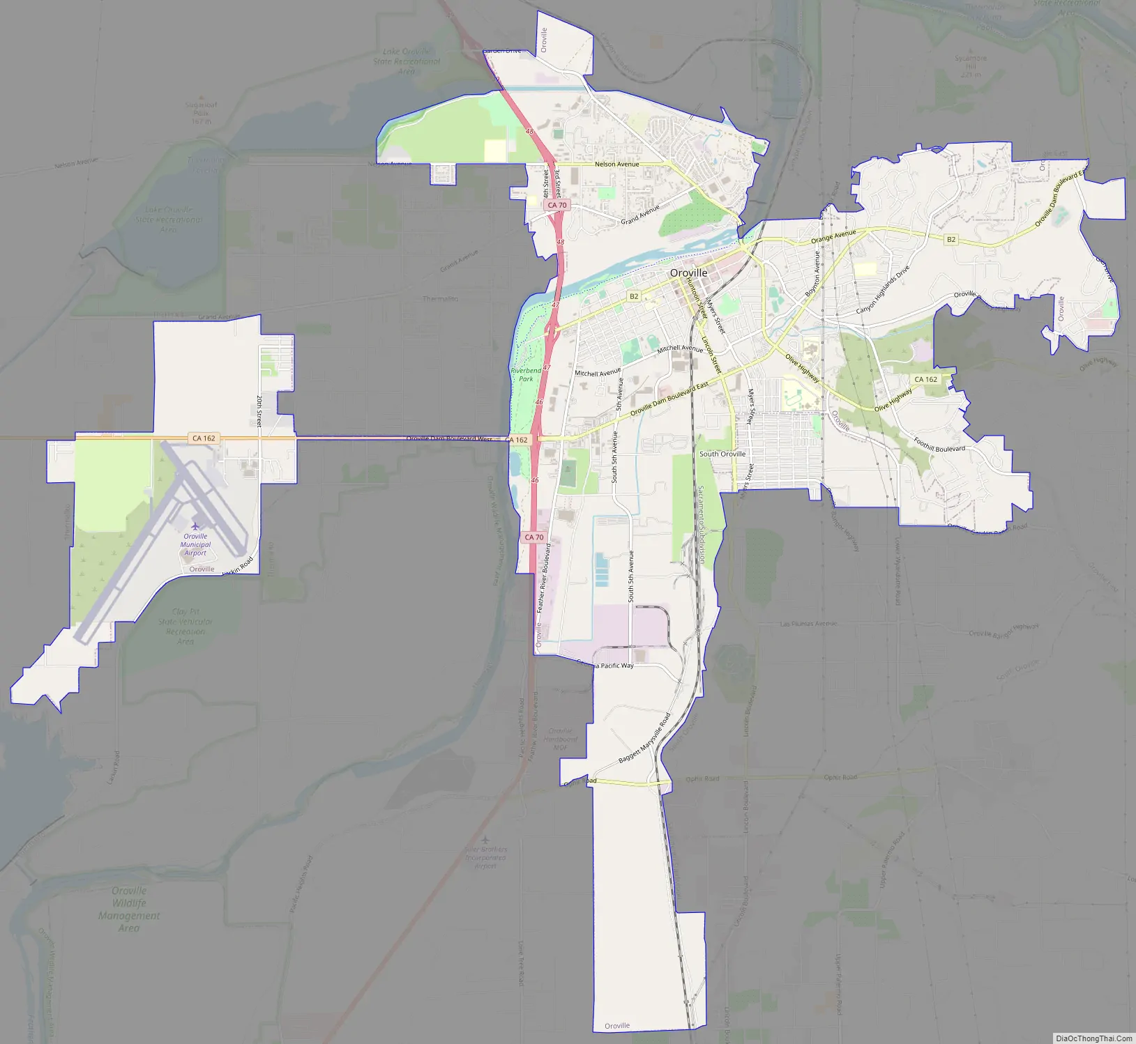
Oroville Road Map
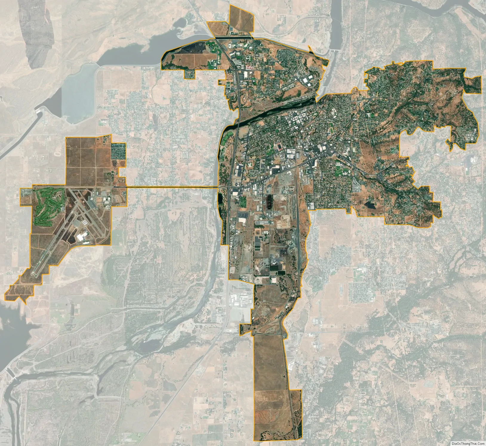
Oroville city Satellite Map
Geography
According to the United States Census Bureau, the city has a total area of 12.3 square miles (31.9 km), of which 12.2 square miles (31.6 km) of it is land and 0.04 square miles (0.1 km) of it (0.16%) is water.
Oroville is situated at the head of navigation on the Feather River. The Yuba River flows into the Feather River near Marysville, California and these flow together to the Sacramento River. Geologically, Oroville is situated at the meeting place of three provinces: the Central Valley alluvial plain to the west, the crystalline Sierra Nevada to the SE and the volcanic Cascade Mountains to the north. It has a Mediterranean climate.
Oroville sits on the eastern rim of the Great Valley, defined today by the floodplains of the Sacramento River and its tributaries. Around Oroville these sediments are dominated by thick fans of Feather River sediments, but just east of this there is a thin, N–S band of late Cretaceous sediments. These sit on top of the Sierran basement, which beneath eastern Oroville comprise greenschist-facies metavolcanic rocks of Jurassic age, giving way to granites of the Sierra batholith to the east. These are manifestations of a vigorous island arc sequence, built out over an east-dipping subduction zone of mid-to-late Mesozoic age. The gold veins lace this ancient arc, remobilized by Mesozoic shearing and intrusions of igneous rock. The crystalline foothills are locally overlain by a Cenozoic sequence of Eocene clean beach sands overlain by Neogene volcanics, including the Diamond Head-like profile of “Table Mountain”.
Climate
According to the Köppen Climate Classification system, Oroville has a warm-summer Mediterranean climate, abbreviated “Csa” on climate maps.
According to US climate data, on the average Oroville receives 30.7 inches (780 mm) of precipitation per year, which is about 20% less than the national average, but somewhat higher than the average California rainfall total.
See also
Map of California State and its subdivision:- Alameda
- Alpine
- Amador
- Butte
- Calaveras
- Colusa
- Contra Costa
- Del Norte
- El Dorado
- Fresno
- Glenn
- Humboldt
- Imperial
- Inyo
- Kern
- Kings
- Lake
- Lassen
- Los Angeles
- Madera
- Marin
- Mariposa
- Mendocino
- Merced
- Modoc
- Mono
- Monterey
- Napa
- Nevada
- Orange
- Placer
- Plumas
- Riverside
- Sacramento
- San Benito
- San Bernardino
- San Diego
- San Francisco
- San Joaquin
- San Luis Obispo
- San Mateo
- Santa Barbara
- Santa Clara
- Santa Cruz
- Shasta
- Sierra
- Siskiyou
- Solano
- Sonoma
- Stanislaus
- Sutter
- Tehama
- Trinity
- Tulare
- Tuolumne
- Ventura
- Yolo
- Yuba
- Alabama
- Alaska
- Arizona
- Arkansas
- California
- Colorado
- Connecticut
- Delaware
- District of Columbia
- Florida
- Georgia
- Hawaii
- Idaho
- Illinois
- Indiana
- Iowa
- Kansas
- Kentucky
- Louisiana
- Maine
- Maryland
- Massachusetts
- Michigan
- Minnesota
- Mississippi
- Missouri
- Montana
- Nebraska
- Nevada
- New Hampshire
- New Jersey
- New Mexico
- New York
- North Carolina
- North Dakota
- Ohio
- Oklahoma
- Oregon
- Pennsylvania
- Rhode Island
- South Carolina
- South Dakota
- Tennessee
- Texas
- Utah
- Vermont
- Virginia
- Washington
- West Virginia
- Wisconsin
- Wyoming


