Map of Buena Vista town, Colorado

Map of Buena Vista town, Colorado

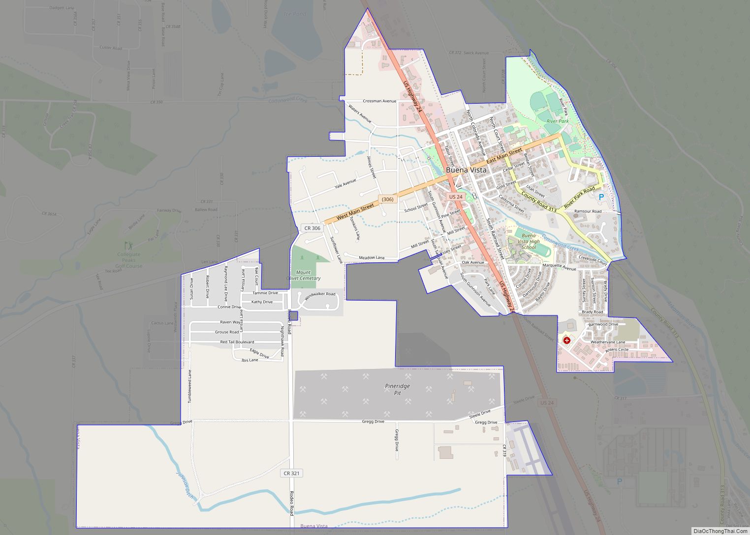
The Town of Buena Vista (BEW-na Vista) is a Statutory Town located in Chaffee County, Colorado, United States. The town population was 2,855 at the 2020 United States Census. Buena Vista town overview: Name: Buena Vista town LSAD Code: 43 LSAD Description: town (suffix) State: Colorado County: Chaffee County Incorporated: November 8, 1879 Elevation: 7,965 ft … Read more

Map of Brush city

Map of Brush city

Brush is a Statutory City located in Morgan County, Colorado, United States. The city population was 5,339 at the 2020 United States Census. Brush is a part of the Fort Morgan, CO Micropolitan Statistical Area. Brush city overview: Name: Brush city LSAD Code: 25 LSAD Description: city (suffix) State: Colorado County: Morgan County Incorporated: November … Read more

Map of Campo town, Colorado

Map of Campo town, Colorado

The Town of Campo is a Statutory Town located in Baca County, Colorado, United States. The town population was 103 at the 2020 United States Census. The town is situated on the High Plains, straddling U.S. Route 287/385. Campo town overview: Name: Campo town LSAD Code: 43 LSAD Description: town (suffix) State: Colorado County: Baca … Read more

Map of Calhan town

Map of Calhan town

The Town of Calhan is a Statutory Town located in El Paso County, Colorado, United States. The town population was 762 at the 2020 United States Census. Calhan is a part of the Colorado Springs, CO Metropolitan Statistical Area and the Front Range Urban Corridor. The town straddles U.S. Highway 24. With Calhan sitting at … Read more

Map of Byers CDP

Map of Byers CDP, Colorado

Byers is an unincorporated town, a post office, and a census-designated place (CDP) located in and governed by Arapahoe County, Colorado, United States. The CDP is a part of the Denver–Aurora–Lakewood, CO Metropolitan Statistical Area. The Byers post office has the ZIP Code 80103. At the United States Census 2020, the population of the Byers … Read more

Map of Carbonate town

Map of Carbonate town

The Town of Carbonate is a ghost town located in Garfield County, Colorado, United States. In 2014, property owners voted to reactivate the town government despite having no year-round residents since 1890. Carbonate town overview: Name: Carbonate town LSAD Code: 43 LSAD Description: town (suffix) State: Colorado County: Garfield County Founded: 1879 Incorporated: April 13, … Read more

Map of Capulin CDP

Map of Capulin CDP, Colorado

Capulin is an unincorporated town, a post office, and a census-designated place (CDP) located in and governed by Conejos County, Colorado, United States. The Capulin post office has the ZIP Code 81124. At the United States Census 2020, the population of the Capulin CDP was 134. Capulin CDP overview: Name: Capulin CDP LSAD Code: 57 … Read more

Map of Carbondale town

Map of Carbondale town, Colorado

The Town of Carbondale is a home rule municipality located in Garfield County, Colorado, United States. The town population was 6,434 at the 2020 United States Census. Carbondale is a part of the Glenwood Springs, CO Micropolitan Statistical Area. The town is located in the Roaring Fork Valley, downstream from Aspen and upstream from the … Read more

Map of Castle Pines city

Map of Castle Pines city

The City of Castle Pines is a home rule municipality located in Douglas County, Colorado, United States. The city population was 11,036 at the 2020 United States Census. Castle Pines is a part of the Denver–Aurora–Lakewood, CO Metropolitan Statistical Area and the Front Range Urban Corridor. The city is located north of the Town of … Read more

Map of Castle Pines Village CDP

Map of Castle Pines Village CDP

Castle Pines Village, also known as The Village at Castle Pines or The Village, is an unincorporated community and a census-designated place (CDP) located in and governed by Douglas County, Colorado, United States. The CDP is a part of the Denver–Aurora–Lakewood, CO Metropolitan Statistical Area. The population of the Castle Pines Village CDP was 4,327 … Read more

Map of Cascade-Chipita Park CDP

Map of Cascade-Chipita Park CDP

Cascade-Chipita Park is a census-designated place (CDP) comprising the unincorporated communities of Cascade and Chipita Park located in and governed by El Paso County, Colorado, United States. The CDP is a part of the Colorado Springs, CO Metropolitan Statistical Area. The population of the Cascade-Chipita Park CDP was 1,628 at the United States Census 2020. … Read more

Map of Catherine CDP, Colorado

Map of Catherine CDP, Colorado

Catherine is a census-designated place (CDP) in and governed by Garfield County, Colorado, United States. The CDP is a part of the Glenwood Springs, CO Micropolitan Statistical Area. The population of the Catherine CDP was 235 at the United States Census 2020. The Glenwood Springs post office (Zip Code 81602) serves the area. Catherine CDP … Read more