Map of Blanchard CDP, Idaho

Map of Blanchard CDP, Idaho

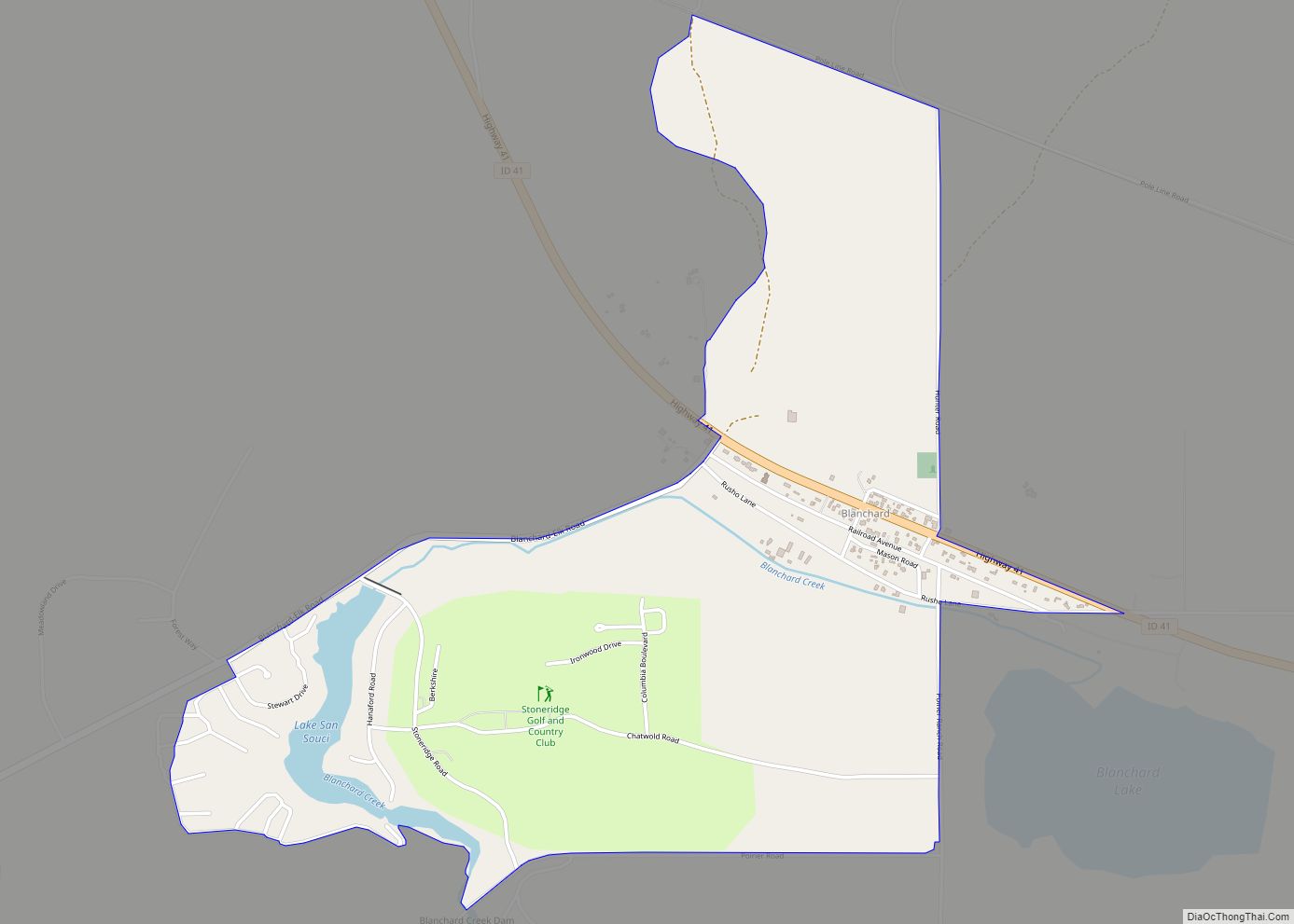
Blanchard is an unincorporated census-designated place in Bonner County, Idaho, United States. Blanchard is located on Idaho State Highway 41 6.5 miles (10.5 km) northwest of Spirit Lake. Blanchard has a post office with ZIP code 83804. As of the 2010 census, its population was 261. Blanchard CDP overview: Name: Blanchard CDP LSAD Code: 57 LSAD … Read more

Map of Buhl city

Map of Buhl city, Idaho

Buhl is a city located on the old Oregon Trail in the western half of Twin Falls County, Idaho. The population was 4,122 at the time of the 2010 census, up from 3,985 in 2000. It is part of the Twin Falls, Idaho metropolitan area. U.S. Route 30 passes through Buhl, along the scenic Thousand … Read more

Map of Bovill city

Map of Bovill city

Bovill is a city in Latah County, Idaho, United States. The population was 260 at the 2010 census, down from 305 in 2000. Bovill city overview: Name: Bovill city LSAD Code: 25 LSAD Description: city (suffix) State: Idaho County: Latah County Elevation: 2,874 ft (876 m) Total Area: 0.16 sq mi (0.41 km²) Land Area: 0.16 sq mi (0.41 km²) Water Area: 0.00 sq mi … Read more

Map of Bonners Ferry city

Map of Bonners Ferry city

Bonners Ferry (Kutenai language: ʔaq̓anqmi) is the largest city and the county seat of Boundary County, Idaho, United States. The population was 2,543 at the 2010 census. Bonners Ferry city overview: Name: Bonners Ferry city LSAD Code: 25 LSAD Description: city (suffix) State: Idaho County: Boundary County Elevation: 1,896 ft (578 m) Total Area: 2.51 sq mi (6.50 km²) Land … Read more

Map of Cambridge city, Idaho

Map of Cambridge city, Idaho

Cambridge is a city in Washington County, Idaho, United States. The population was 328 at the 2010 census, down from 360 in 2000. It is the second largest city in the county, behind the significantly larger Weiser, the county seat. Cambridge city overview: Name: Cambridge city LSAD Code: 25 LSAD Description: city (suffix) State: Idaho … Read more

Map of Butte City city

Map of Butte City

Butte City is a city in Butte County, Idaho, United States. The population was 74 at the 2010 census. Butte City overview: Name: Butte City LSAD Code: 25 LSAD Description: city (suffix) State: Idaho County: Butte County Elevation: 5,322 ft (1,622 m) Total Area: 0.17 sq mi (0.44 km²) Land Area: 0.17 sq mi (0.44 km²) Water Area: 0.00 sq mi (0.00 km²) Total Population: 74 … Read more

Map of Burley city

Map of Burley city, Idaho

Burley (/ˈbʊrliː/) is a city in Cassia and Minidoka counties in southern Idaho, United States. The population was 11,704 at the 2020 census, up from 10,345 in 2010. The city is the county seat of Cassia County. Burley is the principal city of the Burley, Idaho, Micropolitan Statistical Area, which comprises Cassia and Minidoka counties. … Read more

Map of Castleford city

Map of Castleford city

Castleford is a city in Twin Falls County, Idaho, United States. The population was 226 at the 2010 census. It is part of the Twin Falls, Idaho Micropolitan Statistical Area. Castleford city overview: Name: Castleford city LSAD Code: 25 LSAD Description: city (suffix) State: Idaho County: Twin Falls County Elevation: 3,872 ft (1,180 m) Total Area: 0.10 sq mi … Read more

Map of Cascade city, Idaho

Map of Cascade city, Idaho

Cascade is a rural city in and the county seat of Valley County, Idaho, United States. The population was 939 at the 2010 census, down from 997 in 2000. Cascade city overview: Name: Cascade city LSAD Code: 25 LSAD Description: city (suffix) State: Idaho County: Valley County Elevation: 4,760 ft (1,450 m) Total Area: 4.71 sq mi (12.19 km²) Land … Read more

Map of Carey city

Map of Carey city, Idaho

Carey is a city in Blaine County, Idaho, United States. The population was 604 at the 2010 census. Carey is primarily an agricultural city and is the location of the Blaine County Fairgrounds. Nearby recreational destinations include the Craters of the Moon National Monument, Carey Lake, Silver Creek and the Little Wood River. Further west … Read more

Map of Clark Fork city

Map of Clark Fork city

Clark Fork is a small town in Bonner County, Idaho. The population was 536 at the time of the 2010 census. Clark Fork city overview: Name: Clark Fork city LSAD Code: 25 LSAD Description: city (suffix) State: Idaho County: Bonner County Elevation: 2,090 ft (640 m) Total Area: 0.98 sq mi (2.55 km²) Land Area: 0.98 sq mi (2.55 km²) Water Area: 0.00 sq mi … Read more

Map of Chubbuck city

Map of Chubbuck city

Chubbuck is a city in Bannock County, Idaho. It is part of the Pocatello Metropolitan Statistical Area. The population was 13,922 at the 2010 census. Chubbuck is located immediately north of Pocatello, Idaho, and has opposed several consolidation proposals since the 1960s. Chubbuck city overview: Name: Chubbuck city LSAD Code: 25 LSAD Description: city (suffix) … Read more