Map of Pleasanton city, Kansas

Map of Pleasanton city, Kansas

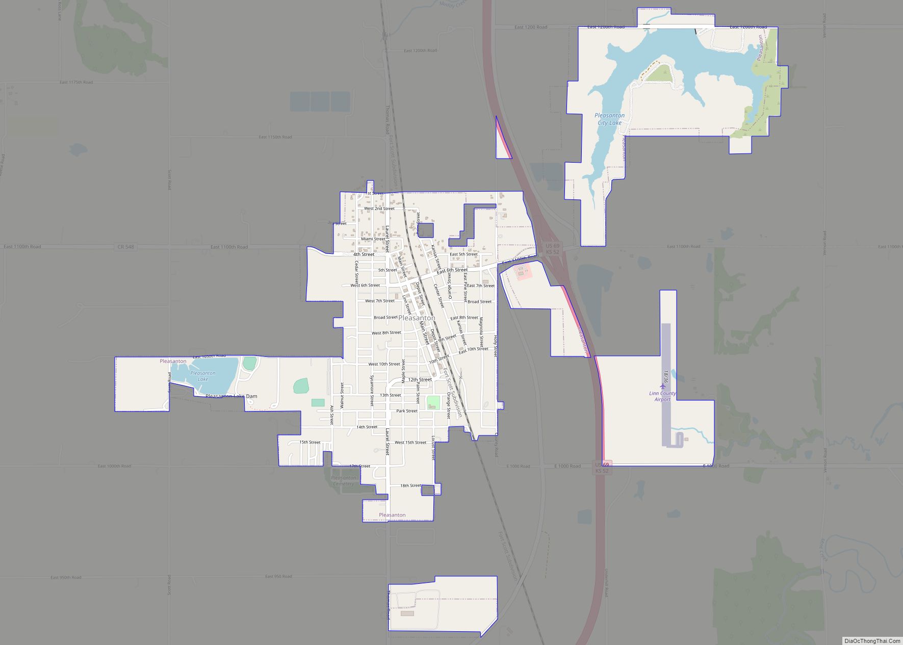
Pleasanton is a city in Linn County, Kansas, United States. As of the 2020 census, the population of the city was 1,208. Pleasanton city overview: Name: Pleasanton city LSAD Code: 25 LSAD Description: city (suffix) State: Kansas County: Linn County Founded: 1869 Incorporated: 1878 Elevation: 856 ft (261 m) Total Area: 2.34 sq mi (6.05 km²) Land Area: 2.08 sq mi (5.39 km²) … Read more

Map of Powhattan city

Map of Powhattan city

Powhattan is a city in Brown County, Kansas, United States. As of the 2020 census, the population of the city was 69. Powhattan city overview: Name: Powhattan city LSAD Code: 25 LSAD Description: city (suffix) State: Kansas County: Brown County Founded: 1877 Incorporated: 1887 Elevation: 1,204 ft (367 m) Total Area: 0.14 sq mi (0.35 km²) Land Area: 0.14 sq mi (0.35 km²) … Read more

Map of Potwin city

Map of Potwin city

Potwin is a city in Butler County, Kansas, United States. It is named after the town site land owner Charles Potwin. As of the 2020 census, the population of the city was 421. Potwin city overview: Name: Potwin city LSAD Code: 25 LSAD Description: city (suffix) State: Kansas County: Butler County Founded: 1880s Incorporated: 1885 … Read more

Map of Portis city

Map of Portis city

Portis is a city in Osborne County, Kansas, United States. As of the 2020 census, the population of the city was 86. Portis city overview: Name: Portis city LSAD Code: 25 LSAD Description: city (suffix) State: Kansas County: Osborne County Founded: 1870s Incorporated: 1904 Elevation: 1,542 ft (470 m) Total Area: 0.26 sq mi (0.68 km²) Land Area: 0.26 sq mi (0.68 km²) … Read more

Map of Pratt city

Map of Pratt city, Kansas

Pratt is a city in and the county seat of Pratt County, Kansas, United States. As of the 2020 census, the population of the city was 6,603. It is home to Pratt Community College. Pratt city overview: Name: Pratt city LSAD Code: 25 LSAD Description: city (suffix) State: Kansas County: Pratt County Founded: 1884 Incorporated: … Read more

Map of Prairie Village city

Map of Prairie Village city

Prairie Village is a city in Johnson County, Kansas, United States, and located within the Kansas City Metropolitan Area. As of the 2020 census, the population of the city was 22,957. Prairie Village city overview: Name: Prairie Village city LSAD Code: 25 LSAD Description: city (suffix) State: Kansas County: Johnson County Incorporated: 1951 Elevation: 991 ft … Read more

Map of Prairie View city

Map of Prairie View city, Kansas

Prairie View is a city in Phillips County, Kansas, United States. As of the 2020 census, the population of the city was 106. Prairie View city overview: Name: Prairie View city LSAD Code: 25 LSAD Description: city (suffix) State: Kansas County: Phillips County Founded: 1870s Incorporated: 1905 Elevation: 2,192 ft (668 m) Total Area: 0.15 sq mi (0.38 km²) Land … Read more

Map of Pretty Prairie city

Map of Pretty Prairie city

Pretty Prairie is a city in Reno County, Kansas, United States. As of the 2020 census, the population of the city was 660. Pretty Prairie city overview: Name: Pretty Prairie city LSAD Code: 25 LSAD Description: city (suffix) State: Kansas County: Reno County Founded: 1870s Incorporated: 1906 Elevation: 1,578 ft (481 m) Total Area: 0.58 sq mi (1.49 km²) Land … Read more

Map of Preston city, Kansas

Map of Preston city, Kansas

Preston is a city in Pratt County, Kansas, United States. As of the 2020 census, the population of the city was 115. Preston city overview: Name: Preston city LSAD Code: 25 LSAD Description: city (suffix) State: Kansas County: Pratt County Founded: 1887 Incorporated: 1909 Elevation: 1,834 ft (559 m) Total Area: 0.43 sq mi (1.13 km²) Land Area: 0.43 sq mi (1.13 km²) … Read more

Map of Prescott city, Kansas

Map of Prescott city, Kansas

Prescott is a city in Linn County, Kansas, United States. As of the 2020 census, the population of the city was 207. Prescott city overview: Name: Prescott city LSAD Code: 25 LSAD Description: city (suffix) State: Kansas County: Linn County Incorporated: 1870 Elevation: 883 ft (269 m) Total Area: 0.30 sq mi (0.79 km²) Land Area: 0.28 sq mi (0.74 km²) Water Area: … Read more

Map of Quenemo city

Map of Quenemo city

Quenemo city overview: Name: Quenemo city LSAD Code: 25 LSAD Description: city (suffix) State: Kansas County: Osage County FIPS code: 2058100 Online Interactive Map Quenemo online map. Source: Basemap layers from Google Map, Open Street Map (OSM), Arcgisonline, Wmflabs. Boundary Data from Database of Global Administrative Areas. Quenemo location map. Where is Quenemo city? Quenemo … Read more

Map of Protection city

Map of Protection city

Protection is a city in Comanche County, Kansas, United States. As of the 2020 census, the population of the city was 498. Protection city overview: Name: Protection city LSAD Code: 25 LSAD Description: city (suffix) State: Kansas County: Comanche County Founded: 1884 Incorporated: 1908 Elevation: 1,850 ft (560 m) Total Area: 0.93 sq mi (2.40 km²) Land Area: 0.93 sq mi (2.40 km²) … Read more