Map of Jeff CDP

Map of Jeff CDP

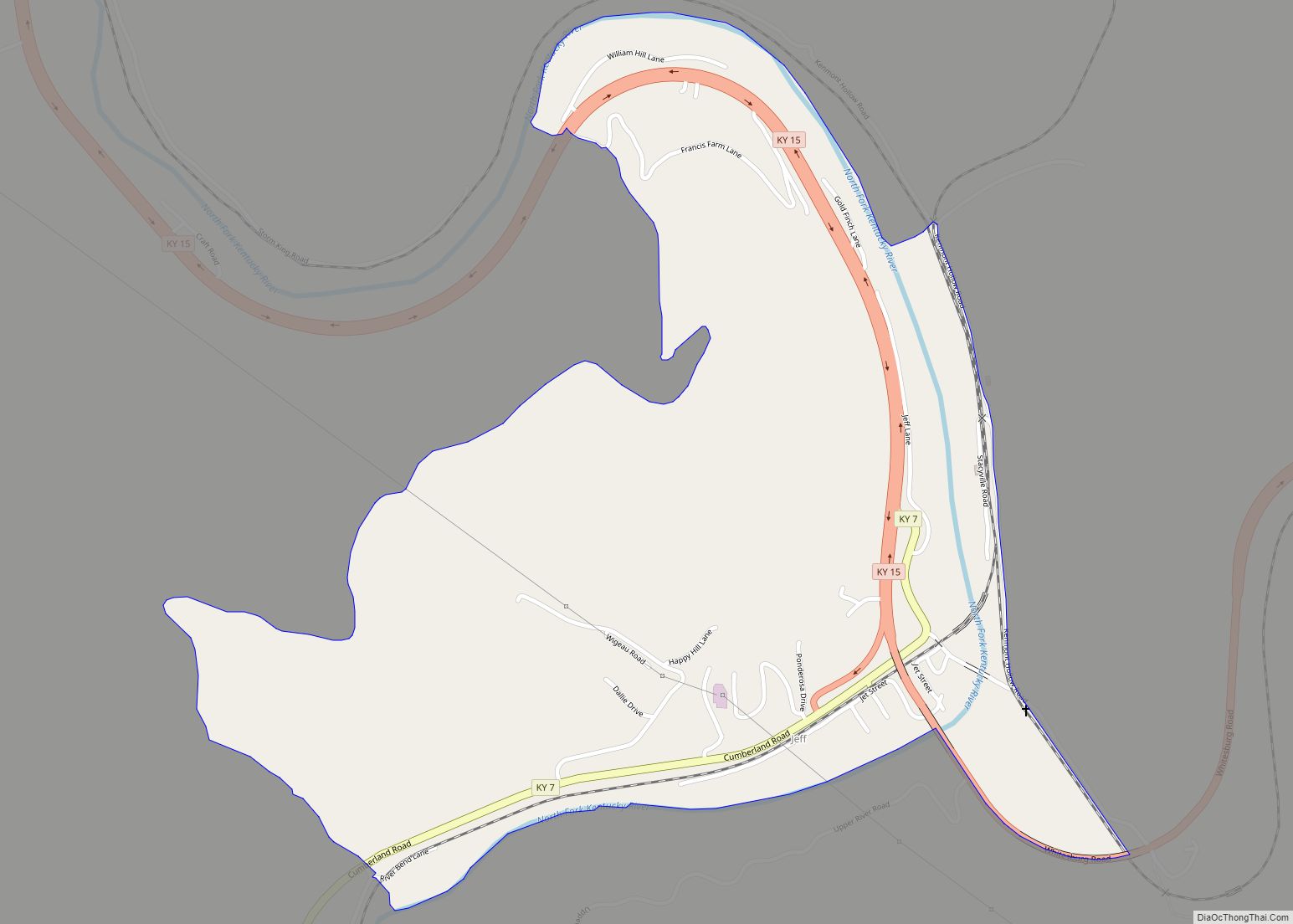
Jeff is a census-designated place and coal town in Perry County, Kentucky, United States. Its population was 323 as of the 2010 census. A post office was established in the community in 1902 and named for the early settler Jefferson Combs. Jeff CDP overview: Name: Jeff CDP LSAD Code: 57 LSAD Description: CDP (suffix) State: … Read more

Map of Junction City, Kentucky

Map of Junction City, Kentucky

Junction City is a home rule-class city in Boyle County on its border with Lincoln County in the U.S. state of Kentucky. Junction City’s population was 2,241 at the 2010 U.S. census. It is part of the Danville Micropolitan Statistical Area. Junction City overview: Name: Junction City LSAD Code: 25 LSAD Description: city (suffix) State: … Read more

Map of Jenkins city

Map of Jenkins city, Kentucky

Jenkins is a home rule-class city in Letcher County, Kentucky, United States. The population was 2,203 as of the 2010 census. Jenkins city overview: Name: Jenkins city LSAD Code: 25 LSAD Description: city (suffix) State: Kentucky County: Letcher County Incorporated: January 9, 1912 Elevation: 1,539 ft (469 m) Total Area: 8.88 sq mi (22.99 km²) Land Area: 8.85 sq mi (22.91 km²) Water … Read more

Map of Jeffersonville city, Kentucky

Map of Jeffersonville city, Kentucky

Jeffersonville is a home rule-class city in Montgomery County, Kentucky, in the United States. The population was 1,708 as of the 2020 census, up from 1,506 in 2010. It is part of the Mount Sterling micropolitan area. Jeffersonville city overview: Name: Jeffersonville city LSAD Code: 25 LSAD Description: city (suffix) State: Kentucky County: Montgomery County … Read more

Map of Kenvir CDP

Map of Kenvir CDP

Kenvir is a census-designated place and unincorporated community in Harlan County, Kentucky, United States. Its population was 297 as of the 2010 census. Kenvir CDP overview: Name: Kenvir CDP LSAD Code: 57 LSAD Description: CDP (suffix) State: Kentucky County: Harlan County Elevation: 1,457 ft (444 m) Total Area: 0.29 sq mi (0.76 km²) Land Area: 0.29 sq mi (0.76 km²) Water Area: 0.00 sq mi … Read more

Map of Kenton Vale city

Map of Kenton Vale city

Kenton Vale is a home rule-class city in Kenton County, Kentucky, in the United States. The population was 110 at the 2010 U.S. census. Kenton Vale consists of only one subdivision and a cemetery branching off Madison Pike (Kentucky Route 17). The subdivision was named for the county, which in turn was named for explorer … Read more

Map of Keene city, Kentucky

Map of Keene city, Kentucky

Keene is a home rule-class city located in Jessamine County, Kentucky, in the United States. It is home to the Keene Springs Hotel. The U.S. Census Bureau does not record Keene as a city and does not publish a population figure for the community. Keene city overview: Name: Keene city LSAD Code: 25 LSAD Description: … Read more

Map of Kevil city

Map of Kevil city

Kevil is a home rule-class city in Ballard County, Kentucky, United States. The population was 376 at the 2010 census, down from 574 in 2000. It is part of the Paducah micropolitan area. Kevil city overview: Name: Kevil city LSAD Code: 25 LSAD Description: city (suffix) State: Kentucky County: Ballard County Incorporated: 1910 Elevation: 430 ft … Read more

Map of Kuttawa city

Map of Kuttawa city

Kuttawa locally /kəˈtɑːwə/ is a home rule-class city in Lyon County, Kentucky, in the United States. The population was 649 as of the 2010 census, up from 596 in 2000. Kuttawa city overview: Name: Kuttawa city LSAD Code: 25 LSAD Description: city (suffix) State: Kentucky County: Lyon County Incorporated: 1872 Elevation: 463 ft (141 m) Total Area: … Read more

Map of Kingsley city, Kentucky

Map of Kingsley city, Kentucky

Kingsley is a home rule-class city in Jefferson County, Kentucky, United States. The population was 381 as of the 2010 census, down from 428 at the 2000 census. It is a suburb of Louisville. Kingsley city overview: Name: Kingsley city LSAD Code: 25 LSAD Description: city (suffix) State: Kentucky County: Jefferson County Incorporated: 1939 Elevation: … Read more

Map of LaFayette city, Kentucky

Map of LaFayette city, Kentucky

LaFayette, also informally written as La Fayette and Lafayette, is a home rule-class city in Christian County, Kentucky, in the United States. The population was 165 at the 2010 U.S. census. LaFayette is part of the Clarksville, Tennessee metropolitan area. LaFayette city overview: Name: LaFayette city LSAD Code: 25 LSAD Description: city (suffix) State: Kentucky … Read more

Map of La Grange city, Kentucky

Map of La Grange city, Kentucky

La Grange is a home rule-class city in Oldham County, Kentucky, in the United States. The population was 10,067 at the time of the 2020 U.S. census. It is the seat of its county. An unusual feature of La Grange is the CSX Transportation street-running mainline track on Main Street. La Grange city overview: Name: … Read more