Kuttawa locally /kəˈtɑːwə/ is a home rule-class city in Lyon County, Kentucky, in the United States. The population was 649 as of the 2010 census, up from 596 in 2000.
| Name: | Kuttawa city |
|---|---|
| LSAD Code: | 25 |
| LSAD Description: | city (suffix) |
| State: | Kentucky |
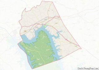
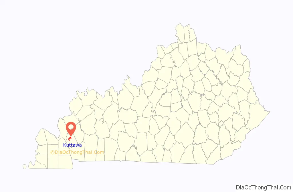
| County: | Lyon County |
| Incorporated: | 1872 |
| Elevation: | 463 ft (141 m) |
| Total Area: | 3.02 sq mi (7.81 km²) |
| Land Area: | 2.19 sq mi (5.67 km²) |
| Water Area: | 0.83 sq mi (2.14 km²) |
| Total Population: | 629 |
| Population Density: | 287.48/sq mi (111.02/km²) |
| ZIP code: | 42055 |
| Area code: | 270 |
| FIPS code: | 2143264 |
| GNISfeature ID: | 2404844 |
| Website: | www.cityofkuttawa.com |
Online Interactive Map
Click on ![]() to view map in "full screen" mode.
to view map in "full screen" mode.
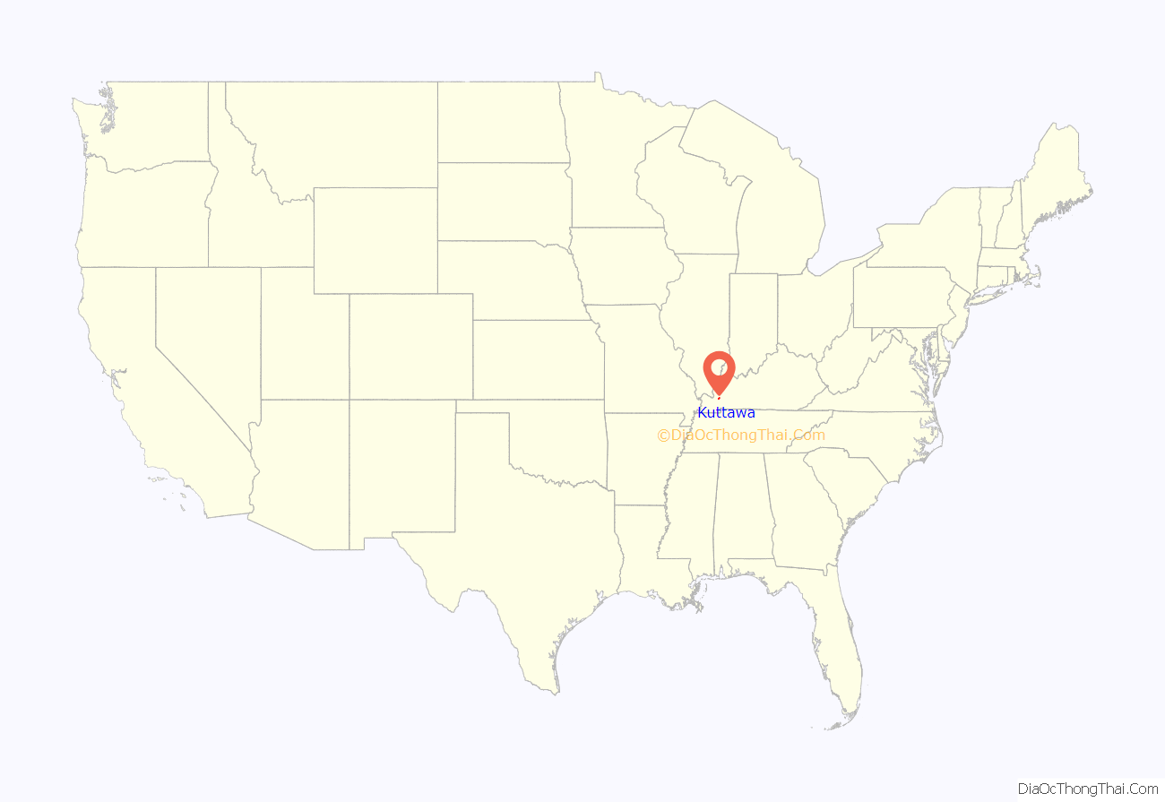
Kuttawa location map. Where is Kuttawa city?
History
Former Ohio governor Charles Anderson founded the town on land he purchased in 1866. Originally spelled “Cuttawa” and “Kittawa”, Kuttawa seems to have been the name of a Cherokee village near the site, whose meaning is a matter of dispute: it has been variously translated as “beautiful”, “city in the woods”, and “great wilderness”. The city was formally incorporated by the state assembly in 1872, the same year it received its post office.
In the early 1960s, the Tennessee Valley Authority constructed a dam across the Cumberland River at Grand Rivers, forming Lake Barkley. Eddyville and Kuttawa were both moved from their original locations owing to the impounded lake.
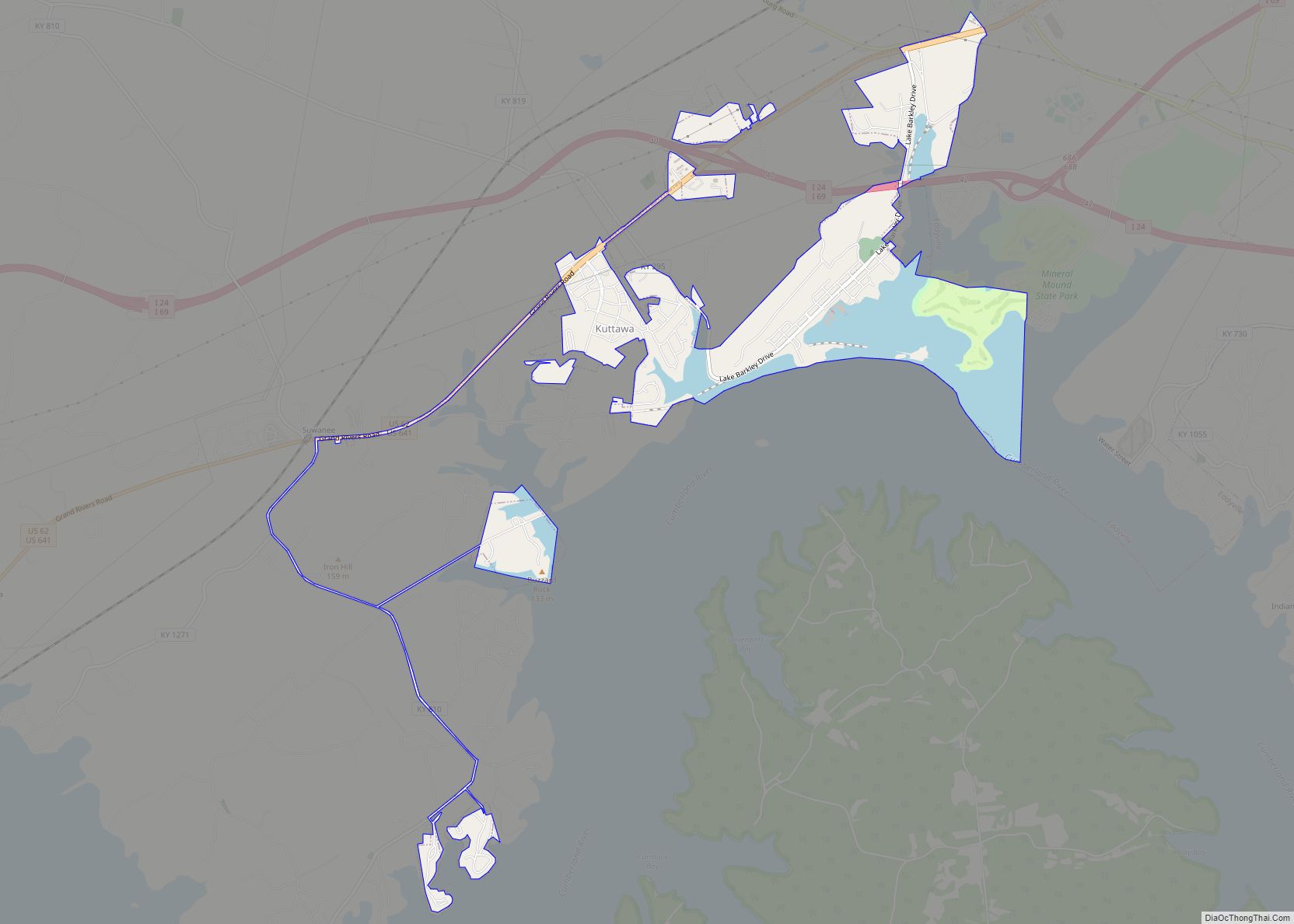
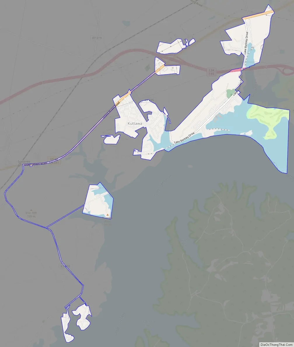
Kuttawa Road Map
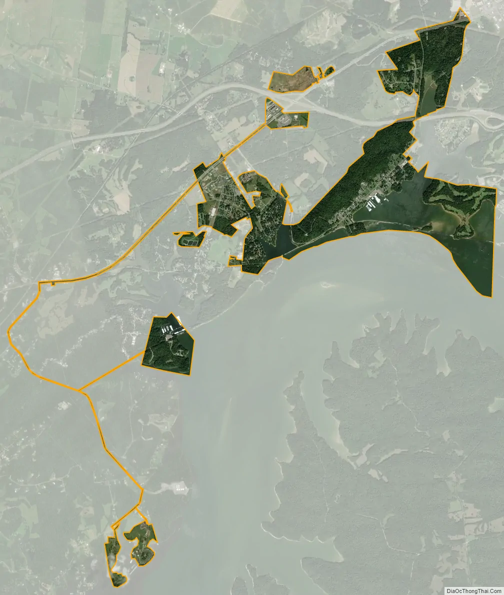
Kuttawa city Satellite Map
Geography
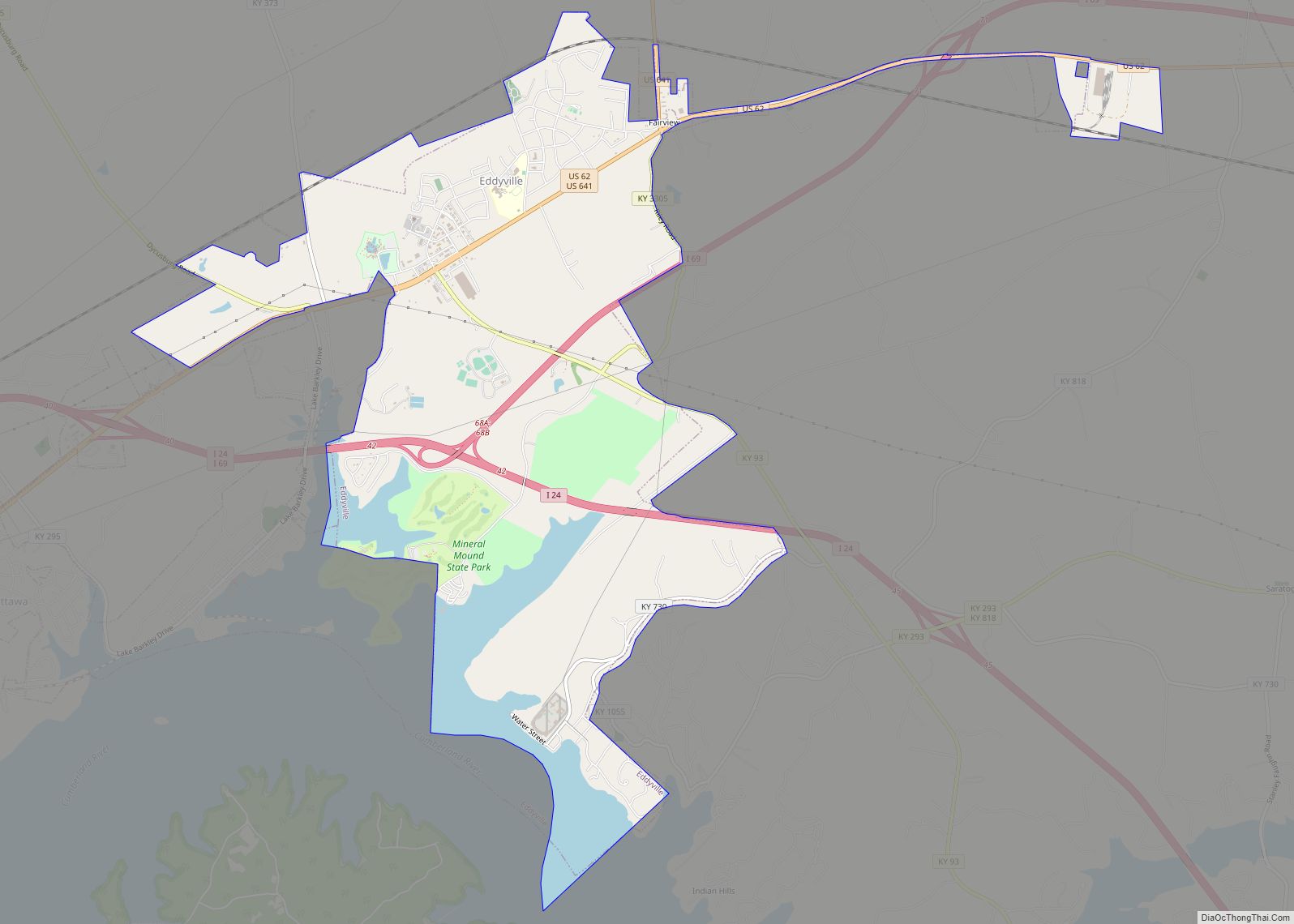
Kuttawa is located in north-central Lyon County and is bordered to the east by Eddyville and to the south by Lake Barkley, an impoundment of the Cumberland River, just upstream from Barkley Dam. The city is concentrated primarily in an area adjacent to the western intersection of U.S. Route 62 and Kentucky Route 295, though its municipal boundaries extend southwestward along US 62 and Kentucky Route 810, northeastward to the intersection of US 62 and the merged Interstate 24/Interstate 69, and along KY 295 as it follows the lakeshore to its eastern intersection with US 62.
The Land Between the Lakes National Recreation Area lies along the lakeshore opposite Kuttawa. Mineral Mound State Park borders the city to the east. Both Barkley Dam and Kentucky Dam (the latter of which impounds the Tennessee River) are located southwest of Kuttawa. By highway, Kuttawa is 32 miles (51 km) east of Paducah, 42 miles (68 km) northwest of Hopkinsville, and 46 miles (74 km) southwest of Madisonville.
According to the United States Census Bureau, the city of Kuttawa has a total area of 3.0 square miles (7.8 km), of which 2.2 square miles (5.7 km) are land and 0.81 square miles (2.1 km), or 27.40%, are water.
See also
Map of Kentucky State and its subdivision:- Adair
- Allen
- Anderson
- Ballard
- Barren
- Bath
- Bell
- Boone
- Bourbon
- Boyd
- Boyle
- Bracken
- Breathitt
- Breckinridge
- Bullitt
- Butler
- Caldwell
- Calloway
- Campbell
- Carlisle
- Carroll
- Carter
- Casey
- Christian
- Clark
- Clay
- Clinton
- Crittenden
- Cumberland
- Daviess
- Edmonson
- Elliott
- Estill
- Fayette
- Fleming
- Floyd
- Franklin
- Fulton
- Gallatin
- Garrard
- Grant
- Graves
- Grayson
- Green
- Greenup
- Hancock
- Hardin
- Harlan
- Harrison
- Hart
- Henderson
- Henry
- Hickman
- Hopkins
- Jackson
- Jefferson
- Jessamine
- Johnson
- Kenton
- Knott
- Knox
- Larue
- Laurel
- Lawrence
- Lee
- Leslie
- Letcher
- Lewis
- Lincoln
- Livingston
- Logan
- Lyon
- Madison
- Magoffin
- Marion
- Marshall
- Martin
- Mason
- McCracken
- McCreary
- McLean
- Meade
- Menifee
- Mercer
- Metcalfe
- Monroe
- Montgomery
- Morgan
- Muhlenberg
- Nelson
- Nicholas
- Ohio
- Oldham
- Owen
- Owsley
- Pendleton
- Perry
- Pike
- Powell
- Pulaski
- Robertson
- Rockcastle
- Rowan
- Russell
- Scott
- Shelby
- Simpson
- Spencer
- Taylor
- Todd
- Trigg
- Trimble
- Union
- Warren
- Washington
- Wayne
- Webster
- Whitley
- Wolfe
- Woodford
- Alabama
- Alaska
- Arizona
- Arkansas
- California
- Colorado
- Connecticut
- Delaware
- District of Columbia
- Florida
- Georgia
- Hawaii
- Idaho
- Illinois
- Indiana
- Iowa
- Kansas
- Kentucky
- Louisiana
- Maine
- Maryland
- Massachusetts
- Michigan
- Minnesota
- Mississippi
- Missouri
- Montana
- Nebraska
- Nevada
- New Hampshire
- New Jersey
- New Mexico
- New York
- North Carolina
- North Dakota
- Ohio
- Oklahoma
- Oregon
- Pennsylvania
- Rhode Island
- South Carolina
- South Dakota
- Tennessee
- Texas
- Utah
- Vermont
- Virginia
- Washington
- West Virginia
- Wisconsin
- Wyoming