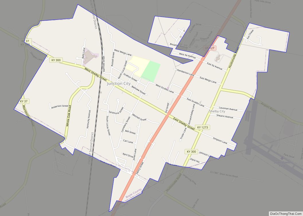
Junction City is a home rule-class city in Boyle County on its border with Lincoln County in the U.S. state of Kentucky. Junction City’s population was 2,241 at the 2010 U.S. census. It is part of the Danville Micropolitan Statistical Area.
| Name: | Junction City city |
|---|---|
| LSAD Code: | 25 |
| LSAD Description: | city (suffix) |
| State: | Kentucky |
| County: | Boyle County, Lincoln County |
| Incorporated: | April 8, 1882 |
| Elevation: | 991 ft (302 m) |
| Total Area: | 2.01 sq mi (5.21 km²) |
| Land Area: | 2.01 sq mi (5.20 km²) |
| Water Area: | 0.01 sq mi (0.01 km²) |
| Total Population: | 2,268 |
| Population Density: | 1,130.61/sq mi (436.54/km²) |
| ZIP code: | 40440 |
| Area code: | 859 |
| FIPS code: | 2141338 |
| GNISfeature ID: | 0495551 |
| Website: | jcky.us |
Online Interactive Map
Click on ![]() to view map in "full screen" mode.
to view map in "full screen" mode.
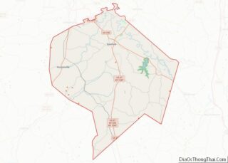
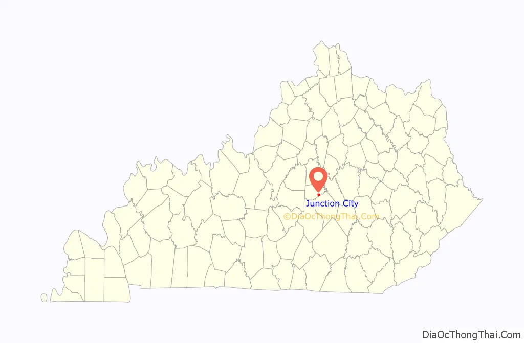
Junction City location map. Where is Junction City city?

History
Junction City began when the Louisville and Nashville Railroad reached the area. It was originally known as “Goresburg” for the proprietors of the Gore Hotel. The Gore post office opened in 1880, and was renamed Goresburg in 1882. The town was renamed “Junction City” when the Cincinnati Southern Railway reached town later that year, its tracks intersecting those of the L&N. The city was formally incorporated April 8, 1882, by the state assembly. The L&N station there was known as “Danville Junction” for its proximity to the larger city of Danville.
The southeastern part of Junction City was once the separate town of Shelby City, incorporated in 1867, and named for Kentucky’s first governor Isaac Shelby, who lived and was buried nearby. This community’s separate post office was known as “South Danville” when it was established April 26, 1866, renamed Shelby City the next year (the eastern portion of Junction City is still known as Shelby City), and closed in 1926. It was also known as “Briartown” and its L&N station was called “Danville Station”. The tomb of Kentucky’s first governor, Isaac Shelby, and his homestead Traveler’s Rest, is located across the Lincoln County line, just south of this part of town.
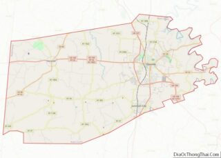
Junction City Road Map
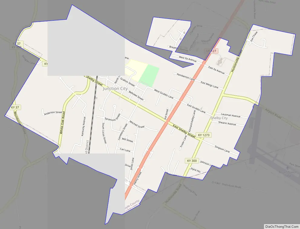
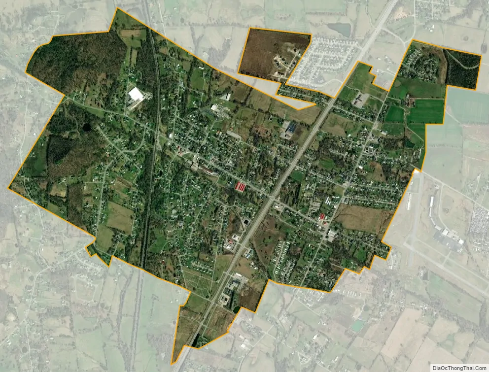
Junction City city Satellite Map
Geography
Junction City is located at 37°35′07″N 84°47′19″W / 37.58528°N 84.78861°W / 37.58528; -84.78861. According to the United States Census Bureau, the city has a total area of 1.9 square miles (4.8 km), all land. The city lies in a broad valley south of Danville, and just north of the border between Boyle and Lincoln counties. Much of Junction City is concentrated along Shelby Street between the Cincinnati Southern tracks on the west and U.S. Route 127 on the east. The part of town east of US 127 is known as “Shelby City.” Kentucky Route 37 and Kentucky Route 300 intersect in northwestern Junction City.
See also
Map of Kentucky State and its subdivision:- Adair
- Allen
- Anderson
- Ballard
- Barren
- Bath
- Bell
- Boone
- Bourbon
- Boyd
- Boyle
- Bracken
- Breathitt
- Breckinridge
- Bullitt
- Butler
- Caldwell
- Calloway
- Campbell
- Carlisle
- Carroll
- Carter
- Casey
- Christian
- Clark
- Clay
- Clinton
- Crittenden
- Cumberland
- Daviess
- Edmonson
- Elliott
- Estill
- Fayette
- Fleming
- Floyd
- Franklin
- Fulton
- Gallatin
- Garrard
- Grant
- Graves
- Grayson
- Green
- Greenup
- Hancock
- Hardin
- Harlan
- Harrison
- Hart
- Henderson
- Henry
- Hickman
- Hopkins
- Jackson
- Jefferson
- Jessamine
- Johnson
- Kenton
- Knott
- Knox
- Larue
- Laurel
- Lawrence
- Lee
- Leslie
- Letcher
- Lewis
- Lincoln
- Livingston
- Logan
- Lyon
- Madison
- Magoffin
- Marion
- Marshall
- Martin
- Mason
- McCracken
- McCreary
- McLean
- Meade
- Menifee
- Mercer
- Metcalfe
- Monroe
- Montgomery
- Morgan
- Muhlenberg
- Nelson
- Nicholas
- Ohio
- Oldham
- Owen
- Owsley
- Pendleton
- Perry
- Pike
- Powell
- Pulaski
- Robertson
- Rockcastle
- Rowan
- Russell
- Scott
- Shelby
- Simpson
- Spencer
- Taylor
- Todd
- Trigg
- Trimble
- Union
- Warren
- Washington
- Wayne
- Webster
- Whitley
- Wolfe
- Woodford
- Alabama
- Alaska
- Arizona
- Arkansas
- California
- Colorado
- Connecticut
- Delaware
- District of Columbia
- Florida
- Georgia
- Hawaii
- Idaho
- Illinois
- Indiana
- Iowa
- Kansas
- Kentucky
- Louisiana
- Maine
- Maryland
- Massachusetts
- Michigan
- Minnesota
- Mississippi
- Missouri
- Montana
- Nebraska
- Nevada
- New Hampshire
- New Jersey
- New Mexico
- New York
- North Carolina
- North Dakota
- Ohio
- Oklahoma
- Oregon
- Pennsylvania
- Rhode Island
- South Carolina
- South Dakota
- Tennessee
- Texas
- Utah
- Vermont
- Virginia
- Washington
- West Virginia
- Wisconsin
- Wyoming