Map of Robards city

Map of Robards city

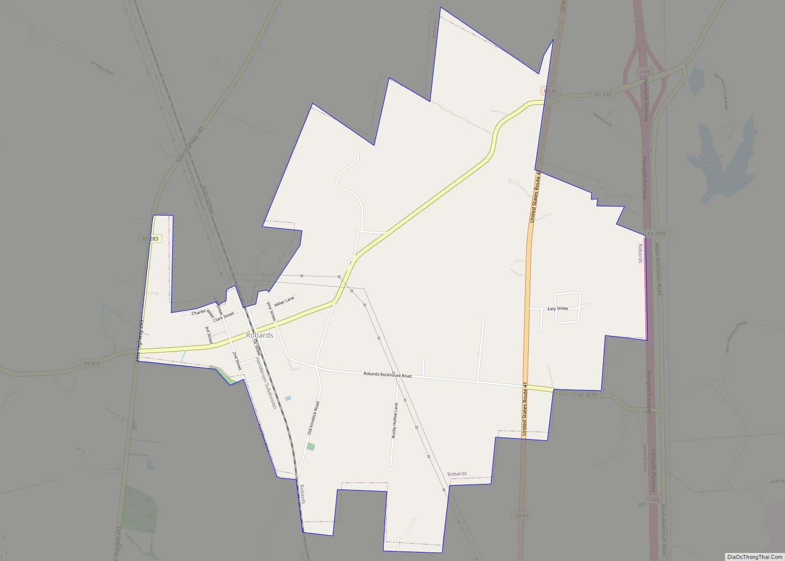
Robards (/ˈrɒbərdz/) is a home rule-class city in Henderson County, Kentucky, United States. The population was 515 at the 2010 census, down from 564 at the 2000 census. Robards city overview: Name: Robards city LSAD Code: 25 LSAD Description: city (suffix) State: Kentucky County: Henderson County Elevation: 430 ft (131 m) Total Area: 3.04 sq mi (7.88 km²) Land Area: … Read more

Map of Rolling Hills city, Kentucky

Map of Rolling Hills city, Kentucky

Rolling Hills is a home rule-class city in Jefferson County, Kentucky. The population was 959 at the time of the 2010 census. Rolling Hills city overview: Name: Rolling Hills city LSAD Code: 25 LSAD Description: city (suffix) State: Kentucky County: Jefferson County Elevation: 650 ft (198 m) Total Area: 0.19 sq mi (0.49 km²) Land Area: 0.19 sq mi (0.49 km²) Water Area: … Read more

Map of Rolling Fields city

Map of Rolling Fields city

Rolling Fields is a home rule-class city in Jefferson County, Kentucky, United States. The population was 646 at the 2010 census. It incorporated as a city in 1958. It was the fifth-wealthiest city in Kentucky by median household income in 2000. It is adjacent to the similar small cities of Indian Hills and Mockingbird Valley, … Read more

Map of Rockport city, Kentucky

Map of Rockport city, Kentucky

Rockport is a home rule-class city in Ohio County, Kentucky, United States. The population was 266 at the 2010 census. The city is descriptively named for the large rocks on a nearby river bank. Rockport city overview: Name: Rockport city LSAD Code: 25 LSAD Description: city (suffix) State: Kentucky County: Ohio County Elevation: 436 ft (133 m) … Read more

Map of Russell city, Kentucky

Map of Russell city, Kentucky

Russell is a home rule-class city on the south bank of the Ohio River in Greenup County, Kentucky, United States. The population was 3,380 as of the 2010 census, down from 3,645 in 2000. Russell is a suburb of Ashland and part of the Huntington-Ashland-Ironton metropolitan area. It has close economic affiliations with its neighbors, … Read more

Map of Russell Springs city, Kentucky

Map of Russell Springs city, Kentucky

Russell Springs is a home rule-class city in Russell County, Kentucky, in the United States. The city is the gateway to Lake Cumberland, one of the largest man-made lakes in the region, created by Wolf Creek Dam. It is the largest city in the county, having a population of 2,441 during the year 2010 U.S. … Read more

Map of Rosine CDP

Map of Rosine CDP

Rosine (/roʊˈziːn/) is an unincorporated community in Ohio County, Kentucky, United States. Bill Monroe, The Father of Bluegrass, is buried in the community and memorialized with a bronze cast disk affixed to the barn where his music remains alive. The community was named for the pen name of Jenny Taylor McHenry, poet and wife of … Read more

Map of Sacramento city, Kentucky

Map of Sacramento city, Kentucky

Sacramento is a home rule-class city in McLean County, Kentucky, in the United States. The population was 429 as of the 2020 census. It is included in the Owensboro metropolitan area. Sacramento city overview: Name: Sacramento city LSAD Code: 25 LSAD Description: city (suffix) State: Kentucky County: McLean County Incorporated: 1860 Elevation: 492 ft (150 m) Total … Read more

Map of Ryland Heights city

Map of Ryland Heights city

Ryland Heights is a home rule-class city in Kenton County, Kentucky, in the United States. The population was 1,022 at the 2010 census, up from 799 at the 2000 census. It is part of the Cincinnati metropolitan area. Ryland Heights city overview: Name: Ryland Heights city LSAD Code: 25 LSAD Description: city (suffix) State: Kentucky … Read more

Map of Russellville city, Kentucky

Map of Russellville city, Kentucky

Russellville is a home rule-class city in Logan County, Kentucky, in the United States. It is the seat of its county. The population was 6,960 at the time of the 2010 census. Russellville city overview: Name: Russellville city LSAD Code: 25 LSAD Description: city (suffix) State: Kentucky County: Logan County Incorporated: 1840 Elevation: 594 ft (181 m) … Read more

Map of Salt Lick city

Map of Salt Lick city

Salt Lick is a home rule-class city in Bath County, Kentucky, in the United States. The population was 303 at the 2010 U.S. Census. Salt Lick city overview: Name: Salt Lick city LSAD Code: 25 LSAD Description: city (suffix) State: Kentucky County: Bath County Incorporated: 1888 Elevation: 676 ft (206 m) Total Area: 0.79 sq mi (2.05 km²) Land Area: … Read more

Map of Salem city, Kentucky

Map of Salem city, Kentucky

Salem is a home rule-class city in Livingston County, Kentucky, in the United States. Salem is part of the Paducah micropolitan area. The population was 752 during the 2010 census, down from 769 in 2000. It the largest city in Livingston County, although the census-designated place of Ledbetter has more than twice the population of … Read more