Russell Springs is a home rule-class city in Russell County, Kentucky, in the United States. The city is the gateway to Lake Cumberland, one of the largest man-made lakes in the region, created by Wolf Creek Dam. It is the largest city in the county, having a population of 2,441 during the year 2010 U.S. Census.
| Name: | Russell Springs city |
|---|---|
| LSAD Code: | 25 |
| LSAD Description: | city (suffix) |
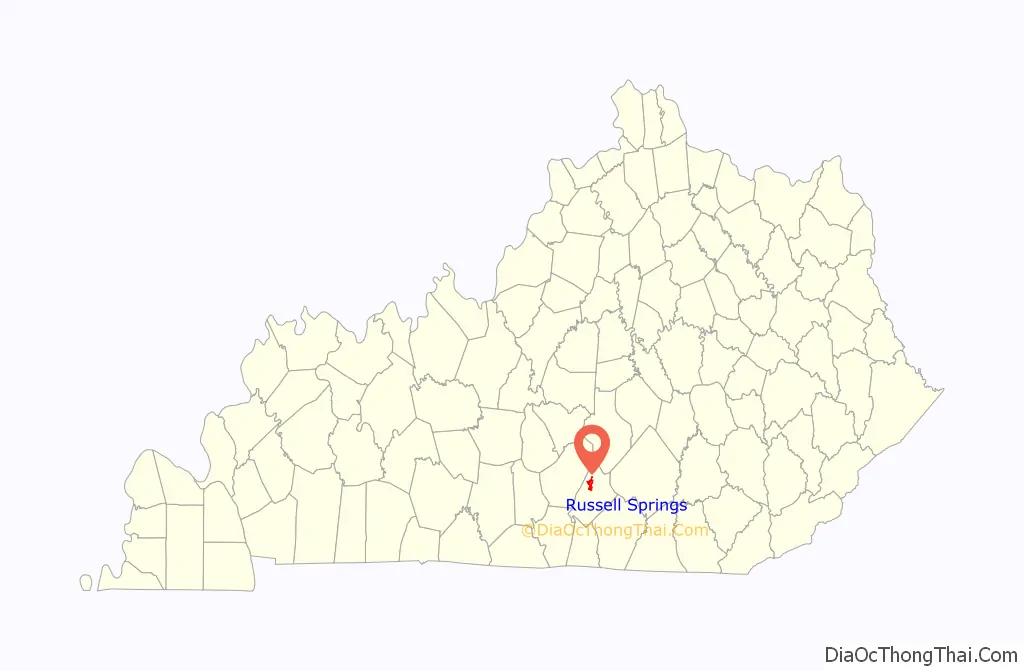
| State: | Kentucky |
| County: | Russell County |
| Incorporated: | 1936 |
| Elevation: | 1,086 ft (331 m) |
| Total Area: | 4.70 sq mi (12.16 km²) |
| Land Area: | 4.68 sq mi (12.13 km²) |
| Water Area: | 0.01 sq mi (0.03 km²) |
| Total Population: | 2,715 |
| Population Density: | 579.51/sq mi (223.74/km²) |
| ZIP code: | 42642 |
| Area code: | 270 & 364 |
| FIPS code: | 2167494 |
| GNISfeature ID: | 0502532 |
| Website: | russellsprings.net |
Online Interactive Map
Click on ![]() to view map in "full screen" mode.
to view map in "full screen" mode.
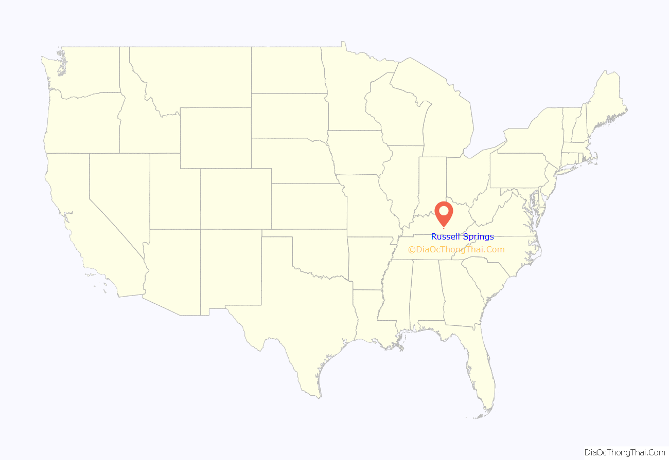
Russell Springs location map. Where is Russell Springs city?
History
The present city grew out of a resort centered on a local chalybeate spring. Rennick relates that Samuel Patterson was generally credited with settling the site and that the community was known as Big Boiling Springs by 1850. The post office was established in 1855 as “Russell Springs” after the county, but was discontinued in 1865 and reopened as Kimble (after local businessman George Kimble) in 1888. The community restored the name Russell Springs in 1901 and incorporated in 1936.
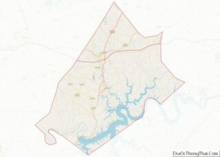
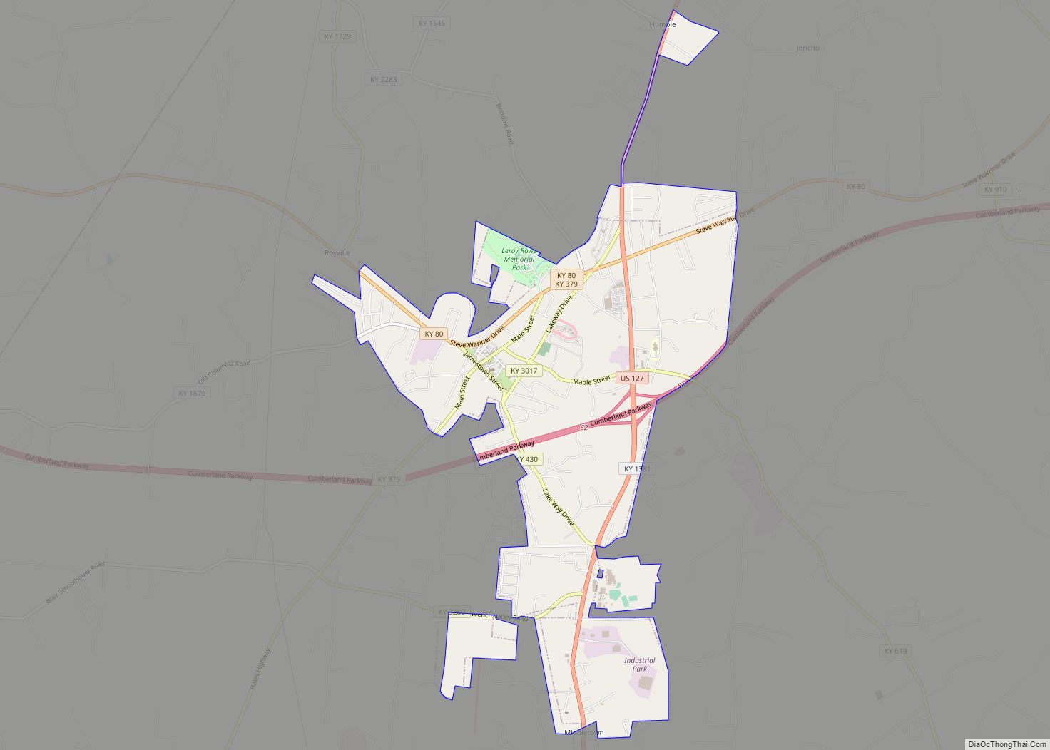
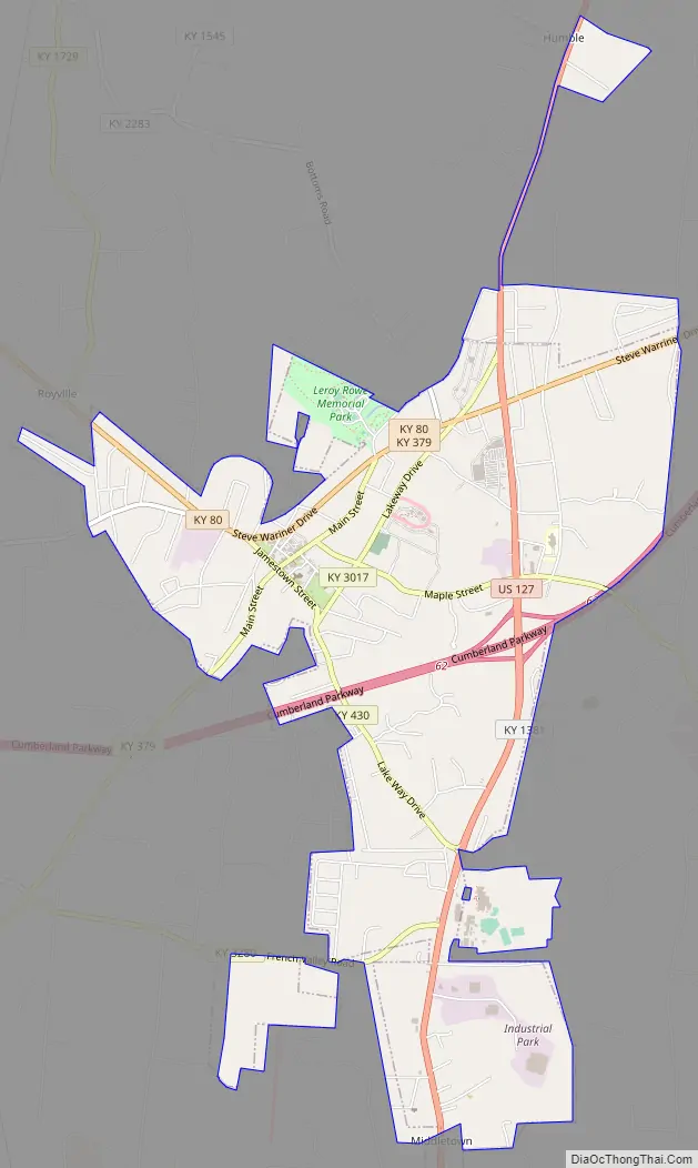
Russell Springs Road Map
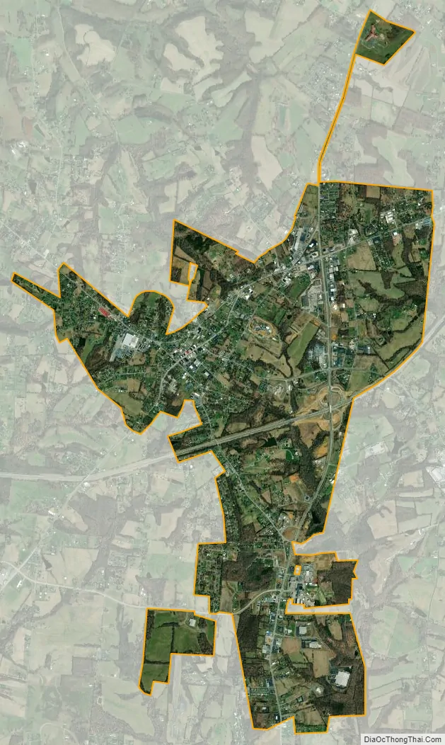
Russell Springs city Satellite Map
Geography
Russell Springs is located at 37°3′17″N 85°4′52″W / 37.05472°N 85.08111°W / 37.05472; -85.08111 (37.054853, -85.081162). According to the United States Census Bureau, the city has a total area of 4.6 square miles (12 km), all land.
Russell Springs is situated in a hilly area in western Russell County, a few miles north of Lake Cumberland (part of the Cumberland River). The city’s historic district is concentrated along Kentucky Route 379 (Main Street) at its intersection with Jamestown Street. The city of Jamestown lies just to the south. U.S. Route 127 passes through the eastern part of the Russell Springs, connecting it with the Lake Cumberland area and Tennessee to the south, and the city of Liberty to the northeast. The Cumberland Parkway also traverses Russell Springs, connecting it with Columbia to the west and Somerset to the east.
See also
Map of Kentucky State and its subdivision:- Adair
- Allen
- Anderson
- Ballard
- Barren
- Bath
- Bell
- Boone
- Bourbon
- Boyd
- Boyle
- Bracken
- Breathitt
- Breckinridge
- Bullitt
- Butler
- Caldwell
- Calloway
- Campbell
- Carlisle
- Carroll
- Carter
- Casey
- Christian
- Clark
- Clay
- Clinton
- Crittenden
- Cumberland
- Daviess
- Edmonson
- Elliott
- Estill
- Fayette
- Fleming
- Floyd
- Franklin
- Fulton
- Gallatin
- Garrard
- Grant
- Graves
- Grayson
- Green
- Greenup
- Hancock
- Hardin
- Harlan
- Harrison
- Hart
- Henderson
- Henry
- Hickman
- Hopkins
- Jackson
- Jefferson
- Jessamine
- Johnson
- Kenton
- Knott
- Knox
- Larue
- Laurel
- Lawrence
- Lee
- Leslie
- Letcher
- Lewis
- Lincoln
- Livingston
- Logan
- Lyon
- Madison
- Magoffin
- Marion
- Marshall
- Martin
- Mason
- McCracken
- McCreary
- McLean
- Meade
- Menifee
- Mercer
- Metcalfe
- Monroe
- Montgomery
- Morgan
- Muhlenberg
- Nelson
- Nicholas
- Ohio
- Oldham
- Owen
- Owsley
- Pendleton
- Perry
- Pike
- Powell
- Pulaski
- Robertson
- Rockcastle
- Rowan
- Russell
- Scott
- Shelby
- Simpson
- Spencer
- Taylor
- Todd
- Trigg
- Trimble
- Union
- Warren
- Washington
- Wayne
- Webster
- Whitley
- Wolfe
- Woodford
- Alabama
- Alaska
- Arizona
- Arkansas
- California
- Colorado
- Connecticut
- Delaware
- District of Columbia
- Florida
- Georgia
- Hawaii
- Idaho
- Illinois
- Indiana
- Iowa
- Kansas
- Kentucky
- Louisiana
- Maine
- Maryland
- Massachusetts
- Michigan
- Minnesota
- Mississippi
- Missouri
- Montana
- Nebraska
- Nevada
- New Hampshire
- New Jersey
- New Mexico
- New York
- North Carolina
- North Dakota
- Ohio
- Oklahoma
- Oregon
- Pennsylvania
- Rhode Island
- South Carolina
- South Dakota
- Tennessee
- Texas
- Utah
- Vermont
- Virginia
- Washington
- West Virginia
- Wisconsin
- Wyoming