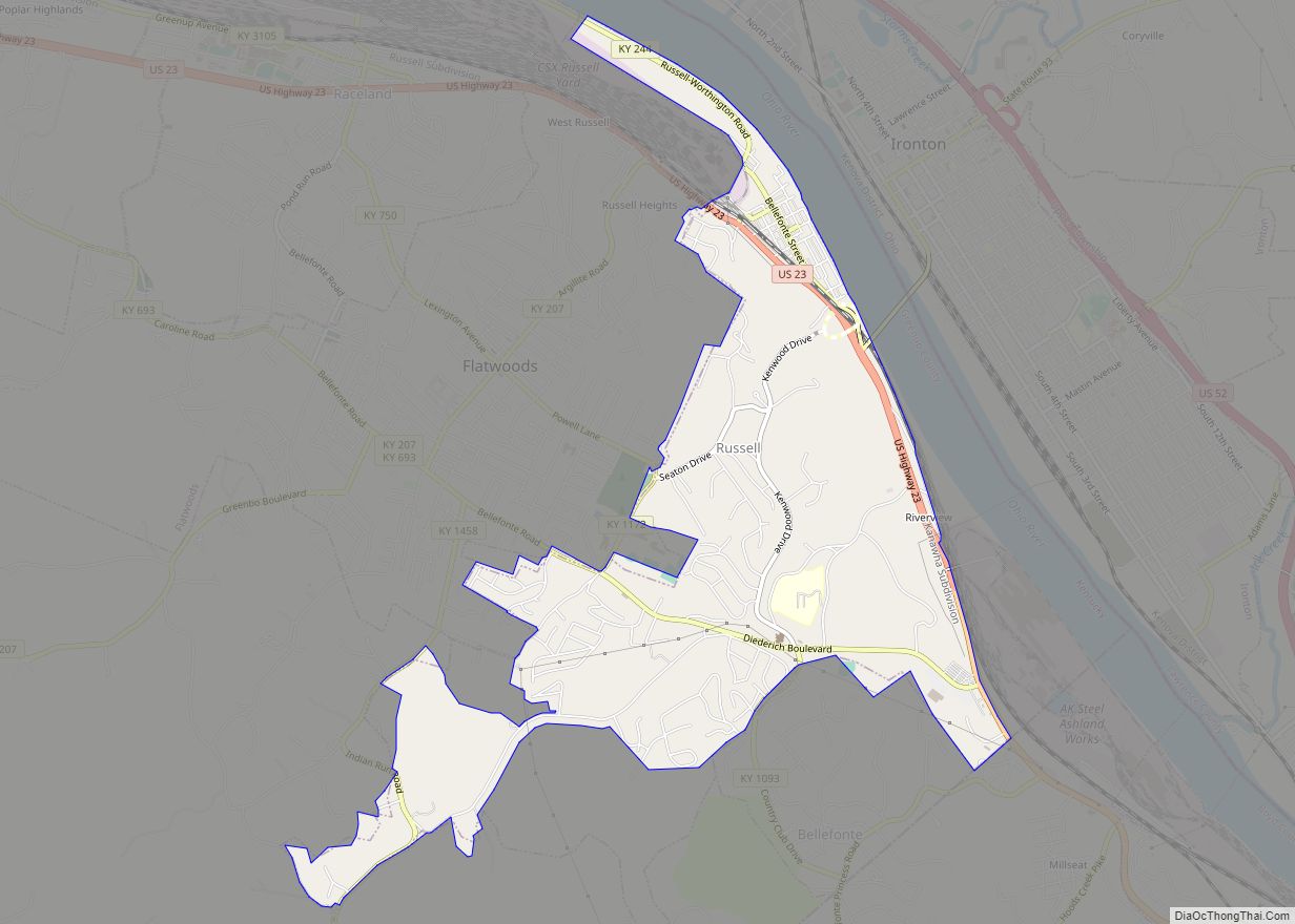
Russell is a home rule-class city on the south bank of the Ohio River in Greenup County, Kentucky, United States. The population was 3,380 as of the 2010 census, down from 3,645 in 2000. Russell is a suburb of Ashland and part of the Huntington-Ashland-Ironton metropolitan area. It has close economic affiliations with its neighbors, Ashland and Flatwoods in Kentucky and Ironton, Ohio.
| Name: | Russell city |
|---|---|
| LSAD Code: | 25 |
| LSAD Description: | city (suffix) |
| State: | Kentucky |
| County: | Greenup County |
| Incorporated: | February 23, 1874 |
| Elevation: | 646 ft (197 m) |
| Total Area: | 3.43 sq mi (8.87 km²) |
| Land Area: | 3.41 sq mi (8.84 km²) |
| Water Area: | 0.01 sq mi (0.04 km²) |
| Total Population: | 3,744 |
| Population Density: | 1,097.30/sq mi (423.69/km²) |
| ZIP code: | 41169 (part in 41101) |
| Area code: | 606 |
| FIPS code: | 2167458 |
| GNISfeature ID: | 0502497 |
| Website: | www.russellky.net |
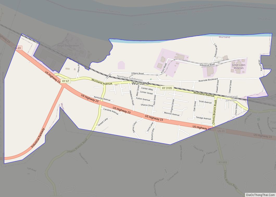
Online Interactive Map
Click on ![]() to view map in "full screen" mode.
to view map in "full screen" mode.
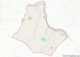
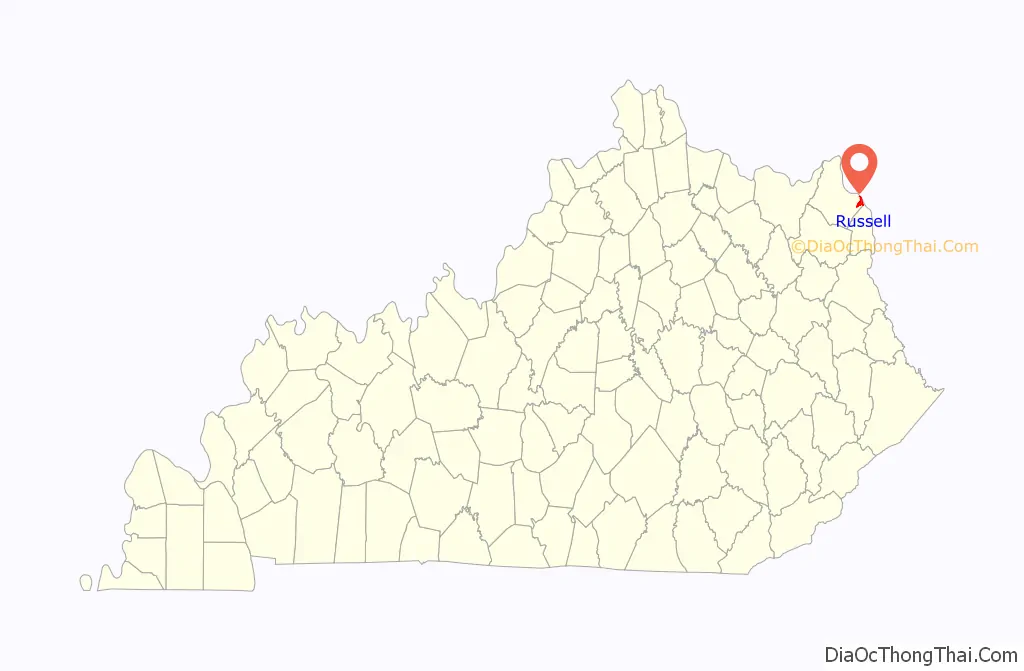
Russell location map. Where is Russell city?

History
The hilly site near the confluence of White Oak Creek and the Ohio was chosen by pioneer Jeff Moore in 1823 in order to provide protection for his camp against attacks by local American Indian tribes. In 1829, James E. McDowell, William Lindsay Poage, and his brother erected an iron furnace; they named the foundry and the community that grew up around it “Amanda Furnace” after William’s infant daughter. The furnace ceased operation in 1861.
John Russell and his Means and Russell Iron Company purchased the land of the present city beside Amanda Hill from the Poage brothers. They laid out and established the town of Riverview in 1869 in expectation of an expansion of the Chesapeake and Ohio Railroad westward from Huntington, West Virginia, to Cincinnati, Ohio. Ferry service to Ohio began in 1870, local landowners agreed to rename the community after its founder in 1873, and the city was formally incorporated under the name “Russell” in 1874. The expected C&O spur did not arrive until 1889 but, when it did, it constructed a railyard, roundhouse, and shops and the city grew quickly. The city celebrates this influence with the annual “Russell Railroad Days” each August.
Numerous disasters limited the city’s growth. The Ohio River flooded the city in 1884, smallpox struck in 1901, and a fire consumed downtown and the city hall in 1903. In 1905, it was still the largest city in Greenup County, but the Ohio flooded again in 1913 and 1937. The 1937 flood affected all but 30 homes, and over 500 people were forced to shelter in C&O boxcars and cabooses until the waters receded. Despite the completion of a bridge to Ironton in 1922 and a floodwall in 1950, Russell was no longer the county’s largest municipality by the mid-1950s.
The Fortune 500 company Ashland Oil relocated its headquarters to Russell in 1974, but moved to the Cincinnati suburb of Covington in 1999.
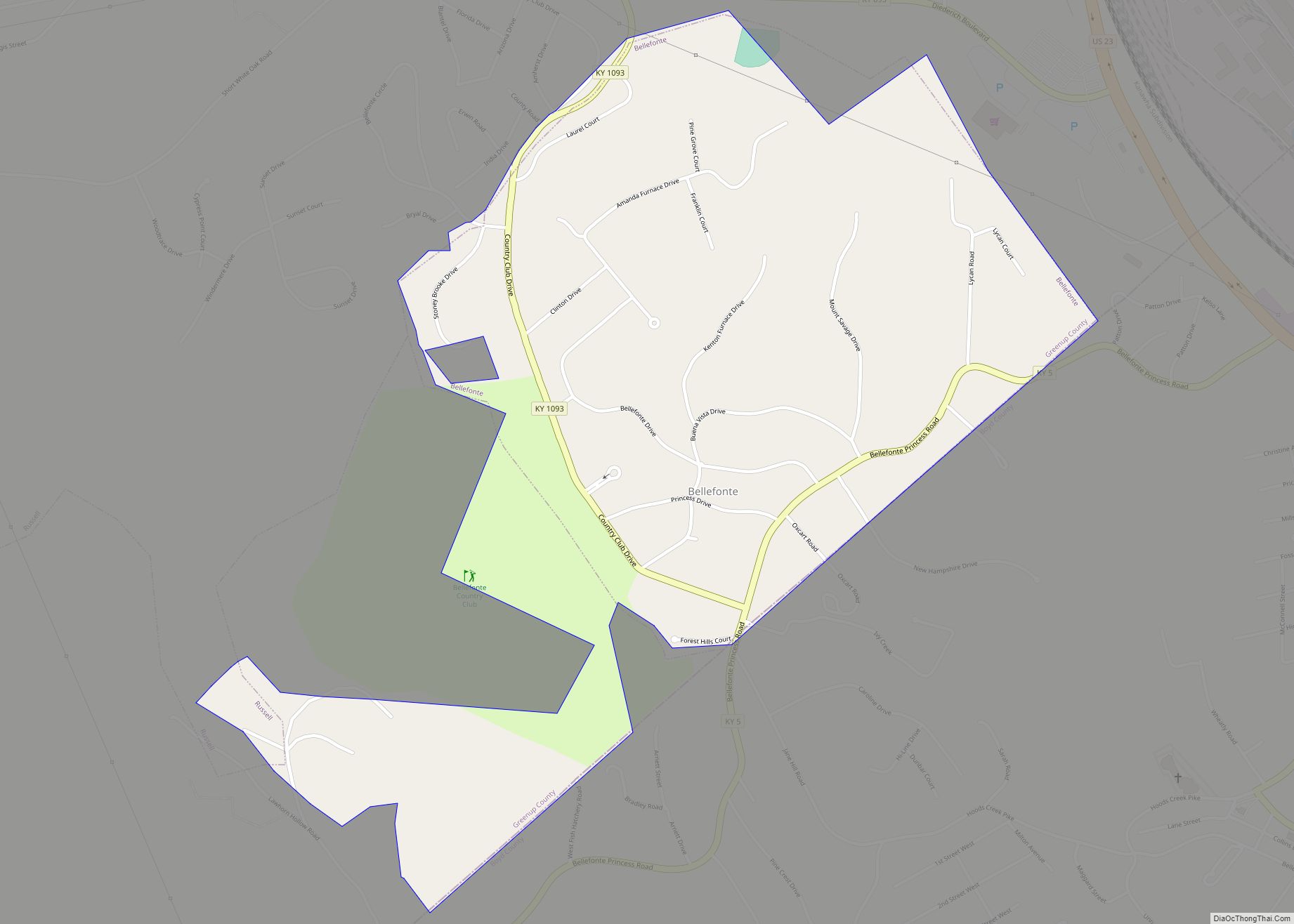
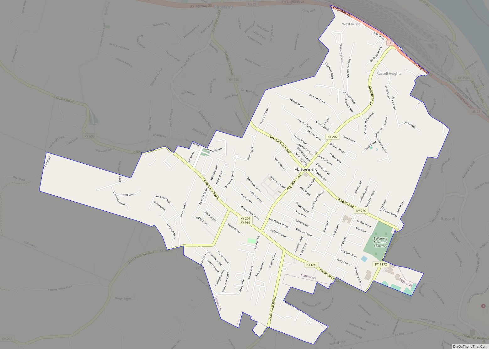
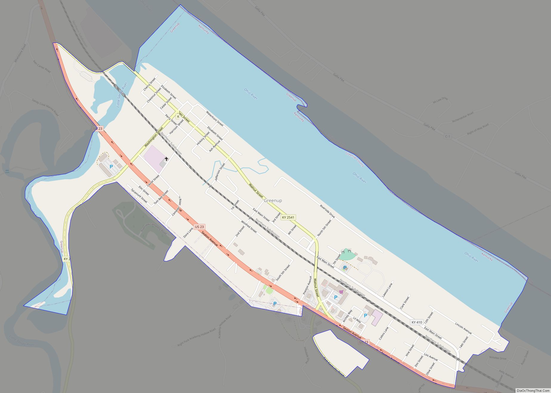
Russell Road Map

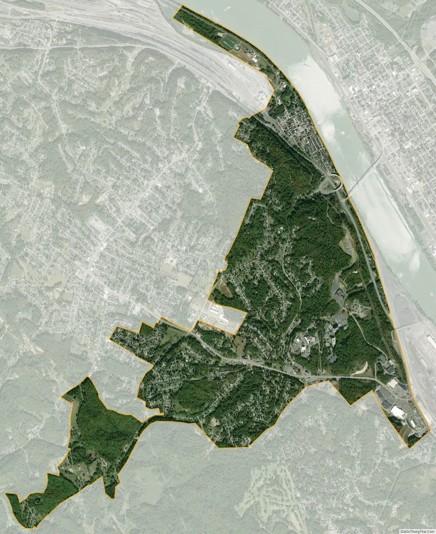
Russell city Satellite Map
Geography
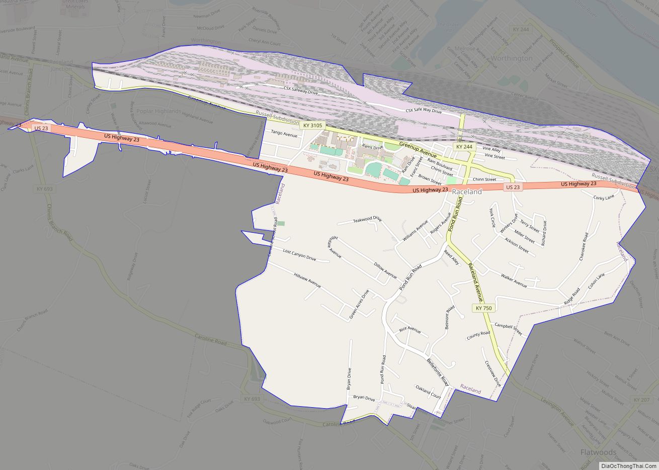
Russell is located in the eastern corner of Greenup County at 38°31′5″N 82°41′52″W / 38.51806°N 82.69778°W / 38.51806; -82.69778 (38.518176, -82.697680), directly across the Ohio River from Ironton, Ohio. It is bordered to the northwest by the city of Worthington, to the west by the city of Flatwoods, and to the south by the city of Bellefonte. The southeast border of Russell is the Boyd County line, separating Russell from the unincorporated community of Westwood. Downtown Ashland is 3 miles (5 km) southeast of Russell via U.S. Route 23.
According to the United States Census Bureau, the city of Russell has a total area of 3.0 square miles (7.8 km), of which 0.02 square miles (0.04 km), or 0.48%, is water.
See also
Map of Kentucky State and its subdivision:- Adair
- Allen
- Anderson
- Ballard
- Barren
- Bath
- Bell
- Boone
- Bourbon
- Boyd
- Boyle
- Bracken
- Breathitt
- Breckinridge
- Bullitt
- Butler
- Caldwell
- Calloway
- Campbell
- Carlisle
- Carroll
- Carter
- Casey
- Christian
- Clark
- Clay
- Clinton
- Crittenden
- Cumberland
- Daviess
- Edmonson
- Elliott
- Estill
- Fayette
- Fleming
- Floyd
- Franklin
- Fulton
- Gallatin
- Garrard
- Grant
- Graves
- Grayson
- Green
- Greenup
- Hancock
- Hardin
- Harlan
- Harrison
- Hart
- Henderson
- Henry
- Hickman
- Hopkins
- Jackson
- Jefferson
- Jessamine
- Johnson
- Kenton
- Knott
- Knox
- Larue
- Laurel
- Lawrence
- Lee
- Leslie
- Letcher
- Lewis
- Lincoln
- Livingston
- Logan
- Lyon
- Madison
- Magoffin
- Marion
- Marshall
- Martin
- Mason
- McCracken
- McCreary
- McLean
- Meade
- Menifee
- Mercer
- Metcalfe
- Monroe
- Montgomery
- Morgan
- Muhlenberg
- Nelson
- Nicholas
- Ohio
- Oldham
- Owen
- Owsley
- Pendleton
- Perry
- Pike
- Powell
- Pulaski
- Robertson
- Rockcastle
- Rowan
- Russell
- Scott
- Shelby
- Simpson
- Spencer
- Taylor
- Todd
- Trigg
- Trimble
- Union
- Warren
- Washington
- Wayne
- Webster
- Whitley
- Wolfe
- Woodford
- Alabama
- Alaska
- Arizona
- Arkansas
- California
- Colorado
- Connecticut
- Delaware
- District of Columbia
- Florida
- Georgia
- Hawaii
- Idaho
- Illinois
- Indiana
- Iowa
- Kansas
- Kentucky
- Louisiana
- Maine
- Maryland
- Massachusetts
- Michigan
- Minnesota
- Mississippi
- Missouri
- Montana
- Nebraska
- Nevada
- New Hampshire
- New Jersey
- New Mexico
- New York
- North Carolina
- North Dakota
- Ohio
- Oklahoma
- Oregon
- Pennsylvania
- Rhode Island
- South Carolina
- South Dakota
- Tennessee
- Texas
- Utah
- Vermont
- Virginia
- Washington
- West Virginia
- Wisconsin
- Wyoming