Russellville is a home rule-class city in Logan County, Kentucky, in the United States. It is the seat of its county. The population was 6,960 at the time of the 2010 census.
| Name: | Russellville city |
|---|---|
| LSAD Code: | 25 |
| LSAD Description: | city (suffix) |
| State: | Kentucky |
| County: | Logan County |
| Incorporated: | 1840 |
| Elevation: | 594 ft (181 m) |
| Total Area: | 10.87 sq mi (28.14 km²) |
| Land Area: | 10.84 sq mi (28.08 km²) |
| Water Area: | 0.02 sq mi (0.06 km²) |
| Total Population: | 7,164 |
| Population Density: | 660.76/sq mi (255.12/km²) |
| ZIP code: | 42276 |
| Area code: | 270 & 364 |
| FIPS code: | 2167512 |
| GNISfeature ID: | 0502534 |
| Website: | www.russellvilleky.org |
Online Interactive Map
Click on ![]() to view map in "full screen" mode.
to view map in "full screen" mode.
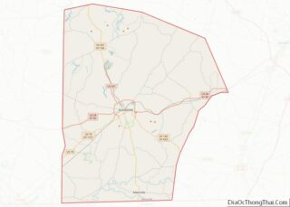
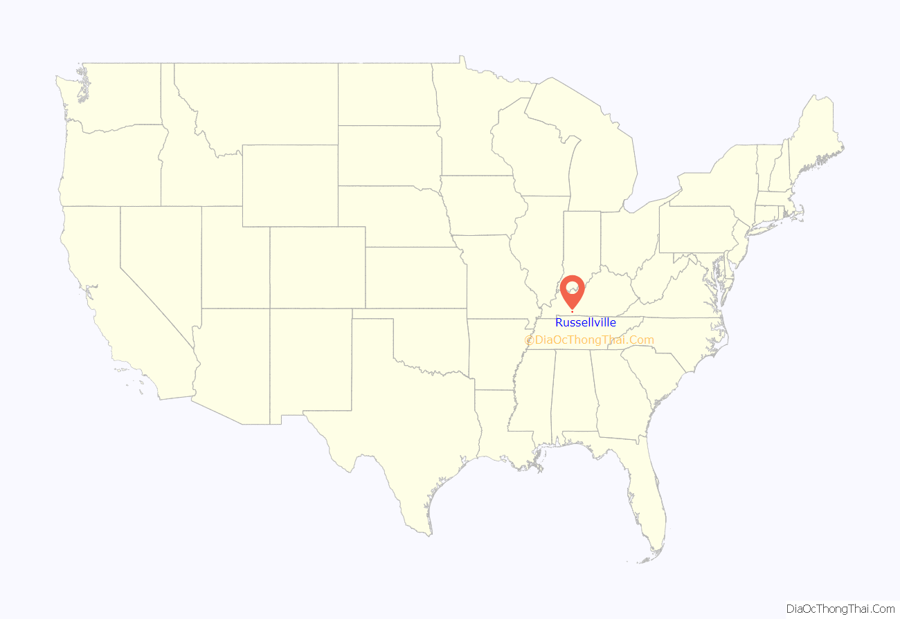
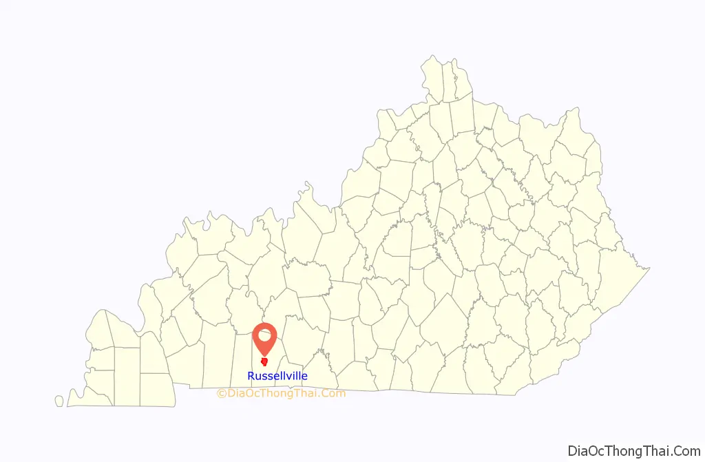
Russellville location map. Where is Russellville city?
History
Local historian Alex C. Finley has claimed the area was first settled by Gasper Butcher, as a frontier settlement of the Transylvania Colony of Virginia, around 1780, but others have questioned this claim. Although the area is known to have been called “Big Boiling Spring”, “Gasper Butcher’s Spring”, and “Butcher’s Station”, W.R. Jillson was unable to find written records of any habitation before 1790. That year William Cook and his wife erected Cook’s Cabin, accompanied by eighteen-year-old William Stewart. Also known as “Cook’s Station”, the community was located about 1 mile (1.6 km) east of the present city. It was renamed “Logan Court House” when it was chosen as the seat of newly formed Logan County in 1792.
General William Russell was given a 2,000-acre (810 ha) grant here for his military service during the American Revolution. He donated part of this property, in 1795, as a platted section for the county seat, known as Logan Court House. The town was renamed in Russell’s honor in 1798. It was formally established by the state legislature on January 15, 1810. It was incorporated as a city on February 19, 1840.
In the early 19th century, the community had leaders who were politically prominent in the state. Four homes in the city still stand that were residences of future governors of Kentucky: John Breathitt, James Morehead, John J. Crittenden, and Charles S. Morehead.
During the Civil War, the Kentucky General Assembly declared its neutrality and declined to secede with the rest of the South. Kentucky was a slave state and Confederate sentiment was strong in the Bluegrass region and the west, but the residents of the mountainous eastern section were mainly small farmers and pro-Union. In the summer of 1861, when Confederate troops had occupied the area, 116 prominent pro-Confederate delegates from 68 counties met as the Russellville Convention and created a rival Confederate government for Kentucky. George W. Johnson was elected as the state’s Confederate governor and the Confederacy controlled more than half the state early in the war. Despite de facto Union control over the rest of Kentucky after 1862, the government was recognized and Kentucky admitted to the Confederacy. Kentucky was represented by the thirteenth star on the Confederate flag. During the war, there were several minor skirmishes in and around Russellville.
After the war, Kentucky struggled for some years with insurgent unrest. A gang made up of the former Confederate guerrillas Cole Younger, George Shepard, and Oliver Shepard, along with Confederate veterans John Jarrett and Arthur McCoy, robbed the Nimrod Long Bank or the Southern Deposit Bank in Russellville on March 20, 1868. Brothers Frank and Jesse James, who later had their own outlaw gang based in western Missouri, may have taken part. A Russellville bank on the city square displays a large mural painted depicting the robbery. A reenactment (called a “play on horseback”) is performed annually during the city’s Tobacco and Heritage Festival.
Several downtown homes have been listed on the National Register of Historic Places including the Victorian Mansion at 224 Cornelius Avenue, a house that boasted the state’s first indoor bathroom.
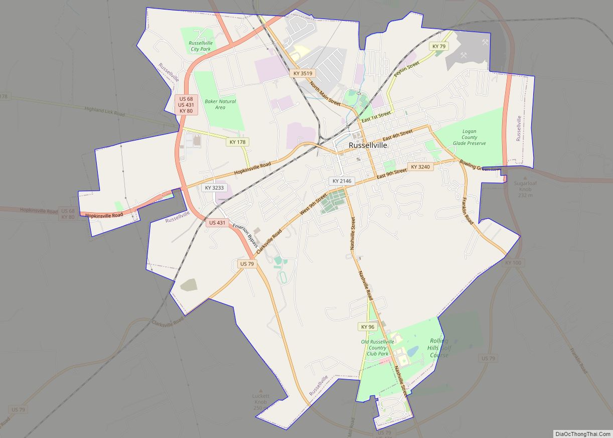
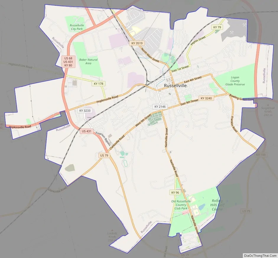
Russellville Road Map
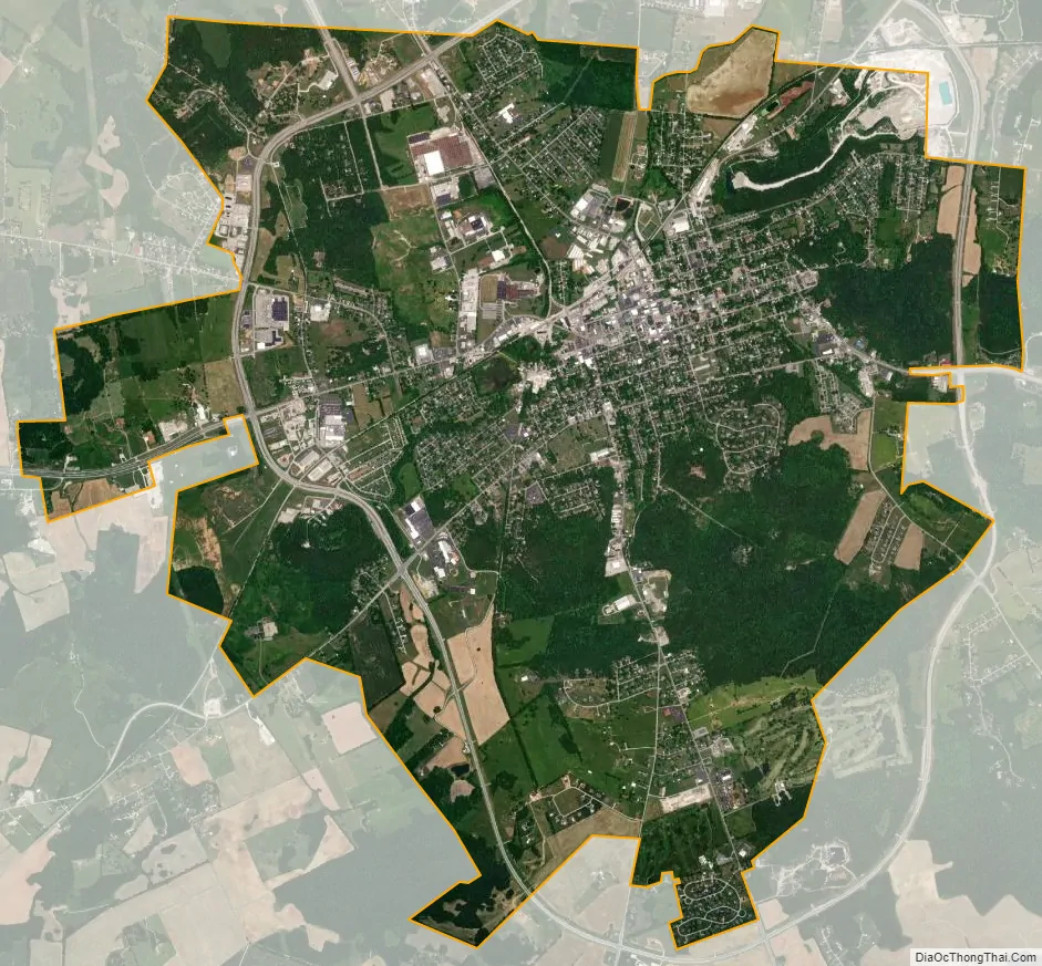
Russellville city Satellite Map
Geography
Russellville is located in central Logan County.
According to the United States Census Bureau, Russellville has a total area of 10.8 square miles (28.1 km), of which 0.02 square miles (0.06 km), or 0.22%, are water. The city is set among small hills in the valley of the Town Branch, a north-flowing tributary of the Mud River and part of the Green River watershed flowing to the Ohio River.
Russellville is served by U.S. Routes 68, 79 and 431. The nearest limited-access highway is the Natcher Parkway (I-165), 24 miles (39 km) to the northeast.
Climate
The climate in this area is characterized by hot, humid summers and generally mild to cool winters. According to the Köppen Climate Classification system, Russellville has a humid subtropical climate, abbreviated “Cfa” on climate maps.
See also
Map of Kentucky State and its subdivision:- Adair
- Allen
- Anderson
- Ballard
- Barren
- Bath
- Bell
- Boone
- Bourbon
- Boyd
- Boyle
- Bracken
- Breathitt
- Breckinridge
- Bullitt
- Butler
- Caldwell
- Calloway
- Campbell
- Carlisle
- Carroll
- Carter
- Casey
- Christian
- Clark
- Clay
- Clinton
- Crittenden
- Cumberland
- Daviess
- Edmonson
- Elliott
- Estill
- Fayette
- Fleming
- Floyd
- Franklin
- Fulton
- Gallatin
- Garrard
- Grant
- Graves
- Grayson
- Green
- Greenup
- Hancock
- Hardin
- Harlan
- Harrison
- Hart
- Henderson
- Henry
- Hickman
- Hopkins
- Jackson
- Jefferson
- Jessamine
- Johnson
- Kenton
- Knott
- Knox
- Larue
- Laurel
- Lawrence
- Lee
- Leslie
- Letcher
- Lewis
- Lincoln
- Livingston
- Logan
- Lyon
- Madison
- Magoffin
- Marion
- Marshall
- Martin
- Mason
- McCracken
- McCreary
- McLean
- Meade
- Menifee
- Mercer
- Metcalfe
- Monroe
- Montgomery
- Morgan
- Muhlenberg
- Nelson
- Nicholas
- Ohio
- Oldham
- Owen
- Owsley
- Pendleton
- Perry
- Pike
- Powell
- Pulaski
- Robertson
- Rockcastle
- Rowan
- Russell
- Scott
- Shelby
- Simpson
- Spencer
- Taylor
- Todd
- Trigg
- Trimble
- Union
- Warren
- Washington
- Wayne
- Webster
- Whitley
- Wolfe
- Woodford
- Alabama
- Alaska
- Arizona
- Arkansas
- California
- Colorado
- Connecticut
- Delaware
- District of Columbia
- Florida
- Georgia
- Hawaii
- Idaho
- Illinois
- Indiana
- Iowa
- Kansas
- Kentucky
- Louisiana
- Maine
- Maryland
- Massachusetts
- Michigan
- Minnesota
- Mississippi
- Missouri
- Montana
- Nebraska
- Nevada
- New Hampshire
- New Jersey
- New Mexico
- New York
- North Carolina
- North Dakota
- Ohio
- Oklahoma
- Oregon
- Pennsylvania
- Rhode Island
- South Carolina
- South Dakota
- Tennessee
- Texas
- Utah
- Vermont
- Virginia
- Washington
- West Virginia
- Wisconsin
- Wyoming