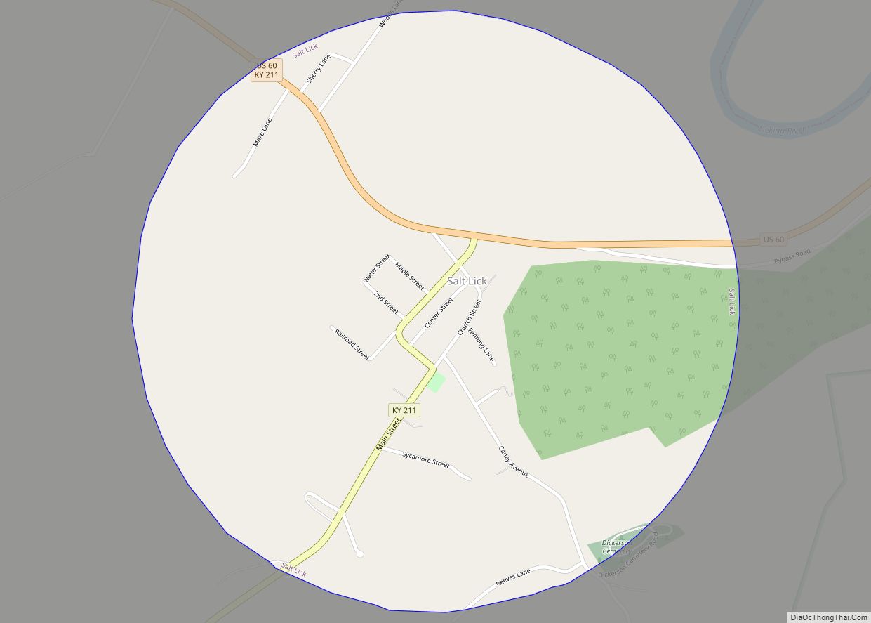
Map of Sadieville city

Map of Sadieville city

Sadieville is a home rule-class city in Scott County, Kentucky, in the United States. The population was 263 during the year 2000 U.S. Census. It is part of the Lexington-Fayette Metropolitan Statistical Area. Sadieville city overview: Name: Sadieville city LSAD Code: 25 LSAD Description: city (suffix) State: Kentucky County: Scott County Incorporated: 1880 Elevation: 833 ft … Read more

Map of Sanders city, Kentucky

Map of Sanders city, Kentucky

Sanders is a home rule-class city in Carroll County, Kentucky, in the United States. The population was 238 as of the 2010 census. Sanders city overview: Name: Sanders city LSAD Code: 25 LSAD Description: city (suffix) State: Kentucky County: Carroll County Incorporated: 1871 Elevation: 486 ft (148 m) Total Area: 0.30 sq mi (0.77 km²) Land Area: 0.29 sq mi (0.76 km²) Water … Read more

Map of Salyersville city

Map of Salyersville city

Salyersville (/ˈsæljərzvəl/) is a home rule-class city on the Licking River in Magoffin County, Kentucky, in the United States. It is the seat of its county. As of the 2020 census, the population was 1,591, down from 1,883 in 2010. Salyersville city overview: Name: Salyersville city LSAD Code: 25 LSAD Description: city (suffix) State: Kentucky … Read more

Map of Salvisa CDP

Map of Salvisa CDP

Salvisa is a census-designated place in Mercer County, Kentucky, United States. Its population was 420 as of the 2010 census. Salvisa is located at the junction of U.S. Route 127 and Kentucky Route 1987, 10.7 miles (17.2 km) north of Harrodsburg. Salvisa has a post office with ZIP code 40372, which opened on April 4, 1825. … Read more

Map of Science Hill city

Map of Science Hill city

Science Hill is a home rule-class city in Pulaski County, Kentucky, in the United States. The population was 693 as of the 2010 U.S. Census. Science Hill city overview: Name: Science Hill city LSAD Code: 25 LSAD Description: city (suffix) State: Kentucky County: Pulaski County Incorporated: 1882 Elevation: 1,132 ft (345 m) Total Area: 0.77 sq mi (1.99 km²) Land … Read more

Map of Sardis city, Kentucky

Map of Sardis city, Kentucky

Sardis is a home rule-class city in Mason and Robertson counties in the U.S. state of Kentucky. The population was 60 as of the 2020 census, down from 103 in 2010. Sardis city overview: Name: Sardis city LSAD Code: 25 LSAD Description: city (suffix) State: Kentucky County: Mason County, Robertson County Elevation: 955 ft (291 m) Total … Read more

Map of Sandy Hook city

Map of Sandy Hook city, Kentucky

Sandy Hook is a home rule-class city beside the Little Sandy River in Elliott County, Kentucky, in the United States. The population was 675 at the 2010 census. Sandy Hook is the county seat of Elliott County, which is a dry county. It is illegal to sell alcohol within the city. The Little Sandy Correctional … Read more

Map of Sedalia CDP, Kentucky

Map of Sedalia CDP, Kentucky

Sedalia is an unincorporated community and census-designated place (CDP) in Graves County, Kentucky, United States. As of the 2010 census the population was 295. Sedalia is considered one of the nicest small “towns” in Graves County. Sedalia is located 7 miles (11 km) south of Mayfield, the Graves County seat. Sedalia CDP overview: Name: Sedalia CDP … Read more

Map of Sebree city

Map of Sebree city

Sebree (/ˈsiːbri/) is a home rule-class city in Webster County, Kentucky, in the United States. The population was 1,603 at the 2010 census. Sebree city overview: Name: Sebree city LSAD Code: 25 LSAD Description: city (suffix) State: Kentucky County: Webster County Incorporated: 1871 Elevation: 387 ft (118 m) Total Area: 2.95 sq mi (7.63 km²) Land Area: 2.94 sq mi (7.61 km²) Water … Read more

Map of Scottsville city, Kentucky

Map of Scottsville city, Kentucky

Scottsville is a home rule-class city in Allen County, Kentucky, in the United States. It is the seat of its county. The population was 4,226 during the 2010 U.S. Census. Scottsville city overview: Name: Scottsville city LSAD Code: 25 LSAD Description: city (suffix) State: Kentucky County: Allen County Incorporated: 1860 Elevation: 761 ft (232 m) Total Area: … Read more

Map of Shelbyville city, Kentucky

Map of Shelbyville city, Kentucky

Shelbyville is a home rule-class city in and the county seat of Shelby County, Kentucky, United States. The population was 17,282 at the 2020 census. Shelbyville city overview: Name: Shelbyville city LSAD Code: 25 LSAD Description: city (suffix) State: Kentucky County: Shelby County Incorporated: 1846 Elevation: 761 ft (232 m) Total Area: 9.13 sq mi (23.64 km²) Land Area: 8.96 sq mi … Read more

Map of Sharpsburg city, Kentucky

Map of Sharpsburg city, Kentucky

Sharpsburg is a home rule-class city in Bath County, Kentucky, in the United States. The population was 323 as of the 2010 U.S. census. It is part of the Mount Sterling micropolitan area. Sharpsburg city overview: Name: Sharpsburg city LSAD Code: 25 LSAD Description: city (suffix) State: Kentucky County: Bath County Incorporated: 1852 Elevation: 1,010 ft … Read more