Salyersville (/ˈsæljərzvəl/) is a home rule-class city on the Licking River in Magoffin County, Kentucky, in the United States. It is the seat of its county. As of the 2020 census, the population was 1,591, down from 1,883 in 2010.
| Name: | Salyersville city |
|---|---|
| LSAD Code: | 25 |
| LSAD Description: | city (suffix) |
| State: | Kentucky |
| County: | Magoffin County |
| Incorporated: | March 2, 1867 |
| Elevation: | 853 ft (260 m) |
| Total Area: | 2.49 sq mi (6.45 km²) |
| Land Area: | 2.47 sq mi (6.39 km²) |
| Water Area: | 0.02 sq mi (0.06 km²) |
| Total Population: | 1,591 |
| Population Density: | 644.39/sq mi (248.85/km²) |
| ZIP code: | 41465 |
| Area code: | 606 |
| FIPS code: | 2168232 |
| GNISfeature ID: | 0502868 |
| Website: | www.cityofsalyersville.org |
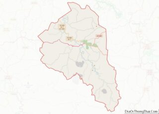
Online Interactive Map
Click on ![]() to view map in "full screen" mode.
to view map in "full screen" mode.
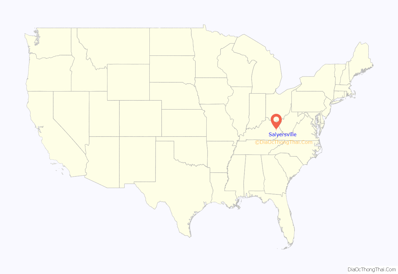
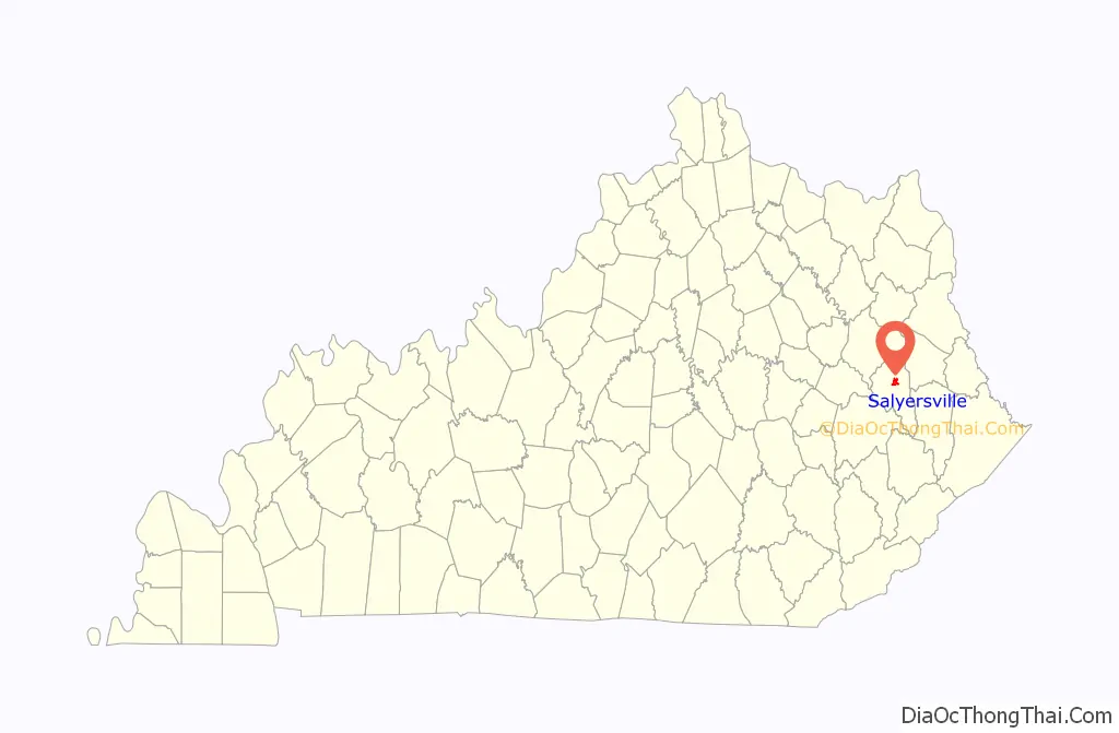
Salyersville location map. Where is Salyersville city?
History
Early history
After an attempt at the first settlement in 1794, the hill overlooking the bend of the Licking River just downriver from the present town was fortified and settled c. 1800 by Archibald Prater, Ebenezer Hanna, and others. Originally known as “Prater’s Fort”, the community had become “Licking Station” by the time of its first post office in 1839.
In 1849, the post office was moved to the community at site of the present city and renamed “Adamsville” after local landowner Uncle William Adams. In addition to his farmland, Adams operated a hotel, a gristmill, a tannery and a blacksmith at the new location.
In 1860, Magoffin County was formed from parts of the surrounding Floyd, Johnson, and Morgan counties. Billy Adams donated land for the platting and establishment of a new county seat, and the community was renamed “Salyersville” in gratitude to State Rep. Samuel Salyer, who sponsored the bill creating the new county. The post office changed the following year.
During the Civil War, Salyersville fell on hard times. Because of its location in the Upper South and its history of settlement by migrants and farmers from Virginia, some residents sided with the Confederacy, despite the general lack of slaves in the area. In 1864, Union forces defeated a Confederate raiding force in the Battle of Salyersville.
Adams gave more land to the city in 1871 for the construction of a proper courthouse. It was completed in 1890 and stood for 67 years before burning to the ground in 1957.
20th century
Salyersville’s first high school, the Magoffin County Institute, was founded in 1908 by A.C. Harlowe.
The Great Depression hit Salyersville hard, since such a high percentage of Salyersville’s citizens were laborers or farmers, who saw prices for crops fall from 40 to 60%. Nearby mining and logging operations also closed or limited production when demand for their products fell sharply. In 1939, the Licking River crested over 25 feet (7.6 m), flooding most of downtown Salyersville and causing extensive property damage.
In 1963, the Bert T. Combs Mountain Parkway was completed, stretching west 76 miles (122 km) from Salyersville to intersect with Interstate 64 at a point just east of Winchester. It enabled more tourists to visit the area, and heritage tourism began to help Salyersville develop a changed economy. The first annual Magoffin County Founder’s Day Festival was held in 1978.
In the winter of 1997, as part of Kentucky’s elk restoration project, Salyersville became one of the locations selected for the release of elk into the wilderness area of its mountains.
21st century
In 2002, the second Magoffin County court house (erected in 1960) was demolished. In its place, a new Justice Center was constructed, which opened in spring 2004. The new Justice Center’s architecture pays tribute to Magoffin County’s original courthouse.
On March 2, 2012, Salyersville was hit by a tornado which caused extensive damage to many businesses and many homes. There were no deaths reported. The tornado was reported an EF3. Kentucky governor Steve Beshear visited Salyersville on March 3 and toured the eastern part of the state after the tornado outbreak.
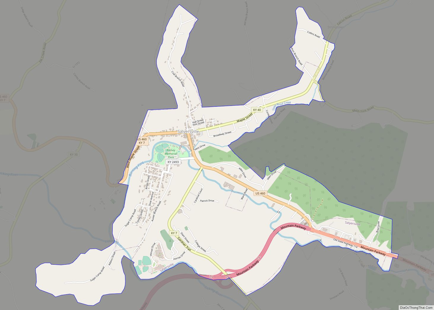
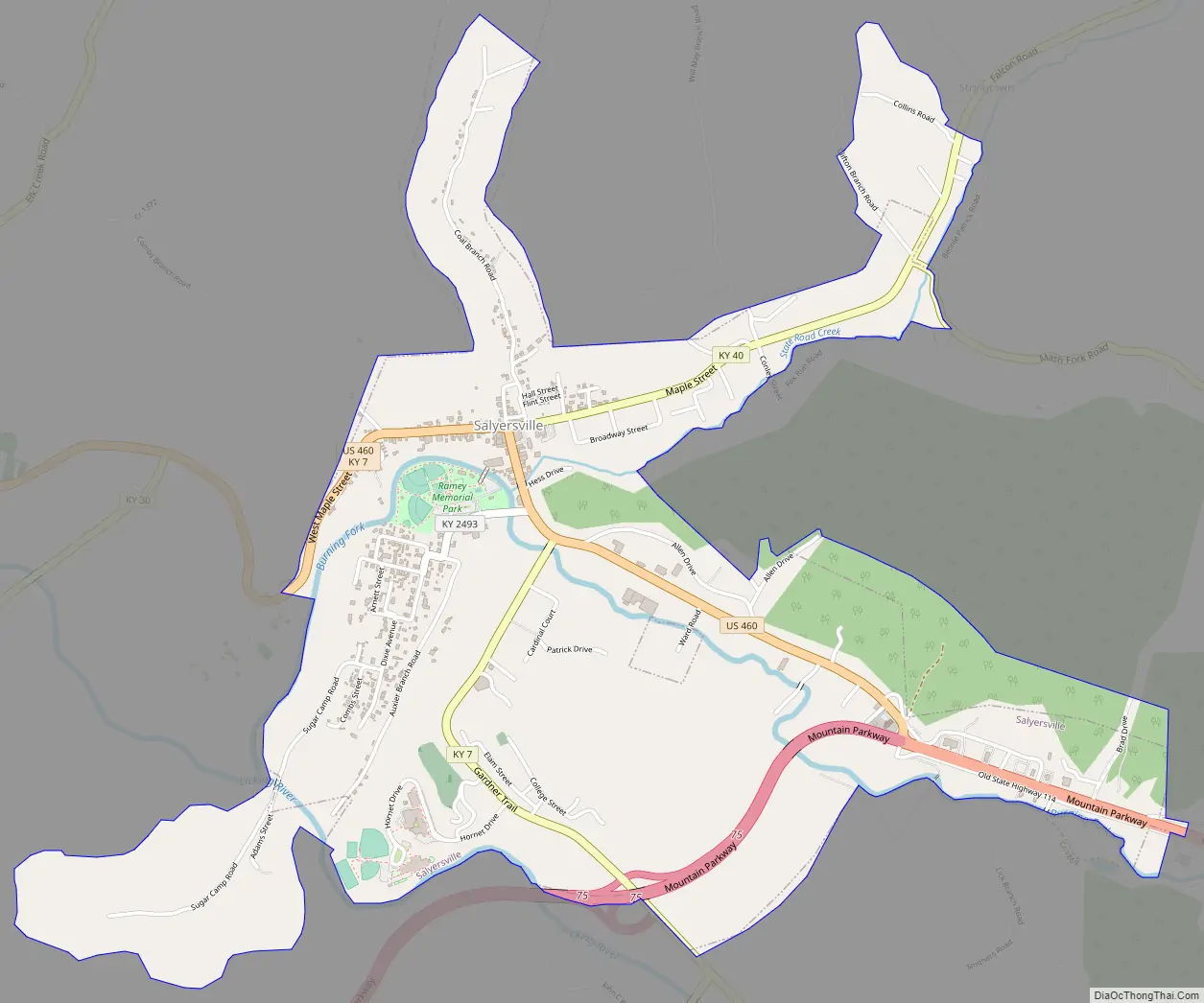
Salyersville Road Map
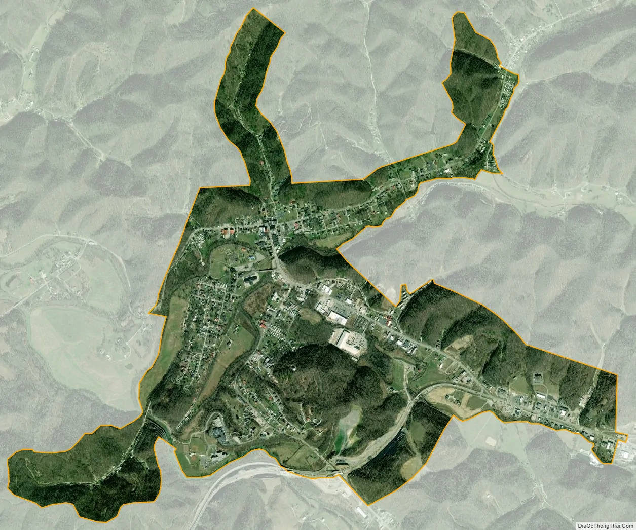
Salyersville city Satellite Map
Geography
Salyersville is in central Magoffin County at 37°44’53” north, 83°3’47” west (37.748171, -83.062984), in the valley of the Licking River, where it is joined from the northeast by the State Road Fork and from the southeast by the Burning Fork. The Licking River is a direct tributary of the Ohio River, joining it at Covington, Kentucky.
U.S. Route 460 passes through the center of Salyersville as Parkway Drive, South Church Street, and West Maple Street. US 460 leads northwest (downriver) 22 miles (35 km) to West Liberty and east 19 miles (31 km) to Paintsville. Kentucky Route 7 passes through downtown Salyersville with US 460 but leads southeast 36 miles (58 km) to Wayland. Kentucky Route 40 runs northeast out of Salyersville and also leads to Paintsville, reaching it in 18 miles (29 km).
According to the United States Census Bureau, the city of Salyersville has a total area of 2.49 square miles (6.45 km), of which 0.02 square miles (0.05 km), or 0.96%, are water.
Climate
The climate in this area is characterized by relatively high temperatures and evenly distributed precipitation throughout the year. The Köppen Climate System describes the weather as humid subtropical, and uses the abbreviation Cfa.
See also
Map of Kentucky State and its subdivision:- Adair
- Allen
- Anderson
- Ballard
- Barren
- Bath
- Bell
- Boone
- Bourbon
- Boyd
- Boyle
- Bracken
- Breathitt
- Breckinridge
- Bullitt
- Butler
- Caldwell
- Calloway
- Campbell
- Carlisle
- Carroll
- Carter
- Casey
- Christian
- Clark
- Clay
- Clinton
- Crittenden
- Cumberland
- Daviess
- Edmonson
- Elliott
- Estill
- Fayette
- Fleming
- Floyd
- Franklin
- Fulton
- Gallatin
- Garrard
- Grant
- Graves
- Grayson
- Green
- Greenup
- Hancock
- Hardin
- Harlan
- Harrison
- Hart
- Henderson
- Henry
- Hickman
- Hopkins
- Jackson
- Jefferson
- Jessamine
- Johnson
- Kenton
- Knott
- Knox
- Larue
- Laurel
- Lawrence
- Lee
- Leslie
- Letcher
- Lewis
- Lincoln
- Livingston
- Logan
- Lyon
- Madison
- Magoffin
- Marion
- Marshall
- Martin
- Mason
- McCracken
- McCreary
- McLean
- Meade
- Menifee
- Mercer
- Metcalfe
- Monroe
- Montgomery
- Morgan
- Muhlenberg
- Nelson
- Nicholas
- Ohio
- Oldham
- Owen
- Owsley
- Pendleton
- Perry
- Pike
- Powell
- Pulaski
- Robertson
- Rockcastle
- Rowan
- Russell
- Scott
- Shelby
- Simpson
- Spencer
- Taylor
- Todd
- Trigg
- Trimble
- Union
- Warren
- Washington
- Wayne
- Webster
- Whitley
- Wolfe
- Woodford
- Alabama
- Alaska
- Arizona
- Arkansas
- California
- Colorado
- Connecticut
- Delaware
- District of Columbia
- Florida
- Georgia
- Hawaii
- Idaho
- Illinois
- Indiana
- Iowa
- Kansas
- Kentucky
- Louisiana
- Maine
- Maryland
- Massachusetts
- Michigan
- Minnesota
- Mississippi
- Missouri
- Montana
- Nebraska
- Nevada
- New Hampshire
- New Jersey
- New Mexico
- New York
- North Carolina
- North Dakota
- Ohio
- Oklahoma
- Oregon
- Pennsylvania
- Rhode Island
- South Carolina
- South Dakota
- Tennessee
- Texas
- Utah
- Vermont
- Virginia
- Washington
- West Virginia
- Wisconsin
- Wyoming