Sandy Hook is a home rule-class city beside the Little Sandy River in Elliott County, Kentucky, in the United States. The population was 675 at the 2010 census.
Sandy Hook is the county seat of Elliott County, which is a dry county. It is illegal to sell alcohol within the city. The Little Sandy Correctional Complex, a medium-security prison operated by the Kentucky Department of Corrections, is located 6 miles (10 km) northeast of Sandy Hook.
| Name: | Sandy Hook city |
|---|---|
| LSAD Code: | 25 |
| LSAD Description: | city (suffix) |
| State: | Kentucky |
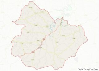
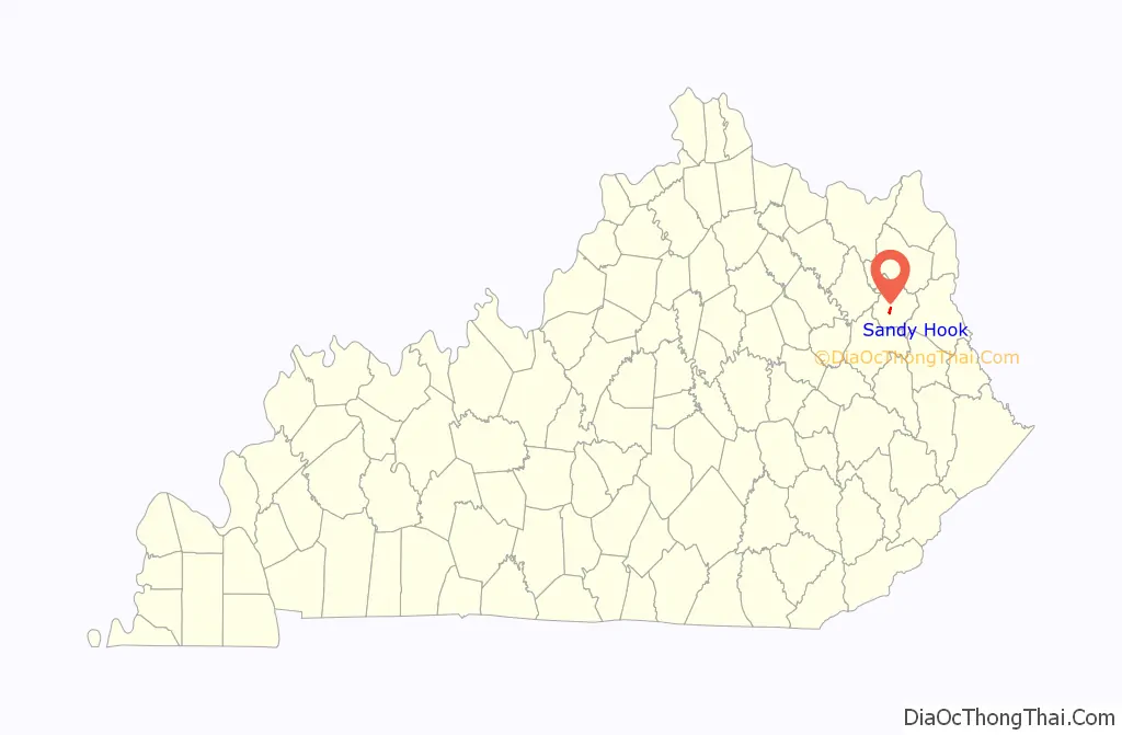
| County: | Elliott County |
| Incorporated: | 1872 |
| Elevation: | 771 ft (235 m) |
| Total Area: | 0.98 sq mi (2.55 km²) |
| Land Area: | 0.98 sq mi (2.54 km²) |
| Water Area: | 0.00 sq mi (0.00 km²) |
| Population Density: | 652.75/sq mi (252.03/km²) |
| ZIP code: | 41171 |
| Area code: | 606 |
| FIPS code: | 2168556 |
| GNISfeature ID: | 0502983 |
Online Interactive Map
Click on ![]() to view map in "full screen" mode.
to view map in "full screen" mode.
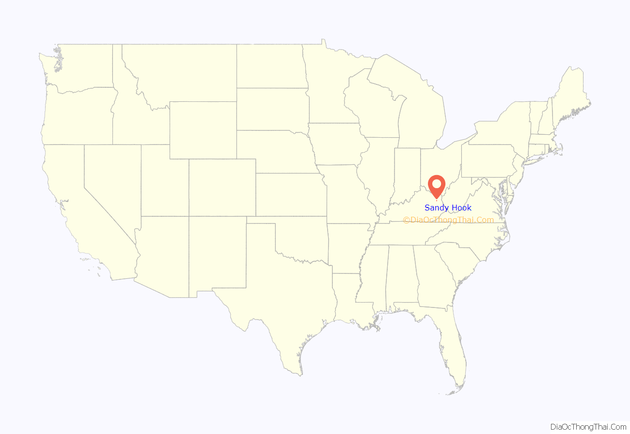
Sandy Hook location map. Where is Sandy Hook city?
History
The head of navigation on the Little Sandy River was first settled in the 1820s. By the time of its establishment by the state legislature in 1850, it was known as “Sandy Hook” for the fishhook-shaped bend in the river at that point.
It was chosen as the seat of the newly established Elliott County over nearby Newfoundland in 1869, owing to a generous donation of land for public buildings by resident James Hunter. In 1872, the city was incorporated as “Martinsburg” in honor of Congressman John P. Martin. The priority of another Martinsburg, Kentucky, meant that the post office (est. 1874) had to be named “Sandy Hook”. The city resumed the name shortly after and was reincorporated as “Sandy Hook” in 1888.
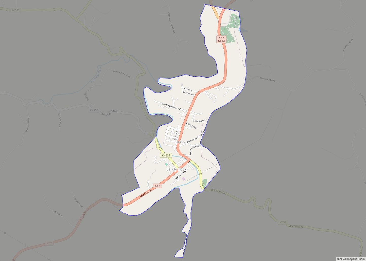
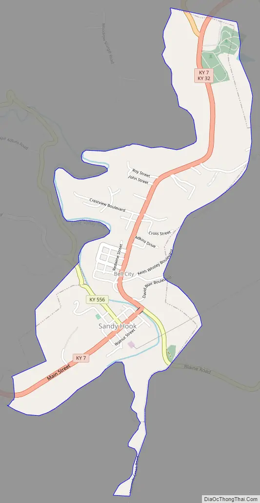
Sandy Hook Road Map
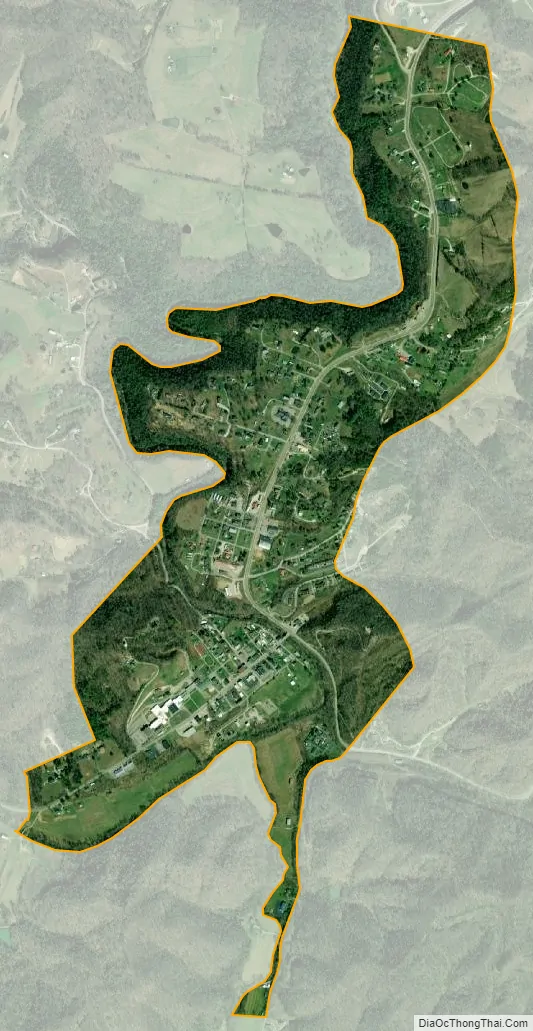
Sandy Hook city Satellite Map
Geography
Sandy Hook is located near the center of Elliott County at 38°5′33″N 83°7′26″W / 38.09250°N 83.12389°W / 38.09250; -83.12389 (38.092447, −83.123918) at the head of navigation on the Little Sandy River in eastern Kentucky. According to the United States Census Bureau, the city has a total area of 0.97 square miles (2.5 km), all land.
Kentucky Route 7 passes through the center of town, leading northeast 22 miles (35 km) to Grayson and southwest 18 miles (29 km) to West Liberty. Kentucky Route 32 leads east 39 miles (63 km) to Louisa and heads north out of Sandy Hook with KY 7, eventually leading northwest 27 miles (43 km) to Morehead.
See also
Map of Kentucky State and its subdivision:- Adair
- Allen
- Anderson
- Ballard
- Barren
- Bath
- Bell
- Boone
- Bourbon
- Boyd
- Boyle
- Bracken
- Breathitt
- Breckinridge
- Bullitt
- Butler
- Caldwell
- Calloway
- Campbell
- Carlisle
- Carroll
- Carter
- Casey
- Christian
- Clark
- Clay
- Clinton
- Crittenden
- Cumberland
- Daviess
- Edmonson
- Elliott
- Estill
- Fayette
- Fleming
- Floyd
- Franklin
- Fulton
- Gallatin
- Garrard
- Grant
- Graves
- Grayson
- Green
- Greenup
- Hancock
- Hardin
- Harlan
- Harrison
- Hart
- Henderson
- Henry
- Hickman
- Hopkins
- Jackson
- Jefferson
- Jessamine
- Johnson
- Kenton
- Knott
- Knox
- Larue
- Laurel
- Lawrence
- Lee
- Leslie
- Letcher
- Lewis
- Lincoln
- Livingston
- Logan
- Lyon
- Madison
- Magoffin
- Marion
- Marshall
- Martin
- Mason
- McCracken
- McCreary
- McLean
- Meade
- Menifee
- Mercer
- Metcalfe
- Monroe
- Montgomery
- Morgan
- Muhlenberg
- Nelson
- Nicholas
- Ohio
- Oldham
- Owen
- Owsley
- Pendleton
- Perry
- Pike
- Powell
- Pulaski
- Robertson
- Rockcastle
- Rowan
- Russell
- Scott
- Shelby
- Simpson
- Spencer
- Taylor
- Todd
- Trigg
- Trimble
- Union
- Warren
- Washington
- Wayne
- Webster
- Whitley
- Wolfe
- Woodford
- Alabama
- Alaska
- Arizona
- Arkansas
- California
- Colorado
- Connecticut
- Delaware
- District of Columbia
- Florida
- Georgia
- Hawaii
- Idaho
- Illinois
- Indiana
- Iowa
- Kansas
- Kentucky
- Louisiana
- Maine
- Maryland
- Massachusetts
- Michigan
- Minnesota
- Mississippi
- Missouri
- Montana
- Nebraska
- Nevada
- New Hampshire
- New Jersey
- New Mexico
- New York
- North Carolina
- North Dakota
- Ohio
- Oklahoma
- Oregon
- Pennsylvania
- Rhode Island
- South Carolina
- South Dakota
- Tennessee
- Texas
- Utah
- Vermont
- Virginia
- Washington
- West Virginia
- Wisconsin
- Wyoming