Map of Summersville CDP

Map of Summersville CDP, Kentucky

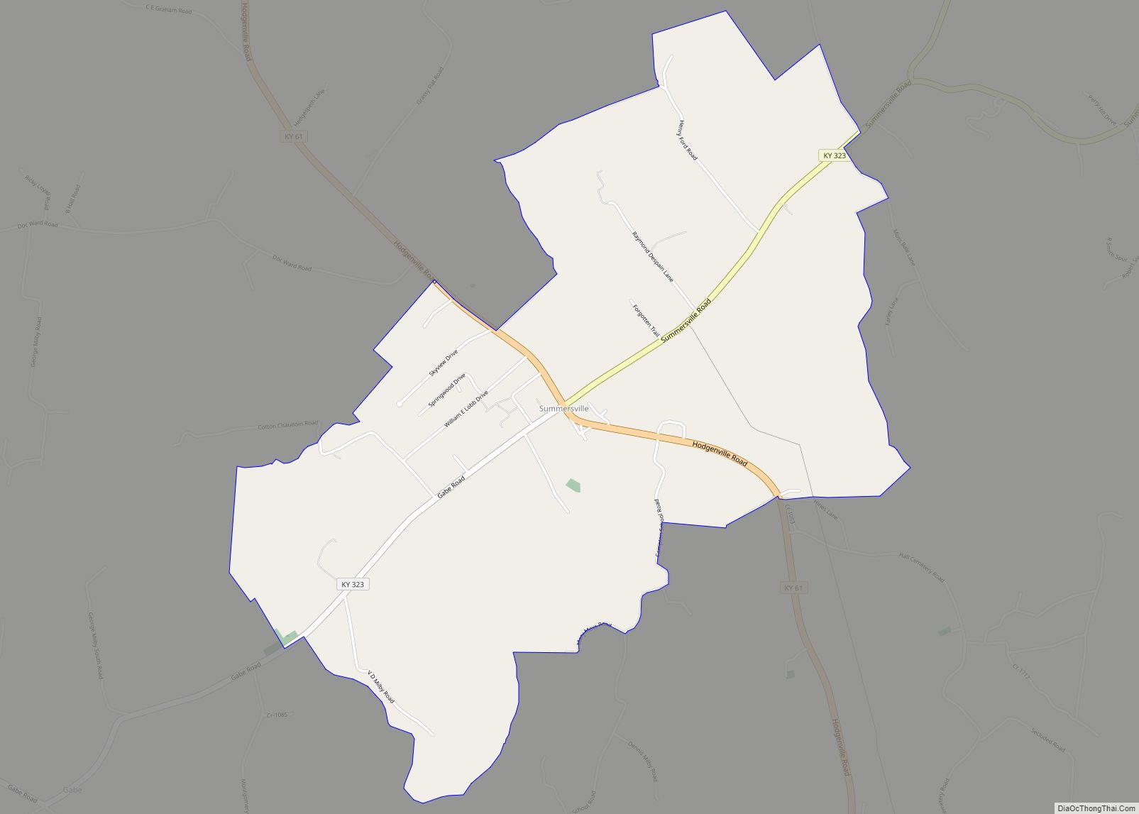
Summersville is a census-designated place (CDP) and unincorporated community in Green County, Kentucky, United States. As of the 2010 census it had a population of 568. It lies along Routes 61 and 323, 6 miles (10 km) northwest of the city of Greensburg, the county seat of Green County. Its elevation is 804 feet (245 m). It … Read more

Map of Ten Broeck city

Map of Ten Broeck city

Ten Broeck is a home rule-class city in Jefferson County, Kentucky, United States. The population was 103 at the 2010 census. Ten Broeck city overview: Name: Ten Broeck city LSAD Code: 25 LSAD Description: city (suffix) State: Kentucky County: Jefferson County Elevation: 614 ft (187 m) Total Area: 0.22 sq mi (0.57 km²) Land Area: 0.22 sq mi (0.56 km²) Water Area: 0.00 sq mi … Read more

Map of Taylorsville city, Kentucky

Map of Taylorsville city, Kentucky

Taylorsville is a home rule-class city in Spencer County, Kentucky, United States. It is the county seat of Spencer County. As of the 2010 census, the city had a total population of 763 and was estimated at 1,275 in 2018. It was incorporated in 1829. Taylorsville city overview: Name: Taylorsville city LSAD Code: 25 LSAD … Read more

Map of Taylor Mill city

Map of Taylor Mill city

Taylor Mill is a home rule-class city in Kenton County, Kentucky, in the United States. The population was 6,604 at the 2010 census, down from 6,913 at the 2000 census. It is the hometown of country music singer Carly Pearce. Taylor Mill city overview: Name: Taylor Mill city LSAD Code: 25 LSAD Description: city (suffix) … Read more

Map of Tompkinsville city

Map of Tompkinsville city

Tompkinsville is a home rule-class city in and the county seat of Monroe County, Kentucky, United States. The population was 2,309 at the 2020 census. The city was named after Vice President Daniel D. Tompkins who served under President James Monroe, for whom the county was named. Tompkinsville city overview: Name: Tompkinsville city LSAD Code: … Read more

Map of Tolu CDP

Map of Tolu CDP

Tolu is an unincorporated community and census-designated place (CDP) in Crittenden County, Kentucky, United States. As of the 2010 census it had a population of 88. It is located along Kentucky Route 135 near the Ohio River. It is 14 miles (23 km) northwest of Marion, the county seat. Tolu CDP overview: Name: Tolu CDP LSAD … Read more

Map of Thornhill city

Map of Thornhill city

Thornhill is a home rule-class city in Jefferson County, Kentucky, United States. The population was 178 at the 2010 census. Thornhill city overview: Name: Thornhill city LSAD Code: 25 LSAD Description: city (suffix) State: Kentucky County: Jefferson County Elevation: 571 ft (174 m) Total Area: 0.04 sq mi (0.12 km²) Land Area: 0.04 sq mi (0.12 km²) Water Area: 0.00 sq mi (0.00 km²) Total Population: … Read more

Map of Uniontown city, Kentucky

Map of Uniontown city, Kentucky

Uniontown is a home rule-class city in Union County, Kentucky, United States. The population was 1,002 at the 2010 census. The John T. Myers Locks and Dam, once known as Uniontown Locks and Dam, is located downriver 3½ miles. Uniontown city overview: Name: Uniontown city LSAD Code: 25 LSAD Description: city (suffix) State: Kentucky County: … Read more

Map of Union city, Kentucky

Map of Union city, Kentucky

Union is a home rule-class city in Boone County, Kentucky, United States. The population was 7,416 as of the 2020 United States Census. The area was rural until residential growth in the 1990s and 2000s. Union is located 17 miles (27 km) southwest of Cincinnati, Ohio. Union city overview: Name: Union city LSAD Code: 25 LSAD … Read more

Map of Trenton city, Kentucky

Map of Trenton city, Kentucky

Trenton is a city in Todd County, Kentucky, United States. The population was 384 at the 2010 census. Trenton city overview: Name: Trenton city LSAD Code: 25 LSAD Description: city (suffix) State: Kentucky County: Todd County Elevation: 587 ft (179 m) Total Area: 0.57 sq mi (1.48 km²) Land Area: 0.57 sq mi (1.47 km²) Water Area: 0.00 sq mi (0.00 km²) Total Population: 326 Population … Read more

Map of Utica CDP, Kentucky

Map of Utica CDP, Kentucky

Utica is a small rural unincorporated community and census-designated place in Daviess County, Kentucky, in the United States. U.S. Route 431 passes through the community, leading 12 miles (19 km) north to Owensboro and 24 miles (39 km) south to Central City. Utica has a post office, a fire station, a cemetery, several churches, a gas station, … Read more

Map of Upton city

Map of Upton city, Kentucky

Upton is a home rule-class city in Hardin and LaRue counties in the U.S. state of Kentucky. The population was 683 at the 2010 census. Its entire area is included in the Elizabethtown–Fort Knox Metropolitan Statistical Area. Upton city overview: Name: Upton city LSAD Code: 25 LSAD Description: city (suffix) State: Kentucky County: Hardin County, … Read more