Uniontown is a home rule-class city in Union County, Kentucky, United States. The population was 1,002 at the 2010 census. The John T. Myers Locks and Dam, once known as Uniontown Locks and Dam, is located downriver 3½ miles.
| Name: | Uniontown city |
|---|---|
| LSAD Code: | 25 |
| LSAD Description: | city (suffix) |
| State: | Kentucky |
| County: | Union County |
| Elevation: | 364 ft (111 m) |
| Total Area: | 0.94 sq mi (2.44 km²) |
| Land Area: | 0.85 sq mi (2.20 km²) |
| Water Area: | 0.09 sq mi (0.24 km²) |
| Total Population: | 929 |
| Population Density: | 1,092.94/sq mi (421.83/km²) |
| ZIP code: | 42461 |
| Area code: | 270 |
| FIPS code: | 2178492 |
| GNISfeature ID: | 0505827 |
Online Interactive Map
Click on ![]() to view map in "full screen" mode.
to view map in "full screen" mode.
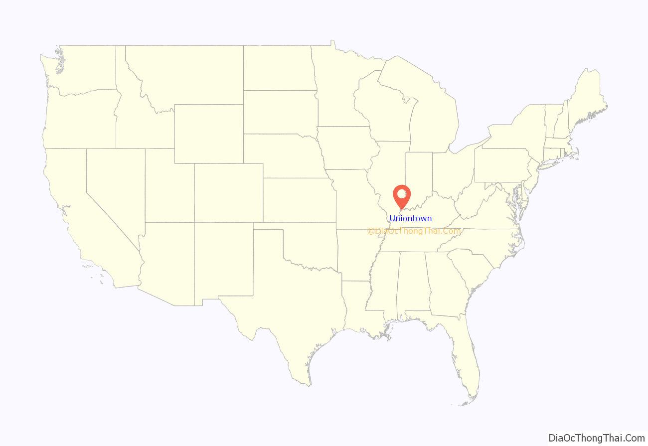
Uniontown location map. Where is Uniontown city?
History
The name “Uniontown” derives from the fact that the city was formed by merging the towns of Francisburg and Locust Port in 1840. A post office with the new name opened in 1842.
The Uniontown levee, built in response to the Ohio River flood of 1937, was completed in 1951.
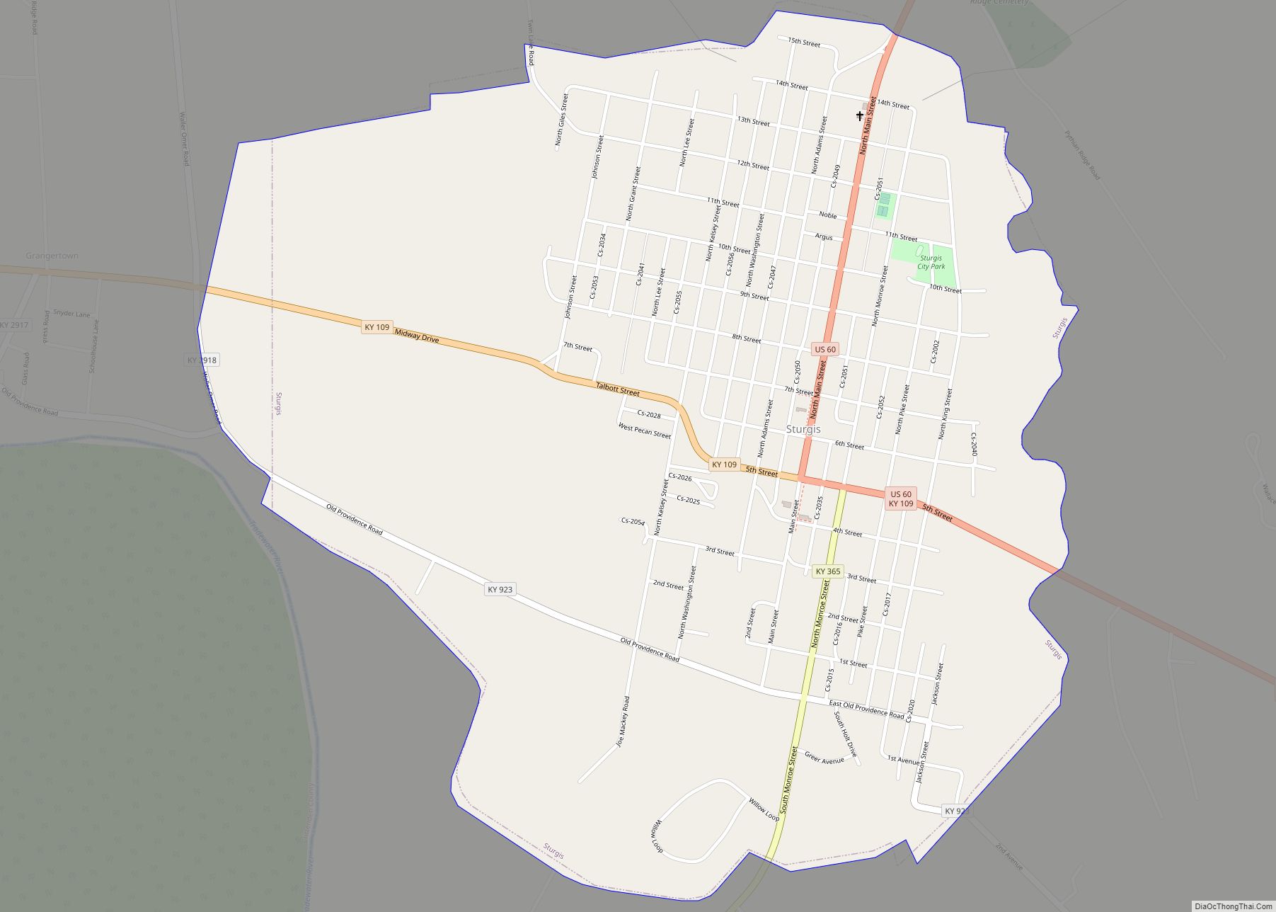
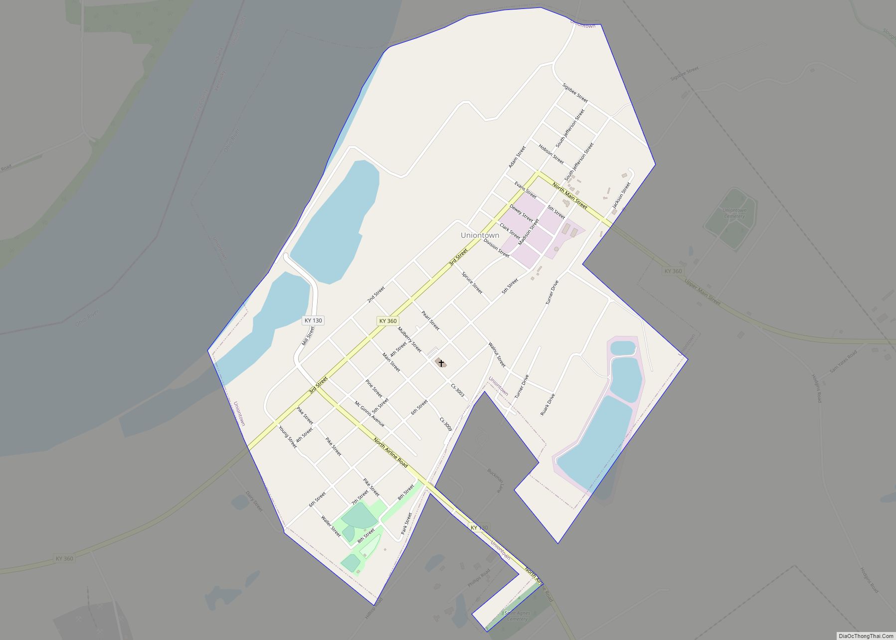
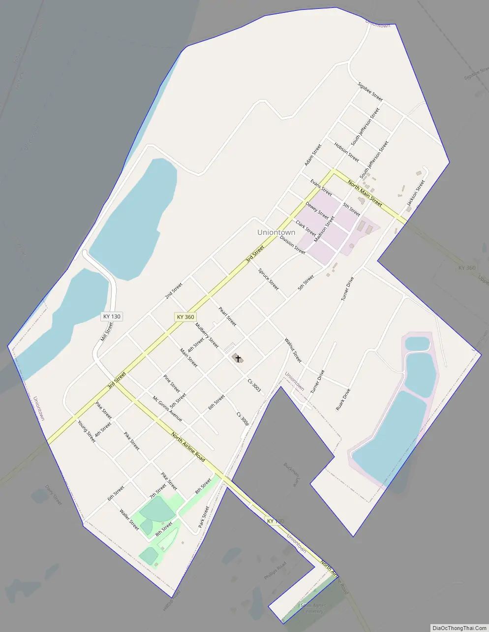
Uniontown Road Map
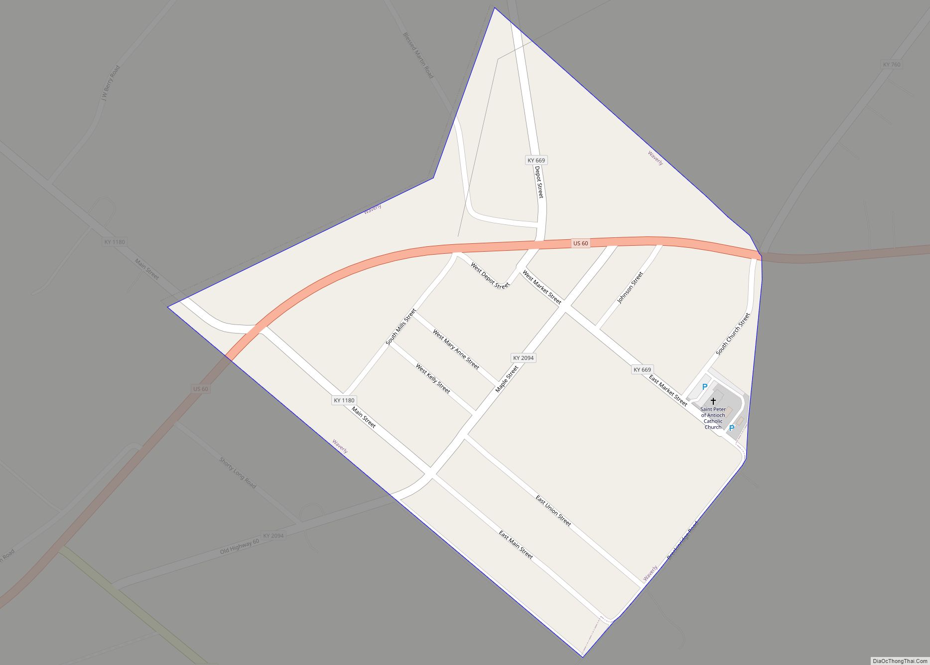
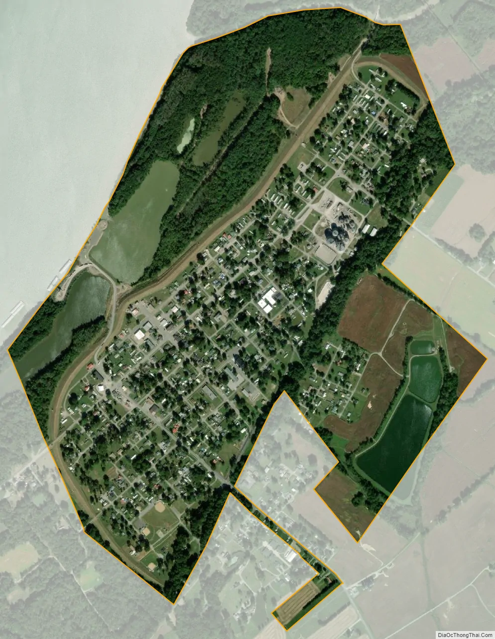
Uniontown city Satellite Map
Geography
Uniontown is located at 37°46′20″N 87°55′55″W / 37.77222°N 87.93194°W / 37.77222; -87.93194 (37.772281, -87.931890). The city is situated along the Ohio River, at its confluence with Highland Creek. A levee protects the city from flooding along the river up to a river level of 66 feet (20 m). Kentucky Route 130 and Kentucky Route 360 intersect in downtown Uniontown. KY 130 crosses the levee, connecting the city with the Uniontown Ferry Boat Dock along the river.
According to the United States Census Bureau, the city has a total area of 1.0 square mile (2.6 km), of which 0.9 square miles (2.3 km) is land and 0.1 square miles (0.26 km) (7.29%) is water.
See also
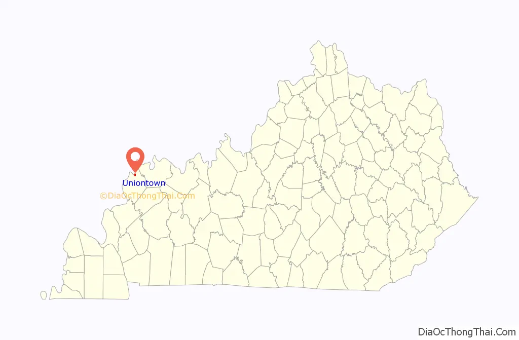
Map of Kentucky State and its subdivision:- Adair
- Allen
- Anderson
- Ballard
- Barren
- Bath
- Bell
- Boone
- Bourbon
- Boyd
- Boyle
- Bracken
- Breathitt
- Breckinridge
- Bullitt
- Butler
- Caldwell
- Calloway
- Campbell
- Carlisle
- Carroll
- Carter
- Casey
- Christian
- Clark
- Clay
- Clinton
- Crittenden
- Cumberland
- Daviess
- Edmonson
- Elliott
- Estill
- Fayette
- Fleming
- Floyd
- Franklin
- Fulton
- Gallatin
- Garrard
- Grant
- Graves
- Grayson
- Green
- Greenup
- Hancock
- Hardin
- Harlan
- Harrison
- Hart
- Henderson
- Henry
- Hickman
- Hopkins
- Jackson
- Jefferson
- Jessamine
- Johnson
- Kenton
- Knott
- Knox
- Larue
- Laurel
- Lawrence
- Lee
- Leslie
- Letcher
- Lewis
- Lincoln
- Livingston
- Logan
- Lyon
- Madison
- Magoffin
- Marion
- Marshall
- Martin
- Mason
- McCracken
- McCreary
- McLean
- Meade
- Menifee
- Mercer
- Metcalfe
- Monroe
- Montgomery
- Morgan
- Muhlenberg
- Nelson
- Nicholas
- Ohio
- Oldham
- Owen
- Owsley
- Pendleton
- Perry
- Pike
- Powell
- Pulaski
- Robertson
- Rockcastle
- Rowan
- Russell
- Scott
- Shelby
- Simpson
- Spencer
- Taylor
- Todd
- Trigg
- Trimble
- Union
- Warren
- Washington
- Wayne
- Webster
- Whitley
- Wolfe
- Woodford
- Alabama
- Alaska
- Arizona
- Arkansas
- California
- Colorado
- Connecticut
- Delaware
- District of Columbia
- Florida
- Georgia
- Hawaii
- Idaho
- Illinois
- Indiana
- Iowa
- Kansas
- Kentucky
- Louisiana
- Maine
- Maryland
- Massachusetts
- Michigan
- Minnesota
- Mississippi
- Missouri
- Montana
- Nebraska
- Nevada
- New Hampshire
- New Jersey
- New Mexico
- New York
- North Carolina
- North Dakota
- Ohio
- Oklahoma
- Oregon
- Pennsylvania
- Rhode Island
- South Carolina
- South Dakota
- Tennessee
- Texas
- Utah
- Vermont
- Virginia
- Washington
- West Virginia
- Wisconsin
- Wyoming