Map of Wheelwright city

Map of Wheelwright city

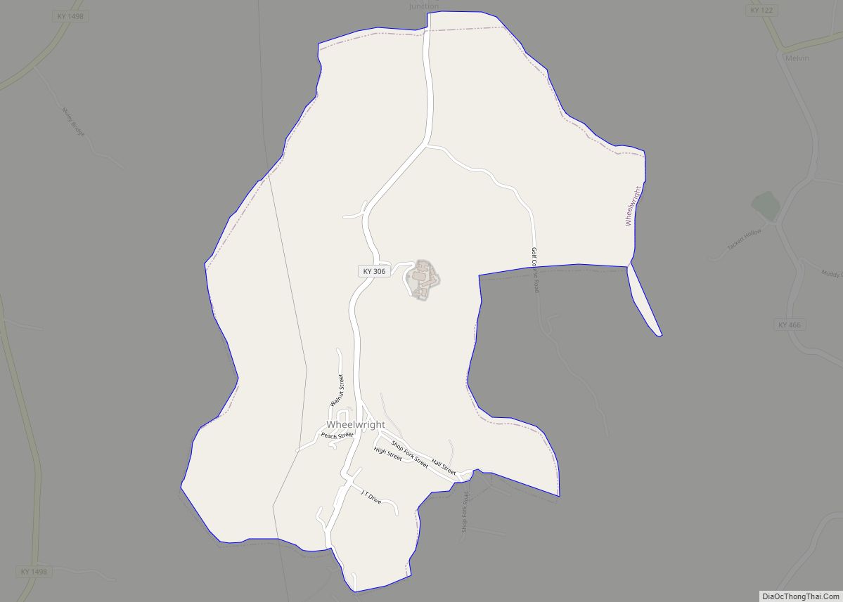
Wheelwright is a home rule-class city in Floyd County, Kentucky, United States. The population was 780 at the 2010 census, down from 1,042 in 2000. Wheelwright city overview: Name: Wheelwright city LSAD Code: 25 LSAD Description: city (suffix) State: Kentucky County: Floyd County Incorporated: February 6, 1917 Elevation: 1,138 ft (347 m) Total Area: 1.76 sq mi (4.57 km²) Land … Read more

Map of Whitley City CDP

Map of Whitley City CDP

Whitley City is an unincorporated community and census-designated place (CDP) in McCreary County, Kentucky, United States. The population was 968 at the 2020 census, down from 1,170 in 2010. It is the county seat of McCreary County. Whitley City is one of two unincorporated county seats in Kentucky (the other being Burlington in Boone County). … Read more

Map of Whitesville city

Map of Whitesville city, Kentucky

Whitesville is a home rule-class city in Daviess County, Kentucky, United States. The population was 552 at the 2010 census, down from 632 at the 2000 census. It is included in the Owensboro, Kentucky Metropolitan Statistical Area. The city was founded in 1844 by Dr. William White, and named for him. The current mayor of … Read more

Map of Wickliffe city

Map of Wickliffe city, Kentucky

Wickliffe is a home rule-class city in Ballard County, Kentucky, United States. The population was 688 at the 2010 census. It is the county seat of Ballard County. Wickliffe is part of the Paducah, KY-IL Micropolitan Statistical Area. Wickliffe city overview: Name: Wickliffe city LSAD Code: 25 LSAD Description: city (suffix) State: Kentucky County: Ballard … Read more

Map of Williamsburg city, Kentucky

Map of Williamsburg city, Kentucky

Williamsburg is a home rule-class city in and the county seat of Whitley County, on the southeastern border of Kentucky, United States. The population was 5,245 at the 2010 census. Developed along the Cumberland River, the city was founded in 1818 and named after William Whitley. Williamsburg city overview: Name: Williamsburg city LSAD Code: 25 … Read more

Map of Wildwood city, Kentucky

Map of Wildwood city, Kentucky

Wildwood is a home rule-class city in Jefferson County, Kentucky, United States. The population was 261 at the 2010 census. Wildwood city overview: Name: Wildwood city LSAD Code: 25 LSAD Description: city (suffix) State: Kentucky County: Jefferson County Elevation: 656 ft (200 m) Total Area: 0.07 sq mi (0.19 km²) Land Area: 0.07 sq mi (0.19 km²) Water Area: 0.00 sq mi (0.00 km²) Total Population: … Read more

Map of Wilder city, Kentucky

Map of Wilder city, Kentucky

Wilder is a home rule-class city in Campbell County, Kentucky, United States. The population was 3,035 at the 2010 census. It is part of the Cincinnati-Northern Kentucky metropolitan area. Wilder city overview: Name: Wilder city LSAD Code: 25 LSAD Description: city (suffix) State: Kentucky County: Campbell County Elevation: 541 ft (165 m) Total Area: 3.75 sq mi (9.72 km²) Land … Read more

Map of Wilmore city, Kentucky

Map of Wilmore city, Kentucky

Wilmore is a home rule-class city in Jessamine County, Kentucky, United States. The population was 5,999 at the 2020 census. It is part of the Lexington–Fayette Metropolitan Statistical Area. According to the United States Census Bureau, the city has a total area of 2.6 square miles (6.7 km), all of it land. Wilmore city overview: Name: … Read more

Map of Willisburg city

Map of Willisburg city

Willisburg is a home rule-class city in Washington County, Kentucky, United States. The population was 304 at the 2000 census. The center of population of Kentucky is located in Willisburg. Willisburg city overview: Name: Willisburg city LSAD Code: 25 LSAD Description: city (suffix) State: Kentucky County: Washington County Elevation: 869 ft (265 m) Total Area: 0.70 sq mi (1.80 km²) … Read more

Map of Williamstown city

Map of Williamstown city, Kentucky

Williamstown is a home-rule-class city in Grant and Pendleton counties in the U.S. state of Kentucky. The population was 3,925 at the 2010 census, up from 3,227 as of the 2000 census. It is the county seat of Grant County. Williamstown city overview: Name: Williamstown city LSAD Code: 25 LSAD Description: city (suffix) State: Kentucky … Read more

Map of Wingo city

Map of Wingo city

Wingo is a home rule-class city in Graves County, Kentucky, United States. The population was 632 at the 2010 census. Wingo city overview: Name: Wingo city LSAD Code: 25 LSAD Description: city (suffix) State: Kentucky County: Graves County Elevation: 502 ft (153 m) Total Area: 0.98 sq mi (2.54 km²) Land Area: 0.97 sq mi (2.53 km²) Water Area: 0.01 sq mi (0.02 km²) Total Population: … Read more

Map of Windy Hills city

Map of Windy Hills city

Windy Hills is a home rule-class city, incorporated in 1952, in eastern Jefferson County, Kentucky, United States. The population was 2,385 at the 2010 census. Windy Hills city overview: Name: Windy Hills city LSAD Code: 25 LSAD Description: city (suffix) State: Kentucky County: Jefferson County Elevation: 581 ft (177 m) Total Area: 0.92 sq mi (2.39 km²) Land Area: 0.92 sq mi … Read more