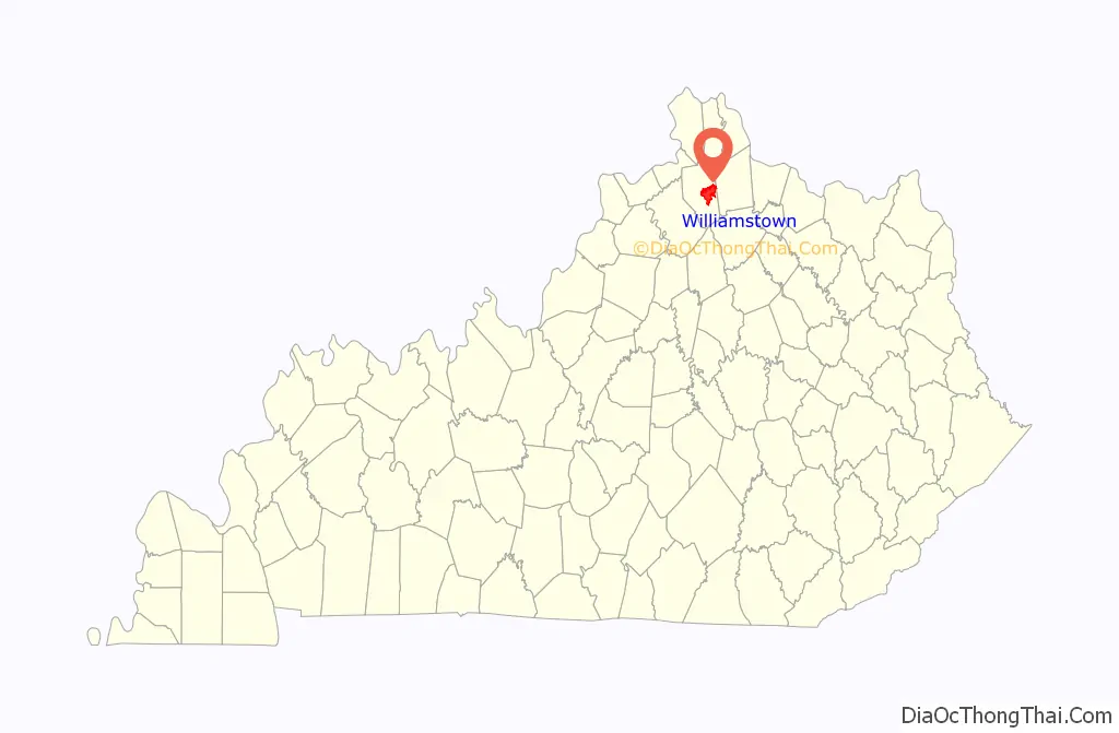
Williamstown is a home-rule-class city in Grant and Pendleton counties in the U.S. state of Kentucky. The population was 3,925 at the 2010 census, up from 3,227 as of the 2000 census. It is the county seat of Grant County.
| Name: | Williamstown city |
|---|---|
| LSAD Code: | 25 |
| LSAD Description: | city (suffix) |
| State: | Kentucky |
| County: | Grant County, Pendleton County |
| Elevation: | 971 ft (296 m) |
| Total Area: | 17.23 sq mi (44.64 km²) |
| Land Area: | 16.71 sq mi (43.27 km²) |
| Water Area: | 0.53 sq mi (1.37 km²) |
| Total Population: | 3,894 |
| Population Density: | 233.06/sq mi (89.99/km²) |
| ZIP code: | 41097 |
| Area code: | 859 |
| FIPS code: | 2183406 |
| GNISfeature ID: | 0506837 |
| Website: | wtownky.org |
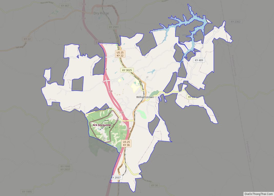
Online Interactive Map
Click on ![]() to view map in "full screen" mode.
to view map in "full screen" mode.
Williamstown location map. Where is Williamstown city?

History
When Grant County was formed in 1820, William Arnold offered land for the county seat. Arnold was a veteran of the Revolutionary War and settled in the area in 1795. The town built there was named after him when it incorporated in 1825.
The county grew slowly, reaching a population of just 281 by 1870. The Cincinnati Southern Railway was built through the county in 1877, and Williamstown Lake was created in 1957. Finally, Interstate 75 was built in the 1960s.
Since 2016, Williamstown is home to Ark Encounter theme park with its newly built Noah’s Ark.
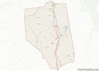
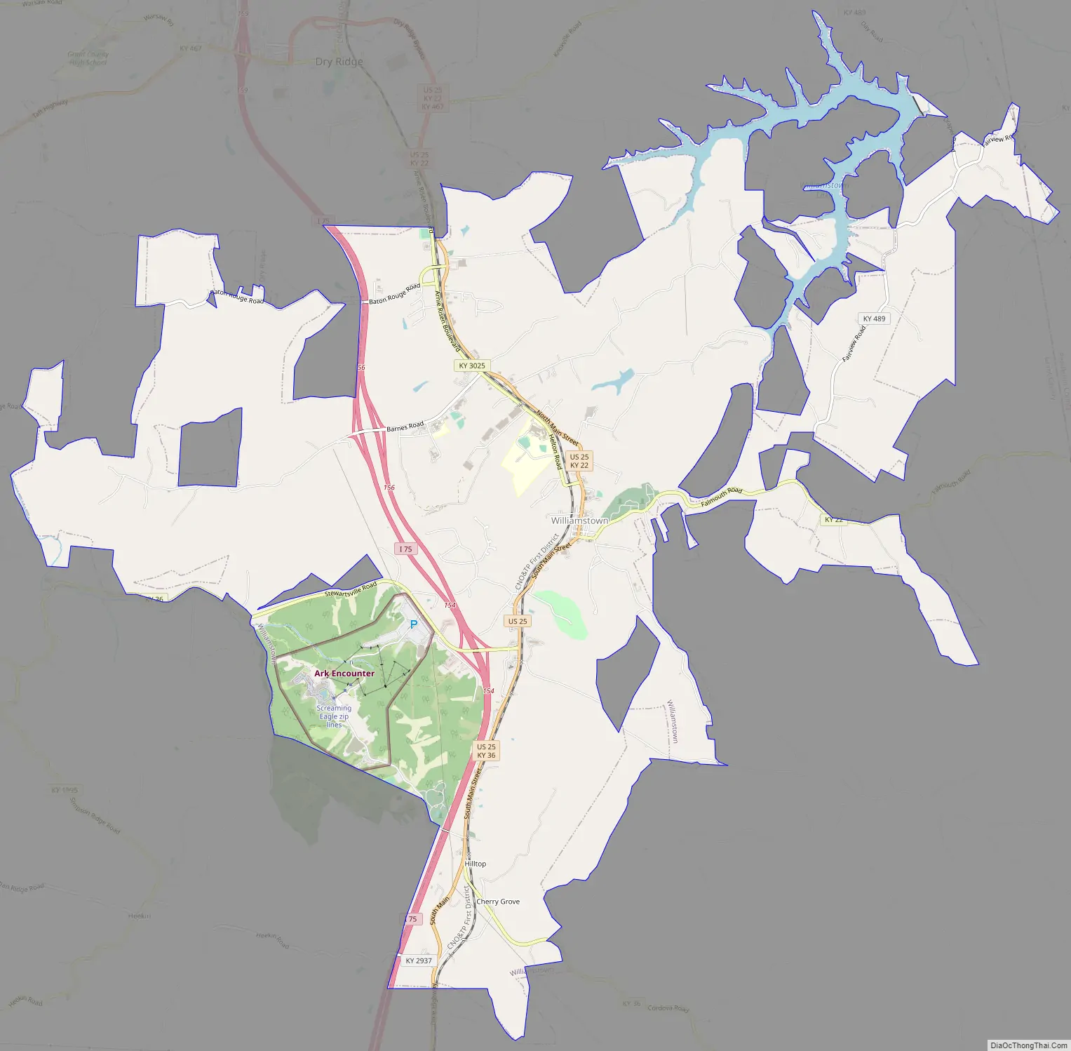
Williamstown Road Map
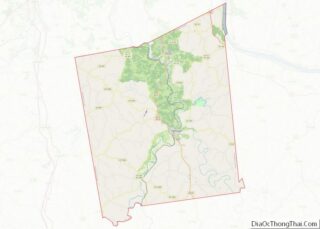
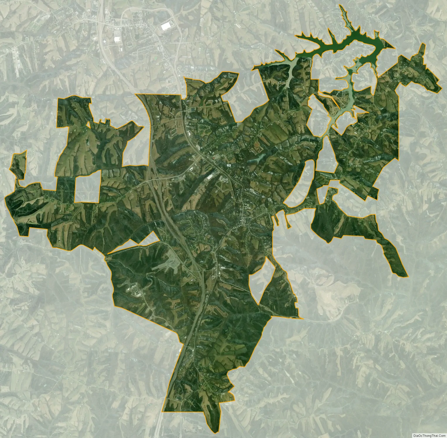
Williamstown city Satellite Map
Geography
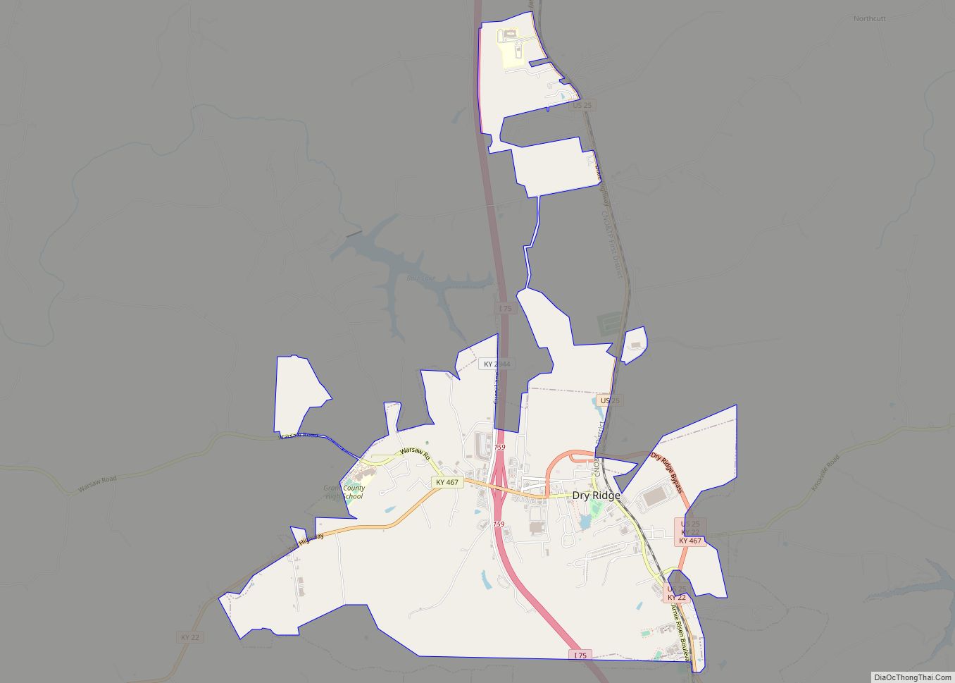
Williamstown is located east of the center of Grant County at 38°38′28″N 84°33′39″W / 38.64111°N 84.56083°W / 38.64111; -84.56083 (38.641184, -84.560920). It is bordered to the north by the city of Dry Ridge. The city limits extend northeast 5 miles (8 km) along Falmouth Road and East Fairview Road to slightly enter Pendleton County. Interstate 75 passes through the west side of the city, with access from Exits 154 and 156. I-75 leads north 37 miles (60 km) to Cincinnati and south 45 miles (72 km) to Lexington. U.S. Route 25 passes through the center of Williamstown as Main Street; US 25 leads north 11 miles (18 km) to Crittenden and south the same distance to Corinth.
According to the United States Census Bureau, Williamstown has a total area of 16.9 square miles (43.9 km), of which 16.4 square miles (42.6 km) is land and 0.54 square miles (1.4 km), or 3.13%, is water. Williamstown Lake, a reservoir on the South Fork of Grassy Creek, is in the northeast part of the city.
Climate
The climate in this area is characterized by hot, humid summers and generally mild to cool winters. According to the Köppen Climate Classification system, Williamstown has a humid subtropical climate, abbreviated “Cfa” on climate maps.
See also
Map of Kentucky State and its subdivision:- Adair
- Allen
- Anderson
- Ballard
- Barren
- Bath
- Bell
- Boone
- Bourbon
- Boyd
- Boyle
- Bracken
- Breathitt
- Breckinridge
- Bullitt
- Butler
- Caldwell
- Calloway
- Campbell
- Carlisle
- Carroll
- Carter
- Casey
- Christian
- Clark
- Clay
- Clinton
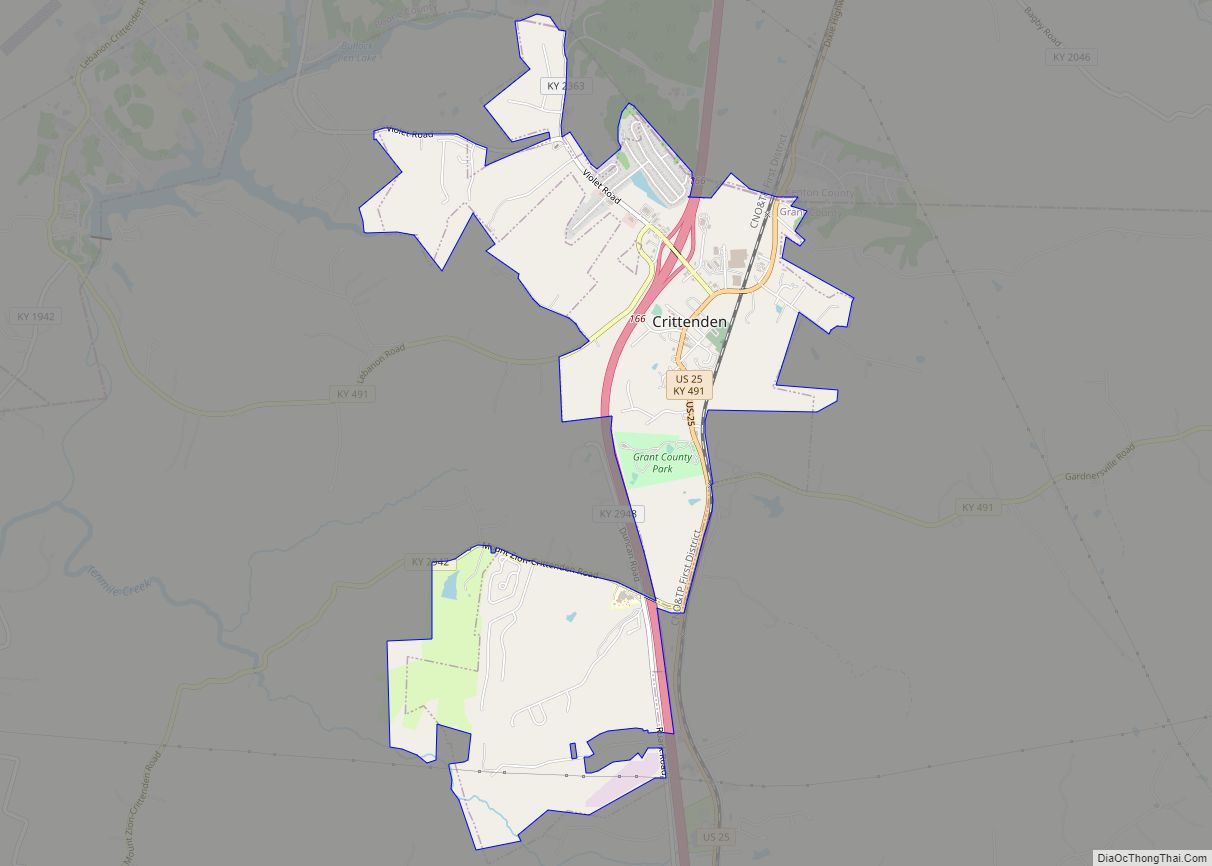
- Crittenden
- Cumberland
- Daviess
- Edmonson
- Elliott
- Estill
- Fayette
- Fleming
- Floyd
- Franklin
- Fulton
- Gallatin
- Garrard
- Grant
- Graves
- Grayson
- Green
- Greenup
- Hancock
- Hardin
- Harlan
- Harrison
- Hart
- Henderson
- Henry
- Hickman
- Hopkins
- Jackson
- Jefferson
- Jessamine
- Johnson
- Kenton
- Knott
- Knox
- Larue
- Laurel
- Lawrence
- Lee
- Leslie
- Letcher
- Lewis
- Lincoln
- Livingston
- Logan
- Lyon
- Madison
- Magoffin
- Marion
- Marshall
- Martin
- Mason
- McCracken
- McCreary
- McLean
- Meade
- Menifee
- Mercer
- Metcalfe
- Monroe
- Montgomery
- Morgan
- Muhlenberg
- Nelson
- Nicholas
- Ohio
- Oldham
- Owen
- Owsley
- Pendleton
- Perry
- Pike
- Powell
- Pulaski
- Robertson
- Rockcastle
- Rowan
- Russell
- Scott
- Shelby
- Simpson
- Spencer
- Taylor
- Todd
- Trigg
- Trimble
- Union
- Warren
- Washington
- Wayne
- Webster
- Whitley
- Wolfe
- Woodford
- Alabama
- Alaska
- Arizona
- Arkansas
- California
- Colorado
- Connecticut
- Delaware
- District of Columbia
- Florida
- Georgia
- Hawaii
- Idaho
- Illinois
- Indiana
- Iowa
- Kansas
- Kentucky
- Louisiana
- Maine
- Maryland
- Massachusetts
- Michigan
- Minnesota
- Mississippi
- Missouri
- Montana
- Nebraska
- Nevada
- New Hampshire
- New Jersey
- New Mexico
- New York
- North Carolina
- North Dakota
- Ohio
- Oklahoma
- Oregon
- Pennsylvania
- Rhode Island
- South Carolina
- South Dakota
- Tennessee
- Texas
- Utah
- Vermont
- Virginia
- Washington
- West Virginia
- Wisconsin
- Wyoming