Williamsburg is a home rule-class city in and the county seat of Whitley County, on the southeastern border of Kentucky, United States. The population was 5,245 at the 2010 census. Developed along the Cumberland River, the city was founded in 1818 and named after William Whitley.
| Name: | Williamsburg city |
|---|---|
| LSAD Code: | 25 |
| LSAD Description: | city (suffix) |
| State: | Kentucky |
| County: | Whitley County |
| Incorporated: | March 3, 1851 (1851-03-03) |
| Elevation: | 928 ft (283 m) |
| Total Area: | 4.28 sq mi (11.08 km²) |
| Land Area: | 4.17 sq mi (10.80 km²) |
| Water Area: | 0.11 sq mi (0.28 km²) |
| Total Population: | 5,326 |
| Population Density: | 1,277.52/sq mi (493.21/km²) |
| ZIP code: | 40769 |
| Area code: | 606 |
| FIPS code: | 2183334 |
| GNISfeature ID: | 0516385 |
| Website: | http://www.williamsburgky.com/ |
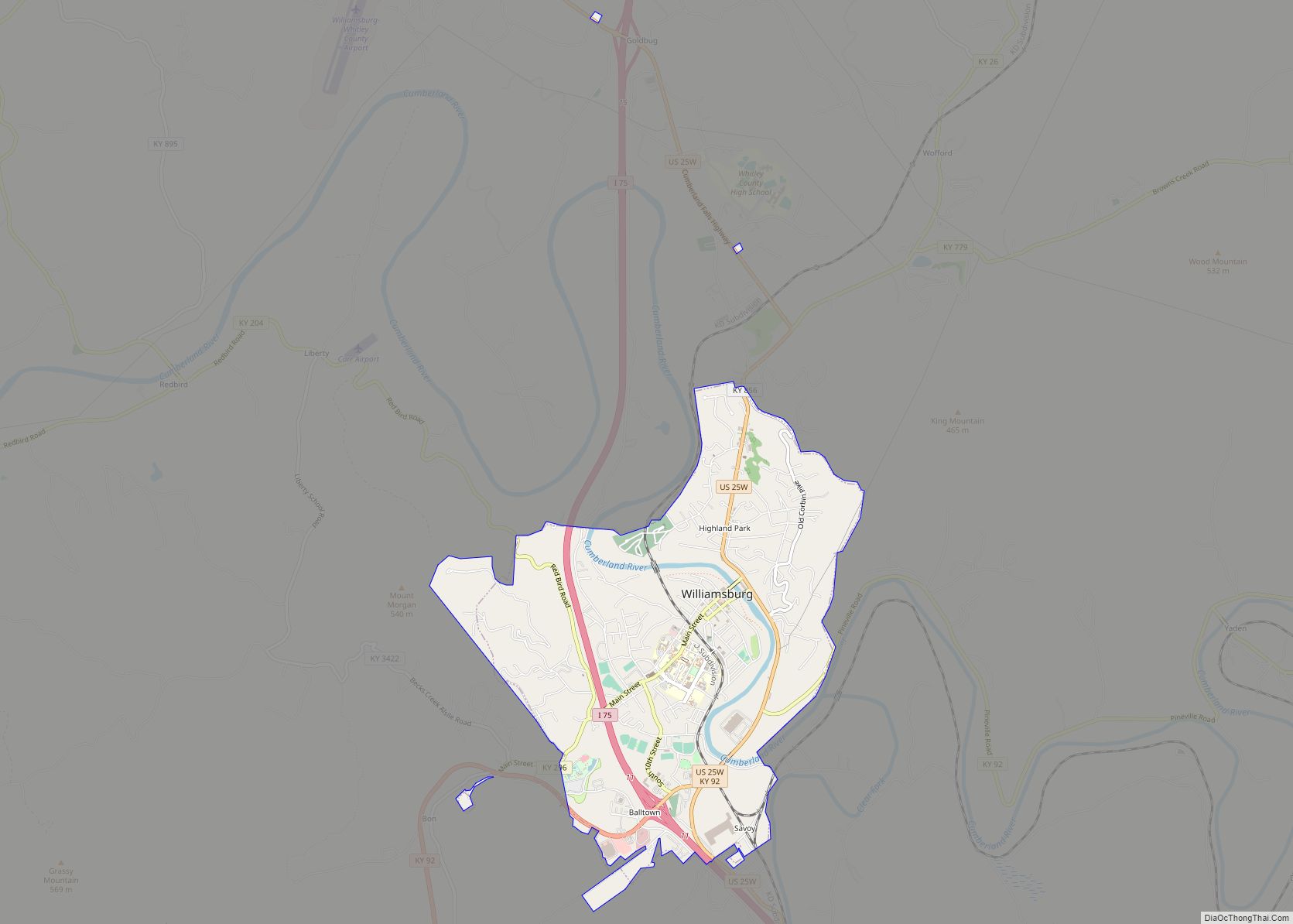
Online Interactive Map
Click on ![]() to view map in "full screen" mode.
to view map in "full screen" mode.
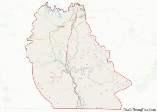
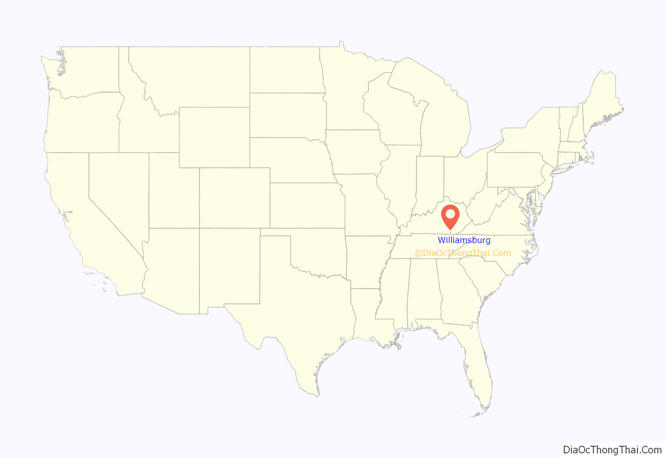
Williamsburg location map. Where is Williamsburg city?
History
Williamsburg was first known by early European-American settlers as the Spring Ford, after a nearby ford crossing the Cumberland River. On April 19, 1818 the first meeting of the Whitley County Court was held at Samuel Cox’s dwelling. This first court appointed local officials as well as constables to work with the county militia. The town was known simply as Whitley Courthouse. In 1882 the city was renamed as Williamsburgh, and the spelling was changed in 1890 to the current Williamsburg.
The town’s initial growth was fueled by three freshwater springs in the area. Settlers were attracted to this water source. They later developed coal mining and lumber industries, based on natural resources of the area.
Construction of the Louisville and Nashville Railroad (L&N) to the town in 1883 stimulated new growth. It connected the town to far-flung markets and attracted new residents and trade. Shortly thereafter in 1886 the town elected W. H. Parker as its first mayor.
This first city government enacted a number of new ordinances including:
- Prohibiting “Bawdy Houses” (brothels)
- Prohibiting Gambling
- Prohibiting Fornication
- Prohibiting Rolling Hoops on Sidewalks
- Prohibiting Barbering on Sundays
- Prohibiting Unattended Cattle on Main Street
The Williamsburg school system was established in 1909; the town residents voted to consolidate the multiple single-room schools in the area into a unified school district. The first consolidated school building was destroyed by fire in 1926. It was rebuilt for the school administration. Later the structure was adapted as the Anderson Building, which is used in the early 21st century by the University of the Cumberlands. The school district moved to its current location in 1983.
The county courthouse was destroyed by fire in 1931. It was rebuilt at the time. Forty years later, it underwent a major renovation to bring it up to standards of 1971. In 2011 the newly constructed Whitley County Judicial Center was completed adjacent to the old courthouse, and the courts moved to the new building.
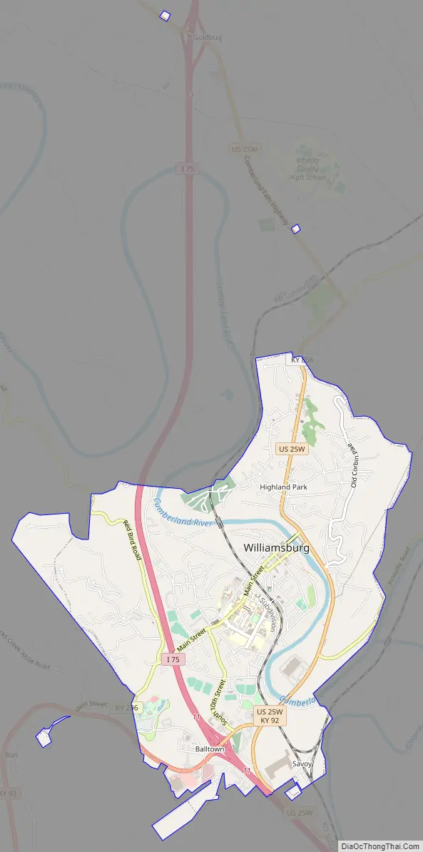
Williamsburg Road Map
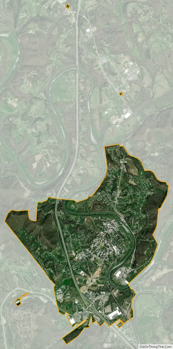
Williamsburg city Satellite Map
Geography
Williamsburg is located at 36°44′12″N 84°09′53″W / 36.736576°N 84.164713°W / 36.736576; -84.164713, within the Eastern Mountain Coal Fields and the Appalachian Plateau regions. It rests along the I-75 corridor at exits 11 and 15. I-75 leads north 103 mi (166 km) to Lexington and south 70 mi (113 km) to Knoxville, Tennessee. U.S. Route 25W runs to the east of downtown from south to north, leading north 21 mi (34 km) to Corbin and south 13 mi (21 km) to Jellico, Tennessee. Kentucky Route 92 runs through the city from west to east, leading east 35 mi (56 km) to Fourmile and west 20 mi (32 km) to Pine Knot.
According to the United States Census Bureau, the city has a total area of 4.8 square miles (12 km), of which 4.7 square miles (12 km) is land and 0.1 square miles (0.26 km) (2.10%) is water.
Percent of U.S. within 600 miles (970 km) of Williamsburg:
- Population: 52%
- Personal Income: 50%
- Retail Sales: 49%
- Manufacturing Employment: 57%
See also
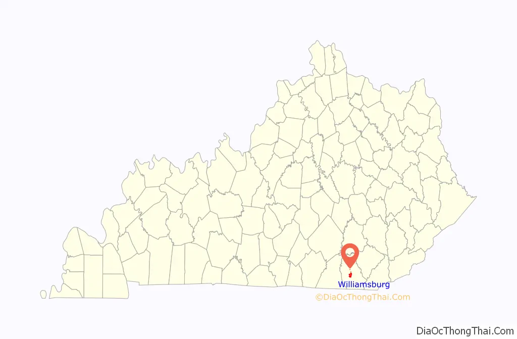
Map of Kentucky State and its subdivision:- Adair
- Allen
- Anderson
- Ballard
- Barren
- Bath
- Bell
- Boone
- Bourbon
- Boyd
- Boyle
- Bracken
- Breathitt
- Breckinridge
- Bullitt
- Butler
- Caldwell
- Calloway
- Campbell
- Carlisle
- Carroll
- Carter
- Casey
- Christian
- Clark
- Clay
- Clinton
- Crittenden
- Cumberland
- Daviess
- Edmonson
- Elliott
- Estill
- Fayette
- Fleming
- Floyd
- Franklin
- Fulton
- Gallatin
- Garrard
- Grant
- Graves
- Grayson
- Green
- Greenup
- Hancock
- Hardin
- Harlan
- Harrison
- Hart
- Henderson
- Henry
- Hickman
- Hopkins
- Jackson
- Jefferson
- Jessamine
- Johnson
- Kenton
- Knott
- Knox
- Larue
- Laurel
- Lawrence
- Lee
- Leslie
- Letcher
- Lewis
- Lincoln
- Livingston
- Logan
- Lyon
- Madison
- Magoffin
- Marion
- Marshall
- Martin
- Mason
- McCracken
- McCreary
- McLean
- Meade
- Menifee
- Mercer
- Metcalfe
- Monroe
- Montgomery
- Morgan
- Muhlenberg
- Nelson
- Nicholas
- Ohio
- Oldham
- Owen
- Owsley
- Pendleton
- Perry
- Pike
- Powell
- Pulaski
- Robertson
- Rockcastle
- Rowan
- Russell
- Scott
- Shelby
- Simpson
- Spencer
- Taylor
- Todd
- Trigg
- Trimble
- Union
- Warren
- Washington
- Wayne
- Webster
- Whitley
- Wolfe
- Woodford
- Alabama
- Alaska
- Arizona
- Arkansas
- California
- Colorado
- Connecticut
- Delaware
- District of Columbia
- Florida
- Georgia
- Hawaii
- Idaho
- Illinois
- Indiana
- Iowa
- Kansas
- Kentucky
- Louisiana
- Maine
- Maryland
- Massachusetts
- Michigan
- Minnesota
- Mississippi
- Missouri
- Montana
- Nebraska
- Nevada
- New Hampshire
- New Jersey
- New Mexico
- New York
- North Carolina
- North Dakota
- Ohio
- Oklahoma
- Oregon
- Pennsylvania
- Rhode Island
- South Carolina
- South Dakota
- Tennessee
- Texas
- Utah
- Vermont
- Virginia
- Washington
- West Virginia
- Wisconsin
- Wyoming