Map of Bremen city, Kentucky

Map of Bremen city, Kentucky

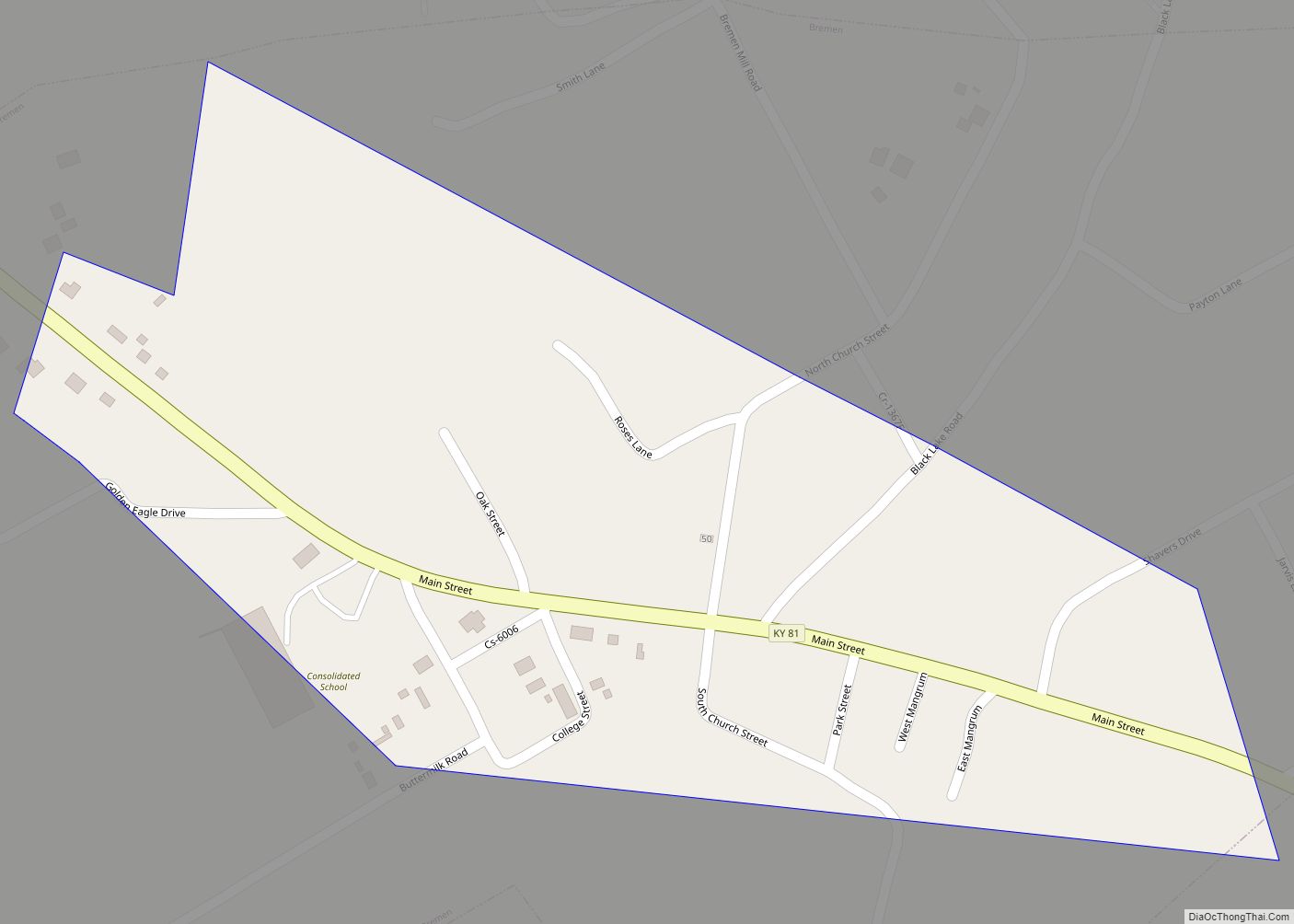
Bremen (/ˈbriːmɪn/) is a home rule-class city in Muhlenberg County, Kentucky, in the United States. The population was 172 at the 2020 census. Bremen city overview: Name: Bremen city LSAD Code: 25 LSAD Description: city (suffix) State: Kentucky County: Muhlenberg County Elevation: 459 ft (140 m) Total Area: 0.21 sq mi (0.54 km²) Land Area: 0.21 sq mi (0.54 km²) Water Area: 0.00 sq mi … Read more

Map of Brooks CDP, Kentucky

Map of Brooks CDP, Kentucky

Brooks is a census-designated place (CDP) in Bullitt County, Kentucky, United States. The population was 2,401 at the 2010 census. Brooks was struck by a tornado in 1996. Brooks CDP overview: Name: Brooks CDP LSAD Code: 57 LSAD Description: CDP (suffix) State: Kentucky County: Bullitt County Elevation: 509 ft (155 m) Total Area: 3.71 sq mi (9.60 km²) Land Area: … Read more

Map of Bromley city

Map of Bromley city

Bromley is a home rule-class city in Kenton County, Kentucky, United States, along the Ohio River. The population was 724 at the 2020 census. It is part of the Cincinnati metropolitan area. Bromley city overview: Name: Bromley city LSAD Code: 25 LSAD Description: city (suffix) State: Kentucky County: Kenton County Elevation: 509 ft (155 m) Total Area: … Read more

Map of Broeck Pointe city

Map of Broeck Pointe city

Broeck Pointe is a home rule-class city in Jefferson County, Kentucky, United States. The population was 272 at the 2010 census. Broeck Pointe city overview: Name: Broeck Pointe city LSAD Code: 25 LSAD Description: city (suffix) State: Kentucky County: Jefferson County Elevation: 656 ft (200 m) Total Area: 0.07 sq mi (0.19 km²) Land Area: 0.07 sq mi (0.19 km²) Water Area: 0.00 sq mi … Read more

Map of Brownsboro Village city

Map of Brownsboro Village city

Brownsboro Village is a home rule-class city in Jefferson County, Kentucky, United States. The population was 319 at the 2010 census. Brownsboro Village city overview: Name: Brownsboro Village city LSAD Code: 25 LSAD Description: city (suffix) State: Kentucky County: Jefferson County Elevation: 571 ft (174 m) Total Area: 0.07 sq mi (0.19 km²) Land Area: 0.07 sq mi (0.19 km²) Water Area: 0.00 sq mi … Read more

Map of Brownsboro Farm city

Map of Brownsboro Farm city

Brownsboro Farm is a home rule-class city in Jefferson County, Kentucky, United States. The population was 648 at the 2010 census. Brownsboro Farm city overview: Name: Brownsboro Farm city LSAD Code: 25 LSAD Description: city (suffix) State: Kentucky County: Jefferson County Elevation: 636 ft (194 m) Total Area: 0.23 sq mi (0.59 km²) Land Area: 0.23 sq mi (0.59 km²) Water Area: 0.00 sq mi … Read more

Map of Brooksville city, Kentucky

Map of Brooksville city, Kentucky

Brooksville is a home rule-class city in Bracken County, Kentucky, in the United States. As of the 2010 census, the city’s population was 642. It is the county seat of Bracken County. The area was settled before 1800 by William and Joel Woodward and was originally known as Woodward’s Crossroads. County government moved from Augusta … Read more

Map of Buckhorn city, Kentucky

Map of Buckhorn city, Kentucky

Buckhorn is a home rule-class city in Perry County, Kentucky, in the United States. The population was 162 at the 2010 census. It is centered on the Buckhorn Presbyterian Church, a log structure listed on the National Register of Historic Places. The Buckhorn Children’s Center and Buckhorn Lake State Resort Park are also located here. … Read more

Map of Brownsville city, Kentucky

Map of Brownsville city, Kentucky

Brownsville is a home rule-class city in Edmonson County, Kentucky, in the United States. It is the county seat and is a certified Kentucky Trail Town. The population was 836 at the time of the 2010 census, down from 921 at the 2000 census. It is included in the Bowling Green metropolitan area. It is … Read more

Map of Buckner CDP, Kentucky

Map of Buckner CDP, Kentucky

Buckner is a census-designated place (CDP) in Oldham County, Kentucky, United States. The population was 4,000 at the 2000 census. Oldham County High School is located in Buckner. Buckner CDP overview: Name: Buckner CDP LSAD Code: 57 LSAD Description: CDP (suffix) State: Kentucky County: Oldham County Elevation: 823 ft (251 m) Total Area: 8.82 sq mi (22.83 km²) Land Area: … Read more

Map of Burkesville city

Map of Burkesville city

Burkesville is a home rule-class city in Cumberland County, Kentucky, in the United States. Nestled among the rolling foothills of Appalachia and bordered by the Cumberland River to the south and east, it is the seat of its county. The population was 1,521 at the 2010 census. Burkesville city overview: Name: Burkesville city LSAD Code: … Read more

Map of Burgin city

Map of Burgin city

Burgin is a home rule-class city in Mercer County, Kentucky, in the United States. Its population was 965 at the 2010 census. Burgin city overview: Name: Burgin city LSAD Code: 25 LSAD Description: city (suffix) State: Kentucky County: Mercer County Incorporated: 1878-03-14 Elevation: 892 ft (272 m) Total Area: 1.26 sq mi (3.28 km²) Land Area: 1.26 sq mi (3.25 km²) Water Area: … Read more