Brownsville is a home rule-class city in Edmonson County, Kentucky, in the United States. It is the county seat and is a certified Kentucky Trail Town. The population was 836 at the time of the 2010 census, down from 921 at the 2000 census. It is included in the Bowling Green metropolitan area. It is just outside Mammoth Cave National Park.
| Name: | Brownsville city |
|---|---|
| LSAD Code: | 25 |
| LSAD Description: | city (suffix) |
| State: | Kentucky |
| County: | Edmonson County |
| Elevation: | 541 ft (165 m) |
| Total Area: | 2.62 sq mi (6.78 km²) |
| Land Area: | 2.61 sq mi (6.77 km²) |
| Water Area: | 0.01 sq mi (0.02 km²) |
| Total Population: | 875 |
| Population Density: | 334.99/sq mi (129.33/km²) |
| ZIP code: | 42210 |
| Area code: | 270 & 364 |
| FIPS code: | 2110324 |
| GNISfeature ID: | 0488045 |
Online Interactive Map
Click on ![]() to view map in "full screen" mode.
to view map in "full screen" mode.
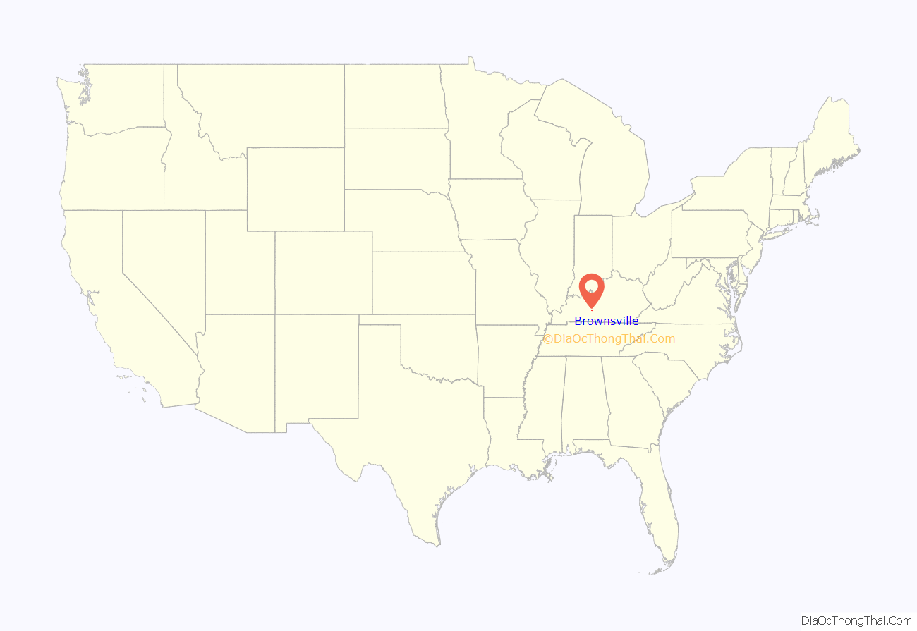
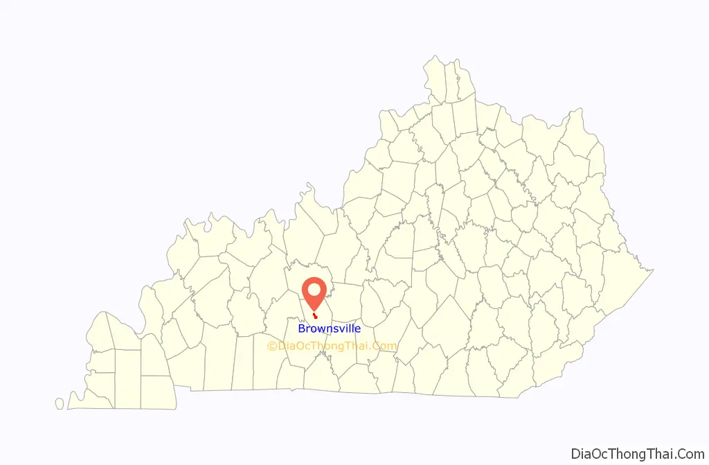
Brownsville location map. Where is Brownsville city?
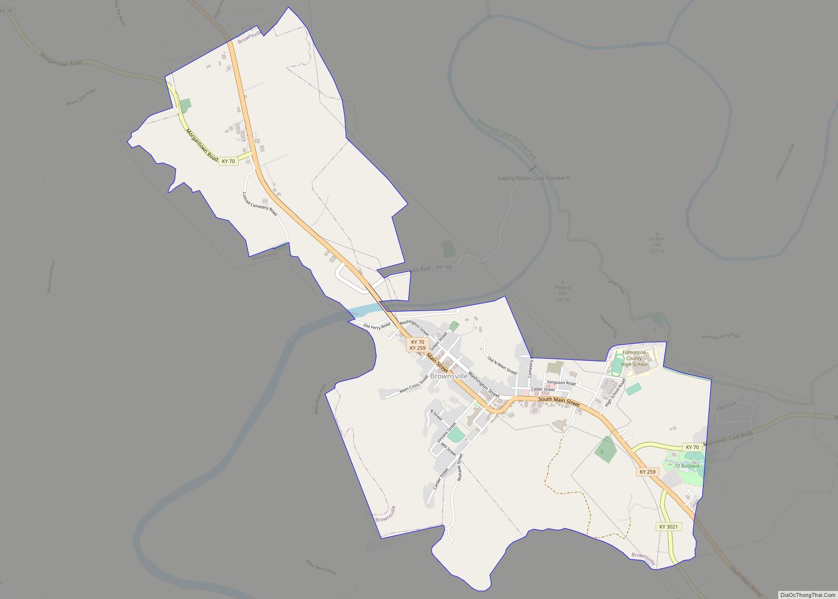
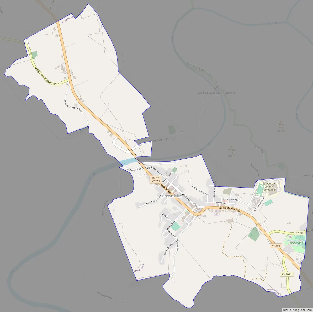
Brownsville Road Map
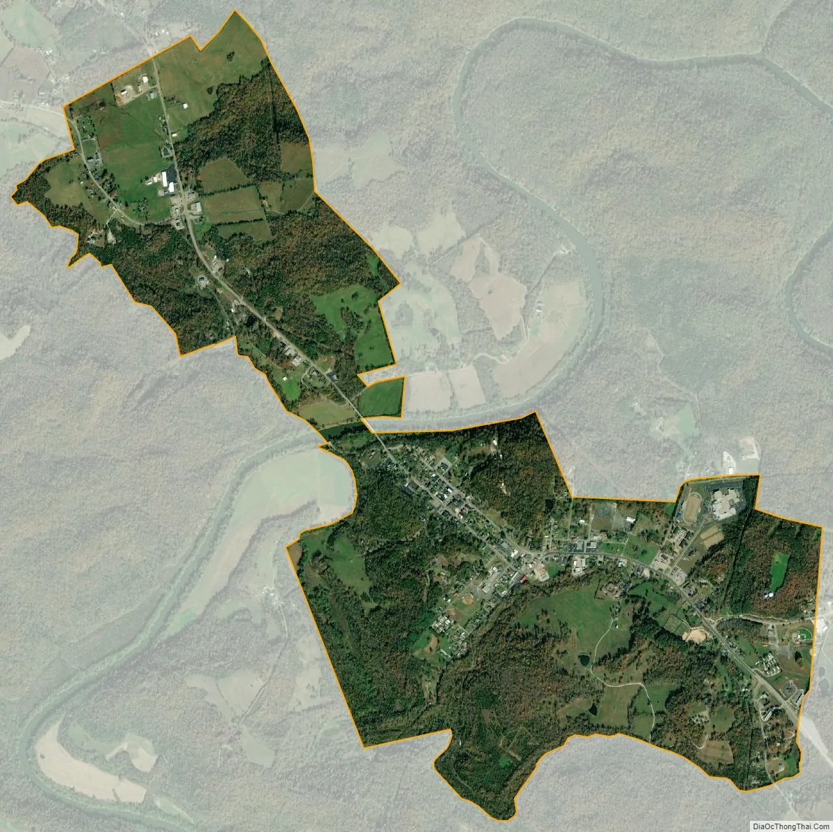
Brownsville city Satellite Map
Geography
Brownsville is located near the center of Edmonson County at 37°11′28″N 86°15′40″W / 37.191169°N 86.261098°W / 37.191169; -86.261098. The city limits border the western edge of Mammoth Cave National Park, with access to Houchin Ferry Campground.
State Routes 70 and 259 pass through the city together as Main Street. KY 70 leads east 20 miles (32 km) to Cave City and west 27 miles (43 km) to U.S. Route 231 at Aberdeen, while KY 259 leads southeast 12 miles (19 km) to U.S. Route 31W and north 25 miles (40 km) to Leitchfield.
According to the United States Census Bureau, Brownsville has a total area of 2.6 square miles (6.8 km), of which 0.01 square miles (0.02 km), or 0.26%, is water. The city is located on the Green River, a tributary of the Ohio River.
See also
Map of Kentucky State and its subdivision:- Adair
- Allen
- Anderson
- Ballard
- Barren
- Bath
- Bell
- Boone
- Bourbon
- Boyd
- Boyle
- Bracken
- Breathitt
- Breckinridge
- Bullitt
- Butler
- Caldwell
- Calloway
- Campbell
- Carlisle
- Carroll
- Carter
- Casey
- Christian
- Clark
- Clay
- Clinton
- Crittenden
- Cumberland
- Daviess
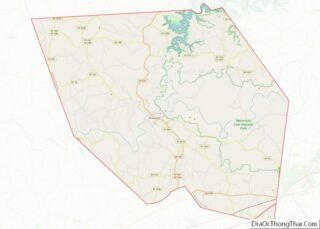
- Edmonson
- Elliott
- Estill
- Fayette
- Fleming
- Floyd
- Franklin
- Fulton
- Gallatin
- Garrard
- Grant
- Graves
- Grayson
- Green
- Greenup
- Hancock
- Hardin
- Harlan
- Harrison
- Hart
- Henderson
- Henry
- Hickman
- Hopkins
- Jackson
- Jefferson
- Jessamine
- Johnson
- Kenton
- Knott
- Knox
- Larue
- Laurel
- Lawrence
- Lee
- Leslie
- Letcher
- Lewis
- Lincoln
- Livingston
- Logan
- Lyon
- Madison
- Magoffin
- Marion
- Marshall
- Martin
- Mason
- McCracken
- McCreary
- McLean
- Meade
- Menifee
- Mercer
- Metcalfe
- Monroe
- Montgomery
- Morgan
- Muhlenberg
- Nelson
- Nicholas
- Ohio
- Oldham
- Owen
- Owsley
- Pendleton
- Perry
- Pike
- Powell
- Pulaski
- Robertson
- Rockcastle
- Rowan
- Russell
- Scott
- Shelby
- Simpson
- Spencer
- Taylor
- Todd
- Trigg
- Trimble
- Union
- Warren
- Washington
- Wayne
- Webster
- Whitley
- Wolfe
- Woodford
- Alabama
- Alaska
- Arizona
- Arkansas
- California
- Colorado
- Connecticut
- Delaware
- District of Columbia
- Florida
- Georgia
- Hawaii
- Idaho
- Illinois
- Indiana
- Iowa
- Kansas
- Kentucky
- Louisiana
- Maine
- Maryland
- Massachusetts
- Michigan
- Minnesota
- Mississippi
- Missouri
- Montana
- Nebraska
- Nevada
- New Hampshire
- New Jersey
- New Mexico
- New York
- North Carolina
- North Dakota
- Ohio
- Oklahoma
- Oregon
- Pennsylvania
- Rhode Island
- South Carolina
- South Dakota
- Tennessee
- Texas
- Utah
- Vermont
- Virginia
- Washington
- West Virginia
- Wisconsin
- Wyoming