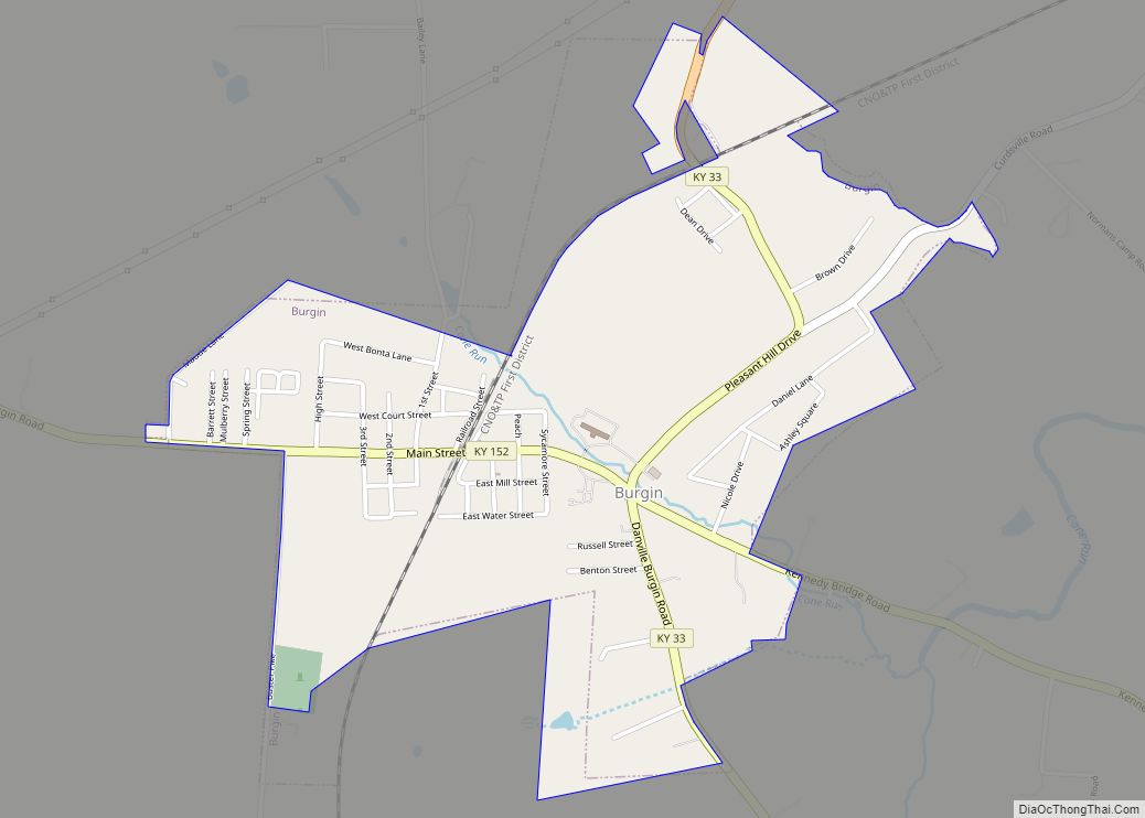
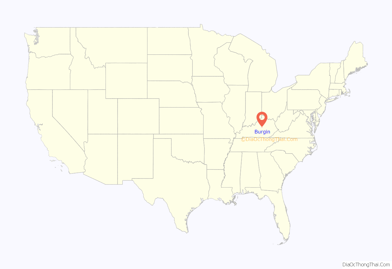
Burgin is a home rule-class city in Mercer County, Kentucky, in the United States. Its population was 965 at the 2010 census.
| Name: | Burgin city |
|---|---|
| LSAD Code: | 25 |
| LSAD Description: | city (suffix) |
| State: | Kentucky |
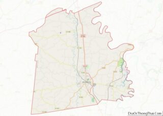
| County: | Mercer County |
| Incorporated: | 1878-03-14 |
| Elevation: | 892 ft (272 m) |
| Total Area: | 1.26 sq mi (3.28 km²) |
| Land Area: | 1.26 sq mi (3.25 km²) |
| Water Area: | 0.01 sq mi (0.02 km²) |
| Total Population: | 979 |
| Population Density: | 779.46/sq mi (300.94/km²) |
| ZIP code: | 40310 |
| Area code: | 859 |
| FIPS code: | 2111044 |
| GNISfeature ID: | 0488423 |
Online Interactive Map
Click on ![]() to view map in "full screen" mode.
to view map in "full screen" mode.
Burgin location map. Where is Burgin city?

History
What is now Burgin was originally known as “Cane Run.” In 1874, the Cincinnati Southern Railway obtained a right-of-way from local landowner Temple Burgin and opened Burgin Station. The town was established in 1877 and incorporated in 1878. The post office opened as “Bergen” in 1877 and changed its name to “Burgin” in 1886.
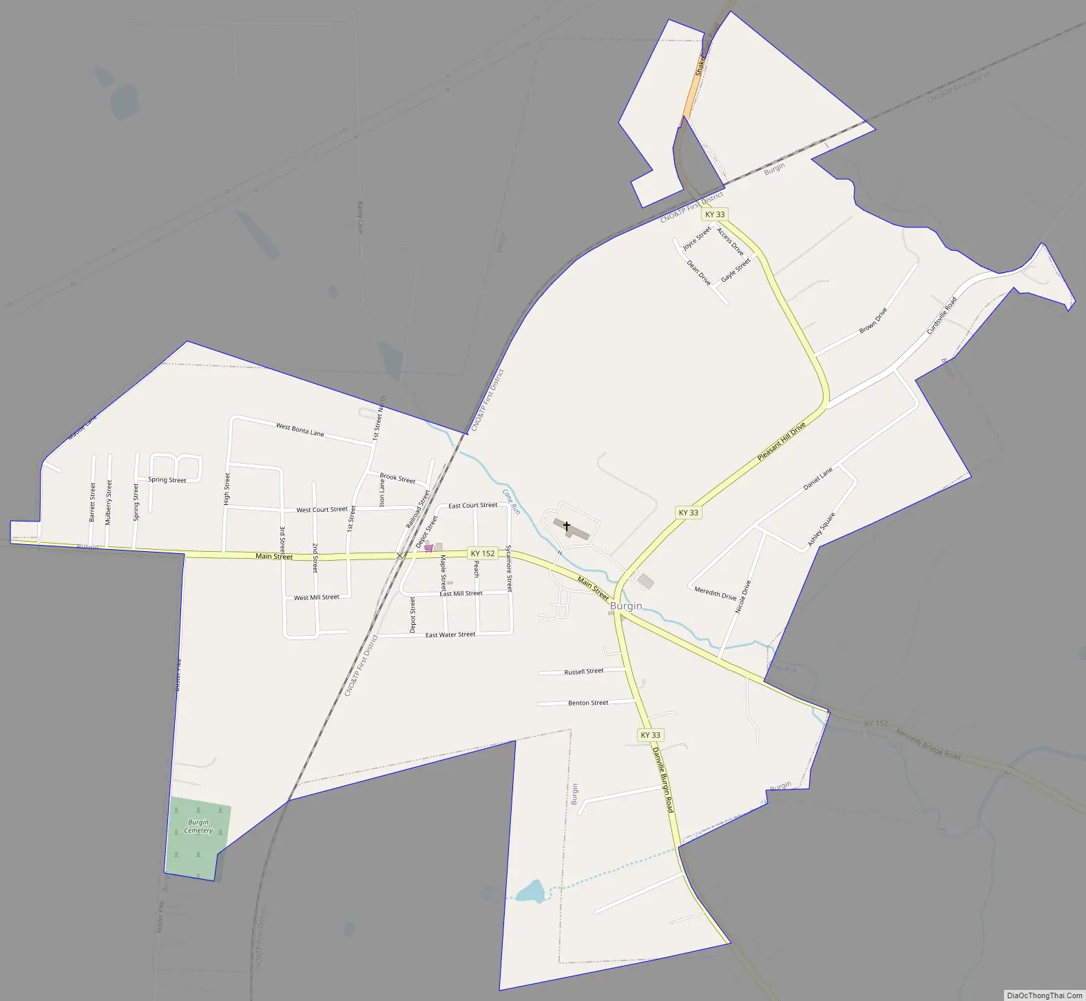
Burgin Road Map
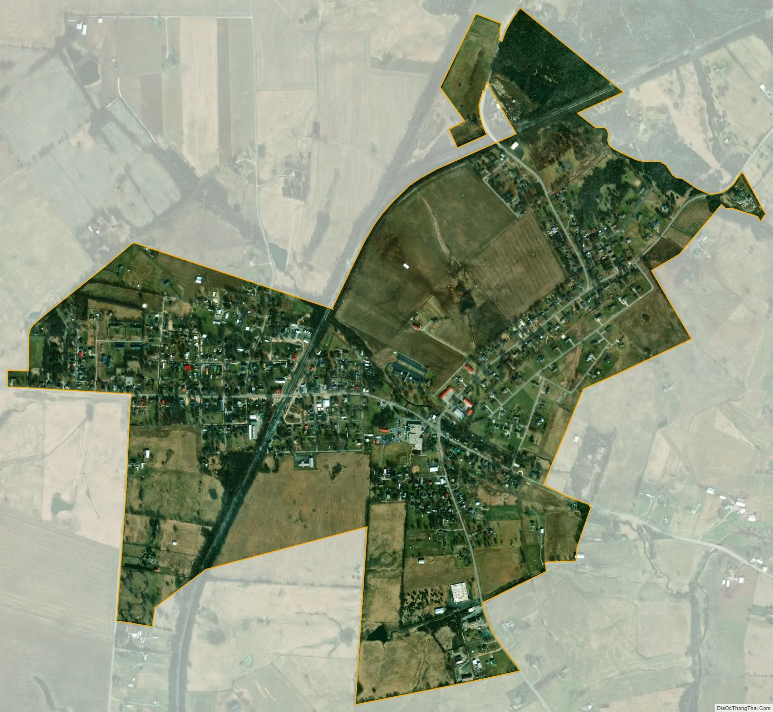
Burgin city Satellite Map
Geography
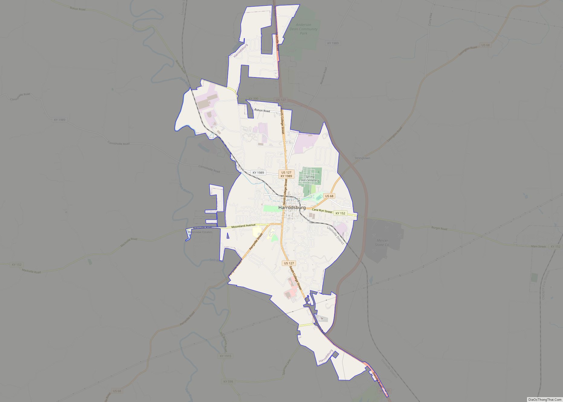
Burgin is located at 37°45′18″N 84°45′56″W / 37.75500°N 84.76556°W / 37.75500; -84.76556 (37.754961, -84.765681). The city is concentrated along Kentucky Route 152 (Main Street), with most of its public buildings lying just west of the highway’s intersection with Kentucky Route 33 (Danville Street/Pleasant Hill Drive). Harrodsburg lies to the west of Burgin along KY 152, and Danville lies to the south along KY 33. Burgin is located at the headwaters of Cane Run, which flows eastward into the Dix River.
According to the United States Census Bureau, the city has a total area of 1.2 square miles (3.1 km), all land.
See also
Map of Kentucky State and its subdivision:- Adair
- Allen
- Anderson
- Ballard
- Barren
- Bath
- Bell
- Boone
- Bourbon
- Boyd
- Boyle
- Bracken
- Breathitt
- Breckinridge
- Bullitt
- Butler
- Caldwell
- Calloway
- Campbell
- Carlisle
- Carroll
- Carter
- Casey
- Christian
- Clark
- Clay
- Clinton
- Crittenden
- Cumberland
- Daviess
- Edmonson
- Elliott
- Estill
- Fayette
- Fleming
- Floyd
- Franklin
- Fulton
- Gallatin
- Garrard
- Grant
- Graves
- Grayson
- Green
- Greenup
- Hancock
- Hardin
- Harlan
- Harrison
- Hart
- Henderson
- Henry
- Hickman
- Hopkins
- Jackson
- Jefferson
- Jessamine
- Johnson
- Kenton
- Knott
- Knox
- Larue
- Laurel
- Lawrence
- Lee
- Leslie
- Letcher
- Lewis
- Lincoln
- Livingston
- Logan
- Lyon
- Madison
- Magoffin
- Marion
- Marshall
- Martin
- Mason
- McCracken
- McCreary
- McLean
- Meade
- Menifee
- Mercer
- Metcalfe
- Monroe
- Montgomery
- Morgan
- Muhlenberg
- Nelson
- Nicholas
- Ohio
- Oldham
- Owen
- Owsley
- Pendleton
- Perry
- Pike
- Powell
- Pulaski
- Robertson
- Rockcastle
- Rowan
- Russell
- Scott
- Shelby
- Simpson
- Spencer
- Taylor
- Todd
- Trigg
- Trimble
- Union
- Warren
- Washington
- Wayne
- Webster
- Whitley
- Wolfe
- Woodford
- Alabama
- Alaska
- Arizona
- Arkansas
- California
- Colorado
- Connecticut
- Delaware
- District of Columbia
- Florida
- Georgia
- Hawaii
- Idaho
- Illinois
- Indiana
- Iowa
- Kansas
- Kentucky
- Louisiana
- Maine
- Maryland
- Massachusetts
- Michigan
- Minnesota
- Mississippi
- Missouri
- Montana
- Nebraska
- Nevada
- New Hampshire
- New Jersey
- New Mexico
- New York
- North Carolina
- North Dakota
- Ohio
- Oklahoma
- Oregon
- Pennsylvania
- Rhode Island
- South Carolina
- South Dakota
- Tennessee
- Texas
- Utah
- Vermont
- Virginia
- Washington
- West Virginia
- Wisconsin
- Wyoming