Brooksville is a home rule-class city in Bracken County, Kentucky, in the United States. As of the 2010 census, the city’s population was 642. It is the county seat of Bracken County.
The area was settled before 1800 by William and Joel Woodward and was originally known as Woodward’s Crossroads. County government moved from Augusta to Woodward’s Crossing in 1833 due to its more central location, although it did not become the official county seat until February 16, 1839. The legislation to formalize Woodward’s Crossing as the county seat was sponsored by Senator David Brooks, and the town was renamed in his honor.
The population has remained stable since 1970, when it was 609.
| Name: | Brooksville city |
|---|---|
| LSAD Code: | 25 |
| LSAD Description: | city (suffix) |
| State: | Kentucky |
| County: | Bracken County |
| Elevation: | 935 ft (285 m) |
| Total Area: | 0.47 sq mi (1.22 km²) |
| Land Area: | 0.47 sq mi (1.22 km²) |
| Water Area: | 0.00 sq mi (0.00 km²) |
| Total Population: | 654 |
| Population Density: | 1,385.59/sq mi (535.38/km²) |
| ZIP code: | 41004 |
| Area code: | 606 |
| FIPS code: | 2110000 |
| GNISfeature ID: | 0487972 |
Online Interactive Map
Click on ![]() to view map in "full screen" mode.
to view map in "full screen" mode.
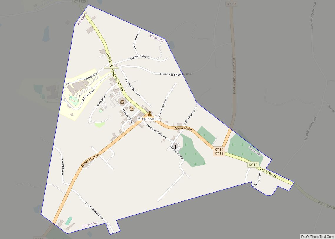
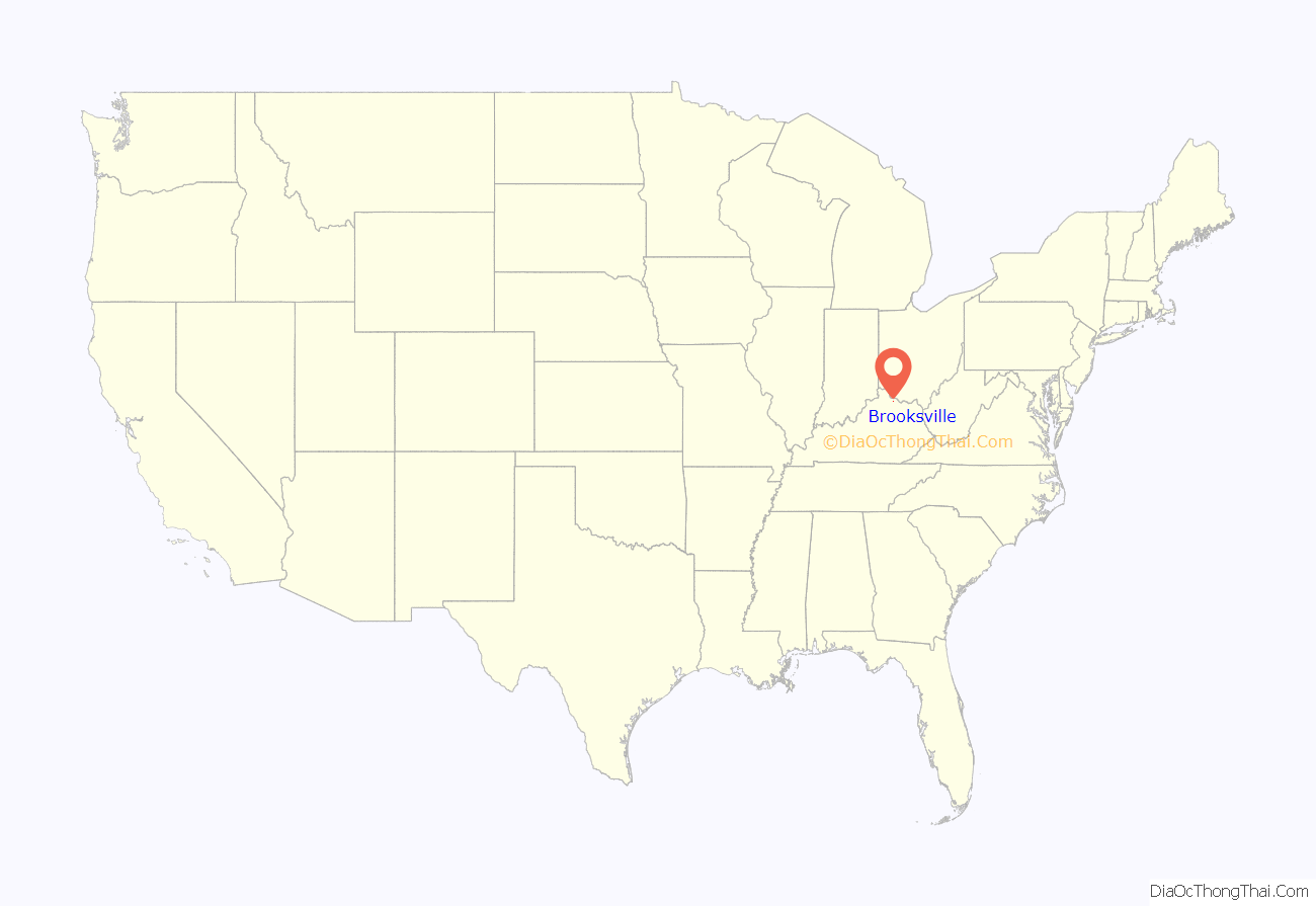
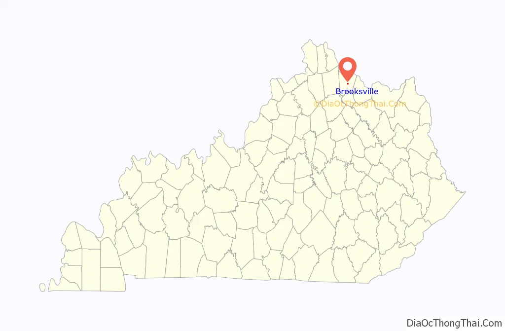
Brooksville location map. Where is Brooksville city?
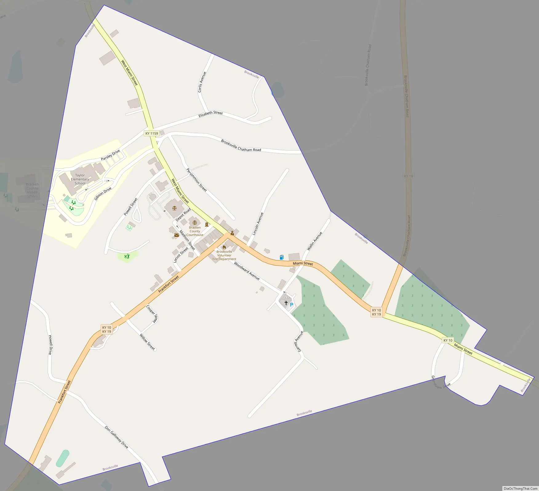
Brooksville Road Map
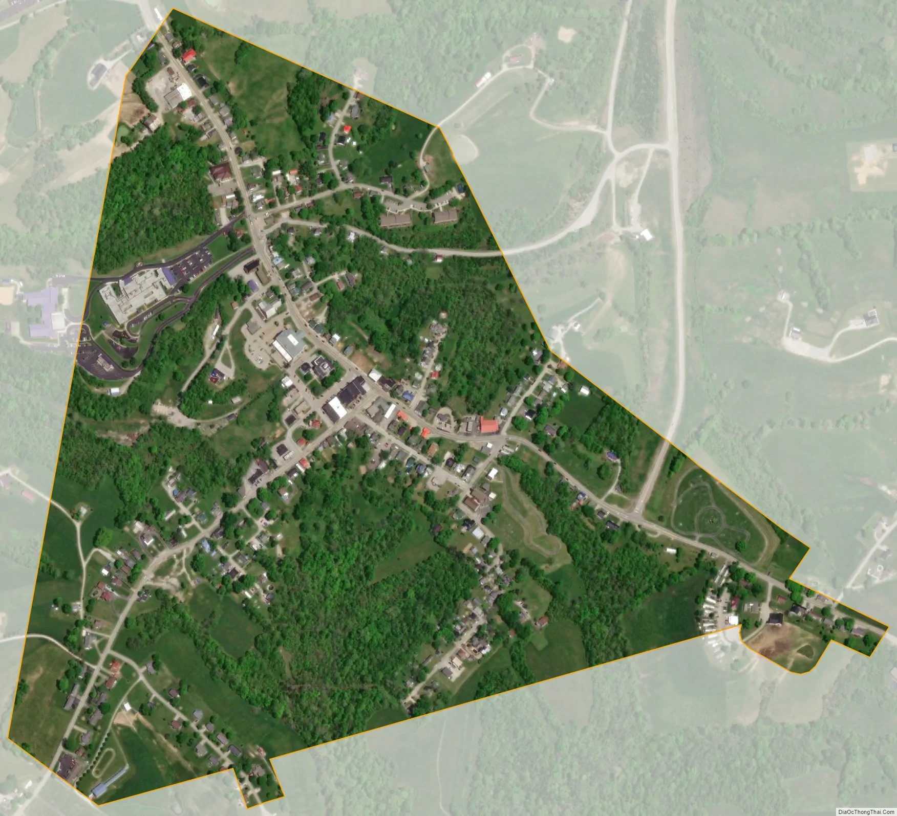
Brooksville city Satellite Map
Geography
Brooksville is located in central Bracken County at 38°40′56″N 84°4′3″W / 38.68222°N 84.06750°W / 38.68222; -84.06750 (38.682144, -84.067362). Kentucky Routes 10 and 19 join in Brooksville. Route 10 leads east 20 miles (32 km) to Maysville, and Route 19 leads northeast 9 miles (14 km) to Augusta; both destinations are on the Ohio River. The two highways head jointly out of town to the southwest from Brooksville.
According to the United States Census Bureau, the city has a total area of 0.46 square miles (1.2 km), all land.
See also
Map of Kentucky State and its subdivision:- Adair
- Allen
- Anderson
- Ballard
- Barren
- Bath
- Bell
- Boone
- Bourbon
- Boyd
- Boyle
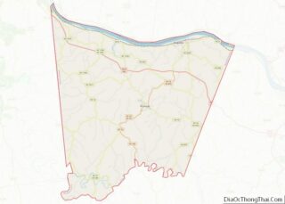
- Bracken
- Breathitt
- Breckinridge
- Bullitt
- Butler
- Caldwell
- Calloway
- Campbell
- Carlisle
- Carroll
- Carter
- Casey
- Christian
- Clark
- Clay
- Clinton
- Crittenden
- Cumberland
- Daviess
- Edmonson
- Elliott
- Estill
- Fayette
- Fleming
- Floyd
- Franklin
- Fulton
- Gallatin
- Garrard
- Grant
- Graves
- Grayson
- Green
- Greenup
- Hancock
- Hardin
- Harlan
- Harrison
- Hart
- Henderson
- Henry
- Hickman
- Hopkins
- Jackson
- Jefferson
- Jessamine
- Johnson
- Kenton
- Knott
- Knox
- Larue
- Laurel
- Lawrence
- Lee
- Leslie
- Letcher
- Lewis
- Lincoln
- Livingston
- Logan
- Lyon
- Madison
- Magoffin
- Marion
- Marshall
- Martin
- Mason
- McCracken
- McCreary
- McLean
- Meade
- Menifee
- Mercer
- Metcalfe
- Monroe
- Montgomery
- Morgan
- Muhlenberg
- Nelson
- Nicholas
- Ohio
- Oldham
- Owen
- Owsley
- Pendleton
- Perry
- Pike
- Powell
- Pulaski
- Robertson
- Rockcastle
- Rowan
- Russell
- Scott
- Shelby
- Simpson
- Spencer
- Taylor
- Todd
- Trigg
- Trimble
- Union
- Warren
- Washington
- Wayne
- Webster
- Whitley
- Wolfe
- Woodford
- Alabama
- Alaska
- Arizona
- Arkansas
- California
- Colorado
- Connecticut
- Delaware
- District of Columbia
- Florida
- Georgia
- Hawaii
- Idaho
- Illinois
- Indiana
- Iowa
- Kansas
- Kentucky
- Louisiana
- Maine
- Maryland
- Massachusetts
- Michigan
- Minnesota
- Mississippi
- Missouri
- Montana
- Nebraska
- Nevada
- New Hampshire
- New Jersey
- New Mexico
- New York
- North Carolina
- North Dakota
- Ohio
- Oklahoma
- Oregon
- Pennsylvania
- Rhode Island
- South Carolina
- South Dakota
- Tennessee
- Texas
- Utah
- Vermont
- Virginia
- Washington
- West Virginia
- Wisconsin
- Wyoming