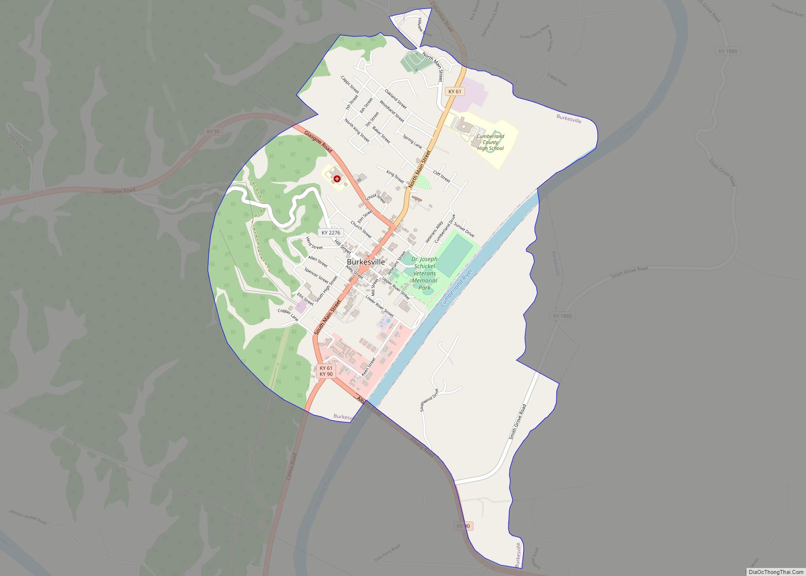
Burkesville is a home rule-class city in Cumberland County, Kentucky, in the United States. Nestled among the rolling foothills of Appalachia and bordered by the Cumberland River to the south and east, it is the seat of its county. The population was 1,521 at the 2010 census.
| Name: | Burkesville city |
|---|---|
| LSAD Code: | 25 |
| LSAD Description: | city (suffix) |
| State: | Kentucky |
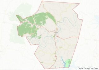
| County: | Cumberland County |
| Elevation: | 581 ft (177 m) |
| Total Area: | 2.65 sq mi (6.87 km²) |
| Land Area: | 2.57 sq mi (6.67 km²) |
| Water Area: | 0.08 sq mi (0.20 km²) |
| Total Population: | 1,388 |
| Population Density: | 539.24/sq mi (208.19/km²) |
| ZIP code: | 42717 |
| Area code: | 270 & 364 |
| FIPS code: | 2111098 |
| GNISfeature ID: | 0488433 |
| Website: | www.cityofburkesville.org |
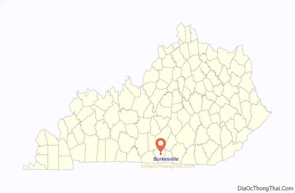
Online Interactive Map
Click on ![]() to view map in "full screen" mode.
to view map in "full screen" mode.
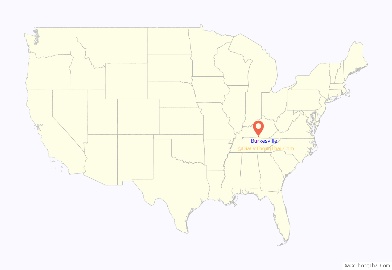
Burkesville location map. Where is Burkesville city?
History
Burkesville began as a small riverside settlement even before the Iroquois Indians officially sold the land in 1768. The settlement was originally called Cumberland Crossing. In 1846, it was incorporated as a city and named Burkesville after Isham Burk, a prominent citizen leader at that time.
Just as Kentucky was a border state in the Civil War, so was Burkesville a border town. Burkesville stood on the Cumberland River, a major natural barrier between opposing forces, so Union and Confederate troops as well as guerillas led by Champ Ferguson sparred across the countryside. Confederate General John Hunt Morgan tore through the area while conducting Morgan’s Raid, and Confederate General Hylan B. Lyon’s raids in December 1864 burned seven courthouses, ending with the one in Burkesville on January 3.
Burkesville was a fairly busy river port whose heyday came during the latter part of the nineteenth century, when water transportation was the most feasible way to move large quantities of goods. The rise of larger craft, such as the riverboat, required diligent dredging of the riverbed to keep it navigable so far upstream. The last steamboat docked in Burkesville in 1929, the year after the first major road was opened to the larger city of Glasgow, 40 miles (64 km) to the west. The river’s head of commercial navigation moved from Burnside (which has a railroad) to Burkesville (which does not) when the U.S. Army Corps of Engineers began building Wolf Creek Dam without a lock about 25 miles upstream before World War II. The dam controlled flooding that had plagued the town from its beginning, but was the last nail in the coffin of commercial navigation. The corps’ impoundment of Dale Hollow Reservoir in 1944 gave the town a tourist and fishing trade, and development of a trout fishery on the river from the dam to Burkesville has also provided a small economic boost, as has development of Dale Hollow Lake State Resort Park.
Burkesville had a pack horse library serving rural residents in the late 1930s and early 1940s.
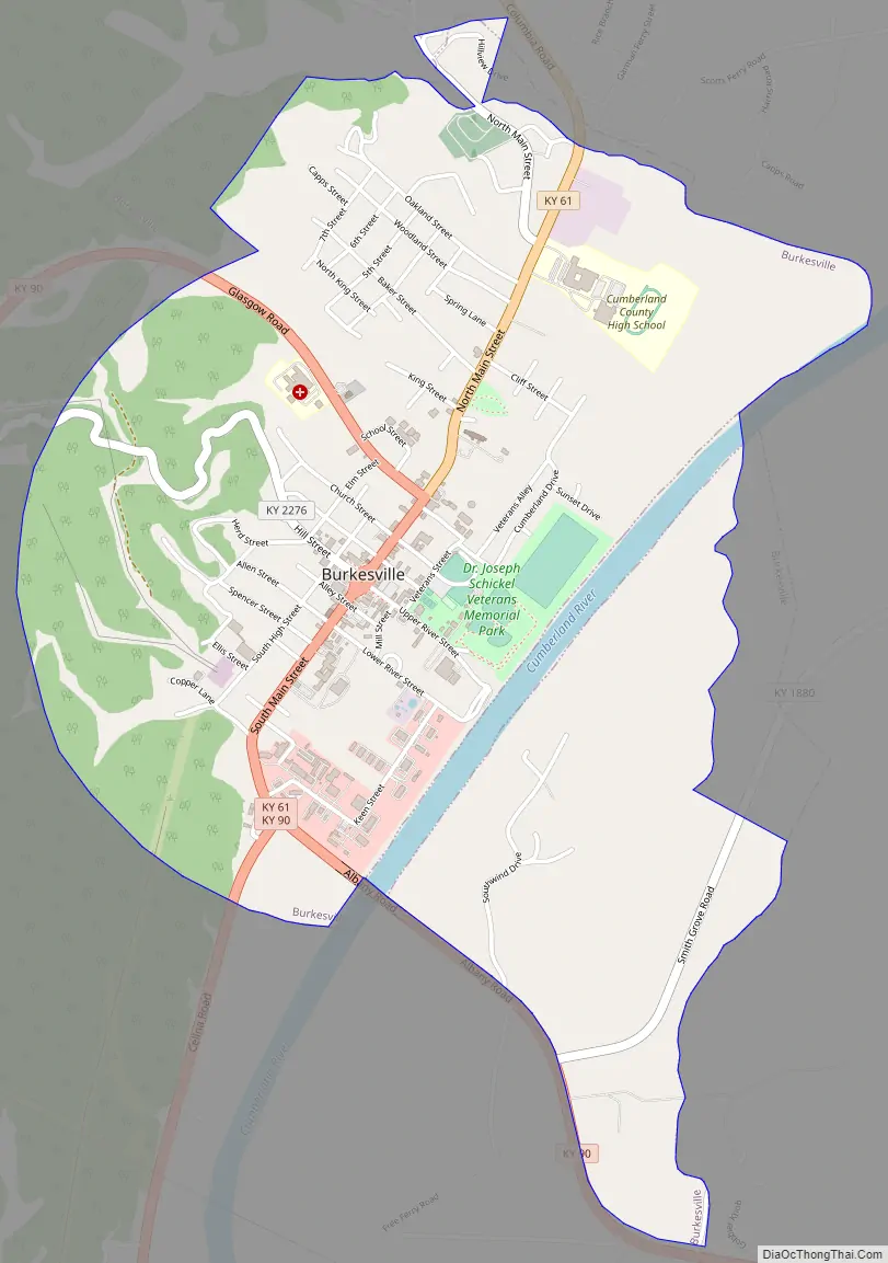
Today the main routes of access to the city are State Highways 90 and state 61. KY 90 East and KY 61 South are part of the Appalachian Development Highway System; Burkesville has the only 90-degree turn in an APD corridor, because the original route was moved west to please Tennessee Congressman Joe L. Evins and perhaps Kentucky Congressman Tim Lee Carter of Tompkinsville. An old-fashioned town square sits on Main Street, which splits and forms a circle around the Cumberland County court house, the third incarnation of the structure. The first was built by Thomas Lincoln, the father of Abraham Lincoln. Original buildings ring the square on three sides; the fourth was razed to make way for a modern justice center, completed in 2006. Two streets branch off perpendicular to Main: River Street runs straight toward the Cumberland River and provides access to the town’s only public boat ramp, while Hill Street immediately begins scaling the Alpine Hill that towers over the city. This road was the only access to the city from the west for many years until Highway 90 was rerouted through a gap called the Sawmill Cut, site of a small sawmill until the road was further modernized in the 21st century. Highway 61 North was most recently modernized; the highway and park improvements were pushed by Burkesville lawyer David Williams as president of the state Senate from 2000 to 2013.
Burkesville Road Map
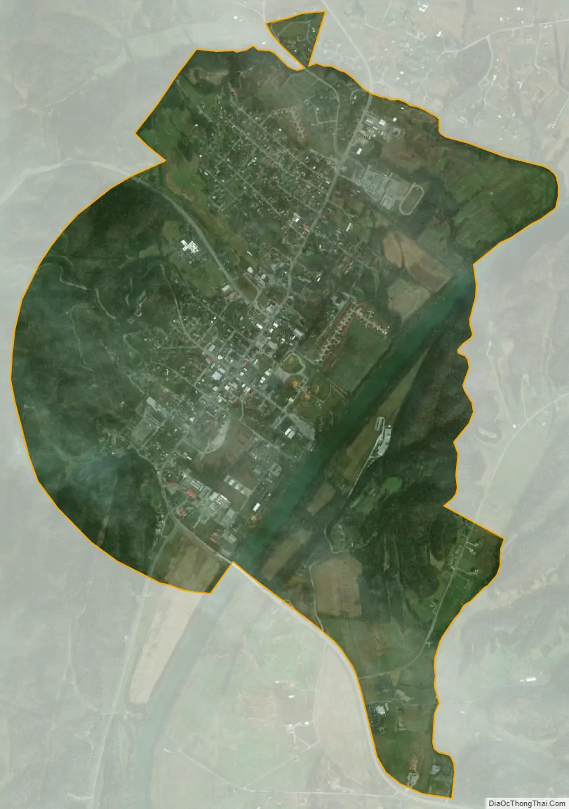
Burkesville city Satellite Map
Geography
Burkesville is located at 36°47′34″N 85°22′10″W / 36.79278°N 85.36944°W / 36.79278; -85.36944 (36.792787, -85.369578).
According to the United States Census Bureau, the city has a total area of 2.64 square miles (6.85 km), of which 2.57 square miles (6.65 km) is land and 0.08 square miles (0.20 km), or 2.90%, is water.
Climate
The climate in this area is characterized by hot, humid summers and generally mild to cool winters. According to the Köppen Climate Classification system, Burkesville has a humid subtropical climate, abbreviated “Cfa” on climate maps.
See also
Map of Kentucky State and its subdivision:- Adair
- Allen
- Anderson
- Ballard
- Barren
- Bath
- Bell
- Boone
- Bourbon
- Boyd
- Boyle
- Bracken
- Breathitt
- Breckinridge
- Bullitt
- Butler
- Caldwell
- Calloway
- Campbell
- Carlisle
- Carroll
- Carter
- Casey
- Christian
- Clark
- Clay
- Clinton
- Crittenden
- Cumberland
- Daviess
- Edmonson
- Elliott
- Estill
- Fayette
- Fleming
- Floyd
- Franklin
- Fulton
- Gallatin
- Garrard
- Grant
- Graves
- Grayson
- Green
- Greenup
- Hancock
- Hardin
- Harlan
- Harrison
- Hart
- Henderson
- Henry
- Hickman
- Hopkins
- Jackson
- Jefferson
- Jessamine
- Johnson
- Kenton
- Knott
- Knox
- Larue
- Laurel
- Lawrence
- Lee
- Leslie
- Letcher
- Lewis
- Lincoln
- Livingston
- Logan
- Lyon
- Madison
- Magoffin
- Marion
- Marshall
- Martin
- Mason
- McCracken
- McCreary
- McLean
- Meade
- Menifee
- Mercer
- Metcalfe
- Monroe
- Montgomery
- Morgan
- Muhlenberg
- Nelson
- Nicholas
- Ohio
- Oldham
- Owen
- Owsley
- Pendleton
- Perry
- Pike
- Powell
- Pulaski
- Robertson
- Rockcastle
- Rowan
- Russell
- Scott
- Shelby
- Simpson
- Spencer
- Taylor
- Todd
- Trigg
- Trimble
- Union
- Warren
- Washington
- Wayne
- Webster
- Whitley
- Wolfe
- Woodford
- Alabama
- Alaska
- Arizona
- Arkansas
- California
- Colorado
- Connecticut
- Delaware
- District of Columbia
- Florida
- Georgia
- Hawaii
- Idaho
- Illinois
- Indiana
- Iowa
- Kansas
- Kentucky
- Louisiana
- Maine
- Maryland
- Massachusetts
- Michigan
- Minnesota
- Mississippi
- Missouri
- Montana
- Nebraska
- Nevada
- New Hampshire
- New Jersey
- New Mexico
- New York
- North Carolina
- North Dakota
- Ohio
- Oklahoma
- Oregon
- Pennsylvania
- Rhode Island
- South Carolina
- South Dakota
- Tennessee
- Texas
- Utah
- Vermont
- Virginia
- Washington
- West Virginia
- Wisconsin
- Wyoming