Map of Ellsworth village, Michigan

Map of Ellsworth village, Michigan

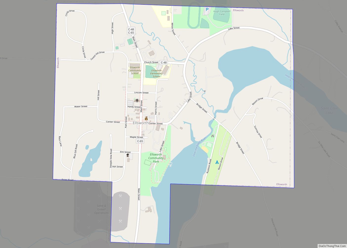
Ellsworth is a village in Antrim County in the U.S. state of Michigan. The population was 349 at the 2010 census. The village is located within Banks Township. The village is primarily a bedroom community with its primary industry being gravel and other aggregates. Agriculture and forestry are also important industries. Ellsworth is home to … Read more

Map of Elkton village, Michigan

Map of Elkton village, Michigan

Elkton is a village in Huron County in the U.S. state of Michigan. The population was 796 at the 2020 census. The village is within Oliver Township, along the Pinnebog River. It was incorporated in 1897. Elkton village overview: Name: Elkton village LSAD Code: 47 LSAD Description: village (suffix) State: Michigan County: Huron County Founded: … Read more

Map of Elk Rapids village

Map of Elk Rapids village

Elk Rapids is a village in the U.S. state of Michigan. The population was 1,529 at the 2020 census. Located in the southwest of Antrim County, Elk Rapids lies on an isthmus between Elk Lake and Grand Traverse Bay, a bay of Lake Michigan. The Elk River bisects the village, flowing west. The village is … Read more

Map of Elberta village, Michigan

Map of Elberta village, Michigan

Elberta (/ˌɛlˈbɜːr.tə/ el-BER-tə) is a village in Benzie County in the U.S. state of Michigan. The population was 329 at the 2020 census. Located in Gilmore Township, Elberta overlooks Lake Michigan and lies across Betsie Lake from Frankfort. Elberta is part of Northern Michigan. Elberta village overview: Name: Elberta village LSAD Code: 47 LSAD Description: … Read more

Map of Escanaba city

Map of Escanaba city

Escanaba (/ˌɛskəˈnɑːbə/ ES-kə-NAH-bə), commonly shortened to Esky, is a port city and the county seat of Delta County in the U.S. state of Michigan, located on Little Bay de Noc in the state’s Upper Peninsula. The population was 12,616 at the 2010 census, making it the third-largest city in the Upper Peninsula after Marquette and … Read more

Map of Empire village, Michigan

Map of Empire village, Michigan

Empire is a village on Lake Michigan in the northwestern Lower Peninsula of Michigan. Located in southwestern Leelanau County, its population was 362 at the 2020 census. The village is located within Empire Township, and is famous for its proximity to the Sleeping Bear Dunes National Lakeshore. Empire is home to the lakeshore’s headquarters, the … Read more

Map of Emmett village, Michigan

Map of Emmett village, Michigan

Emmett is a village in St. Clair County of the U.S. state of Michigan. The population was 269 at the 2010 census. The village is located within Emmett Township. Emmett village overview: Name: Emmett village LSAD Code: 47 LSAD Description: village (suffix) State: Michigan County: St. Clair County Elevation: 774 ft (236 m) Total Area: 1.50 sq mi (3.88 km²) … Read more

Map of Estral Beach village

Map of Estral Beach village

Estral Beach is a village in Monroe County in the U.S. state of Michigan. The population was 403 at the 2020 census. The village is located within Berlin Charter Township. Estral Beach village overview: Name: Estral Beach village LSAD Code: 47 LSAD Description: village (suffix) State: Michigan County: Monroe County Incorporated: 1925 Elevation: 571 ft (174 m) … Read more

Map of Essexville city

Map of Essexville city

Essexville is a city in Bay County in the U.S. state of Michigan. The population at 3,478 at the 2010 census. Located along the Saginaw River, Essexville is part of the Saginaw, Midland, and Bay City metropolitan area. Essexville city overview: Name: Essexville city LSAD Code: 25 LSAD Description: city (suffix) State: Michigan County: Bay … Read more

Map of Farmington city, Michigan

Map of Farmington city, Michigan

Farmington is a city in Oakland County in the U.S. state of Michigan. It is a northern suburb of Metro Detroit. As of the 2010 census, the population was 10,372. It is surrounded by Farmington Hills, except for a small portion bordered by Livonia to the south. Since 2009, the city’s downtown has been the … Read more

Map of Farmington Hills city

Map of Farmington Hills city

Farmington Hills is a city in Oakland County in the U.S. state of Michigan. Part of the affluent suburbs northwest of Detroit, Farmington Hills is the second most-populated city in Oakland County, after Troy, with a population of 83,986 at the 2020 census. Farmington Hills consistently ranks as one of the safest cities in the … Read more

Map of Fairgrove village

Map of Fairgrove village

Fairgrove is a village in Tuscola County in the U.S. state of Michigan. The population was 563 at the 2010 census. The village is located within Fairgrove Township. Fairgrove village overview: Name: Fairgrove village LSAD Code: 47 LSAD Description: village (suffix) State: Michigan County: Tuscola County Elevation: 659 ft (201 m) Total Area: 1.12 sq mi (2.90 km²) Land Area: … Read more