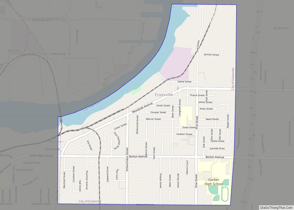
Essexville is a city in Bay County in the U.S. state of Michigan. The population at 3,478 at the 2010 census. Located along the Saginaw River, Essexville is part of the Saginaw, Midland, and Bay City metropolitan area.
| Name: | Essexville city |
|---|---|
| LSAD Code: | 25 |
| LSAD Description: | city (suffix) |
| State: | Michigan |
| County: | Bay County |
| Incorporated: | 1883 (village) 1934 (city) |
| Elevation: | 584 ft (178 m) |
| Total Area: | 1.40 sq mi (3.63 km²) |
| Land Area: | 1.29 sq mi (3.35 km²) |
| Water Area: | 0.11 sq mi (0.28 km²) |
| Total Population: | 3,379 |
| Population Density: | 2,609.27/sq mi (1,007.49/km²) |
| Area code: | 989 |
| FIPS code: | 2626420 |
| GNISfeature ID: | 0625647 |
Online Interactive Map
Click on ![]() to view map in "full screen" mode.
to view map in "full screen" mode.
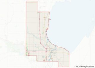
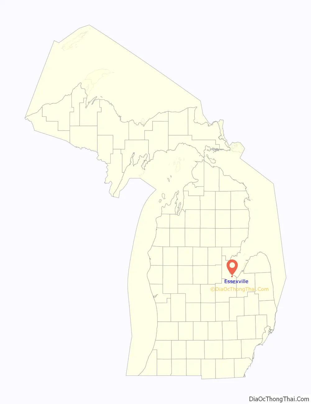
Essexville location map. Where is Essexville city?

History
Essexville is named after Ransom P. Essex, a local settler. It was first platted in 1867. The Essexville Post Office opened on Feb 27, 1871. The Post Office was closed from January 20 to February 24 in 1879. It was incorporated as a village in 1883 within Hampton Township and as a city in 1934.
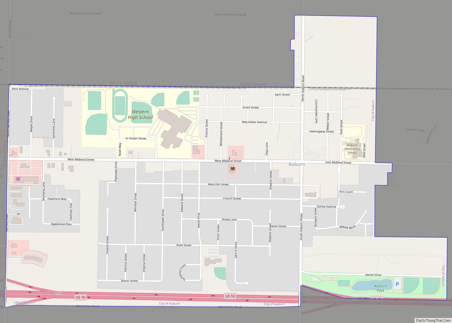
Essexville Road Map

Essexville city Satellite Map

Geography
According to the United States Census Bureau, the city has a total area of 1.41 square miles (3.65 km), of which 1.30 square miles (3.37 km) is land and 0.11 square miles (0.28 km) is water. It is also directly on the Saginaw River.
See also
Map of Michigan State and its subdivision:- Alcona
- Alger
- Allegan
- Alpena
- Antrim
- Arenac
- Baraga
- Barry
- Bay
- Benzie
- Berrien
- Branch
- Calhoun
- Cass
- Charlevoix
- Cheboygan
- Chippewa
- Clare
- Clinton
- Crawford
- Delta
- Dickinson
- Eaton
- Emmet
- Genesee
- Gladwin
- Gogebic
- Grand Traverse
- Gratiot
- Hillsdale
- Houghton
- Huron
- Ingham
- Ionia
- Iosco
- Iron
- Isabella
- Jackson
- Kalamazoo
- Kalkaska
- Kent
- Keweenaw
- Lake
- Lake Hurron
- Lake Michigan
- Lake St. Clair
- Lake Superior
- Lapeer
- Leelanau
- Lenawee
- Livingston
- Luce
- Mackinac
- Macomb
- Manistee
- Marquette
- Mason
- Mecosta
- Menominee
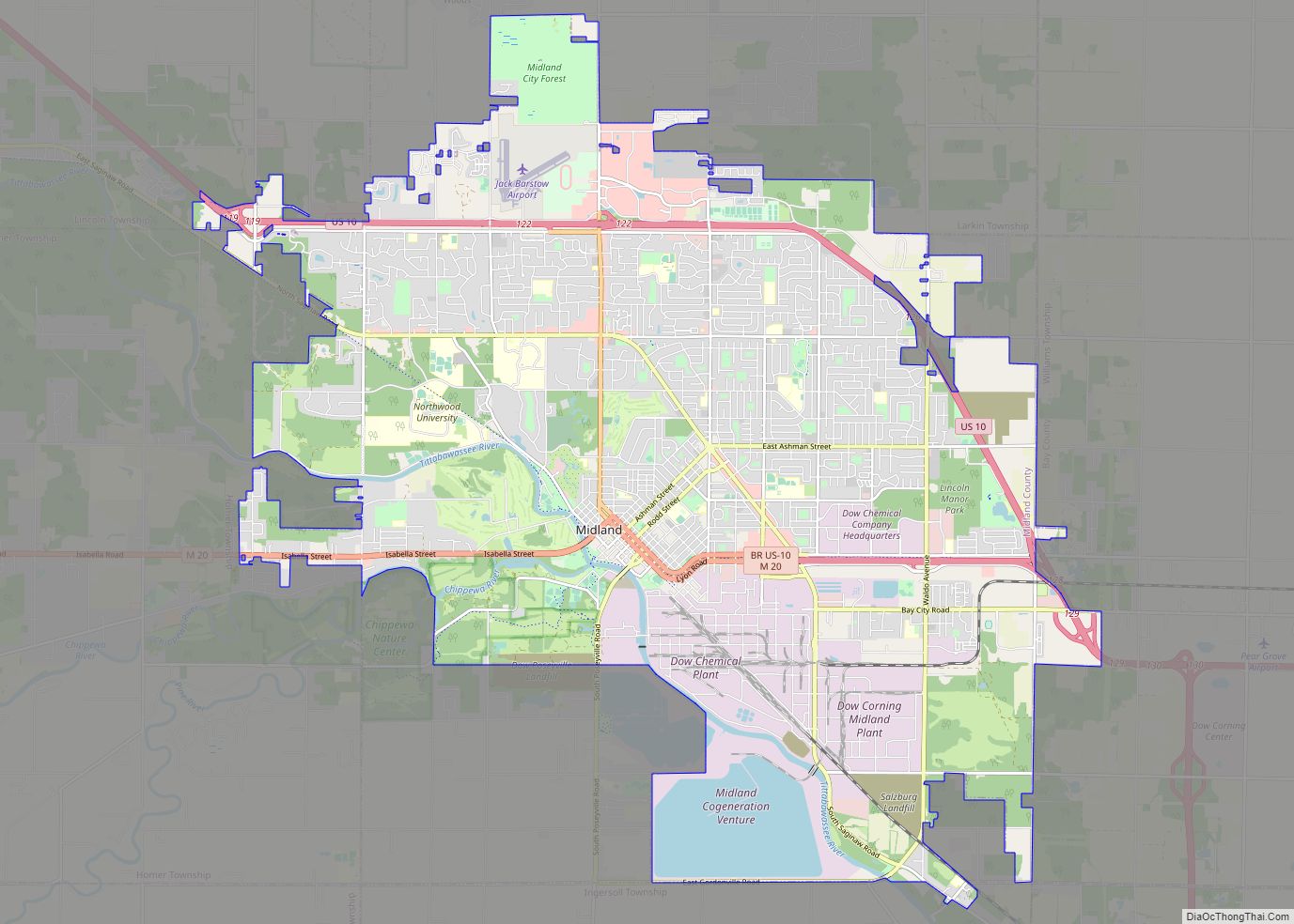
- Midland
- Missaukee
- Monroe
- Montcalm
- Montmorency
- Muskegon
- Newaygo
- Oakland
- Oceana
- Ogemaw
- Ontonagon
- Osceola
- Oscoda
- Otsego
- Ottawa
- Presque Isle
- Roscommon
- Saginaw
- Saint Clair
- Saint Joseph
- Sanilac
- Schoolcraft
- Shiawassee
- Tuscola
- Van Buren
- Washtenaw
- Wayne
- Wexford
- Alabama
- Alaska
- Arizona
- Arkansas
- California
- Colorado
- Connecticut
- Delaware
- District of Columbia
- Florida
- Georgia
- Hawaii
- Idaho
- Illinois
- Indiana
- Iowa
- Kansas
- Kentucky
- Louisiana
- Maine
- Maryland
- Massachusetts
- Michigan
- Minnesota
- Mississippi
- Missouri
- Montana
- Nebraska
- Nevada
- New Hampshire
- New Jersey
- New Mexico
- New York
- North Carolina
- North Dakota
- Ohio
- Oklahoma
- Oregon
- Pennsylvania
- Rhode Island
- South Carolina
- South Dakota
- Tennessee
- Texas
- Utah
- Vermont
- Virginia
- Washington
- West Virginia
- Wisconsin
- Wyoming