Map of Mapleview city
Mapleview is a city in Lansing Township, Mower County, Minnesota, United States. It is situated directly to the north of Austin‘s Oakwood Cemetery and can more or less be considered a suburb of Austin, although it is politically independent of it. The population was 176 at the 2010 census. It was named for a row ... Read more
Map of Mapleview city
Map of Mapleton city, Minnesota
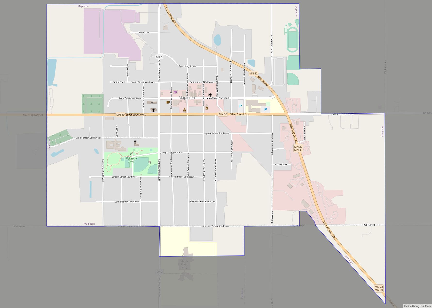
Mapleton is a city in Blue Earth County, Minnesota, United States. The population was 1,710 at the 2020 census. It is part of the Mankato–North Mankato Metropolitan Statistical Area. Mapleton city overview: Name: Mapleton city LSAD Code: 25 LSAD Description: city (suffix) State: Minnesota County: Blue Earth County Founded: 1871 Elevation: 1,037 ft (316 m) Total Area: ... Read more
Map of Mapleton city, Minnesota
Map of Maple Plain city
Maple Plain is a city in Hennepin County, Minnesota, United States. The population was 1,768 at the 2010 census. Maple Plain city overview: Name: Maple Plain city LSAD Code: 25 LSAD Description: city (suffix) State: Minnesota County: Hennepin County Elevation: 1,027 ft (313 m) Land Area: 1.06 sq mi (2.76 km²) Water Area: 0.01 sq mi (0.01 km²)  0.89% Population Density: 1,636.62/sq mi (632.02/km²) ... Read more
Map of Maple Plain city
Map of Maple Lake city
Maple Lake is a city in Wright County, Minnesota, United States. The population was 2,159 at the 2020 census. Minnesota State Highway 55 serves as a main route in the city. Maple Lake city overview: Name: Maple Lake city LSAD Code: 25 LSAD Description: city (suffix) State: Minnesota County: Wright County Elevation: 1,053 ft (321 m) Total ... Read more
Map of Maple Lake city
Map of Maple Grove city, Minnesota
Maple Grove is a suburban city in Hennepin County, Minnesota, United States. The population was 70,253 at the 2020 census. making it Minnesota’s 11th most populous city. Maple Grove serves as a retail, cultural and medical center in the northwest region of the Minneapolis–Saint Paul metropolitan area. One of the Twin Cities’ largest shopping centers, ... Read more
Map of Maple Grove city, Minnesota
Map of Mantorville city
Mantorville (/ˈmæntərvɪl/ MAN-tər-vil) is a city in Dodge County, Minnesota, United States. The population was 1,197 at the 2010 census. It is the county seat of Dodge County. Founded in 1854, the city is one of the oldest in Minnesota. Mantorville shares a school system with nearby Kasson, Minnesota (the “K–M Komets”). The K–M school ... Read more
Map of Mantorville city
Map of Mankato city, Minnesota
Mankato (/mænˈkeɪtoʊ/ man-KAY-toh) is a city in Blue Earth, Nicollet, and Le Sueur counties in the state of Minnesota. The population was 44,488 according to the 2020 census, making it the 21st-largest city in Minnesota, and the 5th-largest outside of the Minneapolis–Saint Paul metropolitan area. It is along a large bend of the Minnesota River ... Read more
Map of Mankato city, Minnesota
Map of Manhattan Beach city, Minnesota
Manhattan Beach is a small city in Crow Wing County, Minnesota, United States, near Crosslake. The population was 57 at the 2010 census. It is part of the Brainerd Micropolitan Statistical Area. Manhattan Beach city overview: Name: Manhattan Beach city LSAD Code: 25 LSAD Description: city (suffix) State: Minnesota County: Crow Wing County Elevation: 1,270 ft ... Read more
Map of Manhattan Beach city, Minnesota
Map of Manchester city, Minnesota
Manchester is a city in Freeborn County, Minnesota, United States. The population was 57 at the 2010 census. Manchester city overview: Name: Manchester city LSAD Code: 25 LSAD Description: city (suffix) State: Minnesota County: Freeborn County Elevation: 1,289 ft (393 m) Total Area: 0.07 sq mi (0.19 km²) Land Area: 0.07 sq mi (0.19 km²) Water Area: 0.00 sq mi (0.00 km²) Total Population: 52 Population ... Read more
Map of Manchester city, Minnesota
Map of Mayer city, Minnesota
Mayer (/ˈmeɪər/ MAY-ər) is a community in Carver County, Minnesota, United States, along the South Fork of the Crow River. The population was 1,749 at the 2010 census. Mayer city overview: Name: Mayer city LSAD Code: 25 LSAD Description: city (suffix) State: Minnesota County: Carver County Elevation: 961 ft (293 m) Total Area: 1.40 sq mi (3.63 km²) Land Area: ... Read more
Map of Mayer city, Minnesota
Map of Martin Lake CDP
Martin Lake is an unincorporated community and census-designated place (CDP) in Linwood Township, Anoka County, Minnesota, United States. Its population was 933 as of the 2010 census. Anoka County Road 26 and Anoka County Road 85 serve as two main routes in the community. Anoka County Road 22 is nearby. Martin Lake is located within ... Read more
Map of Martin Lake CDP
Map of Marshall city, Minnesota
Marshall is a city in Lyon County, Minnesota, United States. The population was 13,680 at the 2010 census. Marshall is a regional center in southwest Minnesota, and the county seat of Lyon County. It is the headquarters of the Schwan Food Company and the home of Southwest Minnesota State University. Marshall city overview: Name: Marshall ... Read more
Map of Marshall city, Minnesota