Map of Vineland CDP, Minnesota

Map of Vineland CDP, Minnesota

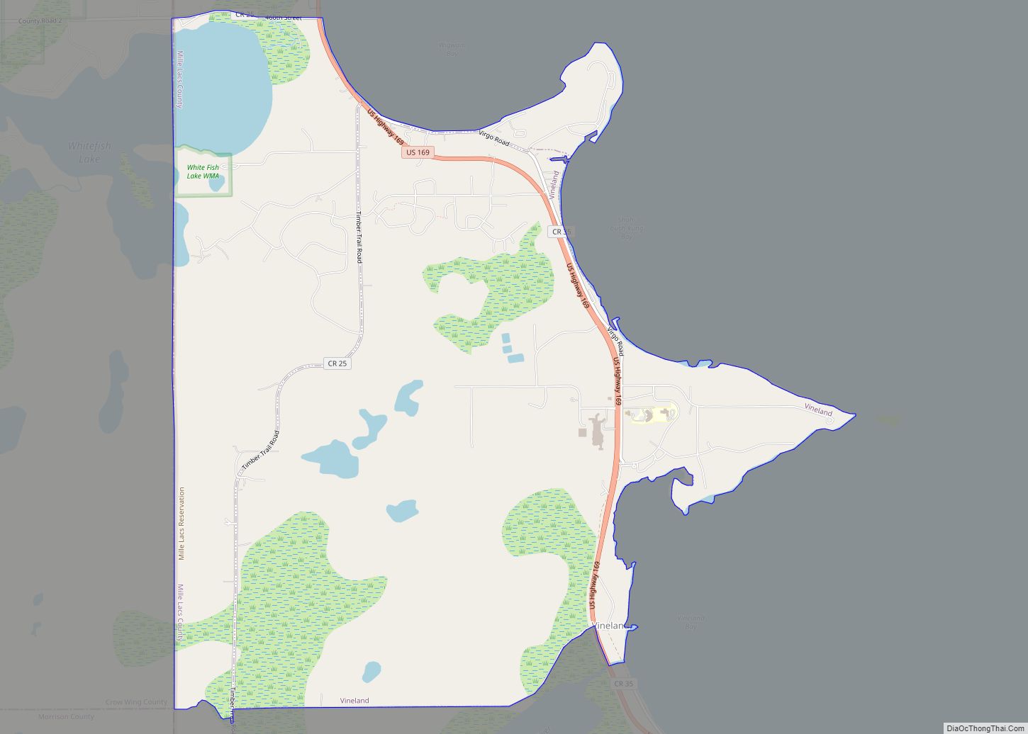
Vineland is an unincorporated community and census-designated place (CDP) in the Mille Lacs Indian Reservation portion of Mille Lacs County, Minnesota, United States. The population was 1,001 at the 2010 census. Its name in the Ojibwe language is Neyaashiing, meaning “on the point of land” due to its location on Indian Point (also known as … Read more

Map of Waconia city

Map of Waconia city

Waconia (/wəˈkoʊnjə/ wə-KOHN-yə) is a city in Carver County, Minnesota, United States. Waconia attracts visitors to nearby Lake Waconia, a lake locally renowned for its fishing and recreation opportunities. The city’s population was 13,033 at the 2020 census. Waconia city overview: Name: Waconia city LSAD Code: 25 LSAD Description: city (suffix) State: Minnesota County: Carver … Read more

Map of Wabasso city, Minnesota

Map of Wabasso city, Minnesota

Wabasso (/wəˈbæsoʊ/) is a city in Redwood County, Minnesota, United States. The population was 696 at the 2010 census. Wabasso city overview: Name: Wabasso city LSAD Code: 25 LSAD Description: city (suffix) State: Minnesota County: Redwood County Elevation: 1,079 ft (329 m) Total Area: 0.85 sq mi (2.20 km²) Land Area: 0.85 sq mi (2.20 km²) Water Area: 0.00 sq mi (0.00 km²) Total Population: 739 … Read more

Map of Wabasha city

Map of Wabasha city

Wabasha is a city and the county seat of Wabasha County, Minnesota. The population was 2,559 at the time of the 2020 census. It is on the Mississippi River, near its confluence with the Zumbro River. Wabasha city overview: Name: Wabasha city LSAD Code: 25 LSAD Description: city (suffix) State: Minnesota County: Wabasha County Elevation: … Read more

Map of Waite Park city

Map of Waite Park city

Waite Park is a city in Stearns County, Minnesota, United States. The population was 8,341 at the 2020 census. It is part of the St. Cloud Metropolitan Statistical Area. Waite Park city overview: Name: Waite Park city LSAD Code: 25 LSAD Description: city (suffix) State: Minnesota County: Stearns County Incorporated: 1893 Elevation: 1,070 ft (326 m) Total … Read more

Map of Wahkon city

Map of Wahkon city

Wahkon is a city in Mille Lacs County, Minnesota, United States. The population was 206 at the 2010 census. Wahkon city overview: Name: Wahkon city LSAD Code: 25 LSAD Description: city (suffix) State: Minnesota County: Mille Lacs County Elevation: 1,273 ft (388 m) Total Area: 0.96 sq mi (2.50 km²) Land Area: 0.96 sq mi (2.48 km²) Water Area: 0.01 sq mi (0.02 km²) Total Population: … Read more

Map of Wadena city, Minnesota

Map of Wadena city, Minnesota

Wadena (/wəˈdiːnə/ wə-DEEN-ə) is a city in Otter Tail and Wadena counties in the State of Minnesota. It is about one hundred sixty miles northwest of the Minneapolis – Saint Paul metro area. The population was 4,325 at the 2020 census. It is the county seat of Wadena County. Wadena is an agricultural community and … Read more

Map of Walnut Grove city, Minnesota

Map of Walnut Grove city, Minnesota

Walnut Grove is a city in Redwood County, Minnesota, United States. The population was 871 at the 2010 census. Another name formerly associated with the area is Walnut Station. Walnut Grove city overview: Name: Walnut Grove city LSAD Code: 25 LSAD Description: city (suffix) State: Minnesota County: Redwood County Founded: 1874 Incorporated: 1879 Elevation: 1,217 ft … Read more

Map of Walker city, Minnesota

Map of Walker city, Minnesota

Walker is a city in Cass County, Minnesota, United States. The population was 941 at the 2010 census. It is the county seat of Cass County. Walker is part of the Brainerd Micropolitan Statistical Area. Minnesota State Highways 34, 200, and 371 are three of the main routes in the city. Walker city overview: Name: … Read more

Map of Waldorf city, Minnesota

Map of Waldorf city, Minnesota

Waldorf is a city in Waseca County, Minnesota, United States. The population was 229 at the 2010 census. Waldorf city overview: Name: Waldorf city LSAD Code: 25 LSAD Description: city (suffix) State: Minnesota County: Waseca County Elevation: 1,079 ft (329 m) Total Area: 0.38 sq mi (0.98 km²) Land Area: 0.38 sq mi (0.98 km²) Water Area: 0.00 sq mi (0.00 km²) Total Population: 201 Population … Read more

Map of Walters city

Map of Walters city, Minnesota

Walters is a city in Faribault County, Minnesota, United States. The population was 73 at the 2010 census. Walters city overview: Name: Walters city LSAD Code: 25 LSAD Description: city (suffix) State: Minnesota County: Faribault County Elevation: 1,257 ft (383 m) Total Area: 0.20 sq mi (0.52 km²) Land Area: 0.20 sq mi (0.52 km²) Water Area: 0.00 sq mi (0.00 km²) Total Population: 69 Population … Read more

Map of Wanamingo city

Map of Wanamingo city

Wanamingo is a community in Goodhue County, Minnesota, United States, incorporated as a city. It lies along the North Fork of the Zumbro River. The population was 1,086 at the 2010 census. The ethanol company POET LLC started on the farm of Lowell Broin in 1983 near the community. Wanamingo city overview: Name: Wanamingo city … Read more