Map of New London city, Missouri

Map of New London city, Missouri

New London is a city in Ralls County, Missouri, United States. The population was 943 at the 2020 census. It is the county seat of Ralls County. New London is part of the Hannibal Micropolitan Statistical Area. William Jameson, claimed land, made a plat, and founded New London in 1819. New London was named the … Read more

Map of New Haven city, Missouri

Map of New Haven city, Missouri

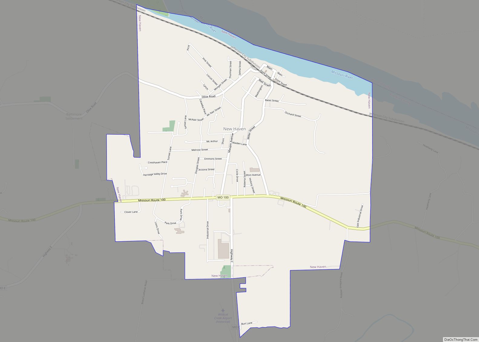
New Haven is a city in Franklin County, Missouri, United States. The population was 2,414 as of the 2020 census. New Haven is within the Hermann AVA (American Viticultural Area). New Haven city overview: Name: New Haven city LSAD Code: 25 LSAD Description: city (suffix) State: Missouri County: Franklin County Elevation: 669 ft (204 m) Total Area: … Read more

Map of New Melle city

Map of New Melle city

New Melle is a small country community in St. Charles County, Missouri, United States. It is located approximately 38 miles west of St. Louis. The population was 475 at the 2010 census. New Melle city overview: Name: New Melle city LSAD Code: 25 LSAD Description: city (suffix) State: Missouri County: St. Charles County Elevation: 771 ft … Read more

Map of Newburg city

Map of Newburg city, Missouri

Newburg is a city in Phelps County, Missouri, United States. The population was 470 at the 2010 census. Newburg city overview: Name: Newburg city LSAD Code: 25 LSAD Description: city (suffix) State: Missouri County: Phelps County Elevation: 728 ft (222 m) Total Area: 0.65 sq mi (1.69 km²) Land Area: 0.65 sq mi (1.67 km²) Water Area: 0.01 sq mi (0.02 km²) Total Population: 333 Population … Read more

Map of Newark village, Missouri

Map of Newark village, Missouri

Newark is a village in southeast Knox County, Missouri, United States, along the South Fabius River. As of the 2020 census, its population was 54. Newark village overview: Name: Newark village LSAD Code: 47 LSAD Description: village (suffix) State: Missouri County: Knox County Elevation: 692 ft (211 m) Total Area: 0.32 sq mi (0.84 km²) Land Area: 0.32 sq mi (0.84 km²) Water … Read more

Map of Niangua city

Map of Niangua city

Niangua is a city in Webster County, Missouri, United States. The population was 405 at the 2010 census. Niangua is part of the Springfield, Missouri Metropolitan Statistical Area. Niangua city overview: Name: Niangua city LSAD Code: 25 LSAD Description: city (suffix) State: Missouri County: Webster County Elevation: 1,440 ft (439 m) Total Area: 0.41 sq mi (1.06 km²) Land Area: … Read more

Map of Newtown town, Missouri

Map of Newtown town, Missouri

Newtown is a city in Sullivan County, Missouri, United States. The population was 113 at the 2020 census. Newtown town overview: Name: Newtown town LSAD Code: 43 LSAD Description: town (suffix) State: Missouri County: Sullivan County Total Area: 0.26 sq mi (0.66 km²) Land Area: 0.25 sq mi (0.65 km²) Water Area: 0.00 sq mi (0.01 km²) Total Population: 113 Population Density: 446.64/sq mi (172.74/km²) … Read more

Map of Newtonia town

Map of Newtonia town

Newtonia is a village in Newton County, Missouri, United States. The population was 199 at the 2010 census. It is part of the Joplin, Missouri Metropolitan Statistical Area. Newtonia was the site of the Battles of Newtonia during the American Civil War. The village contains some Antebellum houses, such as the Mathew H. Ritchey House, … Read more

Map of Norborne city

Map of Norborne city

Norborne is a city in southwest Carroll County, Missouri, United States. The population was 634 at the 2020 census. Norborne was founded in 1868 by Norborne B. Coats, a civil engineer for the railroad. The town has numerous small businesses but is mostly an agricultural community. Norborne is the self-proclaimed Soybean Capital of the World … Read more

Map of Noel city

Map of Noel city

Noel is a city in McDonald County, Missouri, United States, along the Elk River. The population was 1,832 at the 2010 census. The county adjoins the border with Northwest Arkansas. Noel city overview: Name: Noel city LSAD Code: 25 LSAD Description: city (suffix) State: Missouri County: McDonald County Elevation: 833 ft (254 m) Total Area: 2.10 sq mi (5.44 km²) … Read more

Map of Nixa city

Map of Nixa city

Nixa is a city in Christian County, Missouri, United States. As of the 2020 census, the city’s population was 23,257. It is a principal city, and the second largest city in the Springfield, Missouri Metropolitan Statistical Area. Nixa city overview: Name: Nixa city LSAD Code: 25 LSAD Description: city (suffix) State: Missouri County: Christian County … Read more

Map of North Lilbourn village

Map of North Lilbourn village

North Lilbourn is a village in New Madrid County, Missouri, United States. The population was 22 at the 2020 census. North Lilbourn village overview: Name: North Lilbourn village LSAD Code: 47 LSAD Description: village (suffix) State: Missouri County: New Madrid County Elevation: 282 ft (86 m) Total Area: 0.17 sq mi (0.45 km²) Land Area: 0.17 sq mi (0.45 km²) Water Area: 0.00 sq mi … Read more