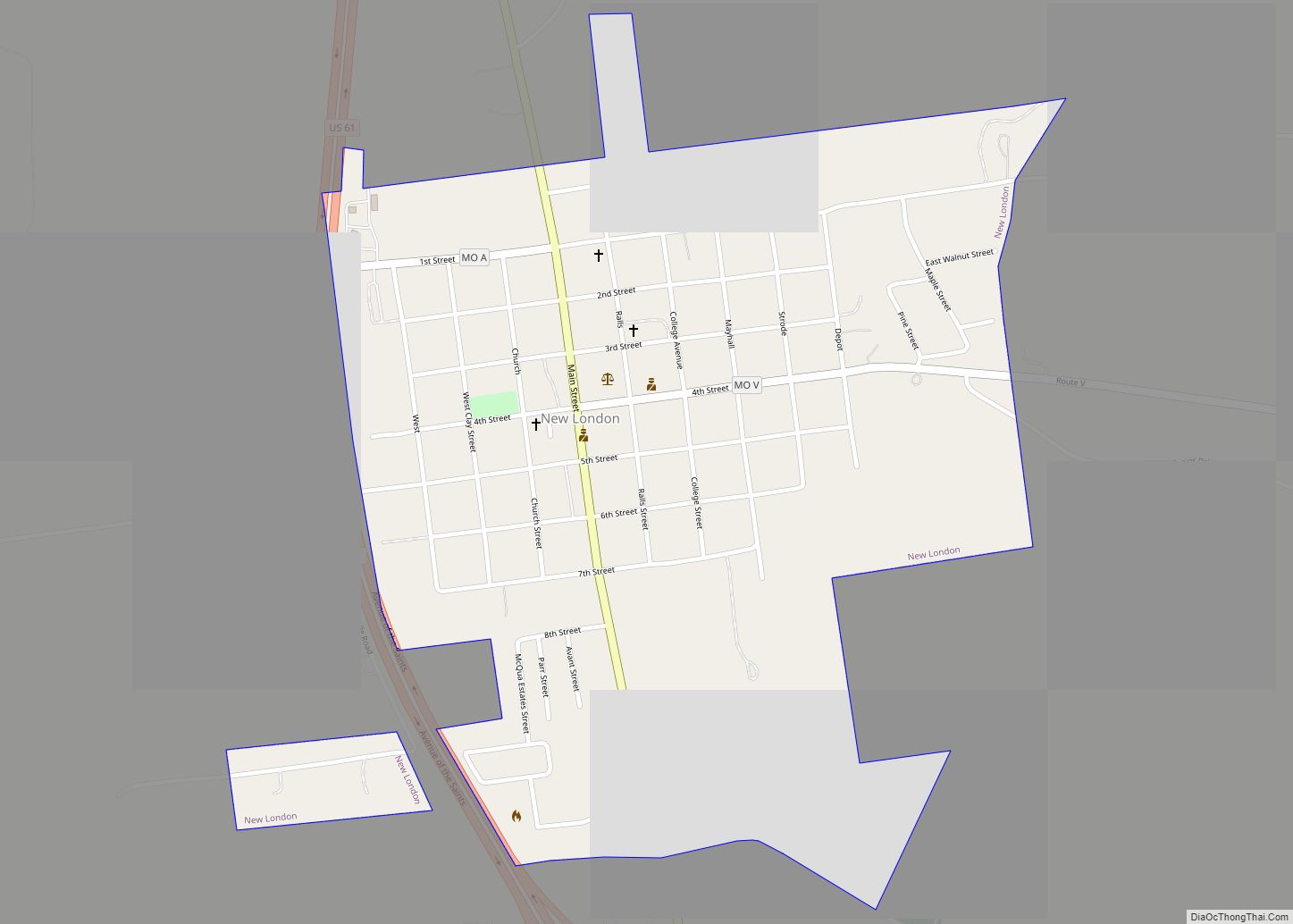
New London is a city in Ralls County, Missouri, United States. The population was 943 at the 2020 census. It is the county seat of Ralls County.
New London is part of the Hannibal Micropolitan Statistical Area. William Jameson, claimed land, made a plat, and founded New London in 1819. New London was named the county seat in 1820. The Ralls County Courthouse in New London was built in 1858 and is the oldest court house in Missouri.
| Name: | New London city |
|---|---|
| LSAD Code: | 25 |
| LSAD Description: | city (suffix) |
| State: | Missouri |
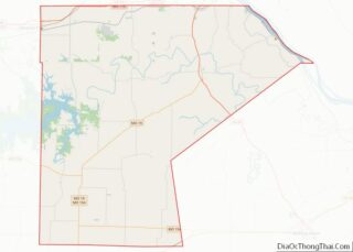
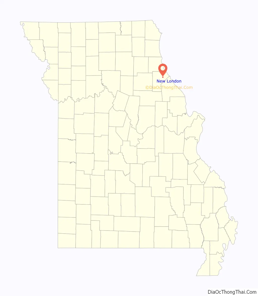
| County: | Ralls County |
| Elevation: | 656 ft (200 m) |
| Total Area: | 0.70 sq mi (1.81 km²) |
| Land Area: | 0.69 sq mi (1.80 km²) |
| Water Area: | 0.00 sq mi (0.01 km²) |
| Total Population: | 943 |
| Population Density: | 1,358.79/sq mi (524.44/km²) |
| ZIP code: | 63459 |
| Area code: | 573 |
| FIPS code: | 2952058 |
| GNISfeature ID: | 0723280 |
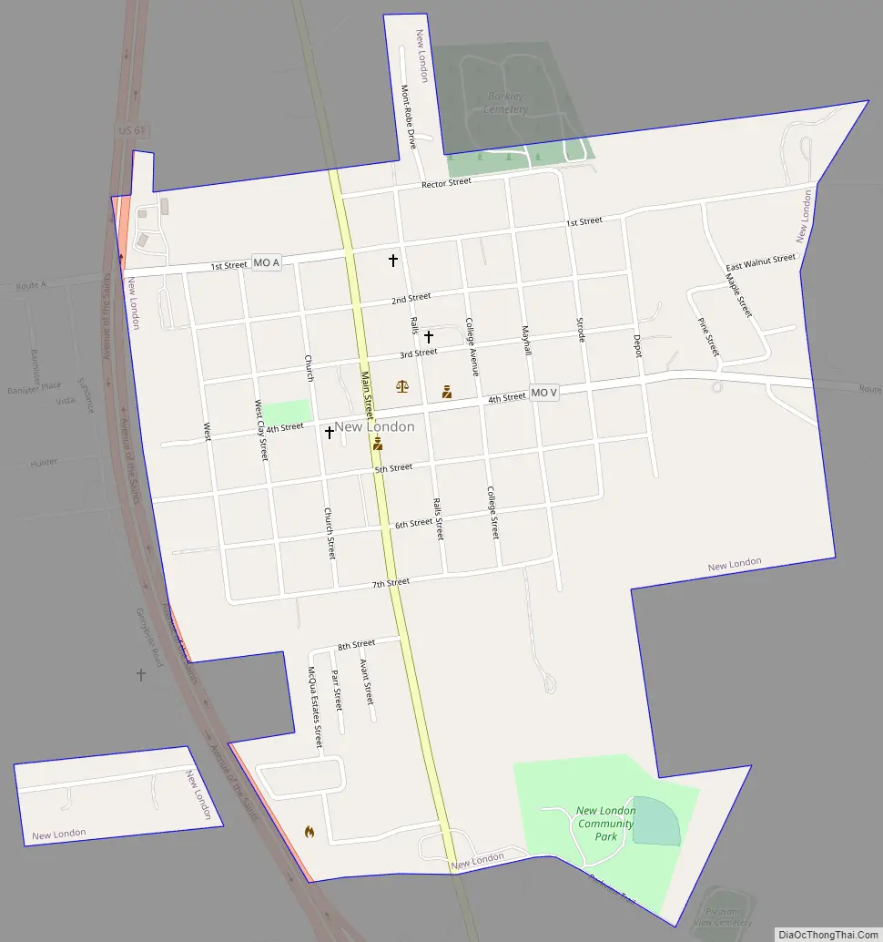
Online Interactive Map
Click on ![]() to view map in "full screen" mode.
to view map in "full screen" mode.
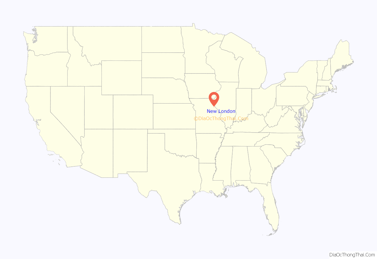
New London location map. Where is New London city?
History
New London was platted in 1819. The community was named after London, England. A post office called New London has been in operation since 1820. The same year it became county seat of Ralls County. The county courthouse was built in 1858 and is the oldest court house in Missouri. In the front yard of the court house stands a WWI cannon. Today, the Ralls County Courthouse and Jail-Sheriff’s House are listed on the National Register of Historic Places.
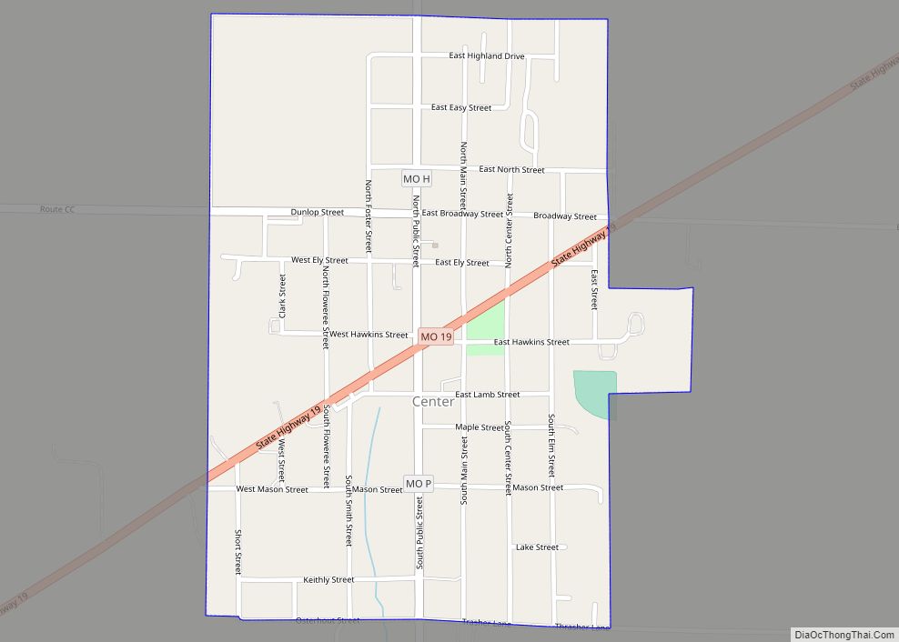
New London Road Map
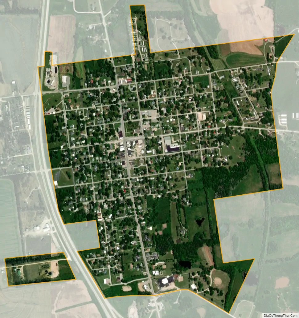
New London city Satellite Map
Geography
New London is located at the intersection of US Route 61 and Missouri Route 19. The Salt River flows past one to two miles to the north and east and the Mississippi River is approximately nine miles to the east. Hannibal is about eight miles north on Route 61.
According to the United States Census Bureau, the city has a total area of 0.69 square miles (1.79 km), all land.
See also
Map of Missouri State and its subdivision:- Adair
- Andrew
- Atchison
- Audrain
- Barry
- Barton
- Bates
- Benton
- Bollinger
- Boone
- Buchanan
- Butler
- Caldwell
- Callaway
- Camden
- Cape Girardeau
- Carroll
- Carter
- Cass
- Cedar
- Chariton
- Christian
- Clark
- Clay
- Clinton
- Cole
- Cooper
- Crawford
- Dade
- Dallas
- Daviess
- De Kalb
- Dent
- Douglas
- Dunklin
- Franklin
- Gasconade
- Gentry
- Greene
- Grundy
- Harrison
- Henry
- Hickory
- Holt
- Howard
- Howell
- Iron
- Jackson
- Jasper
- Jefferson
- Johnson
- Knox
- Laclede
- Lafayette
- Lawrence
- Lewis
- Lincoln
- Linn
- Livingston
- Macon
- Madison
- Maries
- Marion
- McDonald
- Mercer
- Miller
- Mississippi
- Moniteau
- Monroe
- Montgomery
- Morgan
- New Madrid
- Newton
- Nodaway
- Oregon
- Osage
- Ozark
- Pemiscot
- Perry
- Pettis
- Phelps
- Pike
- Platte
- Polk
- Pulaski
- Putnam
- Ralls
- Randolph
- Ray
- Reynolds
- Ripley
- Saint Charles
- Saint Clair
- Saint Francois
- Saint Louis
- Sainte Genevieve
- Saline
- Schuyler
- Scotland
- Scott
- Shannon
- Shelby
- Stoddard
- Stone
- Sullivan
- Taney
- Texas
- Vernon
- Warren
- Washington
- Wayne
- Webster
- Worth
- Wright
- Alabama
- Alaska
- Arizona
- Arkansas
- California
- Colorado
- Connecticut
- Delaware
- District of Columbia
- Florida
- Georgia
- Hawaii
- Idaho
- Illinois
- Indiana
- Iowa
- Kansas
- Kentucky
- Louisiana
- Maine
- Maryland
- Massachusetts
- Michigan
- Minnesota
- Mississippi
- Missouri
- Montana
- Nebraska
- Nevada
- New Hampshire
- New Jersey
- New Mexico
- New York
- North Carolina
- North Dakota
- Ohio
- Oklahoma
- Oregon
- Pennsylvania
- Rhode Island
- South Carolina
- South Dakota
- Tennessee
- Texas
- Utah
- Vermont
- Virginia
- Washington
- West Virginia
- Wisconsin
- Wyoming