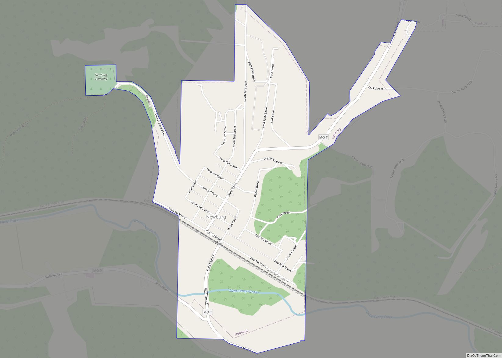
Newburg is a city in Phelps County, Missouri, United States. The population was 470 at the 2010 census.
| Name: | Newburg city |
|---|---|
| LSAD Code: | 25 |
| LSAD Description: | city (suffix) |
| State: | Missouri |
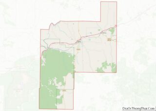
| County: | Phelps County |
| Elevation: | 728 ft (222 m) |
| Total Area: | 0.65 sq mi (1.69 km²) |
| Land Area: | 0.65 sq mi (1.67 km²) |
| Water Area: | 0.01 sq mi (0.02 km²) |
| Total Population: | 333 |
| Population Density: | 516.28/sq mi (199.38/km²) |
| ZIP code: | 65550 |
| Area code: | 573 |
| FIPS code: | 2951716 |
| GNISfeature ID: | 2395222 |
Online Interactive Map
Click on ![]() to view map in "full screen" mode.
to view map in "full screen" mode.
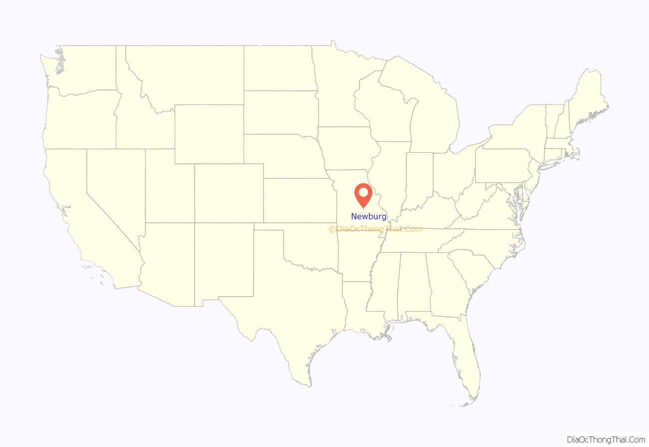
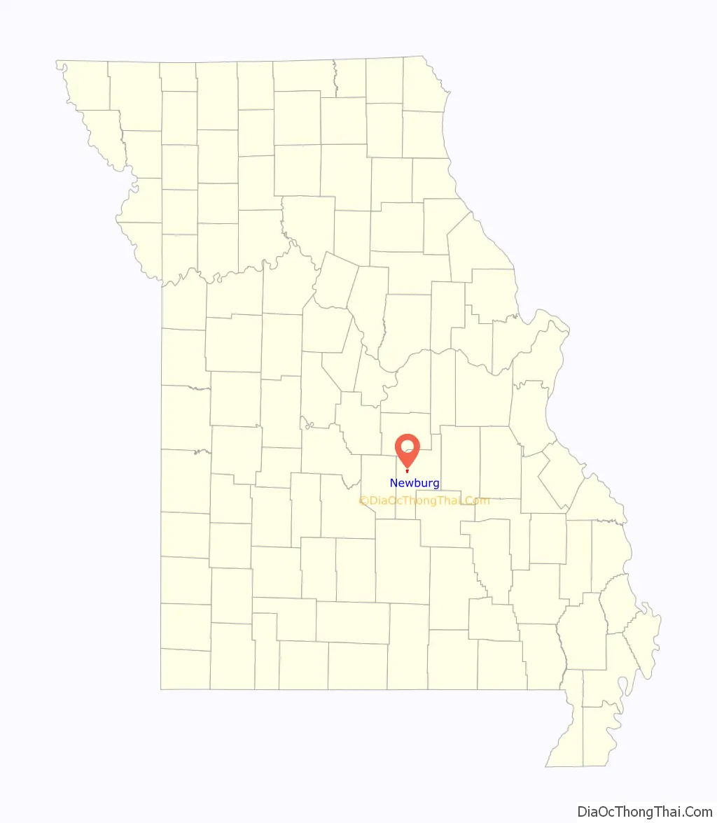
Newburg location map. Where is Newburg city?
History
Newburg was founded in 1883 by St. Louis – San Francisco Railway as a division point for the railroad, where engines would stop for repairs and to change crews. It is currently used heavily by the Burlington Northern Santa Fe Railroad as a maintenance stop, with a large supply of railroad materials along the double tracks.
Iron working was attempted twice in Newburg. Easy access to the railroad made heavy industry a viable business. Construction of the Ozark Iron Works began after 1867, but the business went bankrupt in 1877. The Knotwell Iron Company attempted to use the facilities in 1880, but quit shortly afterwards due to a severe drop in iron prices.
After World War II, the railway switched from coal to diesel engines, which could run much longer distances without refueling. The Newburg stop was closed in the 1960’s, removing the roundhouse, turntable, and freight yards. A single “Frisco” caboose remains near the old freight yards.
Missouri University of Science and Technology in nearby Rolla has planned and implemented many projects in the city of Newburg.
The Community Theater, Gourd Creek Cave Archeological Site, Onyx Cave, and Ozark Iron Furnace Stack are listed on the National Register of Historic Places.
Newburg Road Map
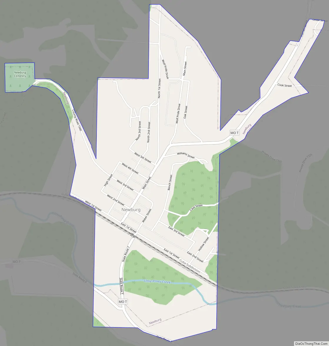
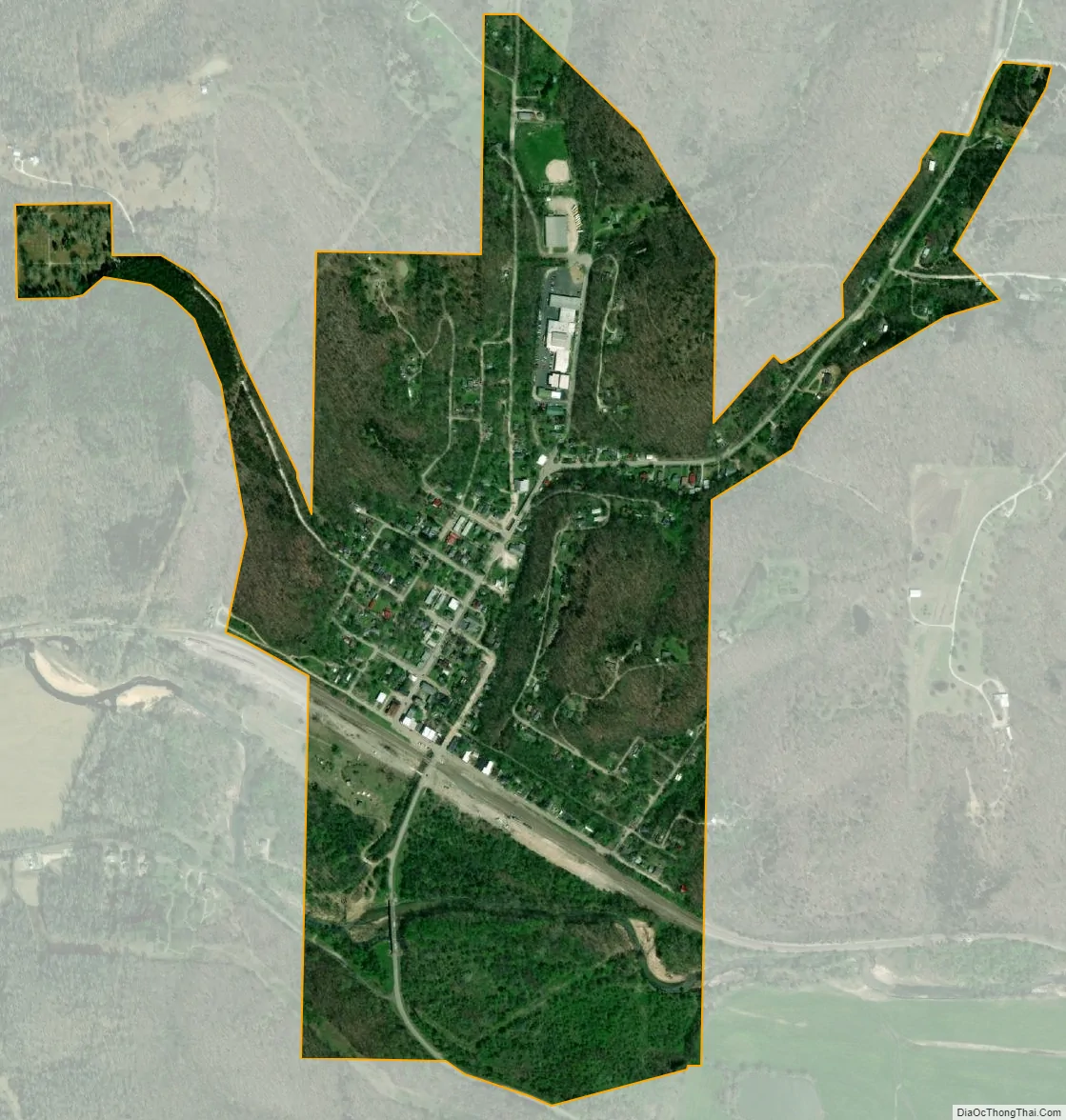
Newburg city Satellite Map
Geography
Newburg is located on the north bank of the Little Piney Creek floodplain. The St. Louis–San Francisco Railway passes through the south edge of the city.
According to the United States Census Bureau, the city has a total area of 0.62 square miles (1.61 km), of which 0.61 square miles (1.58 km) is land and 0.01 square miles (0.03 km) is water.
Newburg is situated near the former U.S. Route 66 on State Hwy T. A handful of structures which served tourism on Route 66 before it was bypassed by Interstate 44 some business structures still remain, including The Houston House, John’s Modern Cabins (a ghost tourist court, now in ruins) and Vernelle’s Motel (still operational, except for an on-site restaurant and filling station demolished when US 66 was widened in 1957).
See also
Map of Missouri State and its subdivision:- Adair
- Andrew
- Atchison
- Audrain
- Barry
- Barton
- Bates
- Benton
- Bollinger
- Boone
- Buchanan
- Butler
- Caldwell
- Callaway
- Camden
- Cape Girardeau
- Carroll
- Carter
- Cass
- Cedar
- Chariton
- Christian
- Clark
- Clay
- Clinton
- Cole
- Cooper
- Crawford
- Dade
- Dallas
- Daviess
- De Kalb
- Dent
- Douglas
- Dunklin
- Franklin
- Gasconade
- Gentry
- Greene
- Grundy
- Harrison
- Henry
- Hickory
- Holt
- Howard
- Howell
- Iron
- Jackson
- Jasper
- Jefferson
- Johnson
- Knox
- Laclede
- Lafayette
- Lawrence
- Lewis
- Lincoln
- Linn
- Livingston
- Macon
- Madison
- Maries
- Marion
- McDonald
- Mercer
- Miller
- Mississippi
- Moniteau
- Monroe
- Montgomery
- Morgan
- New Madrid
- Newton
- Nodaway
- Oregon
- Osage
- Ozark
- Pemiscot
- Perry
- Pettis
- Phelps
- Pike
- Platte
- Polk
- Pulaski
- Putnam
- Ralls
- Randolph
- Ray
- Reynolds
- Ripley
- Saint Charles
- Saint Clair
- Saint Francois
- Saint Louis
- Sainte Genevieve
- Saline
- Schuyler
- Scotland
- Scott
- Shannon
- Shelby
- Stoddard
- Stone
- Sullivan
- Taney
- Texas
- Vernon
- Warren
- Washington
- Wayne
- Webster
- Worth
- Wright
- Alabama
- Alaska
- Arizona
- Arkansas
- California
- Colorado
- Connecticut
- Delaware
- District of Columbia
- Florida
- Georgia
- Hawaii
- Idaho
- Illinois
- Indiana
- Iowa
- Kansas
- Kentucky
- Louisiana
- Maine
- Maryland
- Massachusetts
- Michigan
- Minnesota
- Mississippi
- Missouri
- Montana
- Nebraska
- Nevada
- New Hampshire
- New Jersey
- New Mexico
- New York
- North Carolina
- North Dakota
- Ohio
- Oklahoma
- Oregon
- Pennsylvania
- Rhode Island
- South Carolina
- South Dakota
- Tennessee
- Texas
- Utah
- Vermont
- Virginia
- Washington
- West Virginia
- Wisconsin
- Wyoming