Noel is a city in McDonald County, Missouri, United States, along the Elk River. The population was 1,832 at the 2010 census. The county adjoins the border with Northwest Arkansas.
| Name: | Noel city |
|---|---|
| LSAD Code: | 25 |
| LSAD Description: | city (suffix) |
| State: | Missouri |
| County: | McDonald County |
| Elevation: | 833 ft (254 m) |
| Total Area: | 2.10 sq mi (5.44 km²) |
| Land Area: | 2.02 sq mi (5.25 km²) |
| Water Area: | 0.08 sq mi (0.20 km²) |
| Total Population: | 2,124 |
| Population Density: | 1,048.89/sq mi (404.92/km²) |
| ZIP code: | 64854 |
| Area code: | 417 |
| FIPS code: | 2952742 |
| GNISfeature ID: | 0723397 |
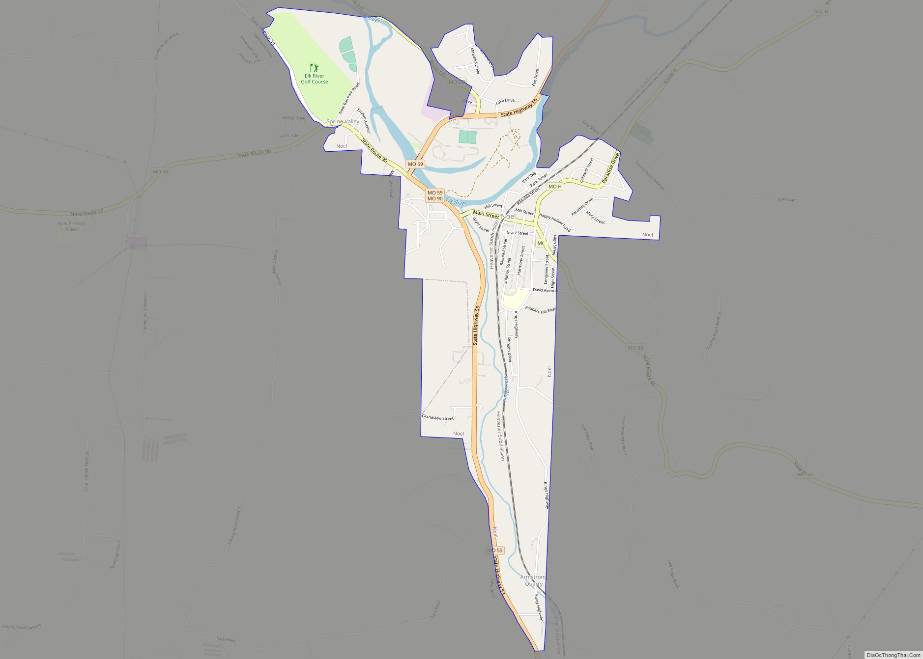
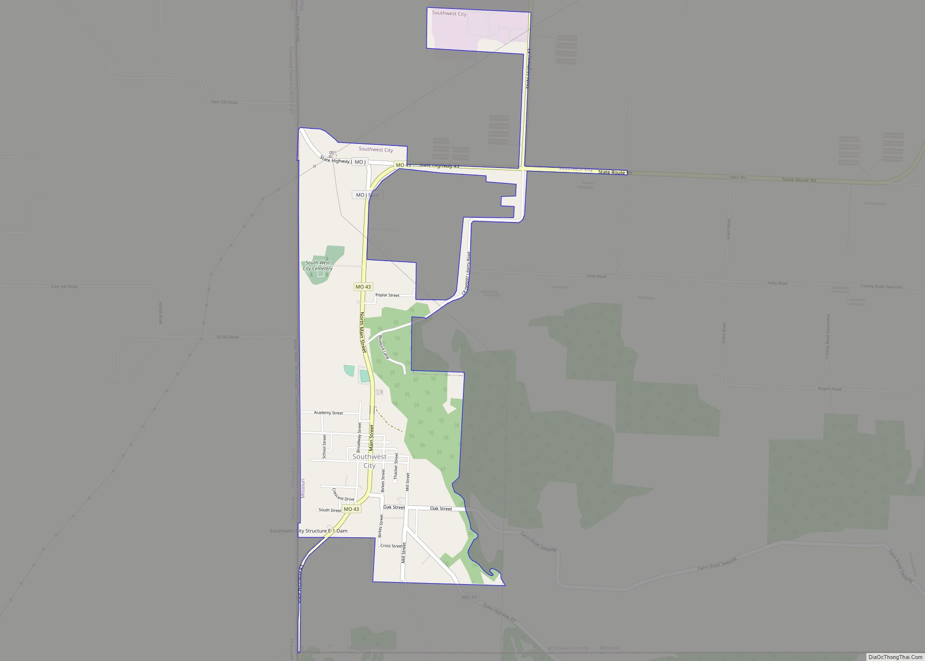
Online Interactive Map
Click on ![]() to view map in "full screen" mode.
to view map in "full screen" mode.
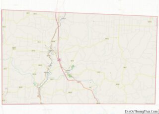
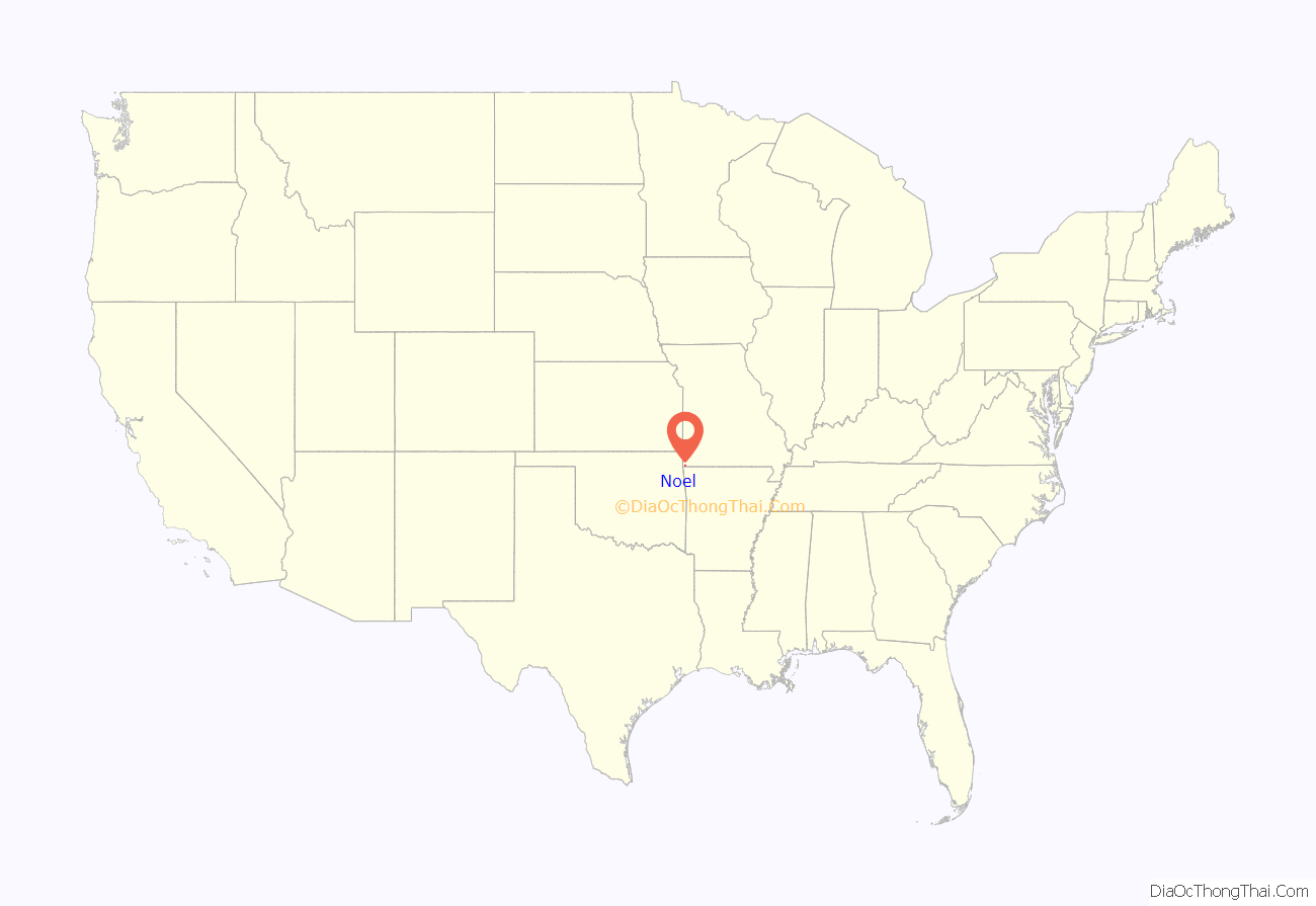
Noel location map. Where is Noel city?

History
A post office called Noel has been in operation since 1886. The community was named for Clark Wallace “C.W.” and William Jasper “W.J.” Noel; brothers, stockmen, and owners of a saw mill.
Noel later capitalized on its Christmas-themed name, along with North Pole, Alaska, Christmas, Michigan, Santa Claus, Indiana, and Bethlehem, Pennsylvania. Each year, tens of thousands of Christmas cards and letters are sent to the USPS Noel Post Office during the holiday season to be stamped with a postmark reading, Noel, Mo. – “The Christmas City in the Ozark Vacation Land”. This practice became popular by the late 1940s when Kate Smith, a radio and television singer, began telling the “Noel Story” during her broadcasts. Most of the year, area residents pronounce Noel as rhyming with mole, in honor of the town’s namesake, Bridges Noel. The town was founded after the Kansas City, Pittsburg, and Gulf Railroad arrived.
Noel is home to a Tyson Foods chicken-processing plant. By 2010, between 400 and 500 Somali refugees, and 60 and 70 Sudanese refugees, out of 1,800 residents, lived in the town, most of whom worked for Tyson Foods. In 2011, 130 Muslim employees stopped working temporarily after they were allegedly discouraged from praying five times a day for fear of low productivity. Tyson Foods later released a statement dismissing it as a cross-cultural misunderstanding.
On August 3, 1969, a freight train exploded while passing through Noel, spraying fragments of metal through houses and buildings over a six-block area. One person was killed, and 40 others injured.
A mosque was established in 2009, and an African Grocery Store which sells headscarves and rugs in 2010; both are located on the Main Street. In 2017, the mayor, John Lafley, said that the Muslim refugees “want to practice their Sharia law here, and that’s one thing the city won’t tolerate”.
On December 28, 2020, an early morning fire broke out at the African Grocery. It was destroyed. The fire spread to the adjacent mosque as well as other businesses. One person inside the store suffered extensive burns from which they died.
A few days after the fire, the Islamic Society of Joplin launched a fundraising campaign to find a new home for the mosque. The goal was met, raising $100,480.
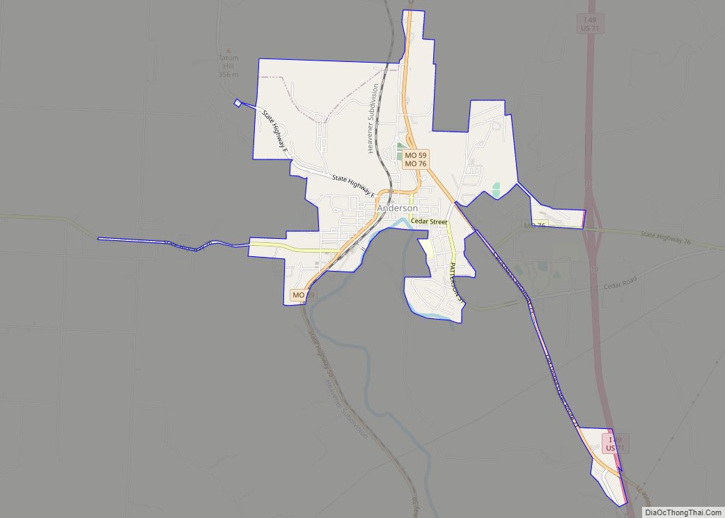
Noel Road Map

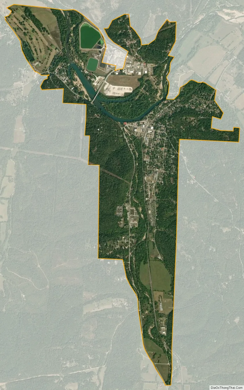
Noel city Satellite Map
Geography
Noel is located at 36°32′36″N 94°29′10″W / 36.54333°N 94.48611°W / 36.54333; -94.48611 (36.543361, -94.486238).
According to the United States Census Bureau, the village has a total area of 2.08 square miles (5.39 km), of which 2.00 square miles (5.18 km) is land and 0.08 square miles (0.21 km) is water.
See also
Map of Missouri State and its subdivision:- Adair
- Andrew
- Atchison
- Audrain
- Barry
- Barton
- Bates
- Benton
- Bollinger
- Boone
- Buchanan
- Butler
- Caldwell
- Callaway
- Camden
- Cape Girardeau
- Carroll
- Carter
- Cass
- Cedar
- Chariton
- Christian
- Clark
- Clay
- Clinton
- Cole
- Cooper
- Crawford
- Dade
- Dallas
- Daviess
- De Kalb
- Dent
- Douglas
- Dunklin
- Franklin
- Gasconade
- Gentry
- Greene
- Grundy
- Harrison
- Henry
- Hickory
- Holt
- Howard
- Howell
- Iron
- Jackson
- Jasper
- Jefferson
- Johnson
- Knox
- Laclede
- Lafayette
- Lawrence
- Lewis
- Lincoln
- Linn
- Livingston
- Macon
- Madison
- Maries
- Marion
- McDonald
- Mercer
- Miller
- Mississippi
- Moniteau
- Monroe
- Montgomery
- Morgan
- New Madrid
- Newton
- Nodaway
- Oregon
- Osage
- Ozark
- Pemiscot
- Perry
- Pettis
- Phelps
- Pike
- Platte
- Polk
- Pulaski
- Putnam
- Ralls
- Randolph
- Ray
- Reynolds
- Ripley
- Saint Charles
- Saint Clair
- Saint Francois
- Saint Louis
- Sainte Genevieve
- Saline
- Schuyler
- Scotland
- Scott
- Shannon
- Shelby
- Stoddard
- Stone
- Sullivan
- Taney
- Texas
- Vernon
- Warren
- Washington
- Wayne
- Webster
- Worth
- Wright
- Alabama
- Alaska
- Arizona
- Arkansas
- California
- Colorado
- Connecticut
- Delaware
- District of Columbia
- Florida
- Georgia
- Hawaii
- Idaho
- Illinois
- Indiana
- Iowa
- Kansas
- Kentucky
- Louisiana
- Maine
- Maryland
- Massachusetts
- Michigan
- Minnesota
- Mississippi
- Missouri
- Montana
- Nebraska
- Nevada
- New Hampshire
- New Jersey
- New Mexico
- New York
- North Carolina
- North Dakota
- Ohio
- Oklahoma
- Oregon
- Pennsylvania
- Rhode Island
- South Carolina
- South Dakota
- Tennessee
- Texas
- Utah
- Vermont
- Virginia
- Washington
- West Virginia
- Wisconsin
- Wyoming