Nixa is a city in Christian County, Missouri, United States. As of the 2020 census, the city’s population was 23,257. It is a principal city, and the second largest city in the Springfield, Missouri Metropolitan Statistical Area.
| Name: | Nixa city |
|---|---|
| LSAD Code: | 25 |
| LSAD Description: | city (suffix) |
| State: | Missouri |
| County: | Christian County |
| Incorporated: | 1946 |
| Elevation: | 1,296 ft (395 m) |
| Total Area: | 9.30 sq mi (24.09 km²) |
| Land Area: | 9.30 sq mi (24.08 km²) |
| Water Area: | 0.00 sq mi (0.01 km²) |
| Total Population: | 23,257 |
| Population Density: | 2,501.56/sq mi (965.83/km²) |
| ZIP code: | 65714 |
| Area code: | 417 |
| FIPS code: | 2952616 |
| GNISfeature ID: | 0723380 |
| Website: | www.nixa.com |
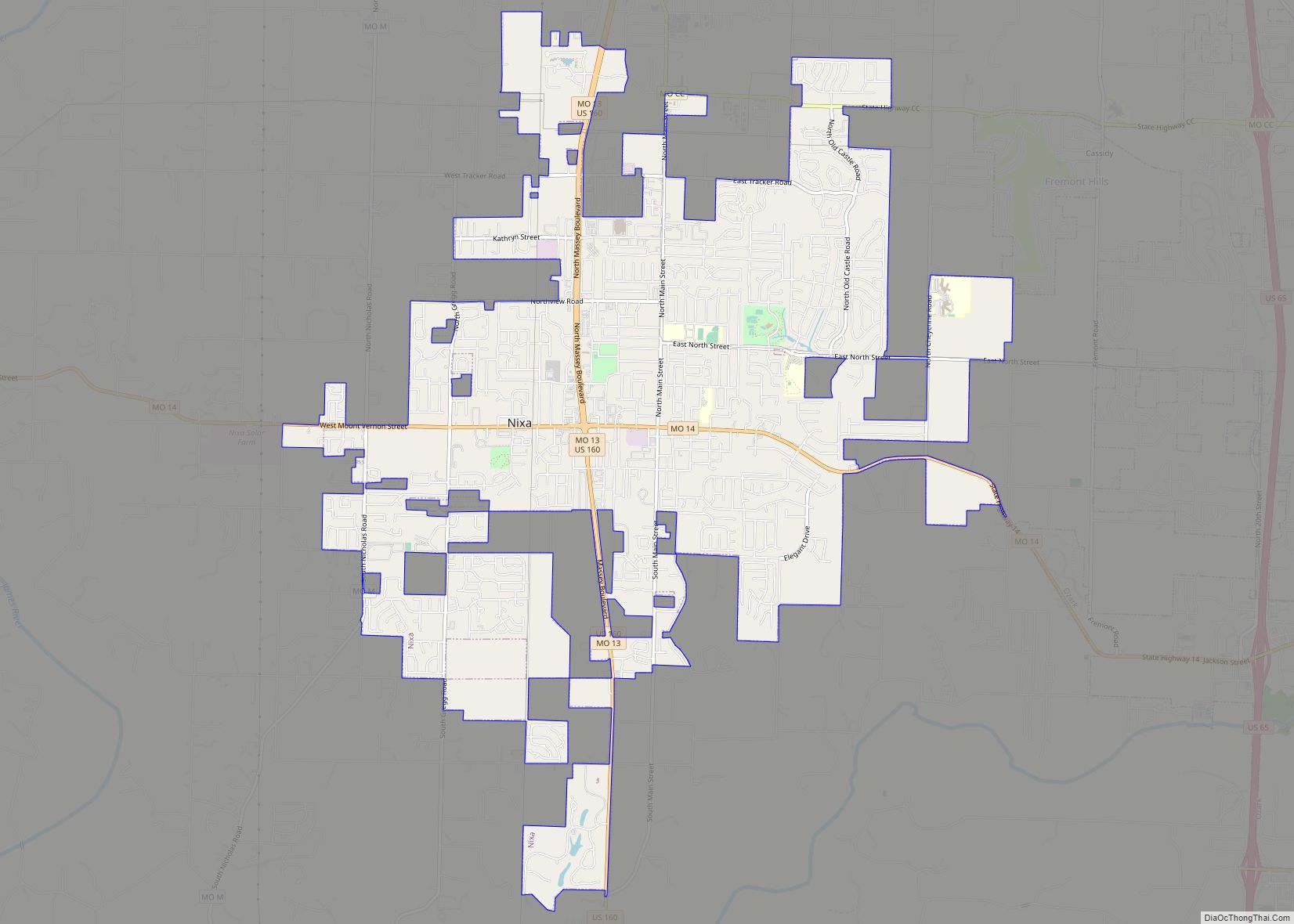
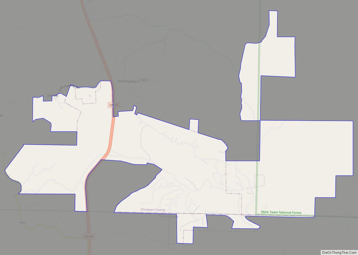
Online Interactive Map
Click on ![]() to view map in "full screen" mode.
to view map in "full screen" mode.
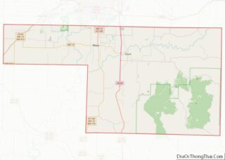
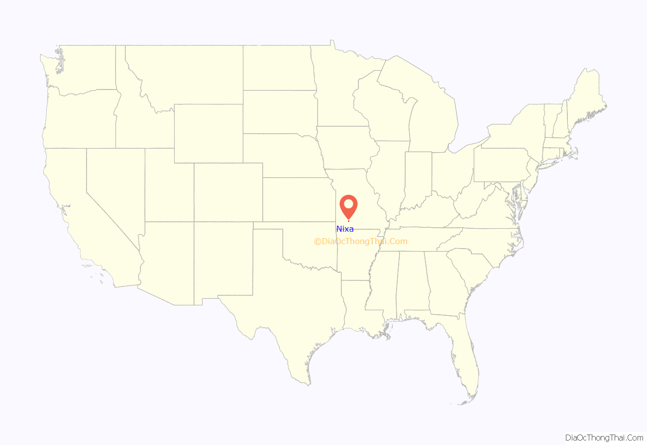
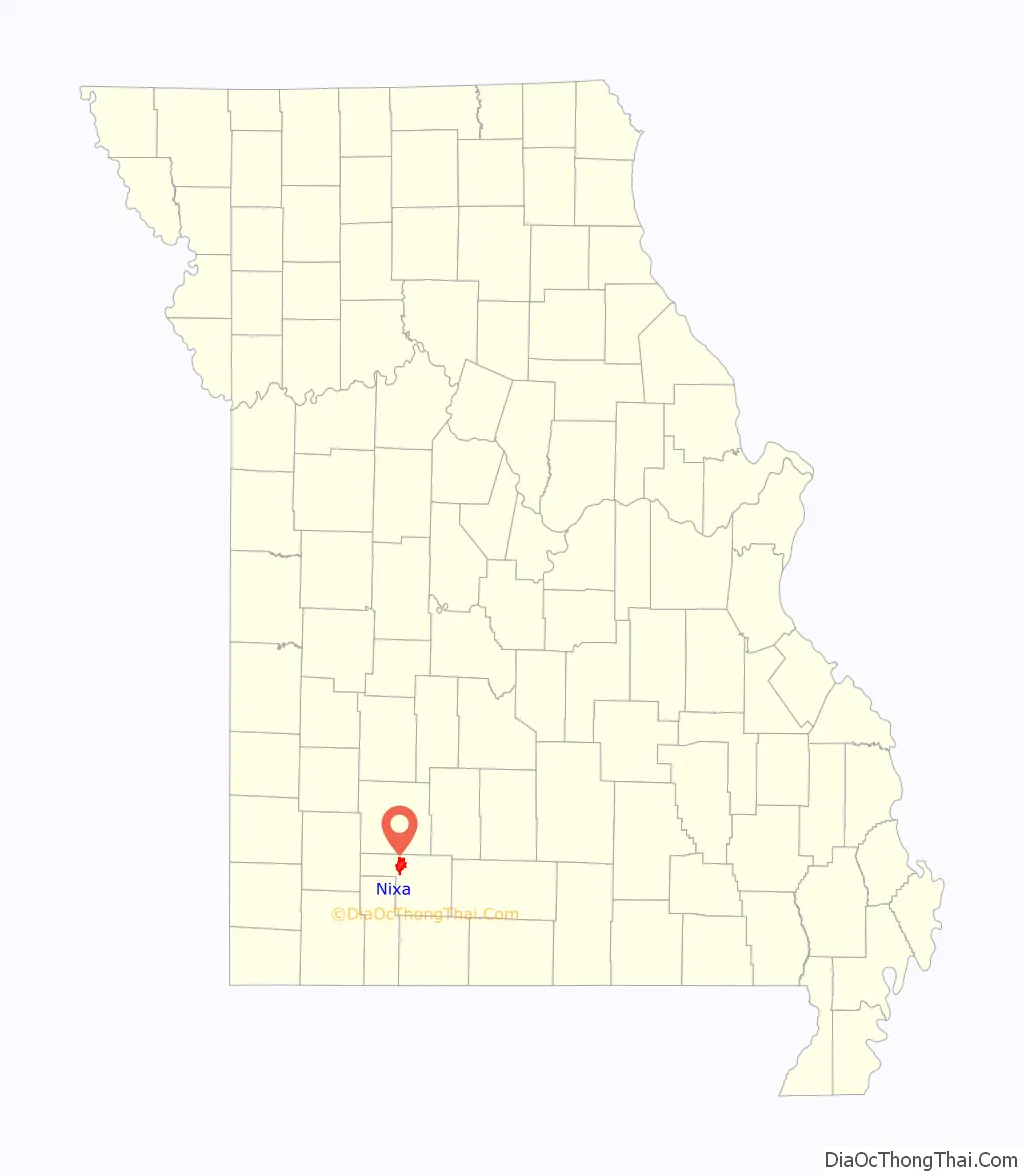
Nixa location map. Where is Nixa city?
History
The area was first settled by farmers who located their farms along the wooded streams near present-day Nixa. The area became a crossroads, as it was a half-day ride with a team of horses from Springfield. Teamsters found it a convenient stopover site when hauling freight between Springfield and Arkansas. The village became known as Faughts. An early resident, Nicholas A. Inman, was a blacksmith from Tennessee, who set up a shop in 1852. When a post office was opened, a town meeting was held to decide on a name for the new community. Because of his years of service to the community, the town was suggested to be named for him. Another suggestion was “nix” because the community was “nothing but a crossroads”. The name Nix was finally decided upon, and Inman’s middle initial “a” was added to get the unique name of Nixa. The village incorporated on June 10, 1902.
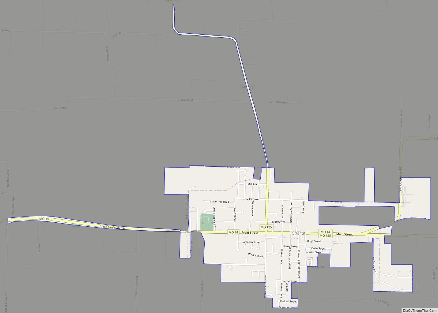
Nixa Road Map

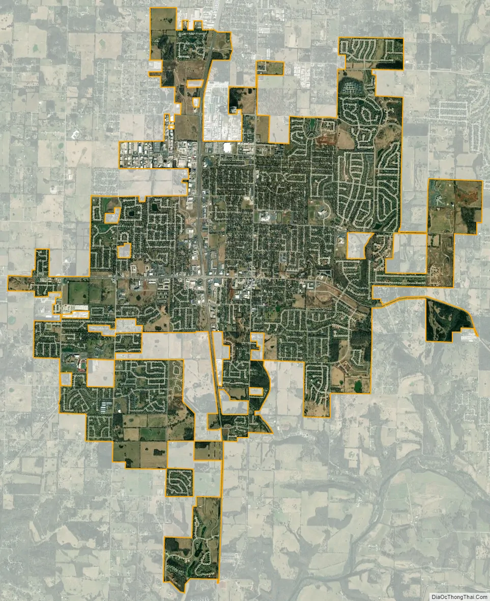
Nixa city Satellite Map
Geography
Nixa is located at 37°2′43″N 93°17′56″W / 37.04528°N 93.29889°W / 37.04528; -93.29889 (37.045253, -93.298755). According to the United States Census Bureau, the city has a total area of 8.48 square miles (21.96 km), all land. The modern city rests on and around seven hills.
See also
Map of Missouri State and its subdivision:- Adair
- Andrew
- Atchison
- Audrain
- Barry
- Barton
- Bates
- Benton
- Bollinger
- Boone
- Buchanan
- Butler
- Caldwell
- Callaway
- Camden
- Cape Girardeau
- Carroll
- Carter
- Cass
- Cedar
- Chariton
- Christian
- Clark
- Clay
- Clinton
- Cole
- Cooper
- Crawford
- Dade
- Dallas
- Daviess
- De Kalb
- Dent
- Douglas
- Dunklin
- Franklin
- Gasconade
- Gentry
- Greene
- Grundy
- Harrison
- Henry
- Hickory
- Holt
- Howard
- Howell
- Iron
- Jackson
- Jasper
- Jefferson
- Johnson
- Knox
- Laclede
- Lafayette
- Lawrence
- Lewis
- Lincoln
- Linn
- Livingston
- Macon
- Madison
- Maries
- Marion
- McDonald
- Mercer
- Miller
- Mississippi
- Moniteau
- Monroe
- Montgomery
- Morgan
- New Madrid
- Newton
- Nodaway
- Oregon
- Osage
- Ozark
- Pemiscot
- Perry
- Pettis
- Phelps
- Pike
- Platte
- Polk
- Pulaski
- Putnam
- Ralls
- Randolph
- Ray
- Reynolds
- Ripley
- Saint Charles
- Saint Clair
- Saint Francois
- Saint Louis
- Sainte Genevieve
- Saline
- Schuyler
- Scotland
- Scott
- Shannon
- Shelby
- Stoddard
- Stone
- Sullivan
- Taney
- Texas
- Vernon
- Warren
- Washington
- Wayne
- Webster
- Worth
- Wright
- Alabama
- Alaska
- Arizona
- Arkansas
- California
- Colorado
- Connecticut
- Delaware
- District of Columbia
- Florida
- Georgia
- Hawaii
- Idaho
- Illinois
- Indiana
- Iowa
- Kansas
- Kentucky
- Louisiana
- Maine
- Maryland
- Massachusetts
- Michigan
- Minnesota
- Mississippi
- Missouri
- Montana
- Nebraska
- Nevada
- New Hampshire
- New Jersey
- New Mexico
- New York
- North Carolina
- North Dakota
- Ohio
- Oklahoma
- Oregon
- Pennsylvania
- Rhode Island
- South Carolina
- South Dakota
- Tennessee
- Texas
- Utah
- Vermont
- Virginia
- Washington
- West Virginia
- Wisconsin
- Wyoming