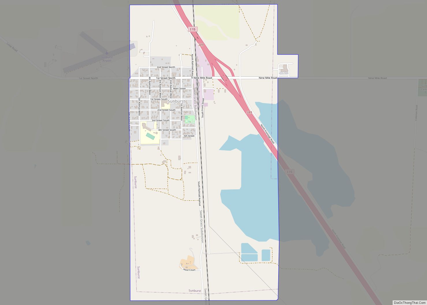
Map of Three Forks city
Three Forks is a city in Gallatin County, Montana, United States and is located within the watershed valley system of both the Missouri and Mississippi rivers drainage basins — and is historically considered the birthplace or start of the Missouri River. The population was 1,989 at the 2020 census. The city of Three Forks is ... Read more
Map of Three Forks city
Map of Thompson Falls city
Thompson Falls is a city in and the county seat of Sanders County, Montana. The population was 1,336 at the time of the 2020 census. Thompson Falls city overview: Name: Thompson Falls city LSAD Code: 25 LSAD Description: city (suffix) State: Montana County: Sanders County Elevation: 2,556 ft (779 m) Total Area: 1.59 sq mi (4.13 km²) Land Area: 1.59 sq mi ... Read more
Map of Thompson Falls city
Map of The Silos CDP
The Silos is a census-designated place (CDP) in Broadwater County, Montana, United States. The population was 506 at the 2010 census. The Silos CDP overview: Name: The Silos CDP LSAD Code: 57 LSAD Description: CDP (suffix) State: Montana County: Broadwater County Elevation: 3,888 ft (1,185 m) Total Area: 5.13 sq mi (13.29 km²) Land Area: 5.13 sq mi (13.29 km²) Water Area: 0.00 sq mi ... Read more
Map of The Silos CDP
Map of Terry town, Montana
Terry, incorporated in 1910, is a town in and the county seat of Prairie County, Montana, United States. The population was 562 at the 2020 census. Terry town overview: Name: Terry town LSAD Code: 43 LSAD Description: town (suffix) State: Montana County: Prairie County Elevation: 2,251 ft (686 m) Total Area: 0.78 sq mi (2.02 km²) Land Area: 0.78 sq mi (2.02 km²) ... Read more
Map of Terry town, Montana
Map of Sylvanite CDP
Sylvanite is a census-designated place (CDP) in Lincoln County, Montana, United States. The population was 103 at the 2010 census. The community is in Kootenai National Forest in northwestern Lincoln County, in the valley of the Yaak River, a south-flowing tributary of the Kootenai River. Yaak River Road (National Forest Road 92) runs through the ... Read more
Map of Sylvanite CDP
Map of Sweet Grass CDP
Sweet Grass (also Sweetgrass) is a census-designated place and unincorporated community in Toole County, Montana, United States, on the Canada–US border. It is the northern terminus of Interstate 15, an important route connecting western Canada, the western United States, and Mexico. The population was 65 according to the 2020 census. In 2004, a joint border ... Read more
Map of Sweet Grass CDP
Map of Swan Lake CDP
Swan Lake is a census-designated place and unincorporated community in Lake County, Montana, United States. Its population was 113 as of the 2010 census. Swan Lake CDP overview: Name: Swan Lake CDP LSAD Code: 57 LSAD Description: CDP (suffix) State: Montana County: Lake County Elevation: 3,104 ft (946 m) Total Area: 7.61 sq mi (19.71 km²) Land Area: 7.61 sq mi (19.71 km²) ... Read more
Map of Swan Lake CDP
Map of Superior town, Montana
Superior is a town in, and the county seat of, Mineral County, Montana, United States. The population was 830 at the 2020 census. Superior town overview: Name: Superior town LSAD Code: 43 LSAD Description: town (suffix) State: Montana County: Mineral County Elevation: 2,720 ft (830 m) Total Area: 1.07 sq mi (2.77 km²) Land Area: 0.95 sq mi (2.47 km²) Water Area: 0.12 sq mi ... Read more
Map of Superior town, Montana
Map of Turtle Lake CDP, Montana
Turtle Lake (Salish: čɫqq̓liʔ ) is a census-designated place (CDP) in Lake County, Montana, United States. The population was 209 at the 2010 census. Turtle Lake CDP overview: Name: Turtle Lake CDP LSAD Code: 57 LSAD Description: CDP (suffix) State: Montana County: Lake County Elevation: 3,097 ft (944 m) Total Area: 0.66 sq mi (1.71 km²) Land Area: 0.60 sq mi (1.55 km²) ... Read more
Map of Turtle Lake CDP, Montana
Map of Turner CDP, Montana
Turner is an unincorporated village in Blaine County, Montana, United States. Turner is located on Montana State Highway 241, 41.5 miles (66.8 km) east-northeast of Chinook. It is 12 miles south of the Canadian border. Its population was 61 as of the 2010 census. Turner has the post office serving ZIP code 59542, and other businesses ... Read more
Map of Turner CDP, Montana
Map of Turah CDP
Turah is an unincorporated community located in the eastern half of Missoula County, Montana, United States along Interstate 90. It has a population of 306 as of 2010 census. Turah CDP overview: Name: Turah CDP LSAD Code: 57 LSAD Description: CDP (suffix) State: Montana County: Missoula County Elevation: 3,329 ft (928 m) Total Area: 1.33 sq mi (3.45 km²) Land ... Read more
Map of Turah CDP
Map of Troy city, Montana
Troy is a city in Lincoln County, Montana, United States. The population was 797 at the 2020 census. It lies at the lowest elevation of any settlement in Montana. The town is on U.S. Route 2, near Montana Highway 56, in the Kootenai River gorge by the Kootenai National Forest. Originally inhabited by the Kutenai, ... Read more
Map of Troy city, Montana