Superior is a town in, and the county seat of, Mineral County, Montana, United States. The population was 830 at the 2020 census.
| Name: | Superior town |
|---|---|
| LSAD Code: | 43 |
| LSAD Description: | town (suffix) |
| State: | Montana |
| County: | Mineral County |
| Elevation: | 2,720 ft (830 m) |
| Total Area: | 1.07 sq mi (2.77 km²) |
| Land Area: | 0.95 sq mi (2.47 km²) |
| Water Area: | 0.12 sq mi (0.30 km²) |
| Total Population: | 830 |
| Population Density: | 869.11/sq mi (335.59/km²) |
| ZIP code: | 59872 |
| Area code: | 406 |
| FIPS code: | 3072625 |
| GNISfeature ID: | 2413356 |
| Website: | https://townofsuperiormontana.org/ |
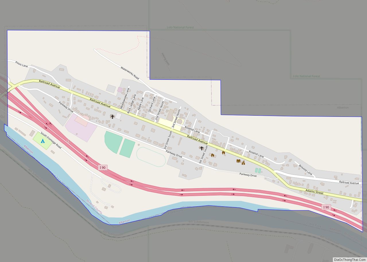
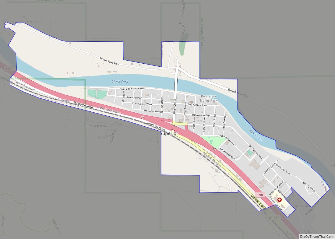
Online Interactive Map
Click on ![]() to view map in "full screen" mode.
to view map in "full screen" mode.
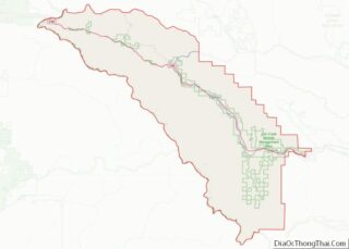
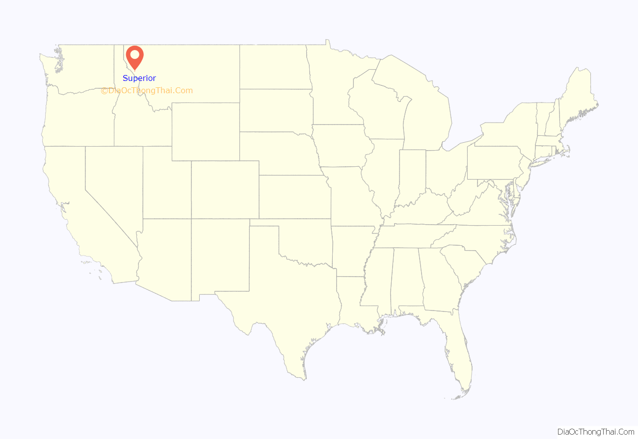
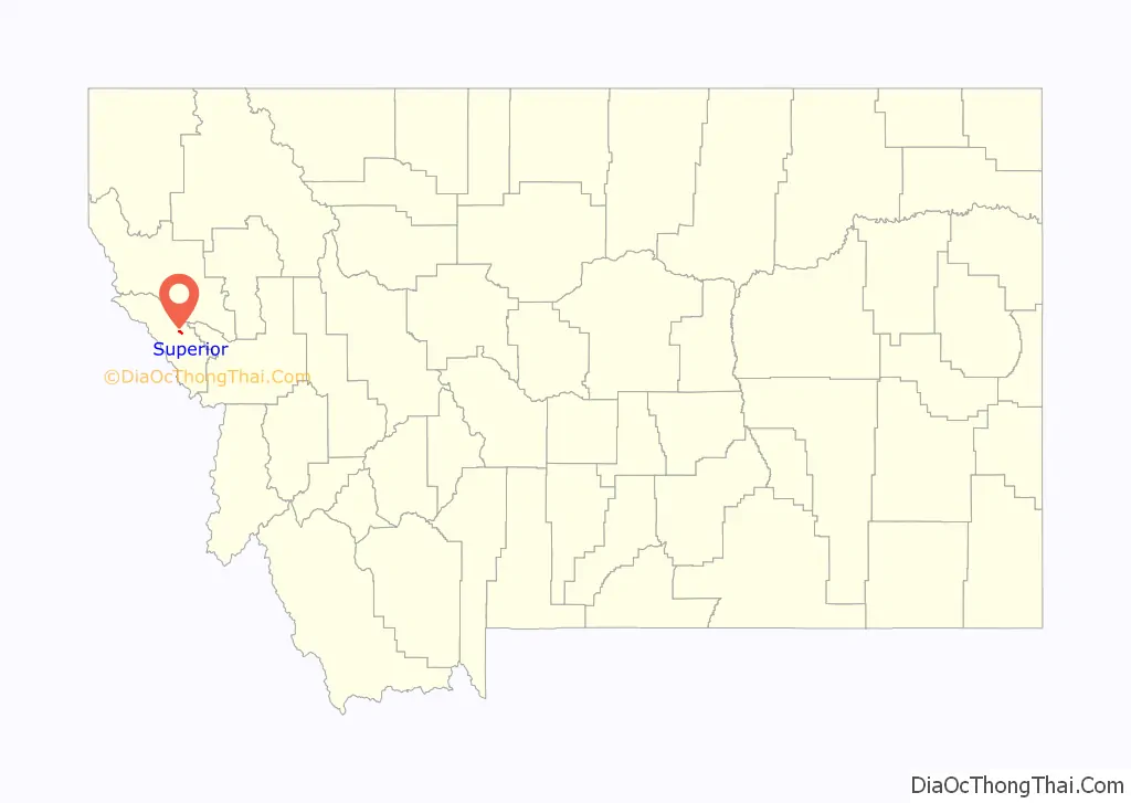
Superior location map. Where is Superior town?
History
Superior was named after its founders’ hometown of Superior, Wisconsin in 1869. The post office was established in 1871 after Mineral County became the site of one of the largest gold strikes that helped settle the West.
In the 1860s and 70s, several thousand miners converged on Cedar Creek. Mining has remained central to the economy, along with the development of logging and United States Forest Service activities.
In 1908, the Superior Hotel received the first Bibles to be placed in hotel rooms by The Gideons. This is noted on a historic plaque on Mullan Road.
The Mineral County Museum is located in Superior.
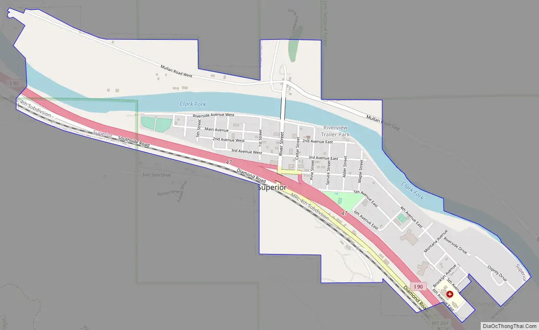
Superior Road Map
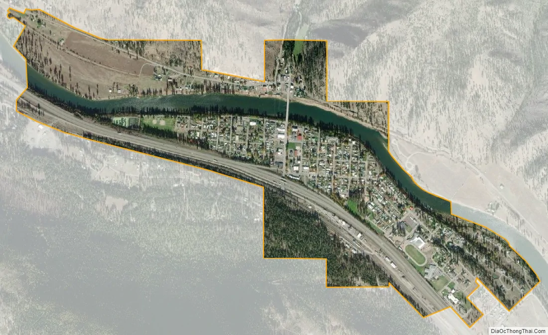
Superior city Satellite Map
Geography
According to the United States Census Bureau, the town has a total area of 1.17 square miles (3.03 km), of which 1.05 square miles (2.72 km) is land and 0.12 square miles (0.31 km) is water.
Superior is located within the Bitterroot Range of mountains. The Clark Fork flows through downtown, heading north towards St. Regis and ultimately emptying into Lake Pend Oreille near Cabinet, Idaho. The mountains to the west of Superior along the Montana/Idaho border receive a large amount of precipitation annually, mostly due to the amount of snow in the winter months. Nearby Lookout Pass Ski and Recreation Area receives approximately 400 in (1,000 cm) of snow each winter. The snow pack melts throughout the spring and summer months, feeding the many mountain streams and creeks with water. All the water eventually reaches the Clark Fork in the valley below, where Superior is located.
Climate
See also
Map of Montana State and its subdivision:- Beaverhead
- Big Horn
- Blaine
- Broadwater
- Carbon
- Carter
- Cascade
- Chouteau
- Custer
- Daniels
- Dawson
- Deer Lodge
- Fallon
- Fergus
- Flathead
- Gallatin
- Garfield
- Glacier
- Golden Valley
- Granite
- Hill
- Jefferson
- Judith Basin
- Lake
- Lewis and Clark
- Liberty
- Lincoln
- Madison
- McCone
- Meagher
- Mineral
- Missoula
- Musselshell
- Park
- Petroleum
- Phillips
- Pondera
- Powder River
- Powell
- Prairie
- Ravalli
- Richland
- Roosevelt
- Rosebud
- Sanders
- Sheridan
- Silver Bow
- Stillwater
- Sweet Grass
- Teton
- Toole
- Treasure
- Valley
- Wheatland
- Wibaux
- Yellowstone
- Alabama
- Alaska
- Arizona
- Arkansas
- California
- Colorado
- Connecticut
- Delaware
- District of Columbia
- Florida
- Georgia
- Hawaii
- Idaho
- Illinois
- Indiana
- Iowa
- Kansas
- Kentucky
- Louisiana
- Maine
- Maryland
- Massachusetts
- Michigan
- Minnesota
- Mississippi
- Missouri
- Montana
- Nebraska
- Nevada
- New Hampshire
- New Jersey
- New Mexico
- New York
- North Carolina
- North Dakota
- Ohio
- Oklahoma
- Oregon
- Pennsylvania
- Rhode Island
- South Carolina
- South Dakota
- Tennessee
- Texas
- Utah
- Vermont
- Virginia
- Washington
- West Virginia
- Wisconsin
- Wyoming