Norfolk (/ˈnɔːrfɔːrk/ or /ˈnɔːrfoʊk/) is a city in Madison County, Nebraska, United States, 113 miles northwest of Omaha and 83 miles west of Sioux City at the intersection of U.S. Routes 81 and 275. The population was 24,210 at the 2010 census, making it the ninth-largest city in Nebraska. It is the principal city of ... Read more
Nebraska Cities and Places
Nora is a village in Nuckolls County, Nebraska, United States. The population was 21 at the 2010 census. Nora village overview: Name: Nora village LSAD Code: 47 LSAD Description: village (suffix) State: Nebraska County: Nuckolls County Elevation: 1,752 ft (534 m) Total Area: 0.38 sq mi (0.98 km²) Land Area: 0.38 sq mi (0.98 km²) Water Area: 0.00 sq mi (0.00 km²) Total Population: 21 Population ... Read more
Niobrara (/ˌnaɪ.əˈbrærə/; Omaha: Ní Ubthátha Tʰáⁿwaⁿgthaⁿ [nĩꜜ ubɫᶞaꜜɫᶞa tʰãꜜwãŋɡɫᶞã], meaning “water spread-out village”) is a village in Knox County, Nebraska, United States. The population was 363 at the 2020 census. Niobrara village overview: Name: Niobrara village LSAD Code: 47 LSAD Description: village (suffix) State: Nebraska County: Knox County Elevation: 1,230 ft (375 m) Total Area: 0.73 sq mi (1.89 km²) ... Read more
Nickerson is a village in Dodge County, Nebraska, United States. The population was 369 at the 2010 census. Nickerson village overview: Name: Nickerson village LSAD Code: 47 LSAD Description: village (suffix) State: Nebraska County: Dodge County Elevation: 1,201 ft (366 m) Total Area: 0.38 sq mi (0.99 km²) Land Area: 0.38 sq mi (0.98 km²) Water Area: 0.00 sq mi (0.01 km²) Total Population: 312 Population ... Read more
Oak is a village in Nuckolls County, Nebraska, United States. The population was 66 at the 2010 census. Oak village overview: Name: Oak village LSAD Code: 47 LSAD Description: village (suffix) State: Nebraska County: Nuckolls County Elevation: 1,588 ft (484 m) Total Area: 0.15 sq mi (0.39 km²) Land Area: 0.15 sq mi (0.39 km²) Water Area: 0.00 sq mi (0.00 km²) Total Population: 54 Population ... Read more
O’Neill is a city in Holt County, Nebraska, United States. The population was 3,705 at the 2010 census. It is the county seat of Holt County. O’Neill city overview: Name: O’Neill city LSAD Code: 25 LSAD Description: city (suffix) State: Nebraska County: Holt County Incorporated: 1882 Elevation: 1,988 ft (606 m) Total Area: 2.38 sq mi (6.18 km²) Land Area: ... Read more
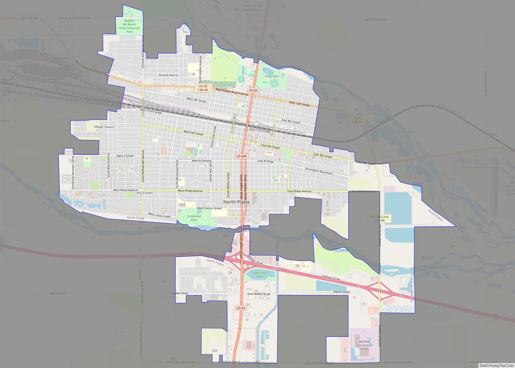
North Platte is a city in and the county seat of Lincoln County, Nebraska, United States. It is located in the west-central part of the state, along Interstate 80, at the confluence of the North and South Platte Rivers forming the Platte River. The population was 23,390 at the 2020 census. North Platte is a ... Read more
North Loup is a village in North Loup Township, Valley County, Nebraska, United States. The population was 297 at the 2010 census. North Loup village overview: Name: North Loup village LSAD Code: 47 LSAD Description: village (suffix) State: Nebraska County: Valley County Elevation: 1,962 ft (598 m) Total Area: 0.41 sq mi (1.06 km²) Land Area: 0.41 sq mi (1.06 km²) Water Area: ... Read more
Ohiowa is a village in Fillmore County, Nebraska, United States. The population was 122 at the 2020 census. Ohiowa village overview: Name: Ohiowa village LSAD Code: 47 LSAD Description: village (suffix) State: Nebraska County: Fillmore County Elevation: 1,588 ft (484 m) Total Area: 0.25 sq mi (0.65 km²) Land Area: 0.25 sq mi (0.65 km²) Water Area: 0.00 sq mi (0.00 km²) Total Population: 122 Population ... Read more
Ogallala is a city in and the county seat of Keith County, Nebraska, United States. The population was 4,737 at the 2010 census. In the days of the Nebraska Territory, the city was a stop on the Pony Express and later along the transcontinental railroad. The Ogallala Aquifer was named after the city. Ogallala city ... Read more
Offutt AFB CDP overview: Name: Offutt AFB CDP LSAD Code: 57 LSAD Description: CDP (suffix) State: Nebraska County: Sarpy County FIPS code: 3135875 Online Interactive Map Offutt AFB online map. Source: Basemap layers from Google Map, Open Street Map (OSM), Arcgisonline, Wmflabs. Boundary Data from Database of Global Administrative Areas. Offutt AFB location map. Where ... Read more
Odessa is a census-designated place (CDP) in Odessa Township, Buffalo County, Nebraska, United States. It is part of the Kearney, Nebraska Micropolitan Statistical Area. The population of the CDP was 130 at the 2010 census. It was named after Odessa, in Ukraine. Odessa CDP overview: Name: Odessa CDP LSAD Code: 57 LSAD Description: CDP (suffix) ... Read more