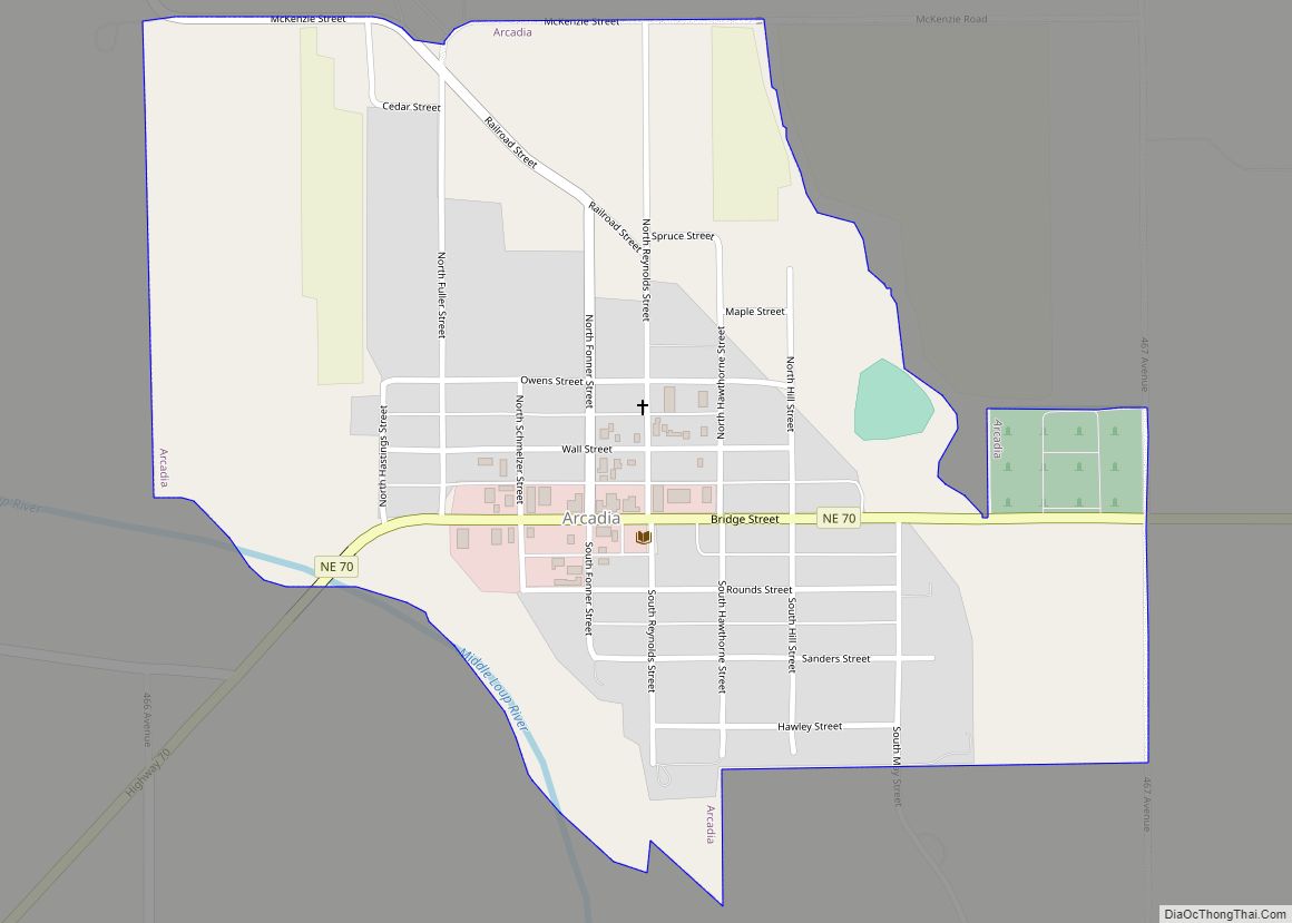
North Loup is a village in North Loup Township, Valley County, Nebraska, United States. The population was 297 at the 2010 census.
| Name: | North Loup village |
|---|---|
| LSAD Code: | 47 |
| LSAD Description: | village (suffix) |
| State: | Nebraska |
| County: | Valley County |
| Elevation: | 1,962 ft (598 m) |
| Total Area: | 0.41 sq mi (1.06 km²) |
| Land Area: | 0.41 sq mi (1.06 km²) |
| Water Area: | 0.00 sq mi (0.00 km²) |
| Total Population: | 254 |
| Population Density: | 621.03/sq mi (239.51/km²) |
| ZIP code: | 68859 |
| Area code: | 308 |
| FIPS code: | 3134825 |
| GNISfeature ID: | 0831708 |
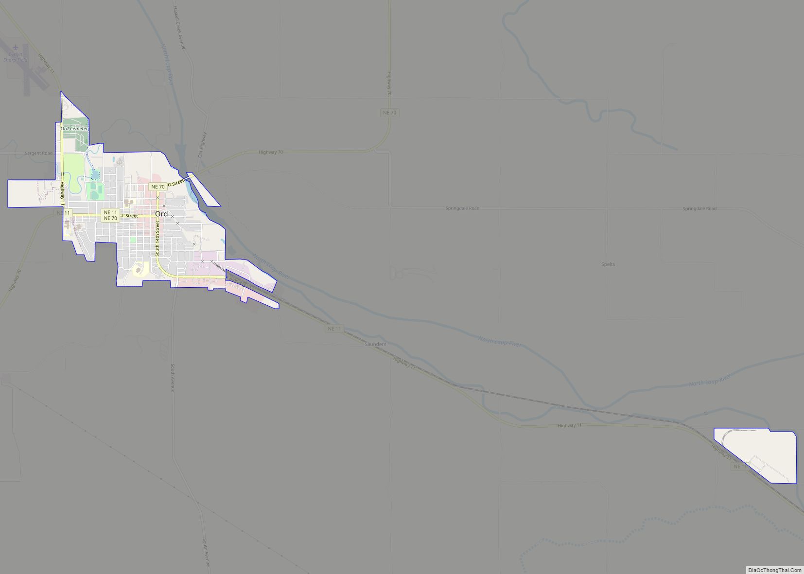
Online Interactive Map
Click on ![]() to view map in "full screen" mode.
to view map in "full screen" mode.
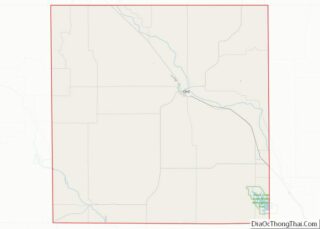
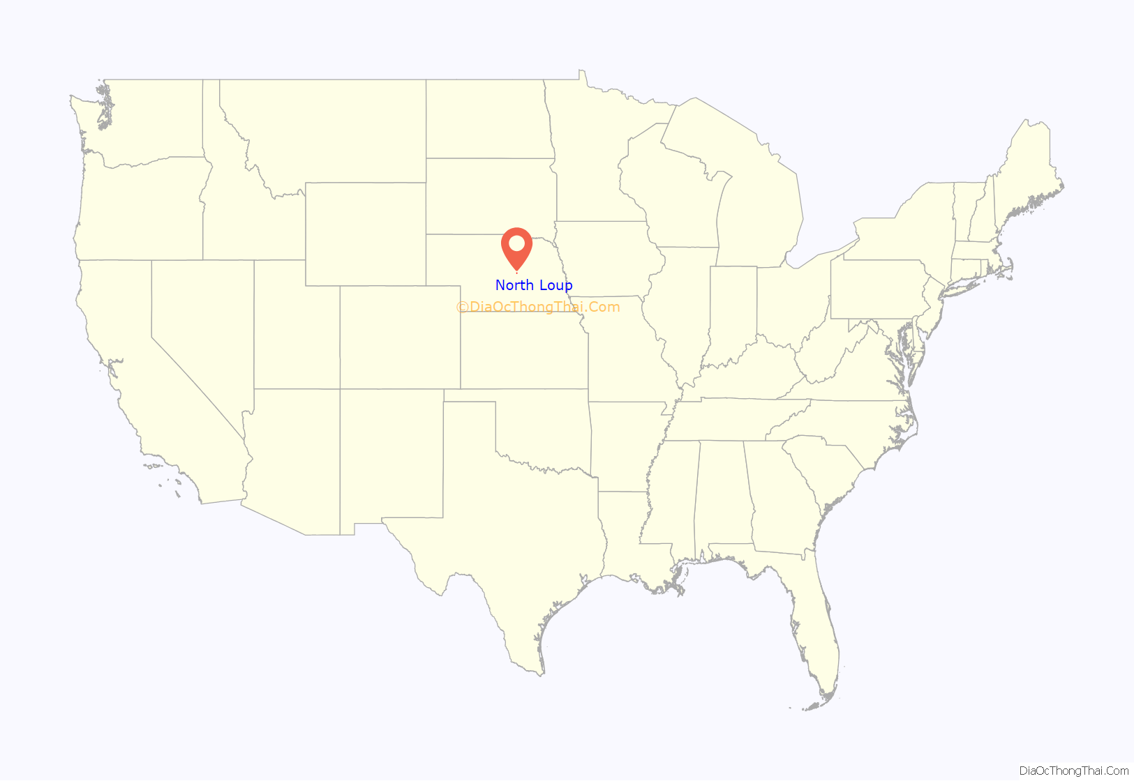
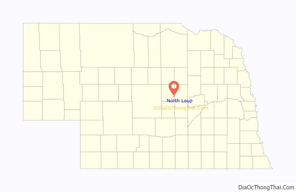
North Loup location map. Where is North Loup village?
History
In 1871, a party of Seventh Day Baptists from Wisconsin explored Valley County for settlement sites. In May 1872, they established a community near what is now North Loup. A post office and general store were established in 1873. In 1877, the town of North Loup was formally organized. The name was taken from the North Loup River, in whose valley the village lies.
In 1880, the Union Pacific Railroad completed a branch line from Grand Island to St. Paul, shortening the distance from the Valley County settlements to rail transport. In the following year, North Loup and Ord voted to issue $9,000 worth of bonds to help subsidize the railroad’s extension through the two towns. The rail connection from St. Paul to North Loup was completed in 1882.
The arrival of the railroad prompted a boom in North Loup, which lasted for some four years. In the course of a single year, the village’s population doubled, to two hundred residents. The boom ended in 1886, when the railway line was finally completed to the county seat of Ord.
From about 1877 to 1890, the Loup valley enjoyed a series of wet years that attracted a wave of settlers, who homesteaded even marginal agricultural land. In 1890, this ended with a series of drought years, lasting until about 1896. During this time, the valley’s farmers experimented with alternative crops, among them winter wheat and alfalfa. In the North Loup valley, one such crop was popcorn. The experiment was successful; in 1901, North Loup celebrated its first “Popcorn Days” celebration, which continues to be held every August.
The village grew rapidly from about 1900 to 1920. By 1915, there were over 600 residents. Growth continued, albeit very slowly, in the 1920s; the maximum population of 643 was reached in 1930. After World War II, the population declined; in 1959, the village was no longer able to support its own school district, which was merged with that of Scotia, in neighboring Greeley County.
2010 flood
On June 12, 2010, the privately owned Bredthauer Dam, located 4.5 miles (7.2 km) upstream from North Loup on Mira Creek, broke due to heavy rain, flooding rural Valley County. Major flooding occurred in North Loup, with water “eight inches deep and running down Main Street.” The village was evacuated for the duration of the flood.
North Loup Road Map

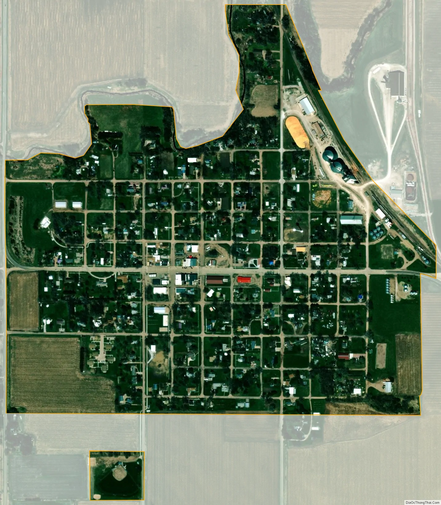
North Loup city Satellite Map
Geography
North Loup is located at 41°29′41″N 98°46′17″W / 41.494856°N 98.771253°W / 41.494856; -98.771253 (41.494856, -98.771253). According to the United States Census Bureau, the village has a total area of 0.41 square miles (1.06 km), all land.
Climate
See also
Map of Nebraska State and its subdivision:- Adams
- Antelope
- Arthur
- Banner
- Blaine
- Boone
- Box Butte
- Boyd
- Brown
- Buffalo
- Burt
- Butler
- Cass
- Cedar
- Chase
- Cherry
- Cheyenne
- Clay
- Colfax
- Cuming
- Custer
- Dakota
- Dawes
- Dawson
- Deuel
- Dixon
- Dodge
- Douglas
- Dundy
- Fillmore
- Franklin
- Frontier
- Furnas
- Gage
- Garden
- Garfield
- Gosper
- Grant
- Greeley
- Hall
- Hamilton
- Harlan
- Hayes
- Hitchcock
- Holt
- Hooker
- Howard
- Jefferson
- Johnson
- Kearney
- Keith
- Keya Paha
- Kimball
- Knox
- Lancaster
- Lincoln
- Logan
- Loup
- Madison
- McPherson
- Merrick
- Morrill
- Nance
- Nemaha
- Nuckolls
- Otoe
- Pawnee
- Perkins
- Phelps
- Pierce
- Platte
- Polk
- Red Willow
- Richardson
- Rock
- Saline
- Sarpy
- Saunders
- Scotts Bluff
- Seward
- Sheridan
- Sherman
- Sioux
- Stanton
- Thayer
- Thomas
- Thurston
- Valley
- Washington
- Wayne
- Webster
- Wheeler
- York
- Alabama
- Alaska
- Arizona
- Arkansas
- California
- Colorado
- Connecticut
- Delaware
- District of Columbia
- Florida
- Georgia
- Hawaii
- Idaho
- Illinois
- Indiana
- Iowa
- Kansas
- Kentucky
- Louisiana
- Maine
- Maryland
- Massachusetts
- Michigan
- Minnesota
- Mississippi
- Missouri
- Montana
- Nebraska
- Nevada
- New Hampshire
- New Jersey
- New Mexico
- New York
- North Carolina
- North Dakota
- Ohio
- Oklahoma
- Oregon
- Pennsylvania
- Rhode Island
- South Carolina
- South Dakota
- Tennessee
- Texas
- Utah
- Vermont
- Virginia
- Washington
- West Virginia
- Wisconsin
- Wyoming